– Civil War Series –
1861 was a rough year on the battlefield for Union forces in the Eastern Theater. After the Civil War commenced at Fort Sumter in April, the young Federal Army suffered a significant setback at the First Battle of Bull Run in July. Although the Confederate Army failed to push the offensive, the two capitals—Washington and Richmond—settled in for what would become a long and bloody chess game. The rest of 1861 was relatively quiet, at least on the Eastern Front, save for an avoidable mistake by Federal forces at Ball’s Bluff on October 21, resulting in another Confederate victory that humiliated Washington.
Ball’s Bluff Battlefield Regional Park in Leesburg, Virginia commemorates this early battle of the Civil War. While the park is crisscrossed by a dizzying array of hiking trails, the Battlefield Interpretive Trail Loop provides the most complete tour of the battle grounds and includes a decent overlook of the Potomac River, which Federal forces fatefully crossed on the morning of October 21, setting off an engagement that ended in a Confederate rout.


The hike
The roughly hour-long hike around the battlefield begins at the main parking area in Ball’s Bluff Battlefield Regional Park, a short drive from downtown Leesburg, Virginia. An impressive array of signage and maps helps orient the visitor, putting them in the shoes of Northern and Southern soldiers as the battle approached…

The story from the Union side is centered around the brigade of General Charles Pomeroy Stone, a prominent commander in General George McClellan’s fledgling Union Army. Stone, a veteran of the Mexican American War, was given the role in early 1861 of securing President Abraham’s Lincoln Inauguration, making him a key player in Washington’s defenses on the eve of the Civil War. After commanding a brigade during the Battle of Bull Run in July, he took the reins of a full division tasked with guarding the Potomac River above Washington in the fall.
On October 20, with Stone’s force situated across the Potomac in Maryland, McClellan directed Stone’s division to send a small scouting party to the Virginia side to make a “slight demonstration”—a feint intended to uncover Confederate soldiers operating in the area. The scouting party reported back that they had discovered an enemy camp that appeared to be deserted—news that persuaded Stone to plan a raid on the camp for the next morning.
Early on the 21st, Colonel Charles Devens led five companies of the 15th Massachusetts across the river from Harrison’s Island, landing around dawn. After they scaled Ball’s Bluff, however, the truth was revealed: the scouting party the night prior had mistook a line of trees for a Confederate encampment. As Devens’ 15th Massachusetts waited for reinforcements, they managed to encounter real Confederates after all, although not what they expected: a portion of Nathan “Shanks” Evans’ Confederate force—Company K of the 17th Mississippi—was on picket duty and ran across and briefly engaged the Federals at around 8:00am near the Jackson house, the opening salvo of what would become a bloody, day-long affair.
The former site of the Jackson house is situated in the woods to the west, outside the park on private property. But heading up the gravel road from the parking area north from the parking area leads hikers to the main battleground. To follow the directions in the “walking tour” handout (found at the entry kiosk), take the first right on the leaf-strewn Burt Trail, the first of several short sections comprising the overall Battlefield Interpretive Trail Loop.

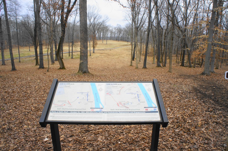
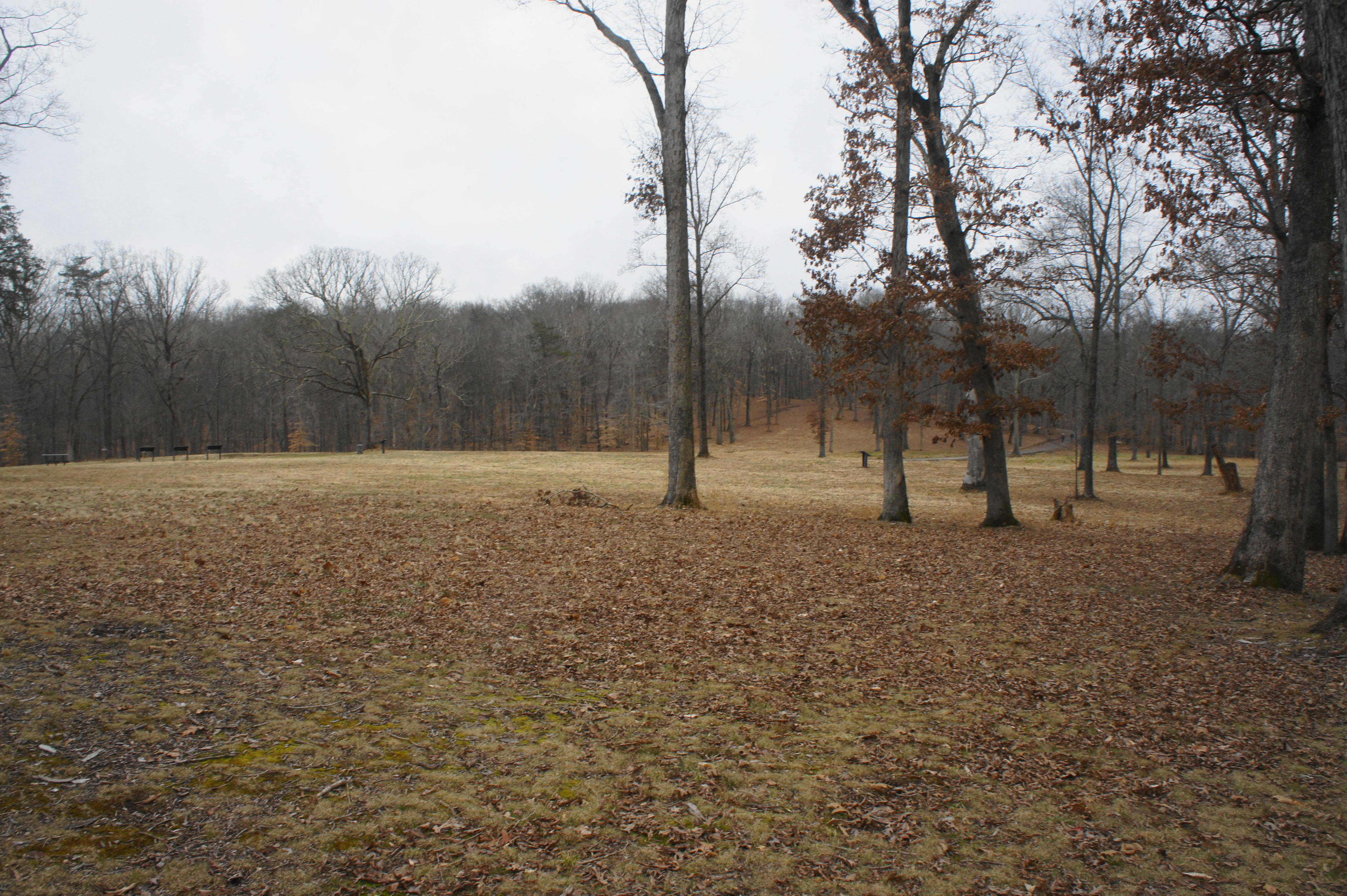
The Burt Trail leads uphill to a vista point with a view of the relatively intimate battle grounds: a 10- to 12-acre meadow enclosed by woods with difficult terrain. The bluff and Potomac River lie just beyond to the east. While the loop hike technically bears right before the viewpoint—bearing right on the Featherston Trail—it is worth the extra few paces to climb up to the lookout in order to gain a lay of the land. A pair of battle maps provide a description of the engagement as it shapes up on the afternoon of October 21.

After engaging in two more skirmishes with the Confederates, the 15th Massachusetts withdrew to the bluff (passing through the area presently occupied by the parking lot). As the 8th Virginia pursued, the Federals were reinforced by a much larger force under the command of Colonel Edward Baker. Baker was notable for also being a US Senator at the time of the battle; while “political” generals were common in the Civil War, Baker would become the first—and, to date, only—sitting US Senator in history to perish on the battlefield.
As the map in front of you indicates, Baker arrayed his forces around the meadow in a formation that resembled a backwards “L.” The 15th Massachusetts pulled back to the north, reinforced by a second regiment from the Bay State, in addition to troops from California, Pennsylvania, and New York.
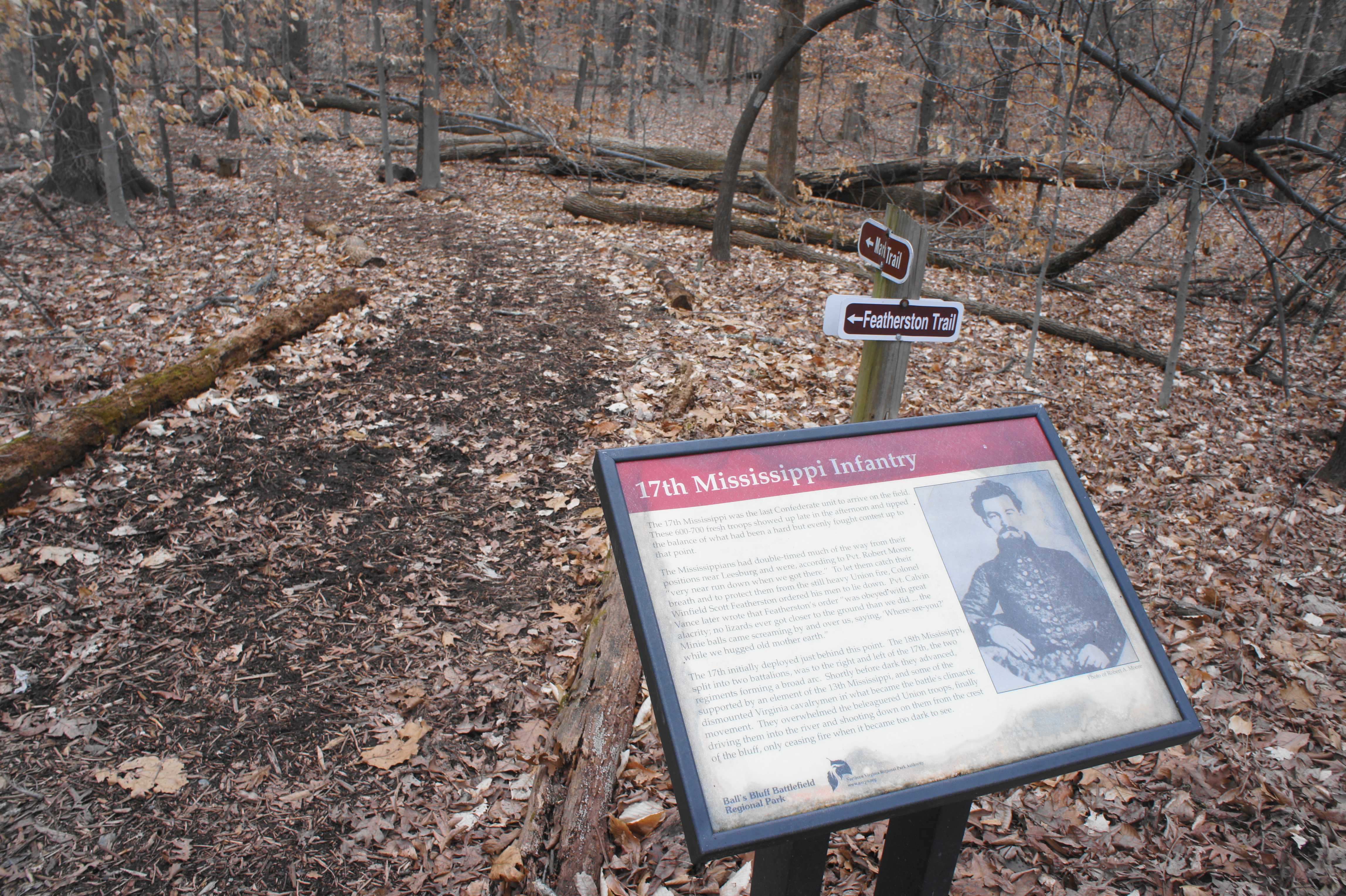
From the vista, complete an about-face and retrace your steps back down the Burt Trail, then turn left on the thin Featherston Trail, which is marked but easy to miss. This path bears southeast through the woods; within around 70 yards, the trail passes a sign for the 17th Mississippi. Although the first Southern contingent to engage the Federals at the Jackson house, the 17th Mississippi Infantry was the last to arrive at the battlefield on the evening of October 21.
It was around this wooded area—open and exposed at the time of the battle—that Baker sent the Union forces on the offensive at around 3:00pm on October 21. Two companies from the 1st California, led by Captain John Markoe, fought a skirmish with the 8th Virginia, leading to Markoe’s capture. Both sides pulled back to resupply and reorganize.
Now on the Markoe Trail (there is no junction, just a name change), the path descends to a sign for the 18th Mississippi Infantry—commanded by Col. Erasmus Burt—which was the second Confederate regiment to arrive for the afternoon battle. The force took position atop the hill behind you before descending, running into a hail of Union bullets that mortally wounded Burt. As Lt. Col. Thomas Griffin took command, the regiment regrouped and split in two, aiming to outflank the Californians. Half of the force dropped down into Deep Ravine to your right to initiate further attacks on the Union left.
Just ahead, the Markoe Trail passes a junction with the Griffin Trail (stay right) and then descends to cross a wooden bridge over a minor ravine. Roughly 2/10 mile from the trailhead, another sign recounts the role of the 42nd New York Infantry, skipping ahead in the story to discuss Col. Milton Cogswell—the regiment commander—who took command of the Federal force after Baker’s death around 4:30-5:00pm. Cogswell’s forces attempted a breakout against the creeping Confederate force but was unable to turn the tide.
After passing a junction with a green-blazed path on the left, hikers continuing on what is now the Markoe Trail will approach a sign for the 1st California Regiment. The 1st California, commanded by Col. Baker, was in fact composed of mostly Pennsylvanians.
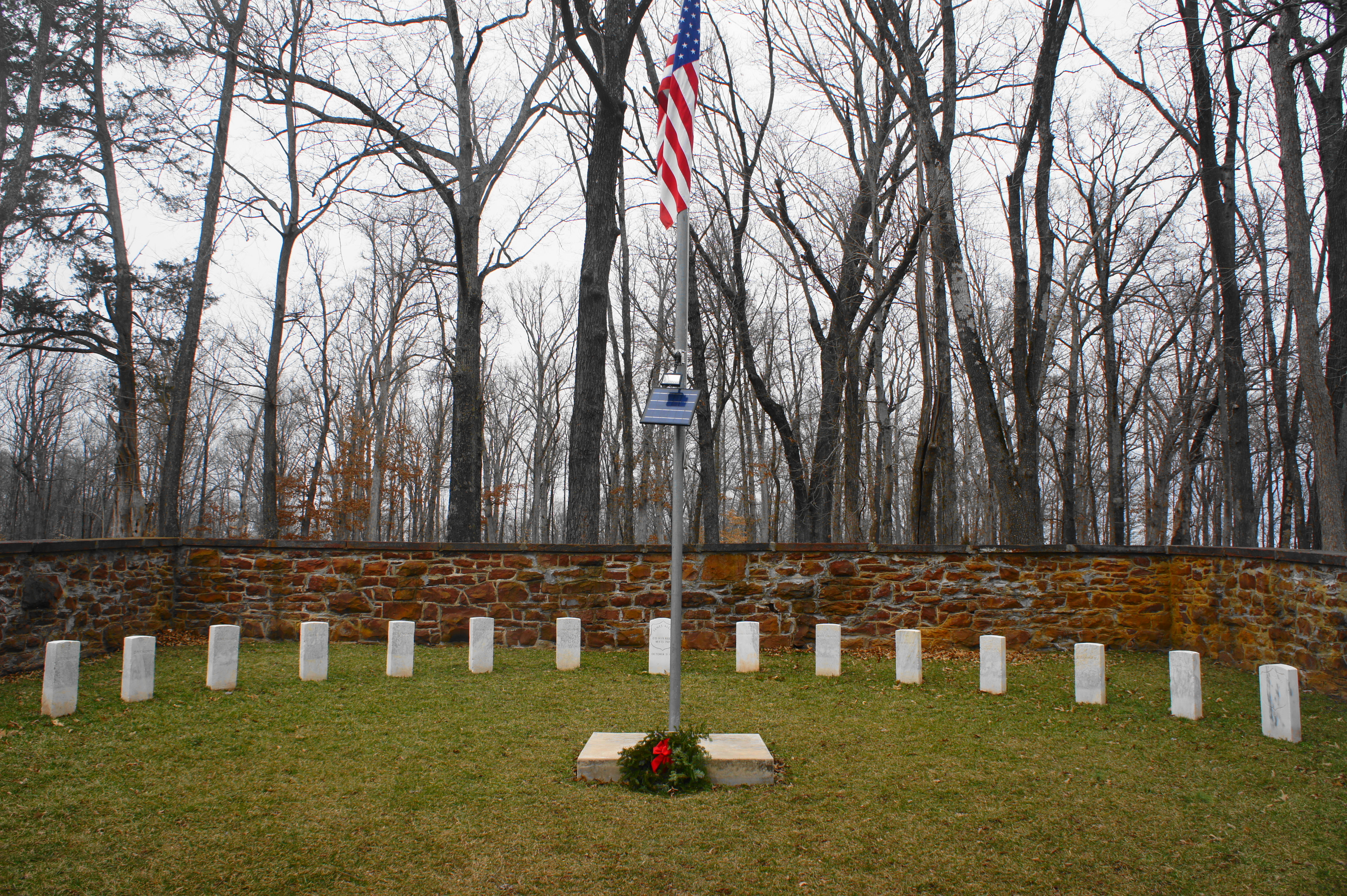
The trail junction at ¼ mile (the River Trail heads north, while the Cogswell Trail bears south) offers a good place to briefly diverge from the main loop and head up into the open field, where there is a small cemetery and a flurry of informational signs.
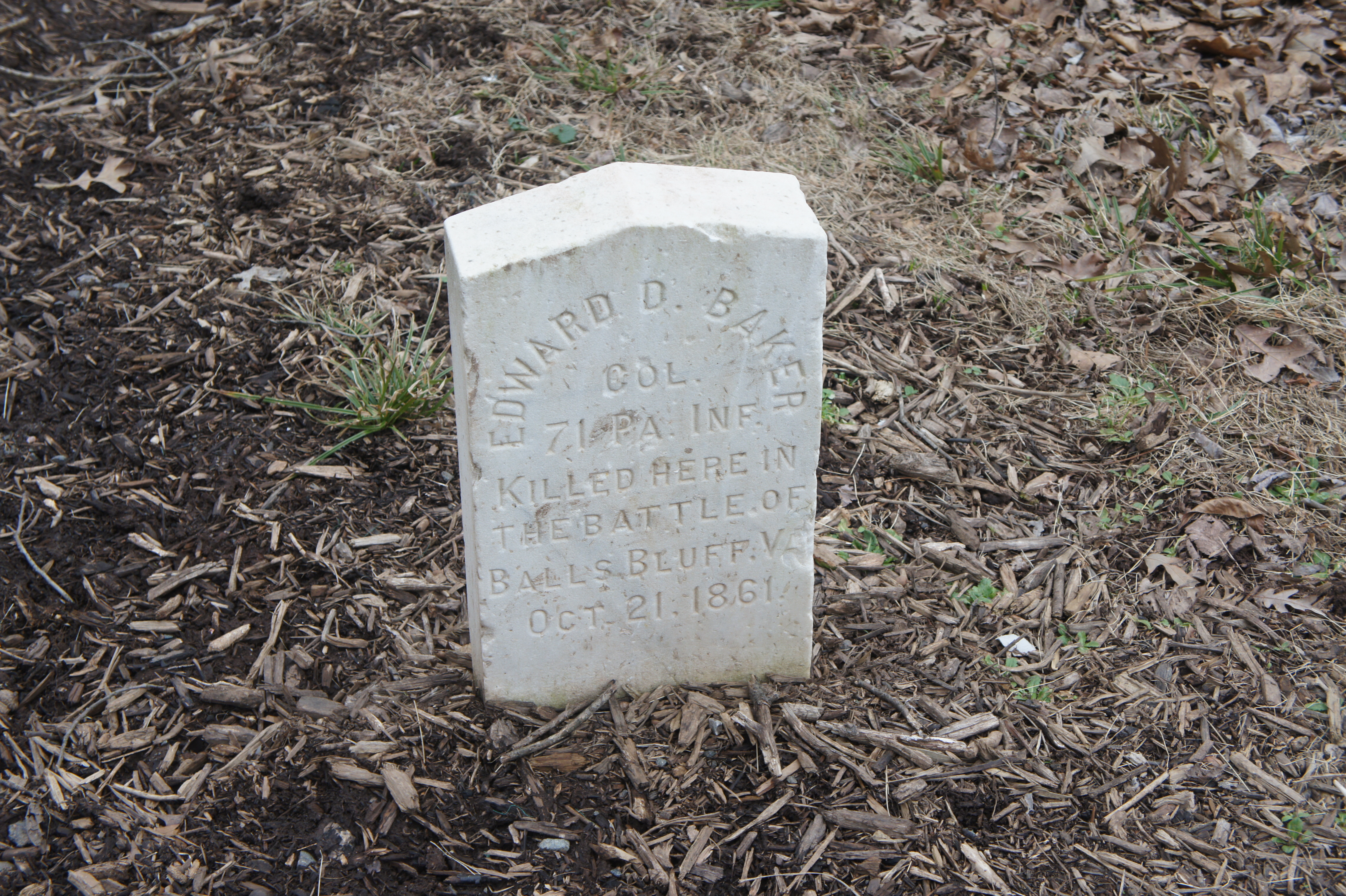
A marker outside the cemetery offers an approximation of where Col. Baker was mortally shot, and a broad wayside with two maps offers an update of where the battle stood in the late afternoon of October 21. What began as a meager Confederate force had grown into an enveloping army, fanned out across the high ground around the meadow. After Cogswell’s brief offensive action failed, the Federal force stumbled back toward the bluff in retreat.
After checking out the cemetery, return to the loop trail and bear left, quickly approaching a sign for the 20th Massachusetts Infantry. This regiment spent much of the day in the rear, boxed between the approaching Confederates and the sheer cliffs leading down to the river. Among the infantrymen in this unit was Oliver Wendell Holmes, Jr., who would go on to become a gifted lawyer and Associate Justice of the US Supreme Court. Company I of the 20th Massachusetts, led by Captain William Bartlett, led the final Union charge of the battle, a short and ill-fated move that was repulsed by members of the 18th Virginia and 13th Mississippi.
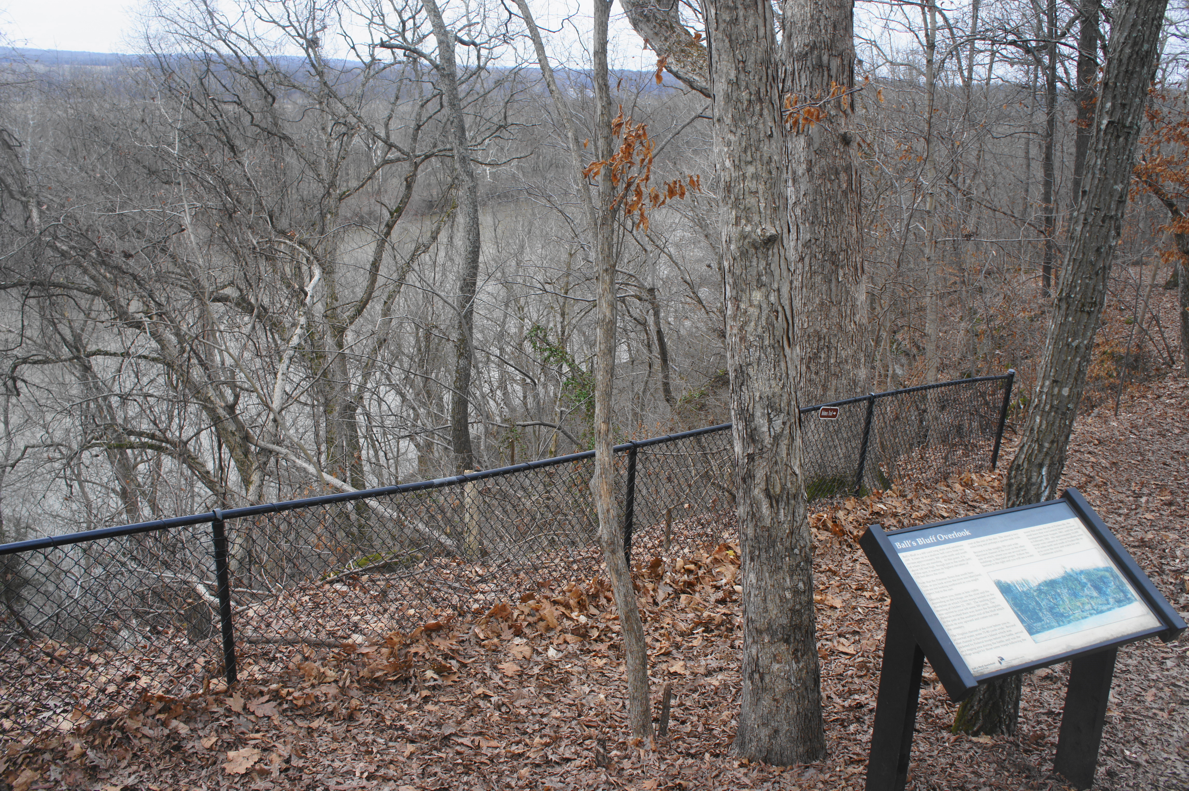
From here, the trail climbs uphill as the river comes into view to the right. At about the 1/3-mile mark, the circuit hike reaches Ball’s Bluff Overlook, a partly obscured lookout high above the Potomac and Harrison’s Island, from where the Federals launched their initial approach. The land beyond the island is mainland Maryland, controlled by the Union but often breached by Confederate attackers during the war.
There is another junction at Ball’s Bluff Overlook. Bear straight on the Devens Trail, which wraps around to the west, back toward the meadow. At 4/10 mile, a spur to the left leads to a pair of Union artillery pieces. (Note: As of February 2019, these pieces were conspicuously missing.) The Federals lugged three pieces of artillery in all to Ball’s Bluff—all of them were overrun by the Confederates. The two mountain howitzers at this position were seized by the 8th Virginia in a bayonet charge at around 5:00pm on the afternoon of the battle.
The Devens Trail hugs the edge of the woods for the next 1/10 mile before approaching a junction with the short Battlefield Restoration Trail on the left. A sign at the end of this spur path discusses the restoration process for returning the battleground to its appearance as it was in 1861.
A minute further down, now following the Hunton Trail, take a right on the Jenifer Trail, which plunges into the forest. Confederate Lieutenant Colonel Walter Jenifer commanded a 300-man cavalry force, a portion of which participated in the early stages of the Battle of Ball’s Bluff. Jenifer’s cavalry was later posted in these woods, playing a largely secondary role during the climax of the battle in the late afternoon.
The Jenifer Trail runs for roughly 150 yards into the woods before reaching a sign for Jenifer’s cavalry, after which the trail abruptly doubles back to the left. Following a deep ravine on the right, the path ends back at the Hinton Trail, completing the minor detour.
Head right on the Hinton Trail, continuing to skirt the fringe of the meadow. The trail reaches a gravel road at about 7/10 mile, where there is a sign and privately-funded monument to the 8th Virginia. This group fought on its native soil during the initial clashes of the afternoon around 3:00pm and then returned to the battlefield for a bayonet charge around 5:00pm that crumpled the Union right.
It was also around this area that the 17th Mississippi arrived around 6:00pm. The addition of these 600-700 fresh troops tipped the balance decisively in the Confederates’ favor, allowing them to drive the Federals to abandon their positions on the cliff. Many of the retreating Northerners were captured or drowned while trying to re-cross the Potomac, while the rest escaped to Maryland with the heavy embarrassment of a staunch defeat in a battle that, with proper intelligence, should have never occurred.
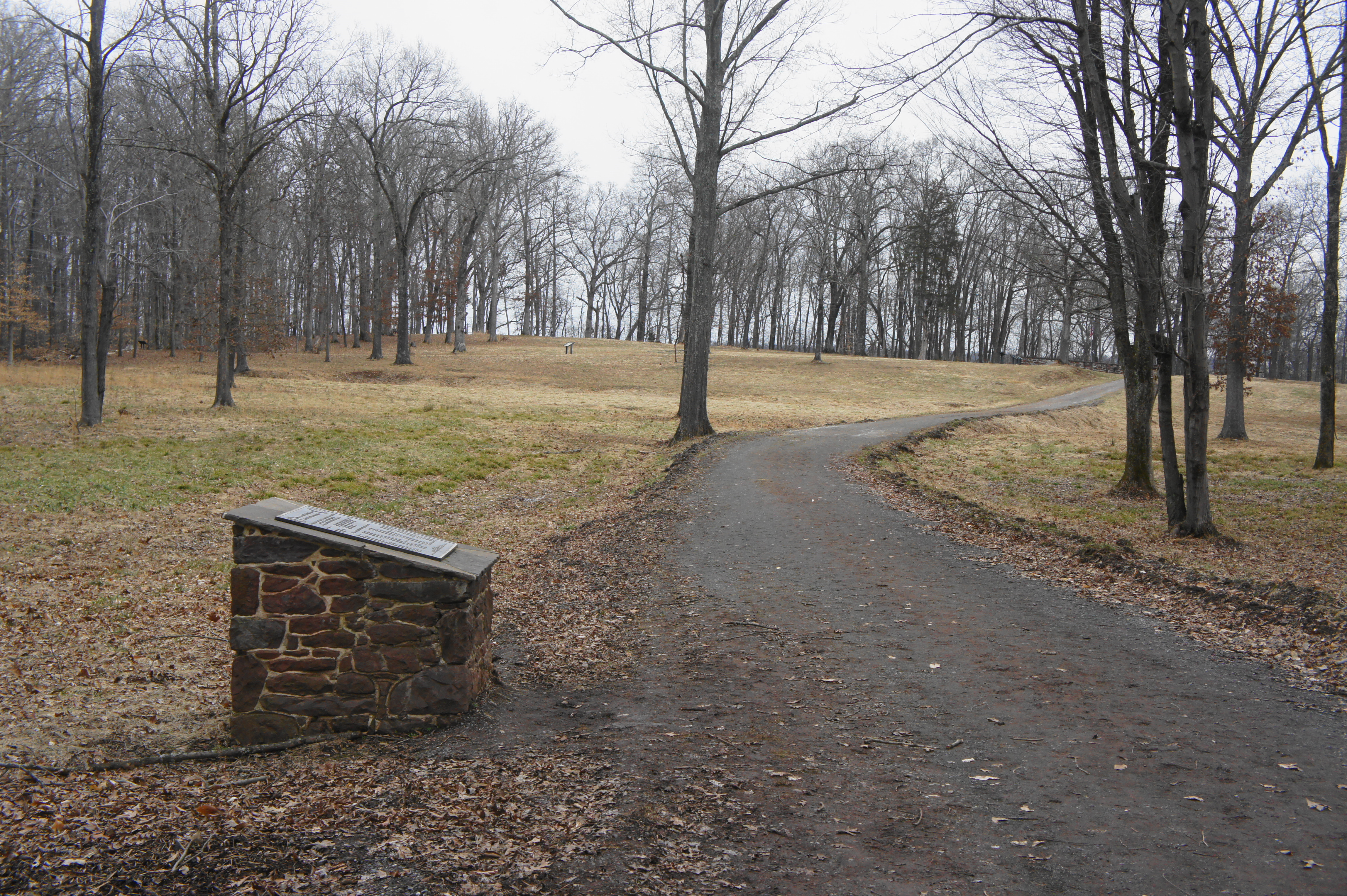
Follow the Burt Trail as it climbs up a hillside, returning to the initial vista with the two maps of the battlefield. Bear right here, dropping back downhill on the Burt Trail to the gravel road and parking area.
All told, the hike clocks in at a mere 9/10 mile, although hikers will want to take their time reading the ubiquitous signage and viewing the many historic markers along the way. Expect to take at least an hour touring the battlefield; there are also a number of other trails in the area, although they generally cover terrain that was relatively inconsequential to the 1861 engagement.
The Battle of Ball’s Bluff had limited strategic consequence, but it had a corrosive impact on Union morale and led to the creation of the Joint Committee on the Conduct of the War, a political instrument of Congress used to investigate Union military losses. General Stone was arrested as a result of the embarrassing loss at Ball’s Bluff, which did irreparable damage to his status before the battle as a rising star in the Union Army.

We didn’t make it to Ball’s Bluff when we did our Civil War battlefields tour, I would love to check it out sometime though! Great pics and write up.