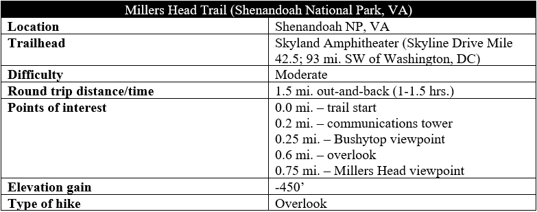
The short but steep hike to Millers Head in Shenandoah National Park’s Skyland area, while otherwise unspectacular, has one terrific payoff: excellent views of the Blue Ridge Mountains and Shenandoah Valley, a particular treat around sunset. The out-and-back trail follows a snaking ridge out to a series of viewpoints, culminating in a partial panorama that is one of the best in Shenandoah’s Central District.

The hike
Catch the start of the ¾-mile path from the Skyland Amphitheater, situated roughly 11 miles south on Skyline Drive from the Thornton Gap Entrance Station in Shenandoah’s Central District. (Note: There is parking at the amphitheater or just outside the “Franklin” cabins, which are part of the Skyland Resort.) The trail begins just north of the amphitheater, cutting across a grassy lawn before entering Shenandoah’s ubiquitous woods.
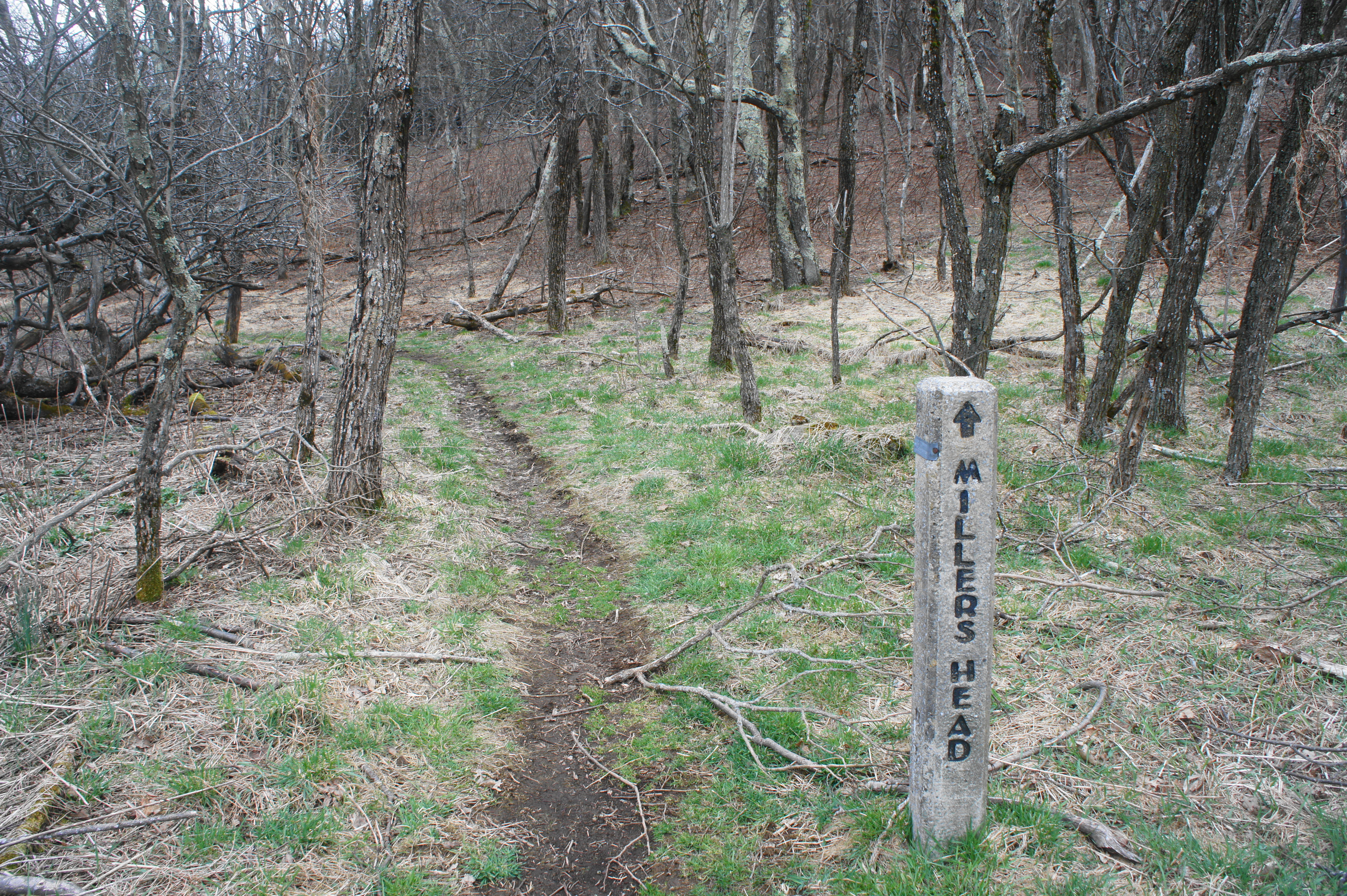
The narrow single-track begins as a gently meandering path, cutting close to a lightly-used gravel road and passing under a set of power lines. At around 200 yards, the trail crests a ridgeline dotted with shady hemlocks and then levels off. The gravel road enters from the left, and the path approaches a small communications tower at 2/10 mile.
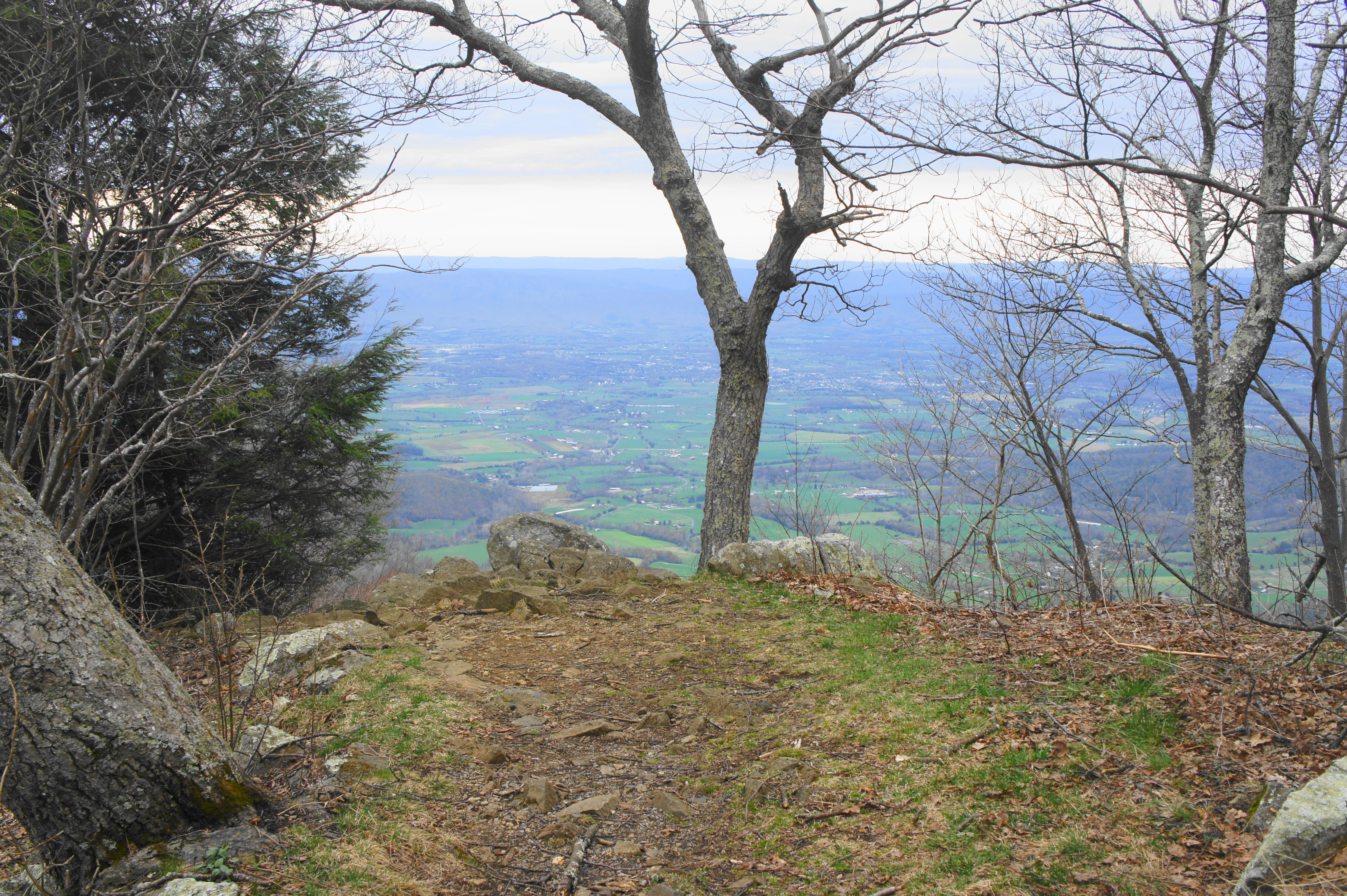
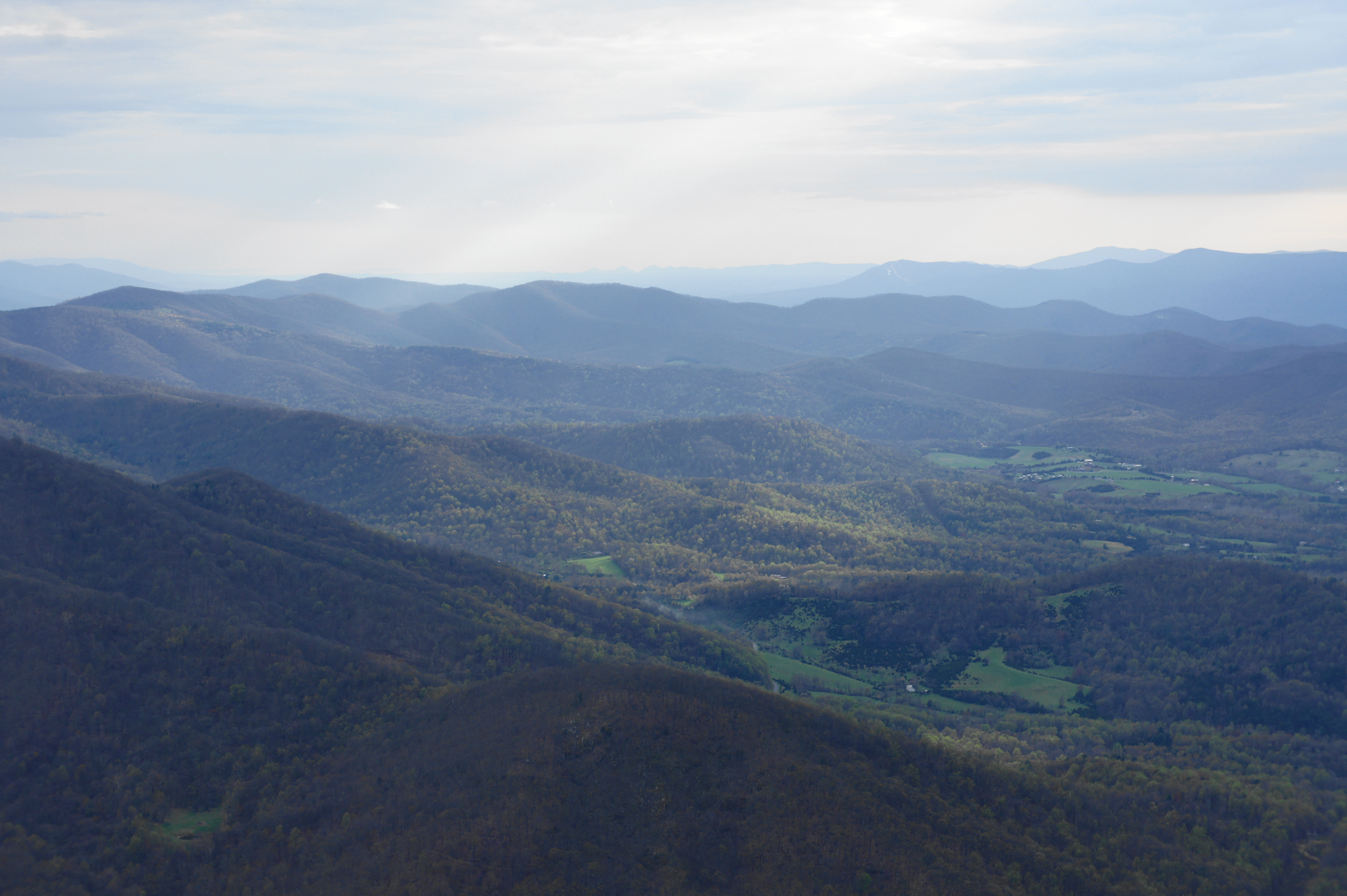
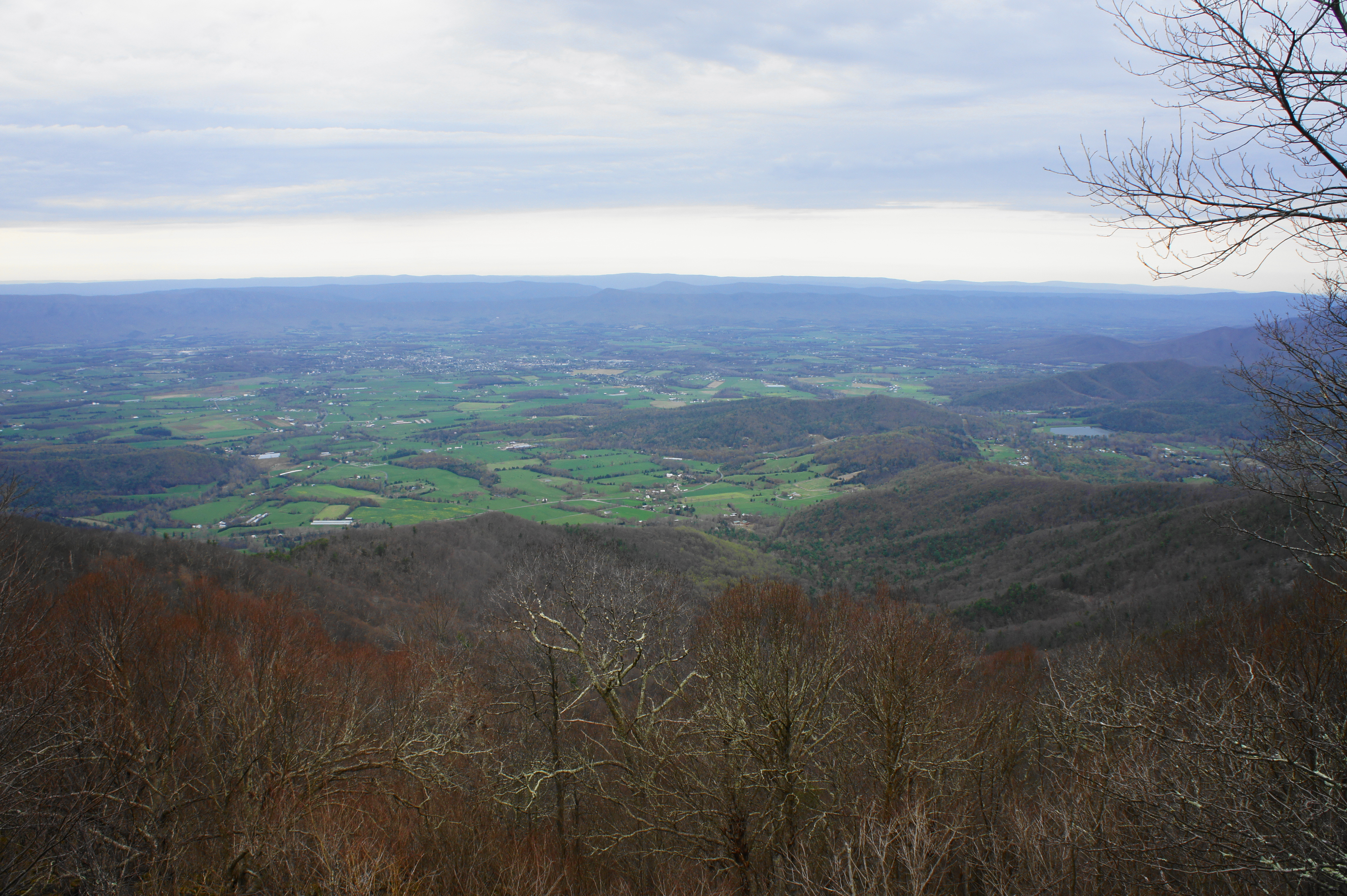
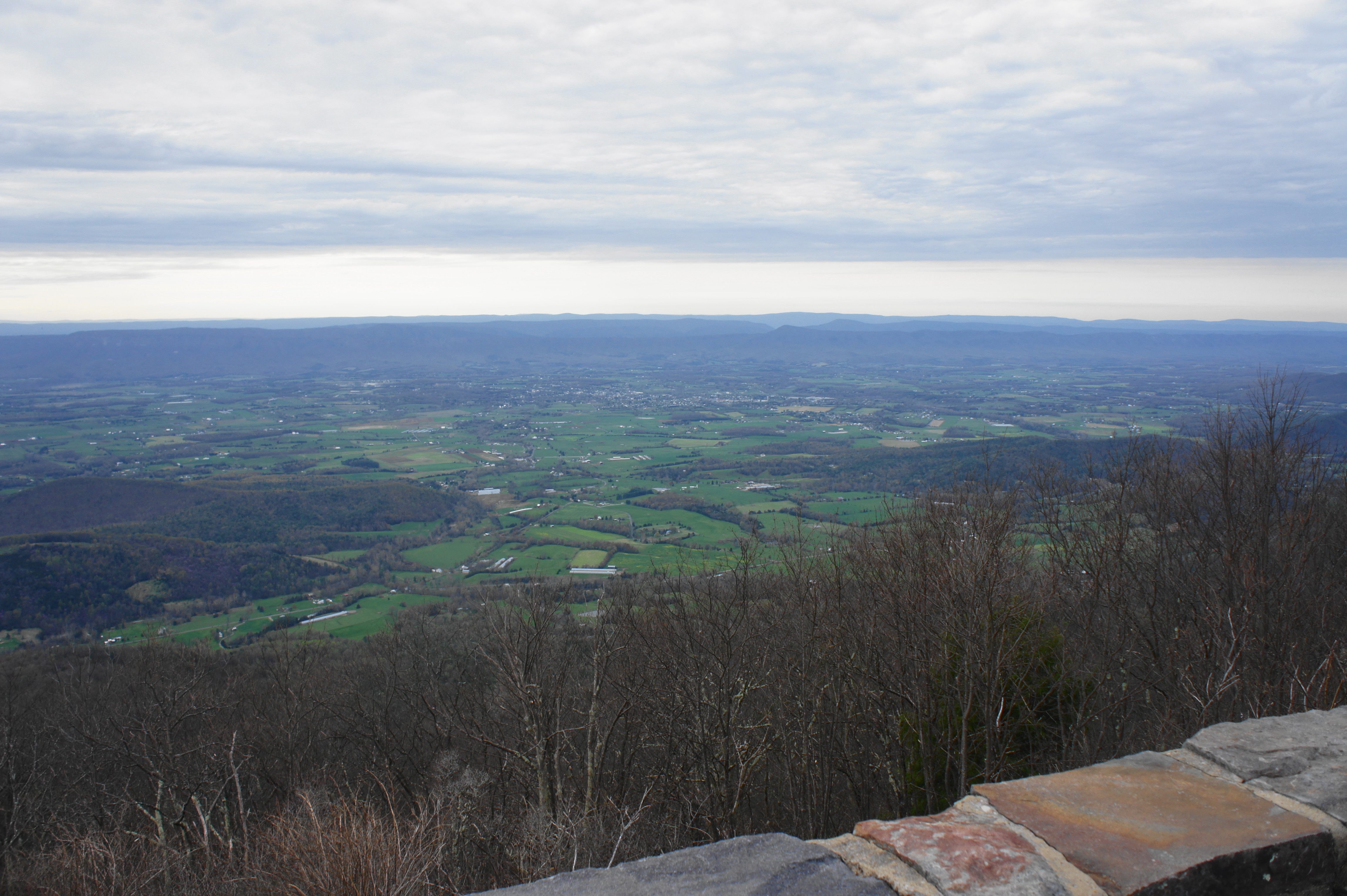
Passing to the right of the tower, the route descends to a trail fork, where a very short spur leads 40 feet to the right. Take this detour to the first of three fine viewpoints on the hike: the Bushytop observation point. This lookout offers expansive views to the northwest, peering out over the Shenandoah Valley, itself a patchwork of open farms and dense woods. The small pond visible nestled at the base of the Blue Ridge Mountains is Lake Arrowhead, while the largest town in the valley is Luray, Virginia. On clear days, one can easily spot Massanutten Mountain in the distance, with Great North Mountain beyond.
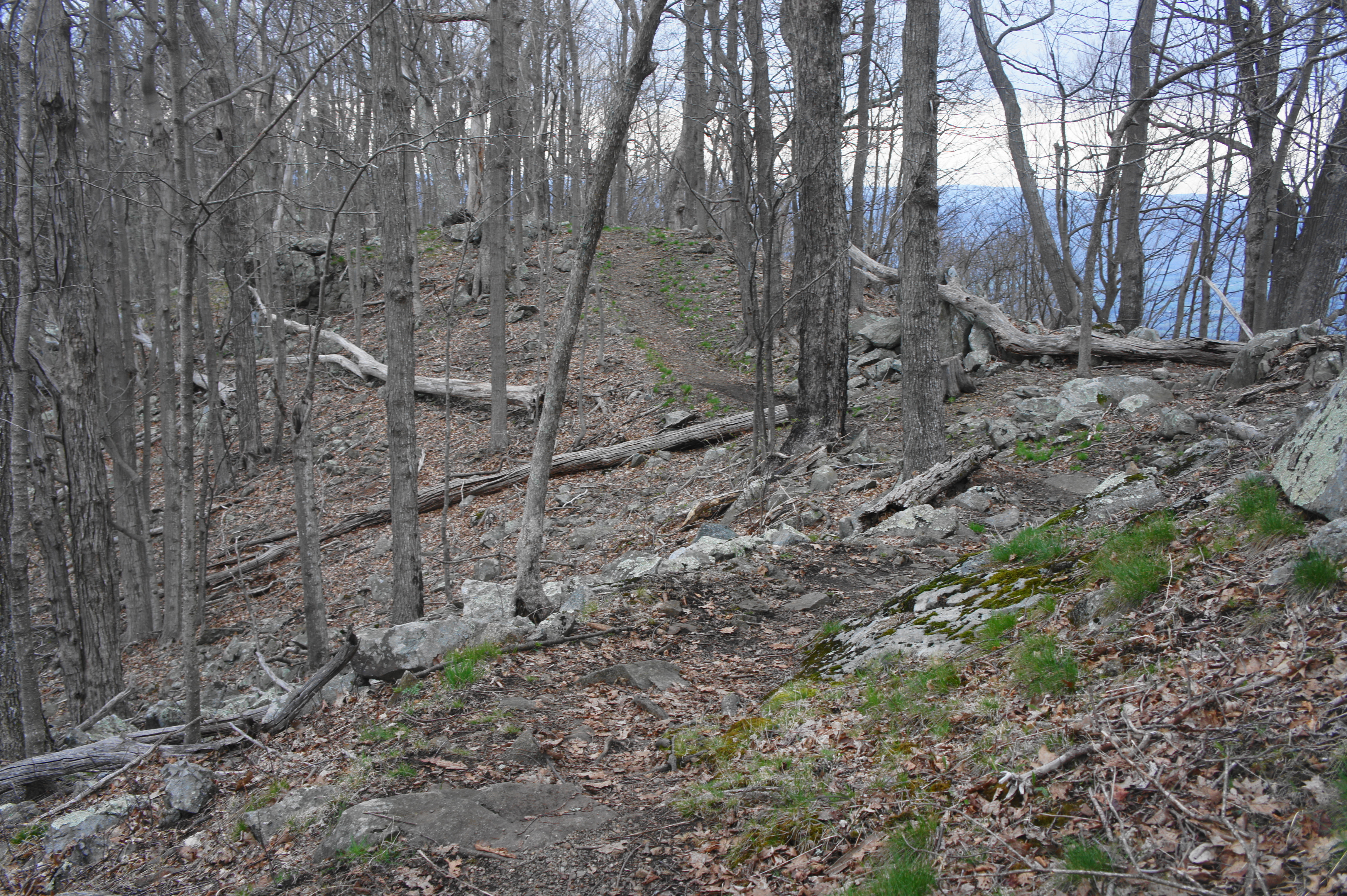
From the overlook, work your way back to the main trail and turn right, beginning a sharp descent from Bushytop down to Millers Head. The next 2/10 mile are very rocky, with several steep and abrupt bends. The switchbacks ease at around 4/10 mile, when the trail briefly levels off and the ridgeline narrows considerably. Steps later, the route passes to the left of a tall rock outcrop.
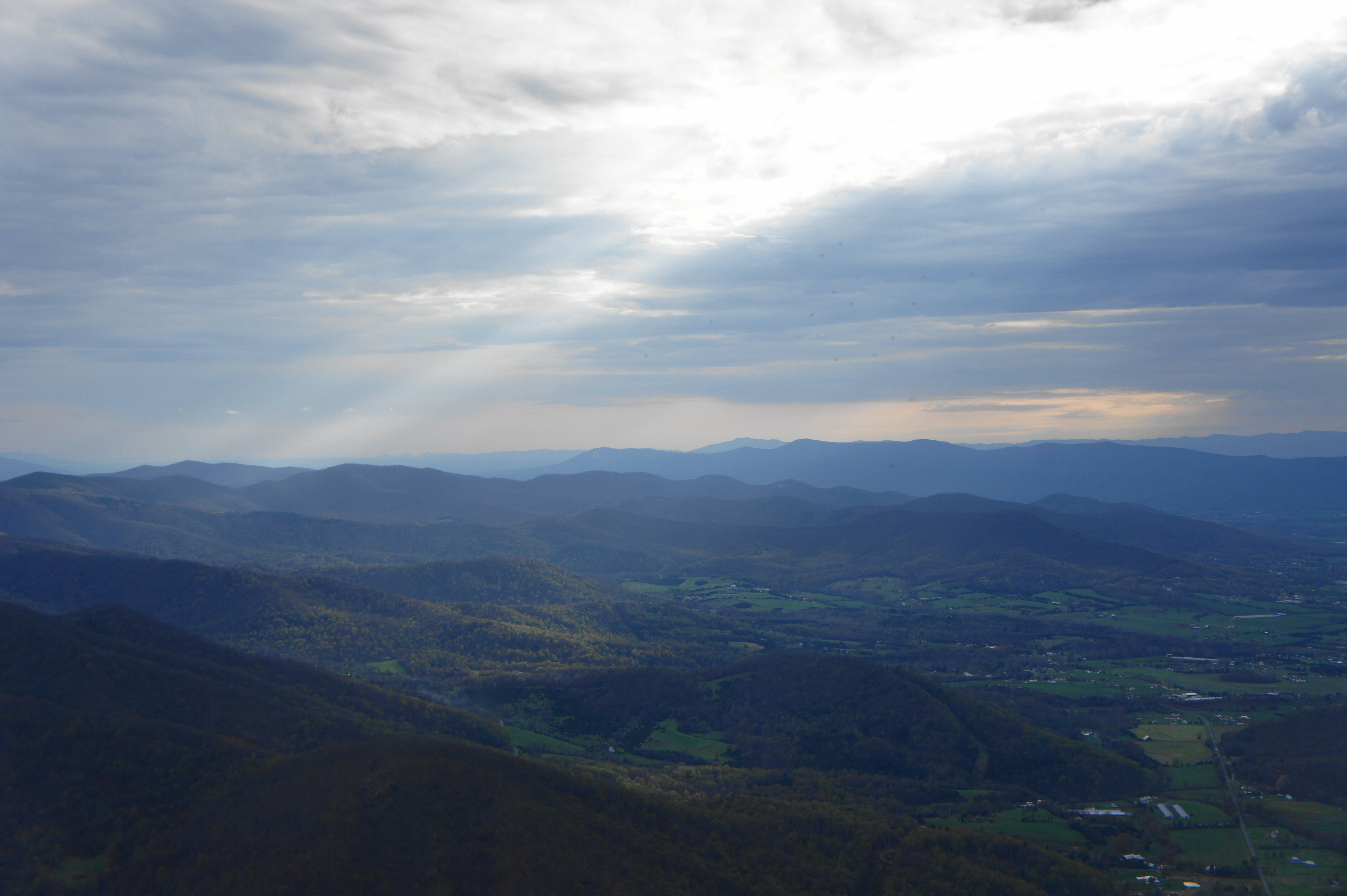
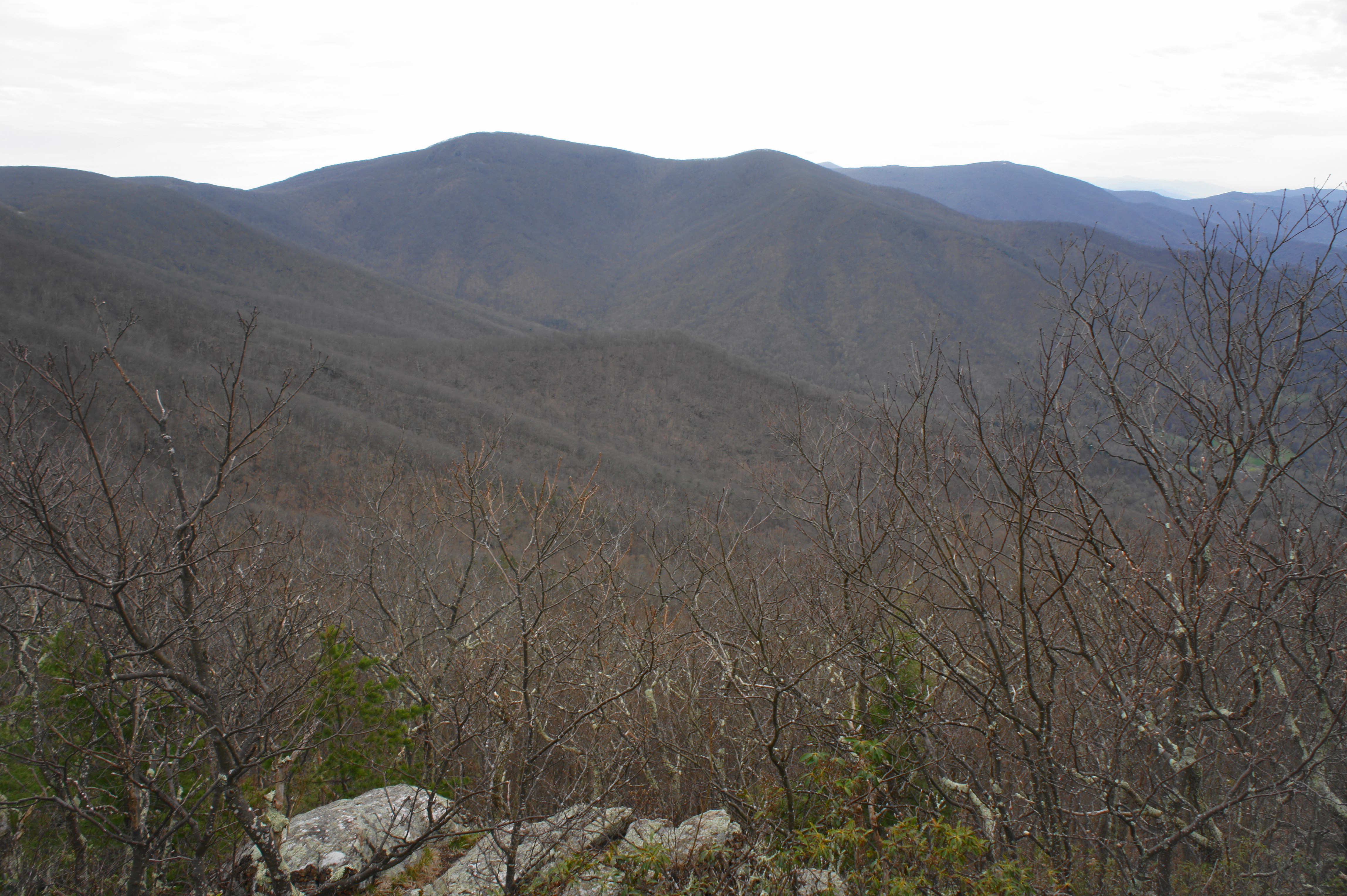
At 6/10 mile, look to your left for a short spur to another fine viewpoint. This one showcases views to the south; the dominant feature is mighty Hawksbill (4,050’), the highest peak in Shenandoah National Park. Beyond Hawksbill, the next high ridge includes the Big Meadows area and Blackrock, which leads westward into Tanners Ridge.
Back on the trail to Millers Head, the terrain drops again, snaking around a set of choppy bends. Cresting a small gap between outcrops, the trail cuts to the right flank of the ridgeline, marking the final stretch of the hike. At about ¾ mile, hikers must make a short climb, finally ending at a well-manicured viewing platform: Millers Head observation point.
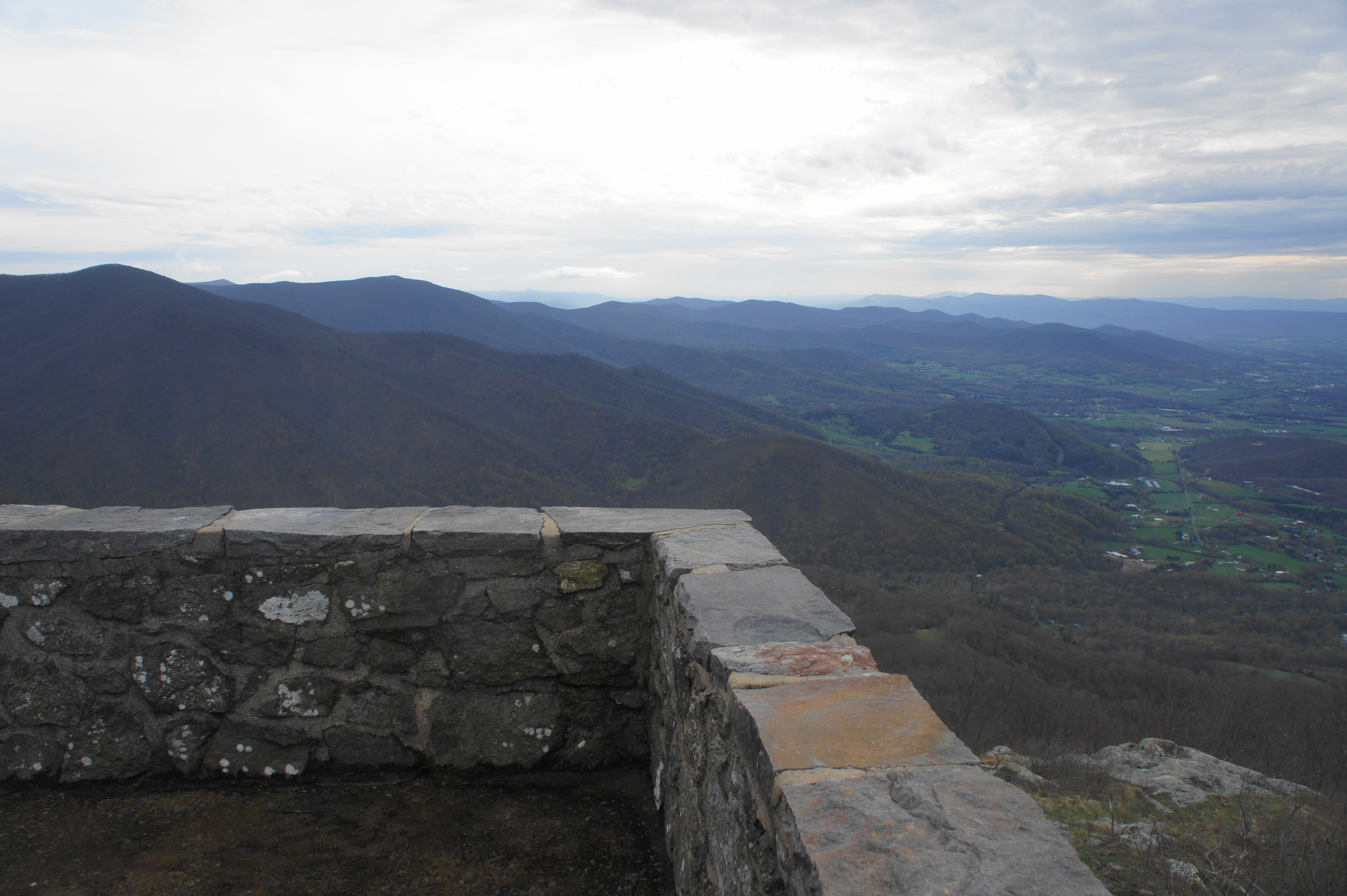
The view from Millers Head puts the previous vistas to shame: there are few to no obstructions to a 270-degree panorama, from Hawksbill to the south to the North District of Shenandoah to the north. Shenandoah Valley unfolds in beautiful splendor below, with Massanutten and Great North Mountains beyond. The scene is particularly spectacular around sunset, as the day’s last light nestles behind the ridges to the west.


Once you have soaked in the view, head back the way you came. The return journey should take longer than your arrival because hikers will have to negotiate 450 feet in elevation gain. Pack water for this deceptively short but tiring hike, and allot perhaps 1-1.5 hours for the round-trip journey.