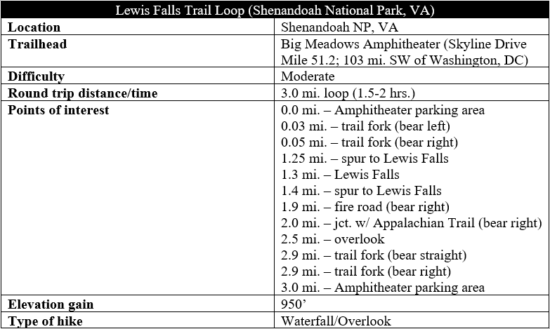
Although not the best waterfall hike in Virginia’s Shenandoah National Park (see here and here for better ones), the Lewis Falls Trail offers a fine view of one of the park’s highest cascades, while a short jaunt on the Appalachian Trail (AT) completes the circuit and features fantastic views of the Shenandoah Valley. The loop hike is moderately difficult, with some steep and rocky stretches; the AT section, which is considerably smoother, passes below the towering Blackrock Cliffs and dives behind Big Meadows Lodge on the way back to the trailhead.
The hike
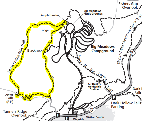
There are several places in the Big Meadows area of Shenandoah’s Central District to begin the roughly 2-hour loop journey, but the most logical place to start is at the Big Meadows Amphitheater, situated along the far curve of a one-way loop drive, next to the Big Meadows Campground. There is relatively limited parking at the site, but it should not be overly crowded.
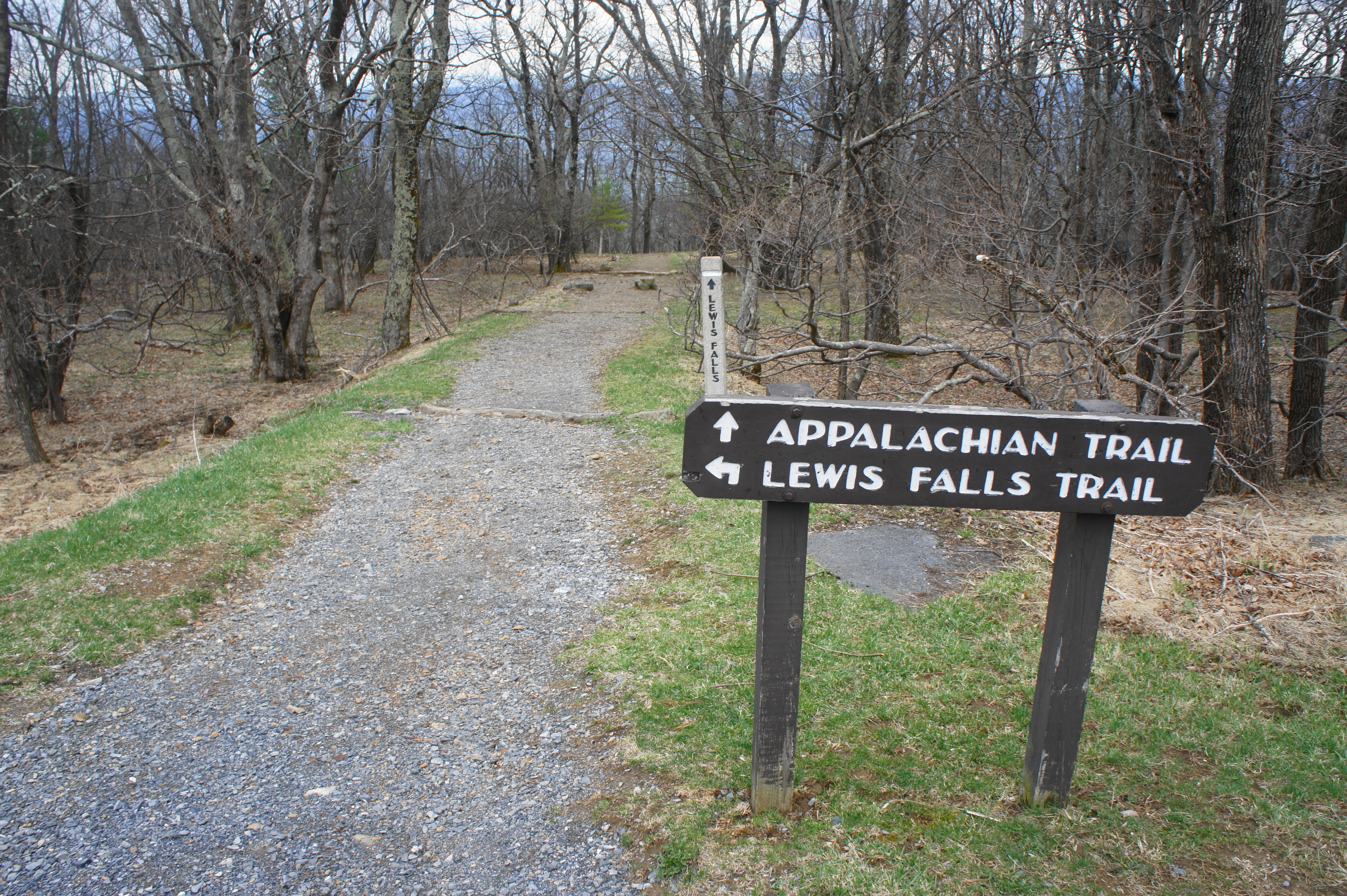
To the left of the small outdoor amphitheater, look for a sign marking the way to the Lewis Falls and Appalachian Trails. Start down the graveled path as it descends 50 yards to the first of several trail junctions. At the cement post, bear left on the Appalachian Trail (AT) for a brief moment. Within a minute, you will reach another fork; this time bear right on the blue-blazed Lewis Falls Trail.
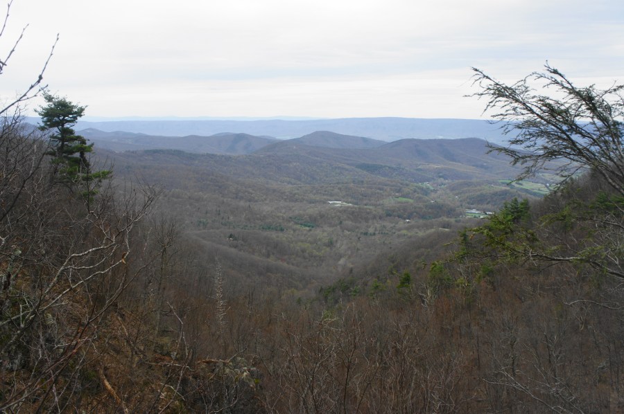
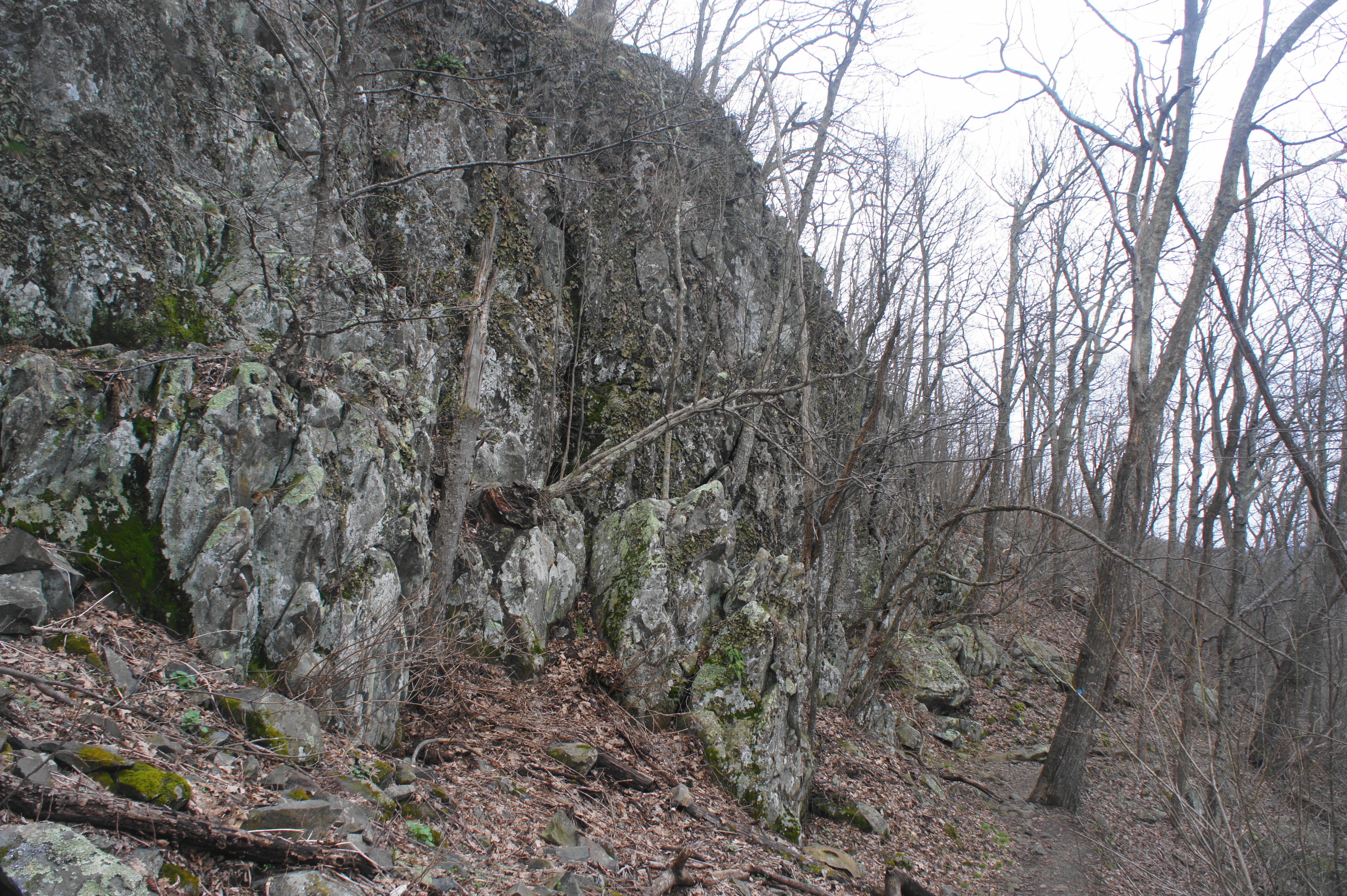
This winding path begins within a pleasant, gradual decline along the northern slopes of the mountain, weaving amid trees with some obstructed views of the Shenandoah Valley below. At ¼ mile, a rocky perch on the right offers a limited vista; another stony outcrop minutes later also provides a similar view. By now the incline drops in fits and starts, with occasional steep sections. As the path bends southward, the track becomes rockier and more difficult to navigate, requiring careful attention. Around 2/3 mile into the hike, a 30- to 40-foot cliff towers over hikers on the left, ushering in a steep but brief descent. Outcrops and rock slides become more frequent as you continue to shed elevation.
At around one mile, the path turns eastward and enters a broad gully; this is the ravine carved by Hawksbill Creek, which can now be faintly heard down below. After passing a group of Virginia pines, the trail embarks on a rocky traverse, requiring cautious footing to negotiate. Although the falls are still not quite visible, one can sense by this time that they are very near.
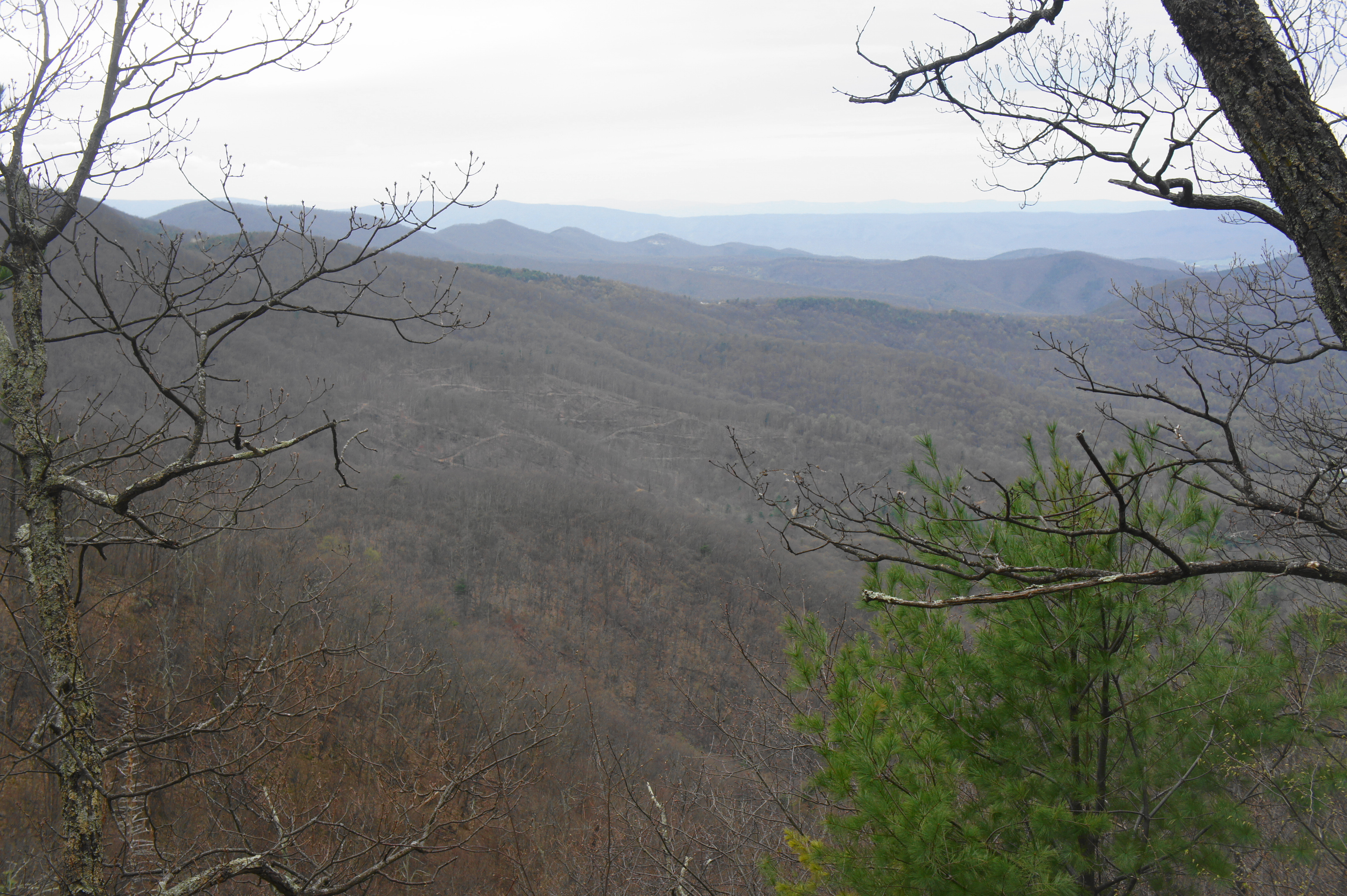
A set of outcrops brings better views of the gap in the Blue Ridge Mountains and Shenandoah Valley to the west. Lengthy Tanners Ridge dominates the landscape to the south, with some minor ridges and bumpy peaks beyond. After a short climb, the trail drops again, reaching a cement post and trail fork at 1.25 miles. This is the start of the short spur to the falls.
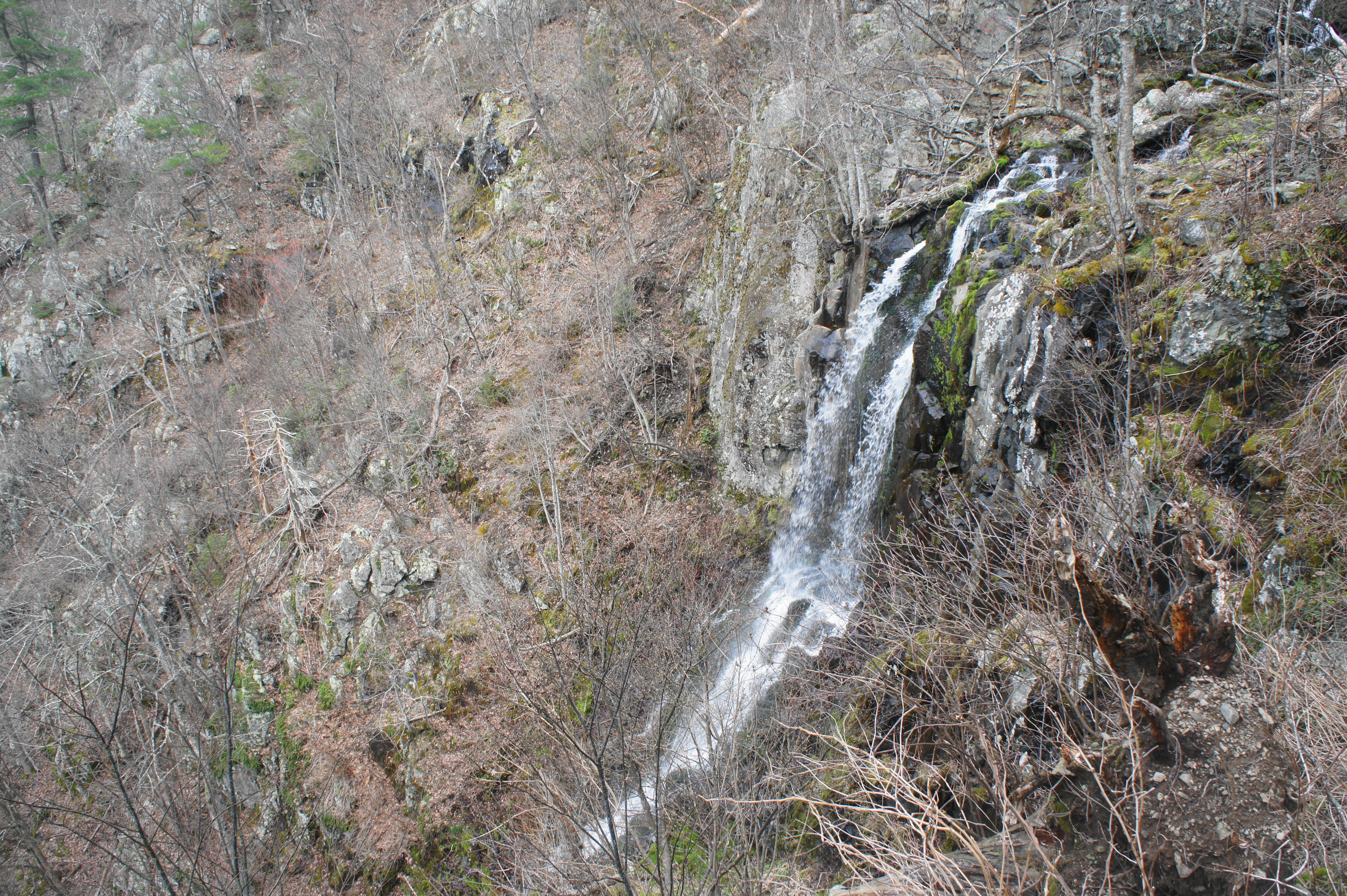
Bear right on the spur trail, heading out to an overlook above Lewis Falls (or Lewis Spring Falls), which drops 81 feet down a single chute to the valley below. The water flow is not always as impressive as other waterfalls in Shenandoah, but the sheer drop makes Lewis Falls appear mighty and intimidating.
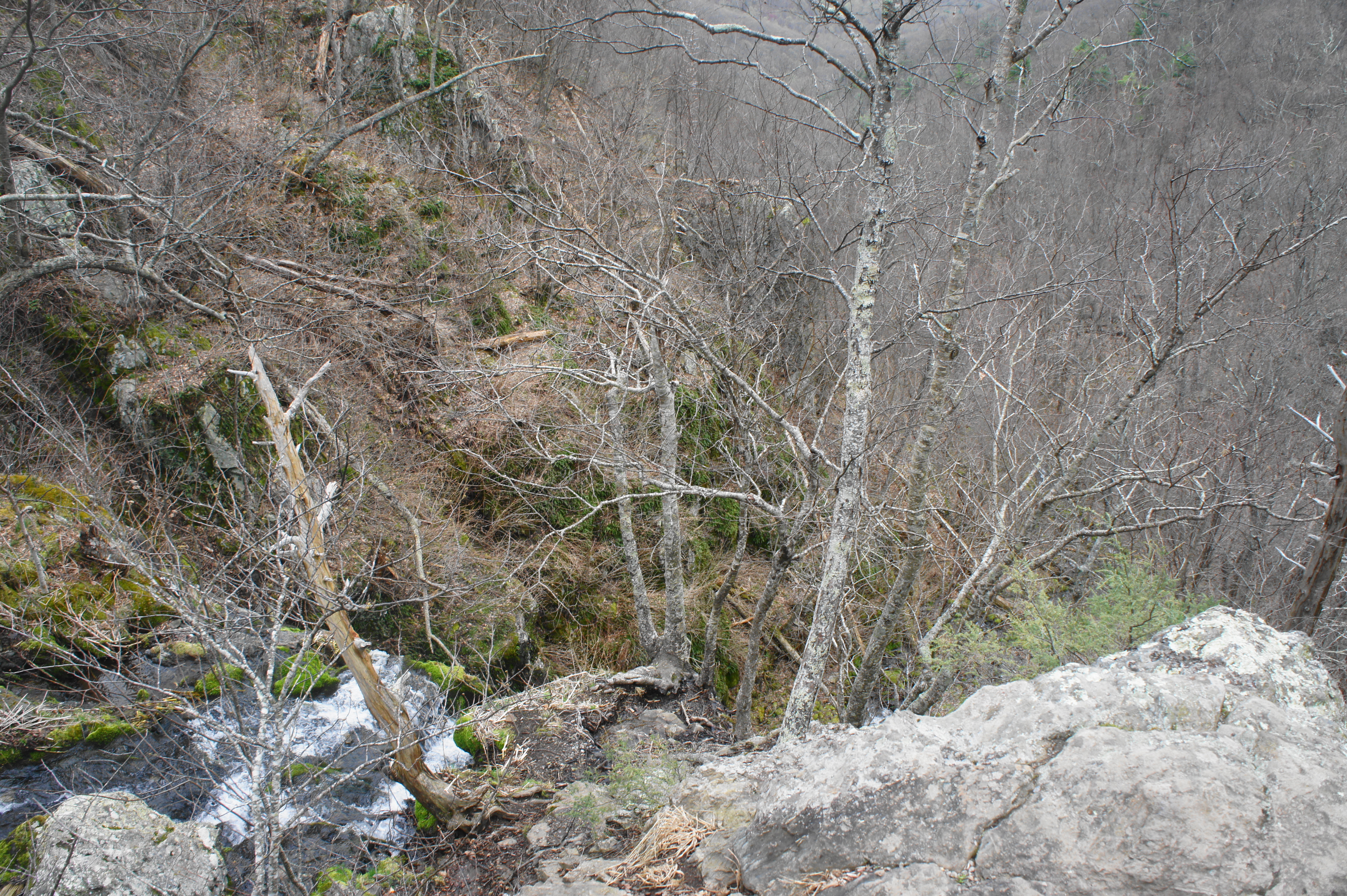
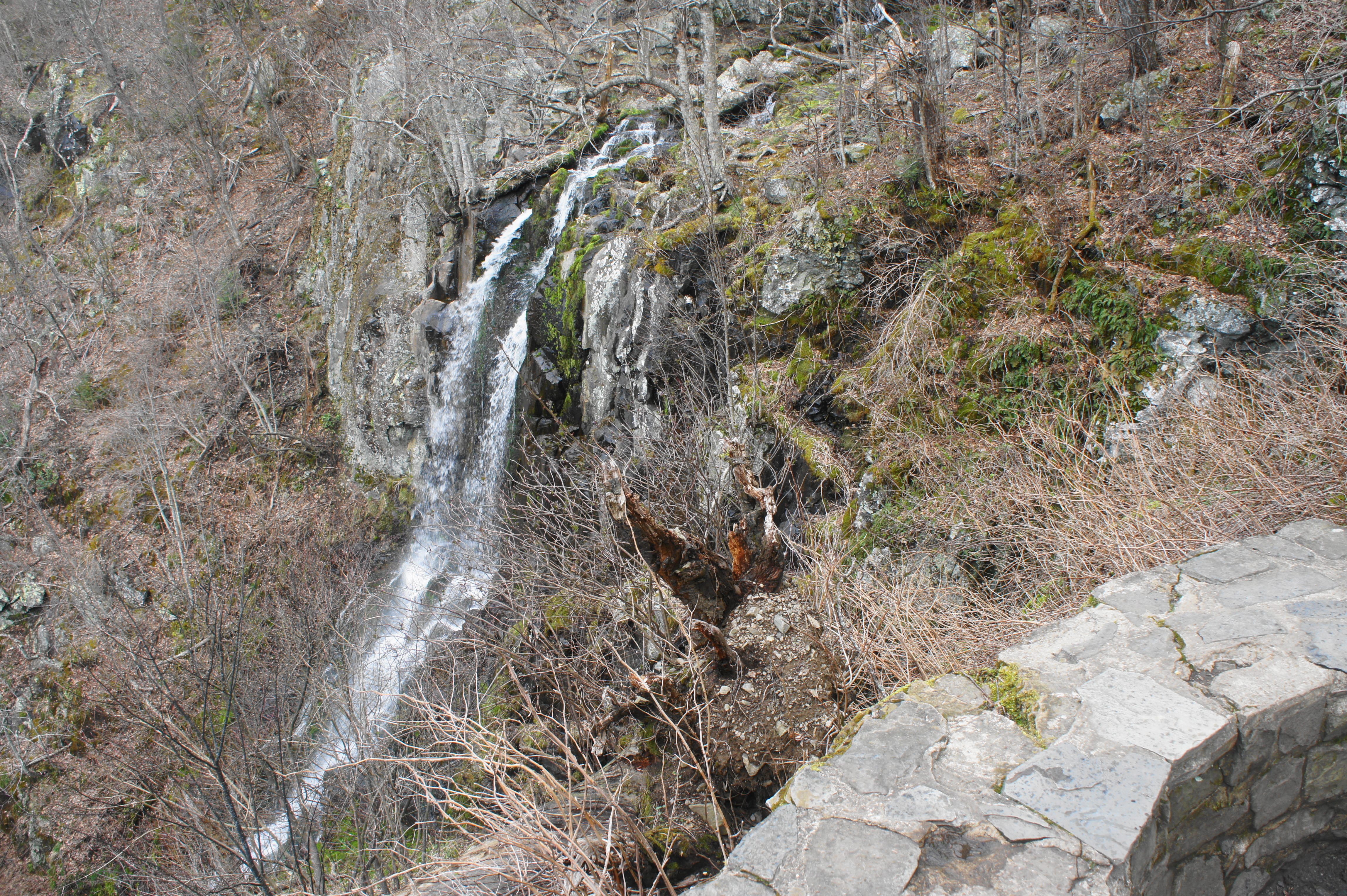
Some stop here and continue onward, but the best views of the falls lie further down the spur trail. From the overlook, head right down to the banks of Hawksbill Creek, just above the top of the falls. Take care as you rock-hop across the moss-laden stream, then follow the well-worn path as it approaches an overlook on the south side of the falls. The descent to the viewpoint can be steep and slippery, making the guardrail a nice addition. From the overlook, around 1.3 miles from the trailhead, most of Lewis Falls comes into view.
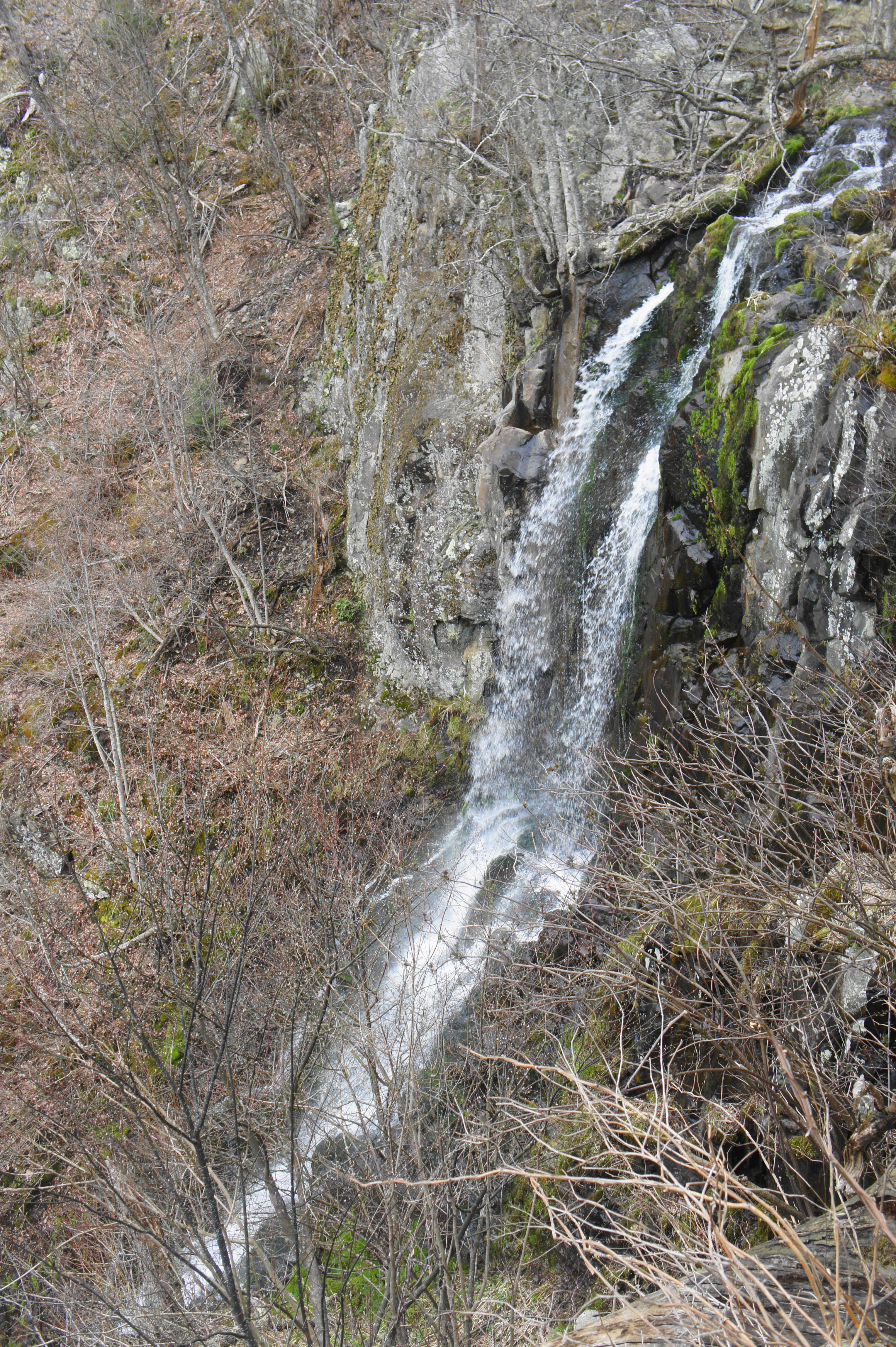
The waterfall divides into two threads as it free-falls down the cliff. The falls are situated at the fault line between rock belonging to the hard Catoctin Formation above and more eroded monzodiorite below, with loose, unconsolidated colluvium deposits scattered at the base of the falls. It is this transition that makes the high cliffs—and thus the vertical drop of the falls—possible.
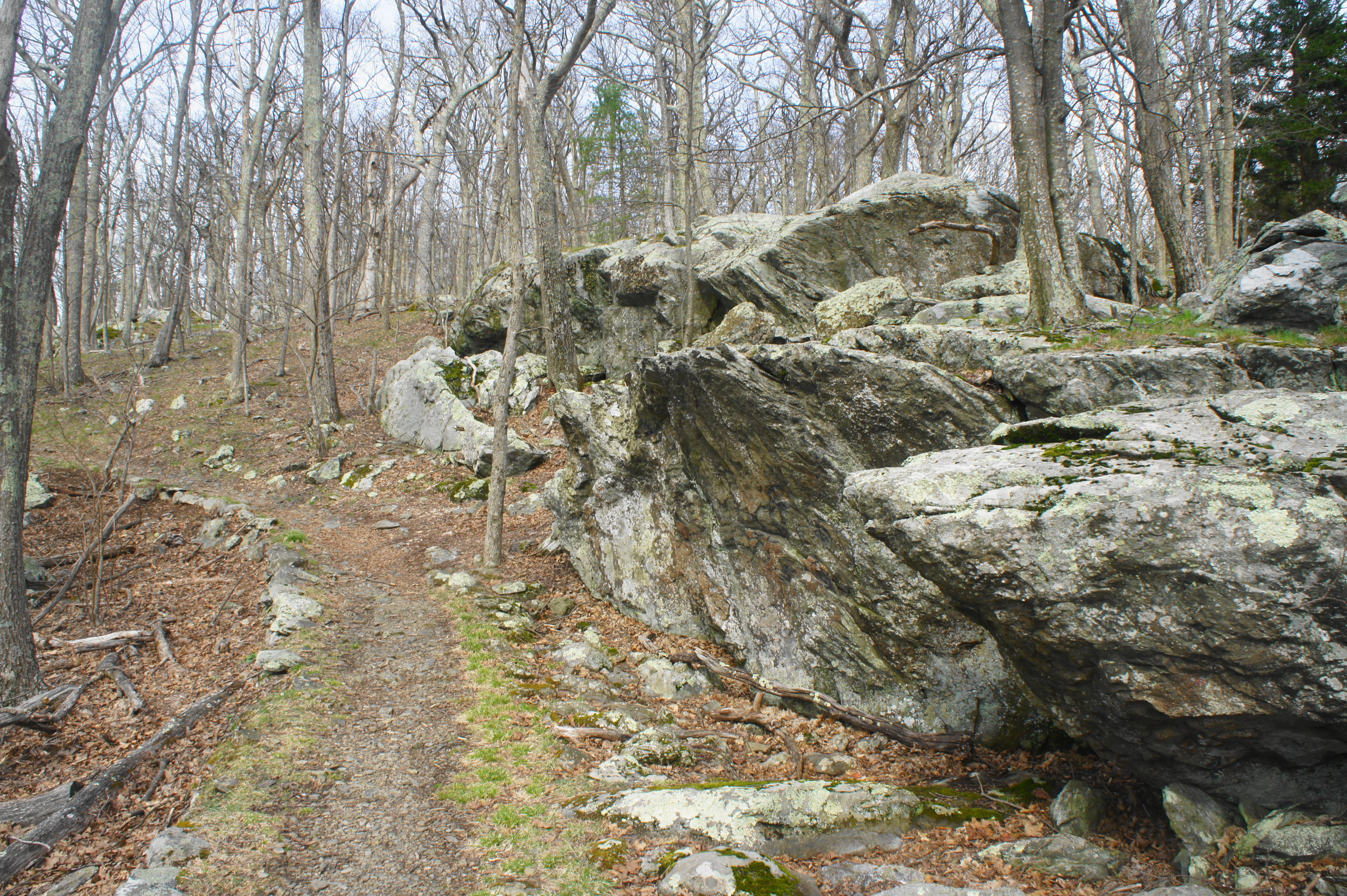
From this overlook of Lewis Falls, make your way back to the start of the spur path. This time take a right at the cement post, beginning a section of steep climbing. From here the path crosses a minor tributary, and the main gully opens into a wide, tree-laced bowl. At 1.5 miles, the route abruptly switchbacks to the left, followed quickly by a right-hand bend amid a patch of mountain laurel. The switchbacks continue for another 2/10 mile, quickly gaining elevation and leaving the falls area behind. Atop a ridgeline, the Lewis Spring Falls Trail passes a large rock outcrop on the right at 1.8 miles, and one can hear and view the stream again for a brief period.
At 1.9 miles, the trail spills out onto a gravel road. Take a right and follow the track for 80 yards, passing a storage bunker on the left. Instead of following the road back to Skyline Drive, however, take a left on the white-blazed Appalachian Trail, initiating the final leg of the hike.
The one-mile stretch along the AT begins as a gradual and generally unassuming ascent through endless stands of trees. One can spot a park-owned house on the right at about 2.2 miles. Minutes later, the rock outcrops reappear, and boulders are scattered across the rising slopes.
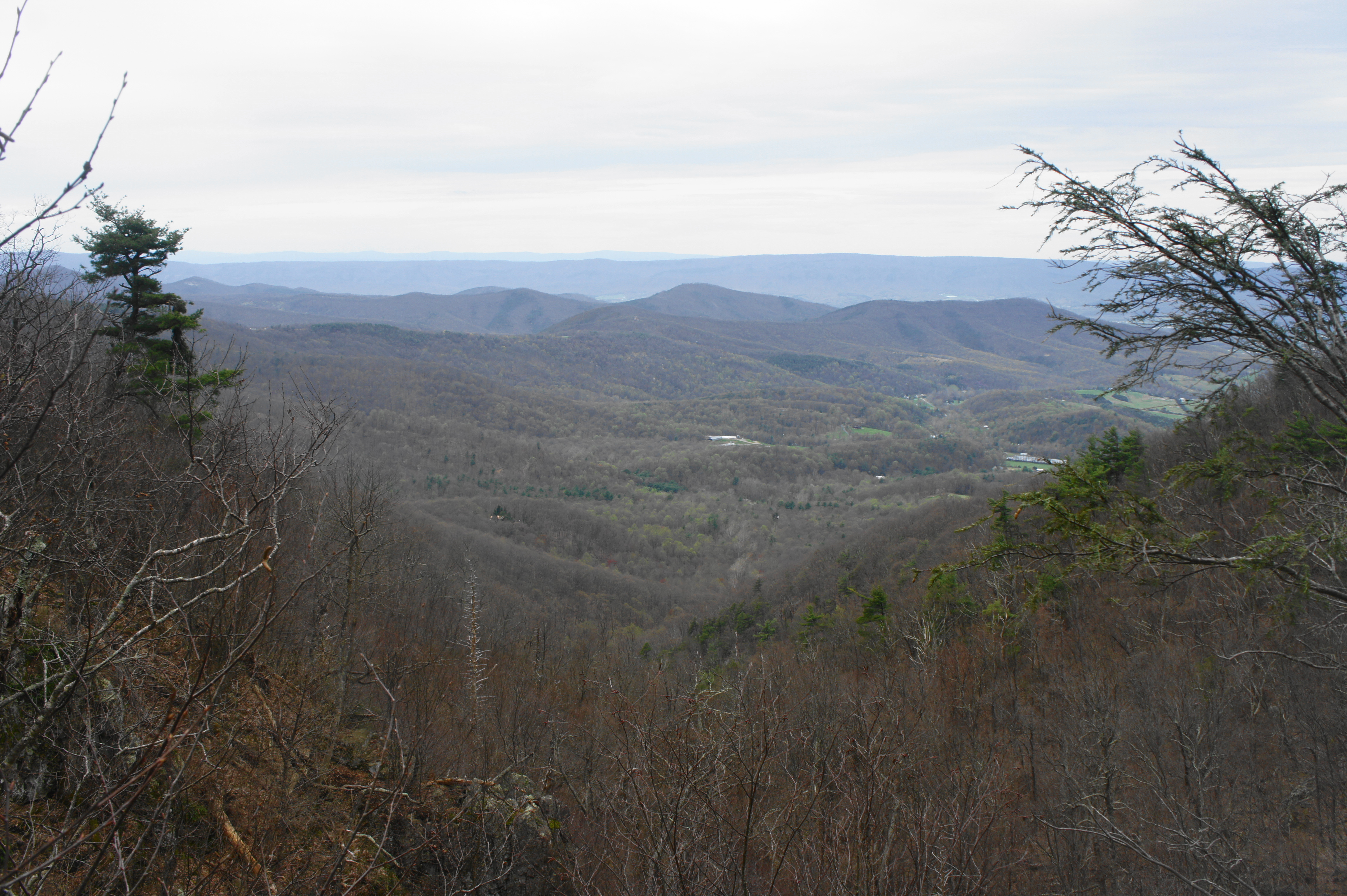
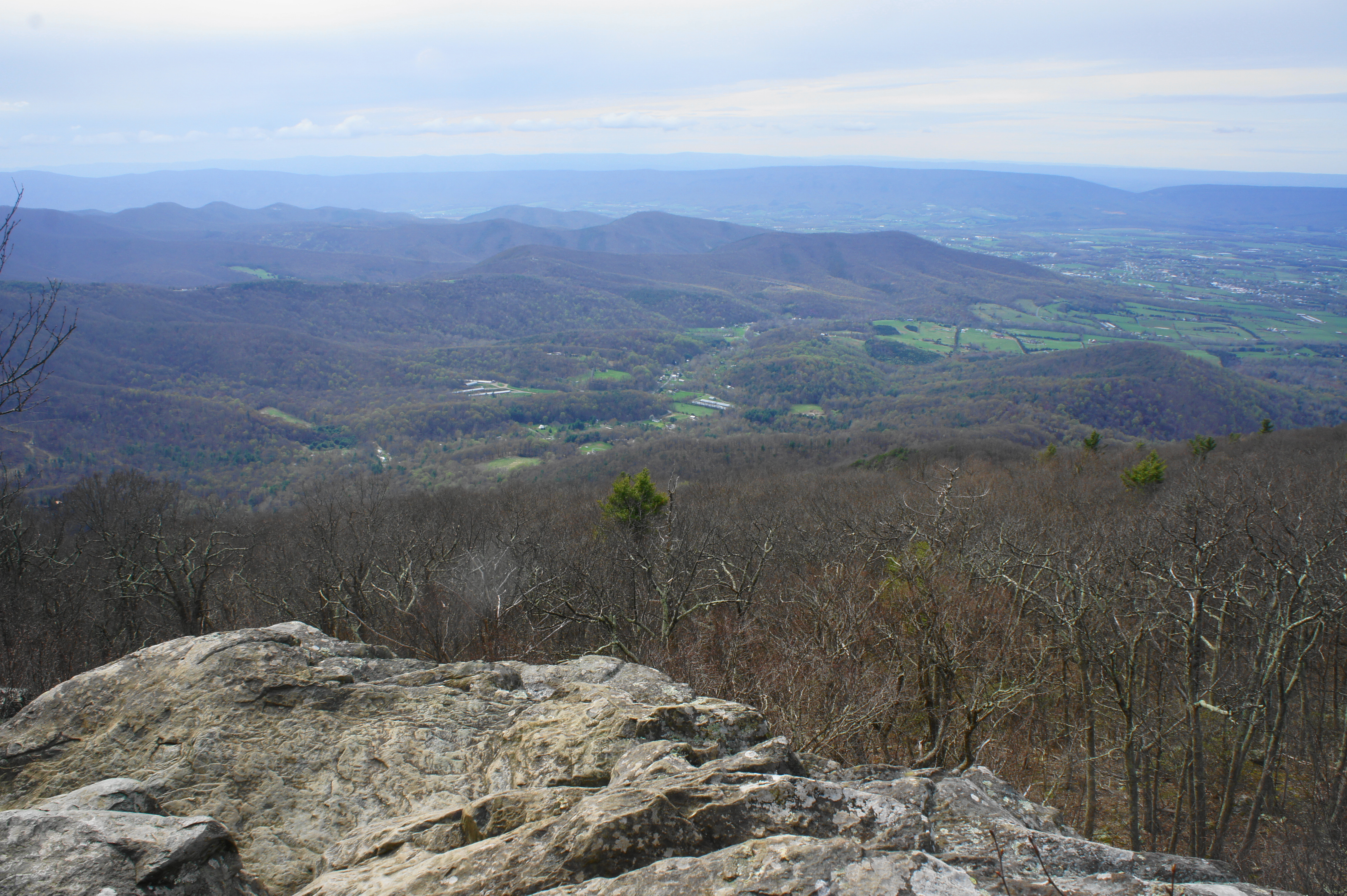
As the trail briefly levels off, a set of outcrops on the left offer excellent views to the west, spanning Shenandoah Valley and extending to the miles-long ridges of Massanutten Mountain and Great North Mountain beyond. The break in Massanutten Mountain to the west, beyond the towns of Stanley and Marksville, is New Market Gap, with Strickler Knob (2,780’) visible. As the eye follows Massanutten north, the mountain splits into two ridges, with Fort Valley in between. The town in the foreground to the northwest is Luray, Virginia.
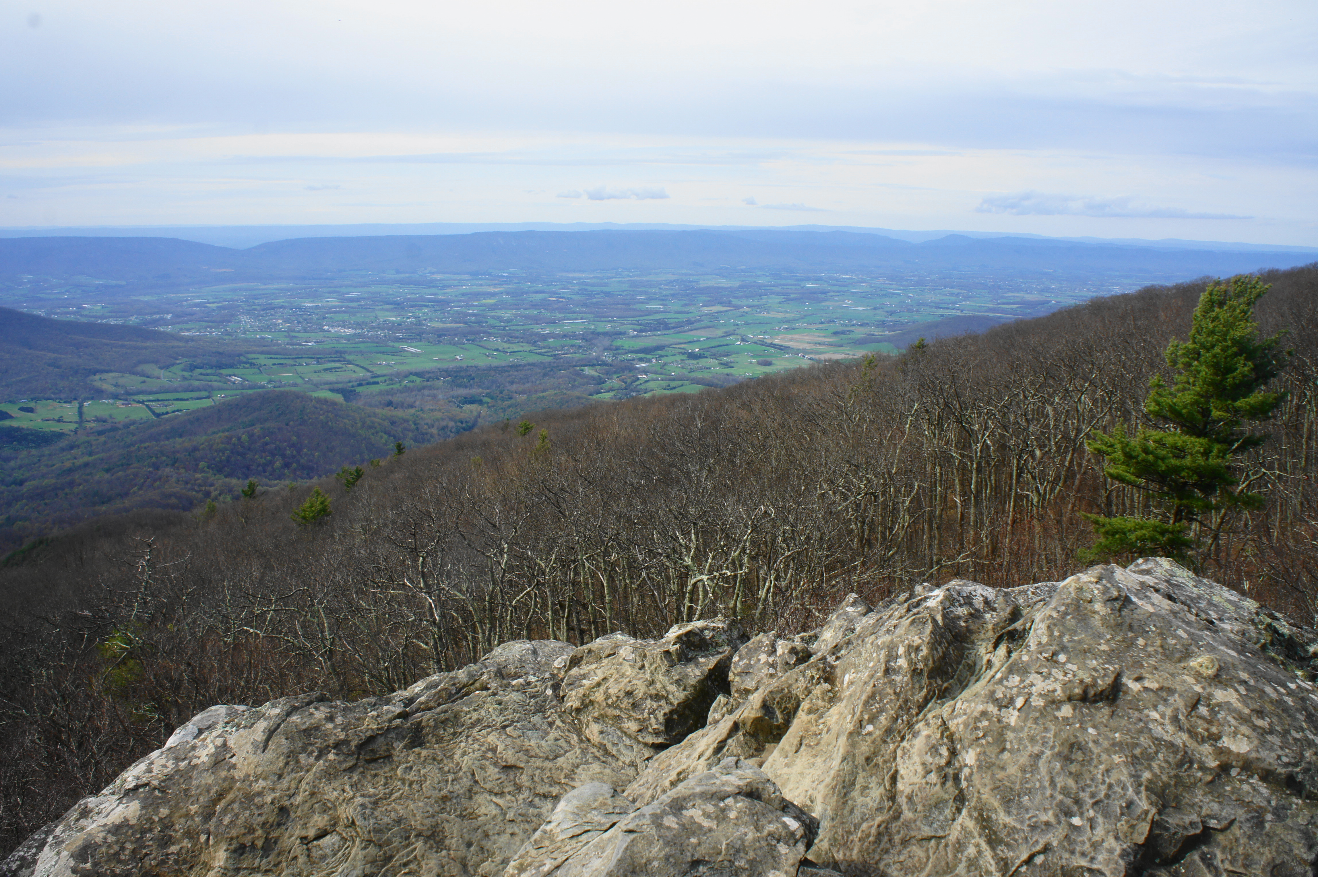
To the southwest, the Blue Ridge Mountains of Shenandoah extend out into a westward arm, with a set of north-south ridges. The hump at the foot of Tanners Ridge is Roundhead Mountain, followed behind it by Dog Slaughter Ridge, Cubbage Mountain, and Dovel Mountain.
After the vista point, the trail hugs the base of sheer cliffs on the right, with the jagged peak of Blackrock above. (Note: Maps show a connector trail to Blackrock from the AT, but I was unable to find it.) The AT passes the rear of several buildings belonging to Big Meadows Lodge, a popular summer destination. From here it is a gradual uphill along the AT back to the original pair of trail junctions. Stay straight at the first, five-way junction; then bear right at the initial fork, climbing back to the amphitheater parking area, clocking in at just under three miles in total.
Allot at least 1.5-2 hours for this moderately-difficult hike in the Big Meadows area.

Pingback: Millers Head Trail (Shenandoah National Park, VA) | Live and Let Hike