
With its sweeping views and hair-raising ascent, the Beehive Trail is one of Acadia National Park’s most iconic hikes. Along with the Beech Cliff Trail, Jordan Cliffs Trail, and Precipice Trail, Beehive is one of the park’s four “iron rung routes”: strenuous climbs that require negotiating ladders, iron aides, and steep staircases to mount exposed granite cliff sides. The epic climb culminates at a fantastic view of the Atlantic Ocean and Frenchman Bay. Combine the short but outstanding Beehive route with the leisurely Bowl Trail, passing a lovely lake before winding back to the trailhead. (Note: Visitors with a fear of heights should not attempt this hike; hiking boots are also a must.)
The hike
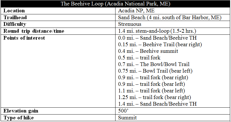
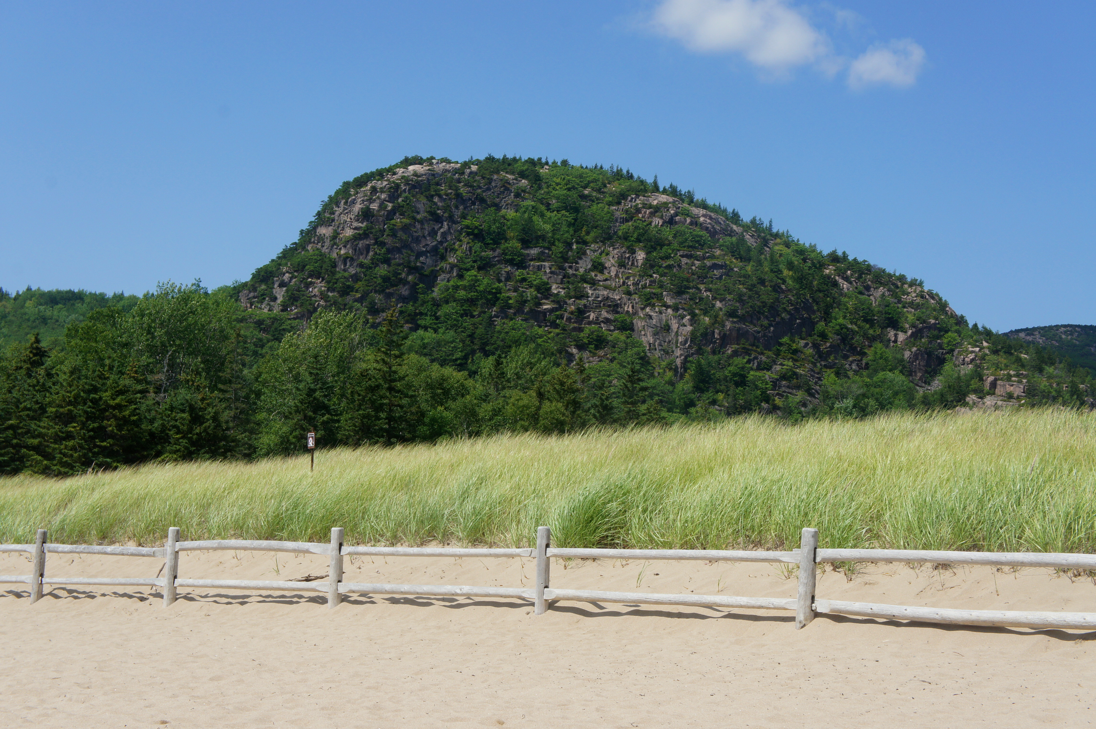
The Beehive Loop begins across Park Loop Road from Sand Beach, four miles south of Bar Harbor, Maine. A word of warning: Acadia is one of the country’s most popular national parks, and Sand Beach is at the heart of the crowds. Arrive early to avoid the masses and to get a parking spot (or take the free shuttle from the Visitor Center). (Note: Park Loop Road is one-way, heading south, as it passes Sand Beach.)
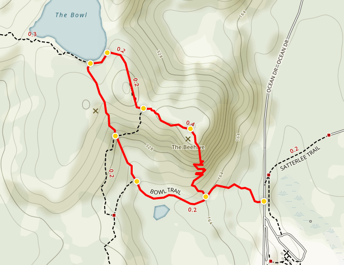
From the Sand Beach parking area, the Beehive & Bowl Trailhead is a short walk north on Park Loop Road; look for a modest but clear sign on the left. (Note: Here you are technically starting the Bowl Trail, though the Beehive Trail will split off soon enough.) The path begins to climb immediately, first up a set of stairs, followed by some rocky clambering through a pine forest to the first of the hike’s several trail junctions. Here the Beehive Trail splits off to the right, your cue to get ready for some iron rung climbing. (Note: Climbing up the Beehive Trail and down the adjacent Bowl Trail is highly recommended, as descending Beehive can be dangerous and considerably more difficult than ascending. Plus, you’d be going against the traffic.)
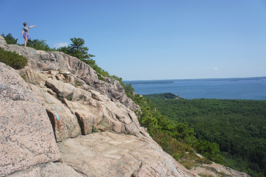
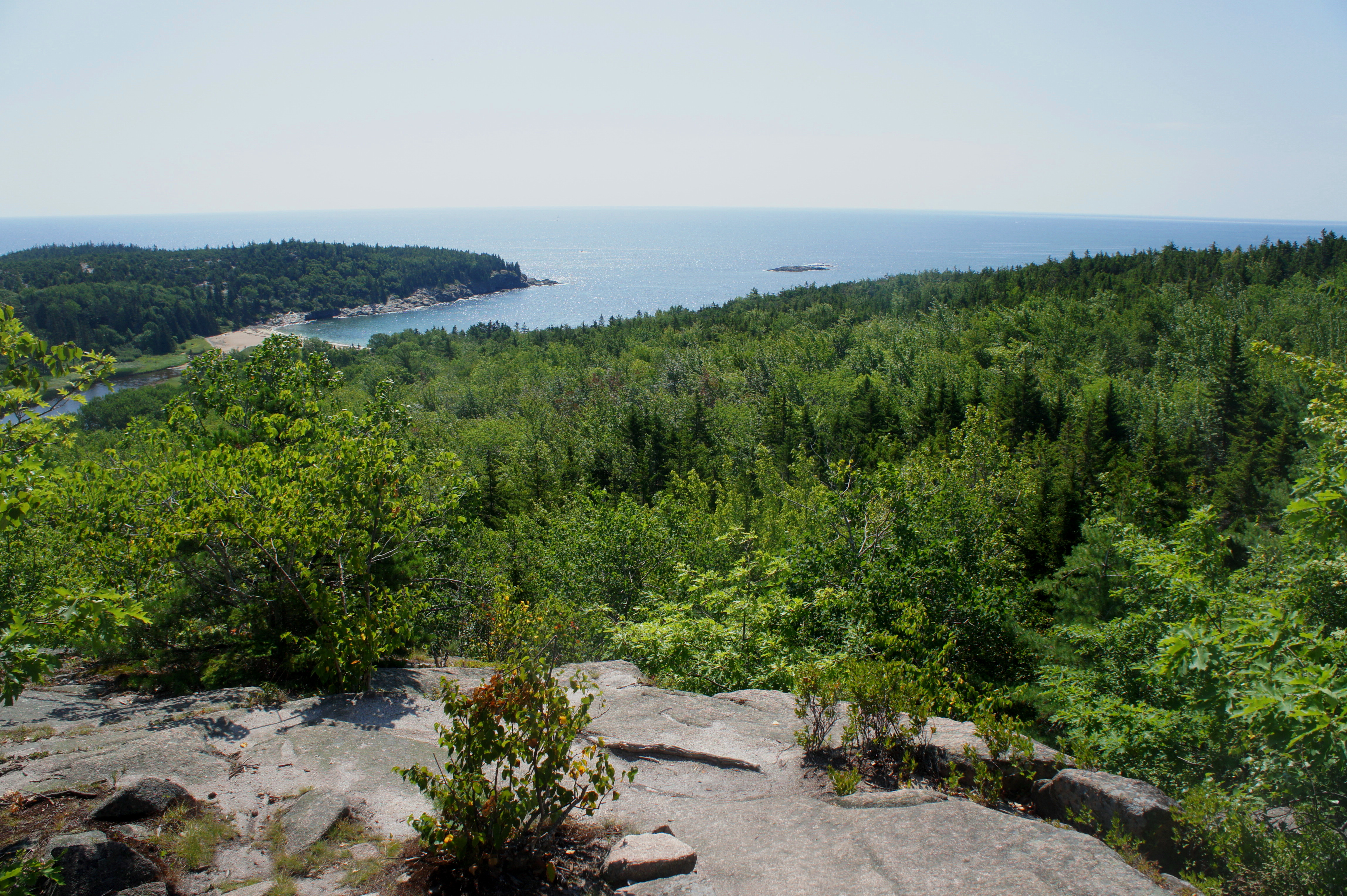
Once on the Beehive Trail, the ascent begins gradually and is relatively free of obstacles. Before encountering a single iron foothold, views open to the south—overlooking Sand Beach, Great Head, and the endless ocean beyond.
About ¼ mile from the trailhead, the trail collides with a blocky jumble of granite, inaugurating the much vaunted “iron rung” section of the hike. Follow the blue blazes as the route ascends—always assisted by man-made steps, rungs, and handrails—the south face of The Beehive.
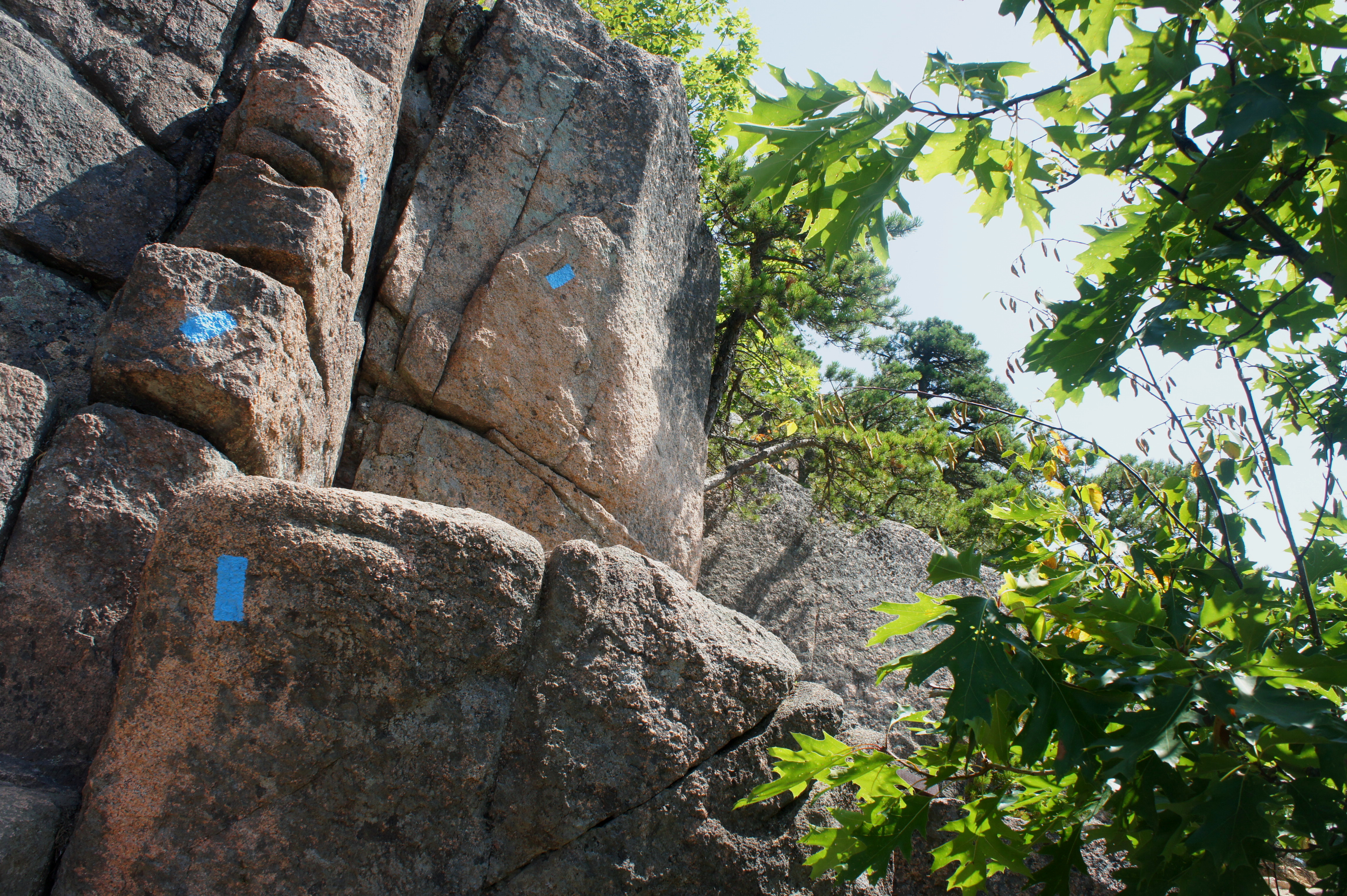
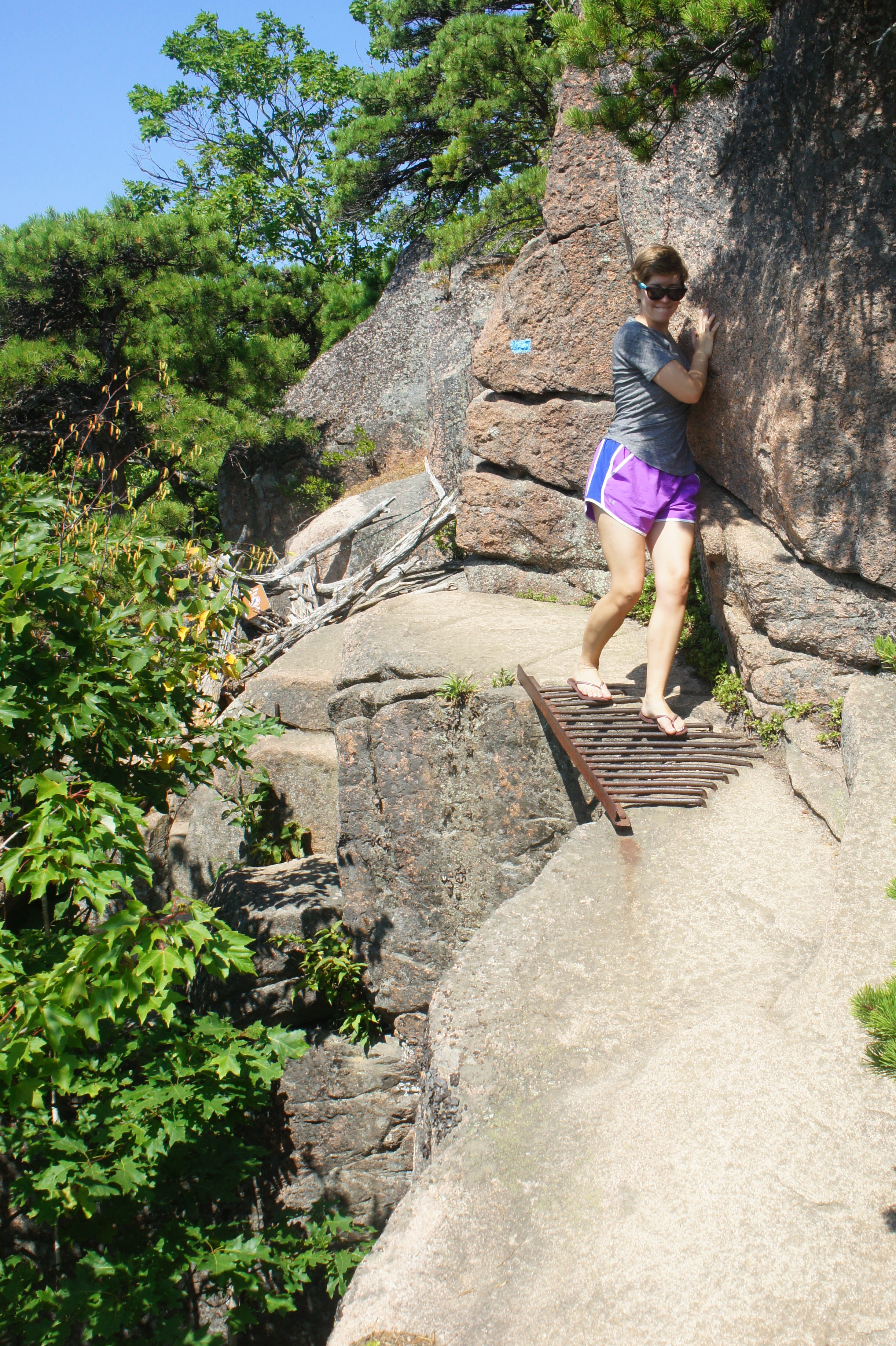
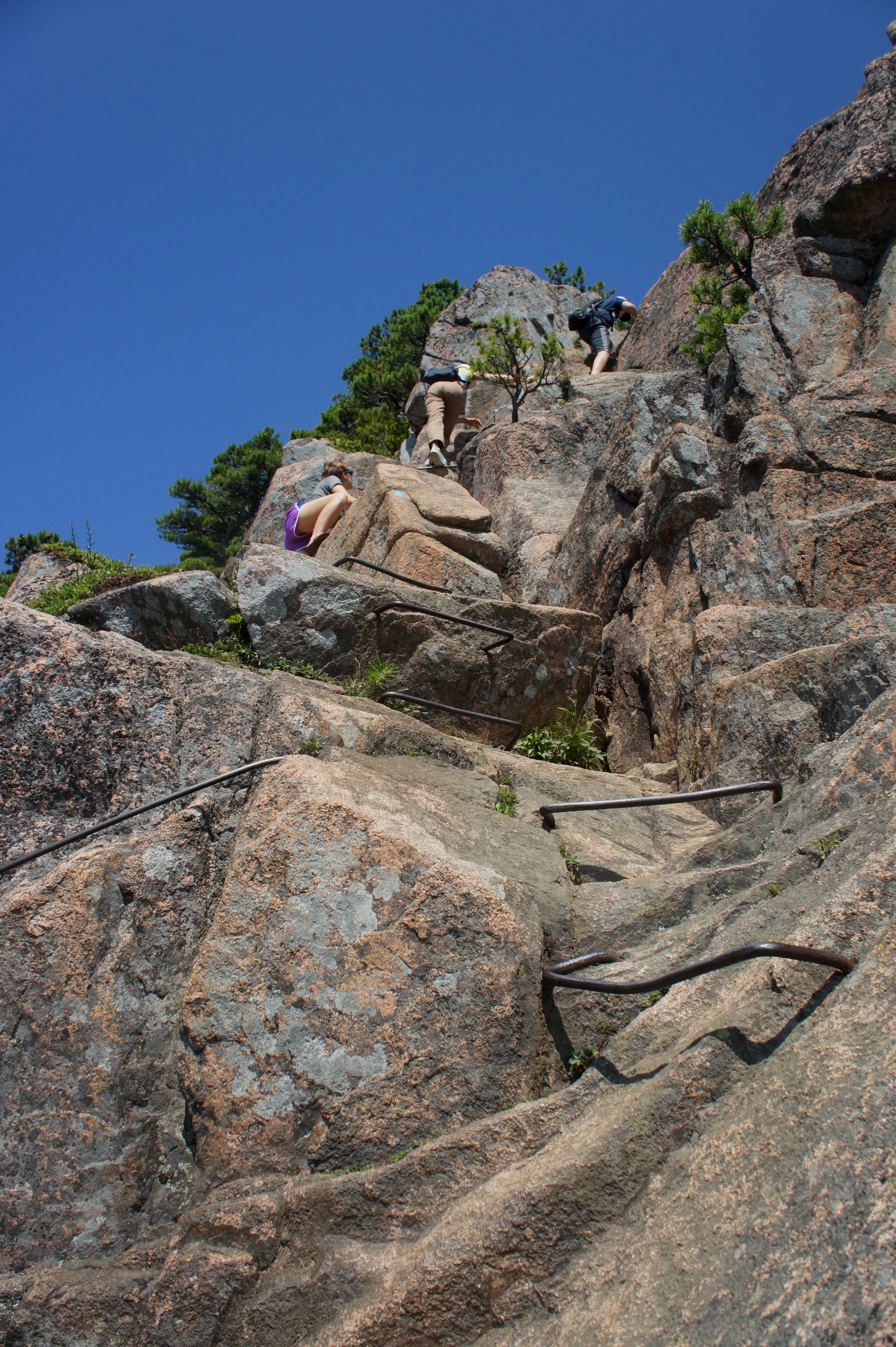
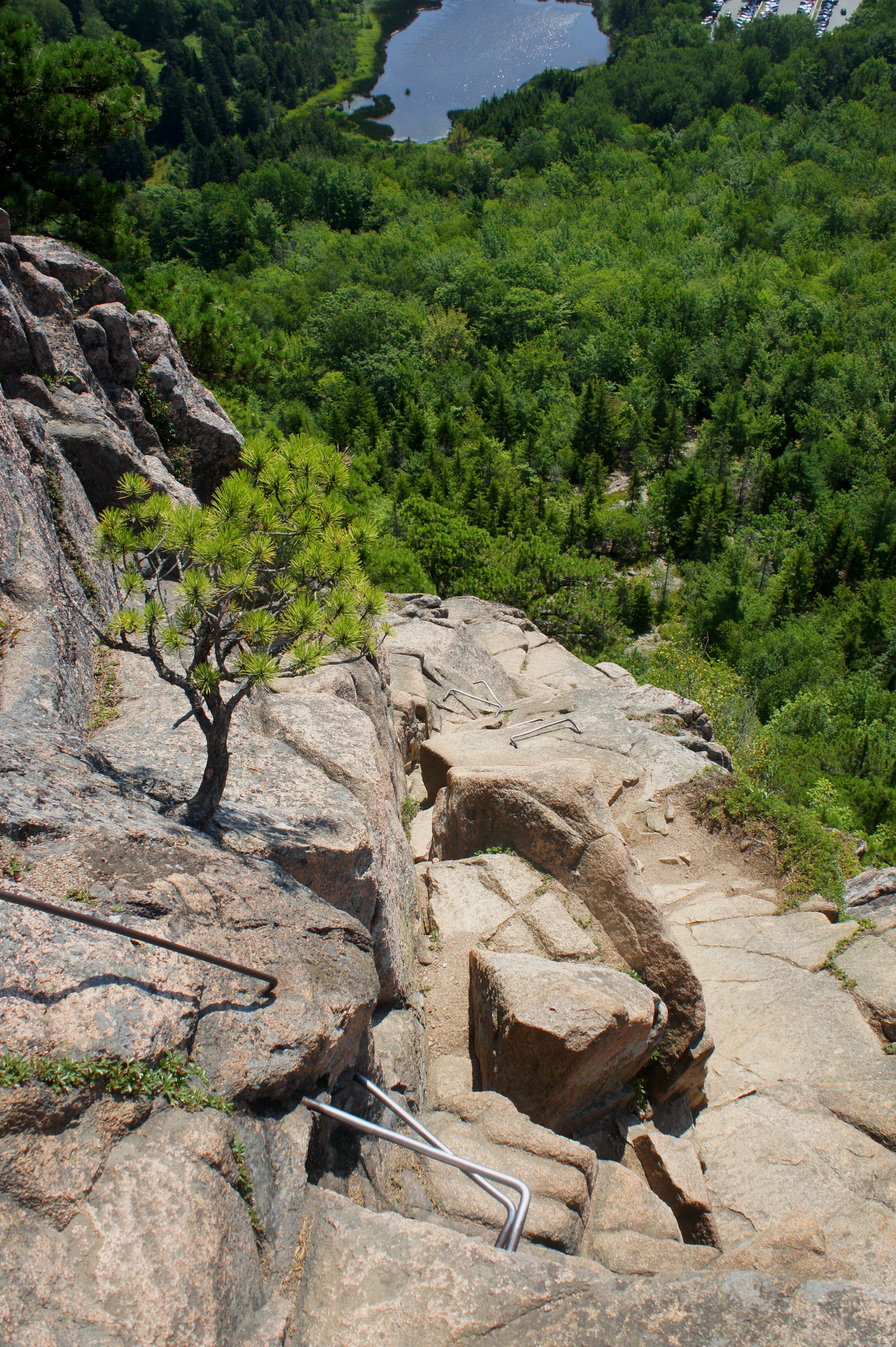
Shortly into the climb, the trail skirts a ledge 2-3 feet wide, complete with a bolted metal grill that provides passage over a crack in the ledge. Next up is the first set of iron rungs—an easy prelude of what’s to come. The initial climb is followed by another, this time with higher walls to surmount. Between iron rung climbs are stony staircases and narrow ledge walks, complete with stunning views of the ocean. At one point, hikers traverse a manmade wooden bridge.
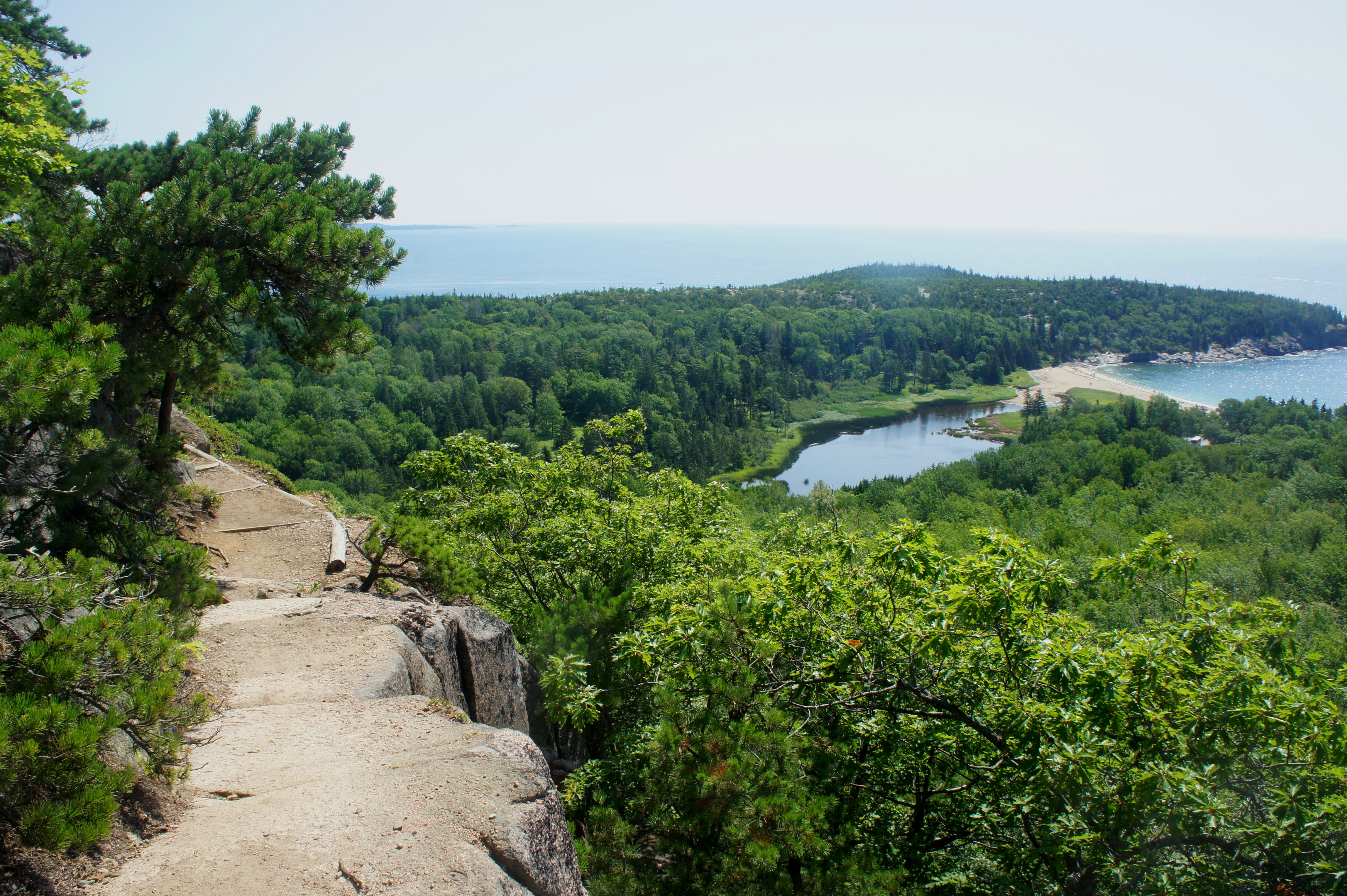


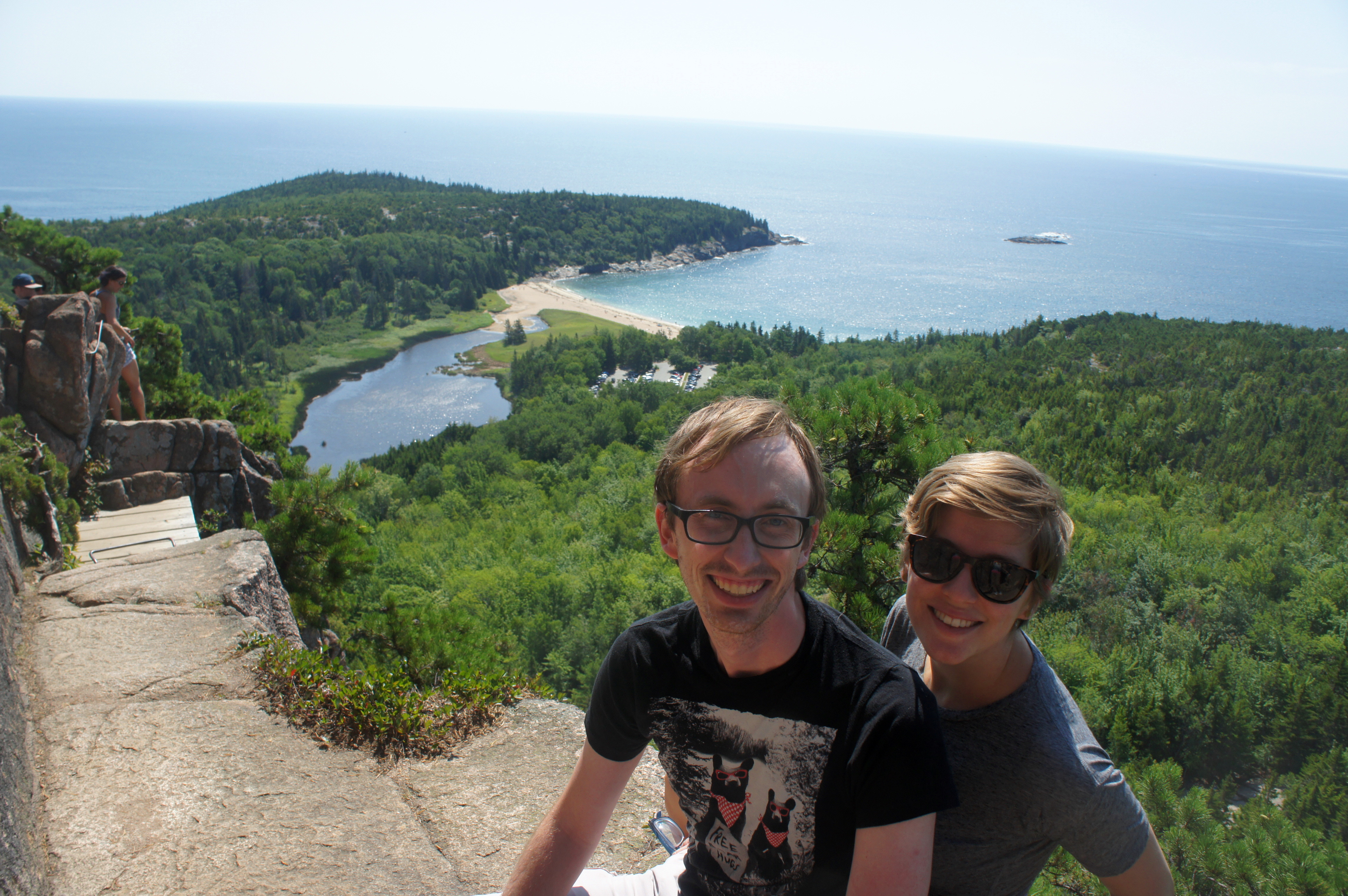
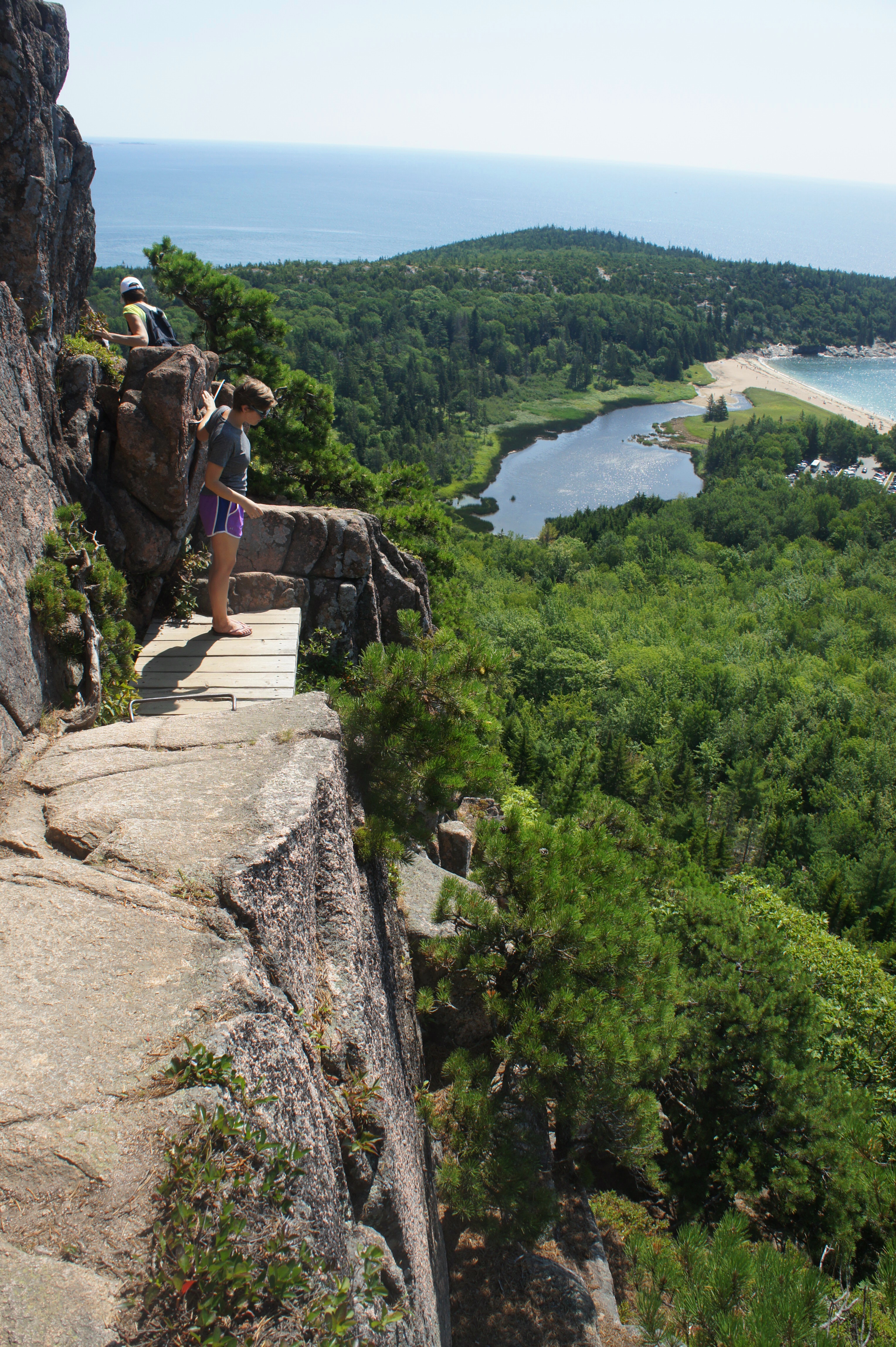
A couple minutes later, a series of iron rungs assist hikers up perhaps the most challenging section. After rounding a left-hand bend, more climbing is required, then a final scramble leads to the top of The Beehive, the end of the iron rung section and the highest point on the hike.

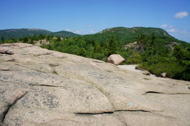
Though far from the tallest mountain in Acadia, The Beehive’s (520’) proximity to the ocean and Frenchman Bay allows for stunning vistas to the south and east. The series of tree-lined bumps sticking out of Frenchman Bay are aptly named The Porcupines, while Schoodic Peninsula—another section of Acadia about an hour and a half away—is visible across the bay. Champlain Mountain (1058’), one of Acadia’s tallest peaks, dominates the landscape to the north.


To the south, views of the ocean are partly obstructed by Gorham Mountain (522’), but Otter Point and Baker Island are visible in the distance.
After enjoying a rest, continue westbound on the Beehive Trail as it makes its way across two lesser summits. After the first, the trail splits—stay straight, following signs to “The Bowl.”
After skirting the third summit, the route begins a sharp descent to The Bowl, a blissfully clear blue lake at the base of Champlain Mountain. On a busy summer day, the shores of the lake are sure to be lined with people, fishing and dipping their toes in the irresistible water (which is often much warmer than the ocean).
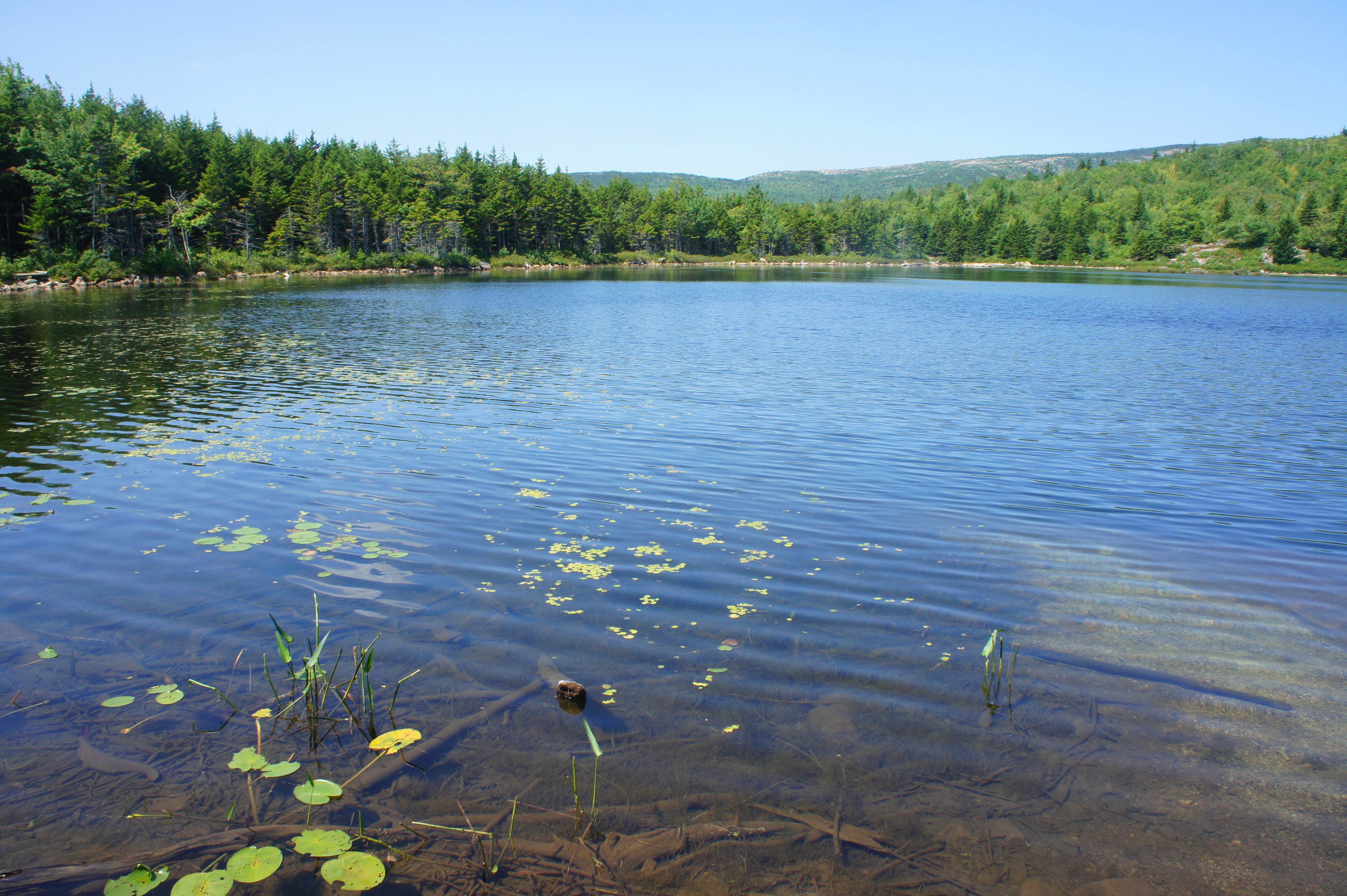

The Beehive Trail skirts the lake’s south shores for 100 yards before terminating at a junction, where the Bowl Trail turns south while the Bear Brook Trail meanders west. Take a left, following the Bowl Trail as it climbs to clear a tree-choked gap between Beehive Mountain and Halfway Mountain to the west.
From here, it is a steady descent back to the trailhead. At 9/10 mile, bear right at the trail fork, then drop down a series of wooden steps to a second junction. This time, stay left and continue downhill on the Bowl Trail. The penultimate fork comes at around 1.1 miles; bear left toward Sand Beach. At 1.25 miles, you have returned to the initial Beehive-Bowl split; stay right and complete the final descent to Park Loop Road…with weary feet and a sense of accomplishment.
Because of the strenuous ascent—which can be extra slow on crowded days—it’s best to allot more time than usual for this 1.4 mile hike. Able hikers will likely be able to complete the loop, while stopping for lunch at the summit or The Bowl, in around two hours.

Looks adventurous and fun.
Pingback: Top 10 Hikes in 2017 | Live and Let Hike
Do you recommend doing this hike in flip flops?
Ha, no…but you gotta do what you gotta do when your hiking boots fall apart during the trip.
haha no