– Civil War Series –
The 1862 Peninsula Campaign, intended by the Union to put a decisive end to the Civil War by capturing the Confederate capital of Richmond, began with a slow start. Gen. George McClellan, despite setting out in March 1862 with the largest army the continent had ever seen, inched up the Virginia Peninsula from Hampton at what seemed like a snail’s pace. The Army of the Potomac stalled at several points, facing a determined but greatly outmanned Confederate Army, and only reached the doorstep of Richmond by mid-May 1862, two months into the campaign.
After turning back a Union naval assault at Drewry’s Bluff, Confederate forces under the command of Gen. Joseph E. Johnston lost their commander to injury in the Battle of Seven Pines in late May. The leadership vacuum gave rise to Gen. Robert E. Lee, who would go on to launch an aggressive campaign against the Federal forces in late June. Known as the “Seven Days’ Battles,” the series of Confederate attacks and Union counter-attacks would result in McClellan’s capitulation and cement Lee’s position as commander of the Army of Northern Virginia until the end of the war in 1865.
Part 1 of this two-part Peninsula Campaign Driving Tour covered the long and cautious march of McClellan’s forces up the Virginia Peninsula to Richmond. (Note: The accompanying post can be found here.) The below driving tour picks up where Part 1 left off and includes several stops in the city of Richmond, as well as trips to the key battlefields of the Seven Days—Oak Grove, Beaver Dam Creek, Gaines’ Mill, Savage’s Station, White Oak Swamp, Glendale, and Malvern Hill. There is enough to see and do in Part 2 to last two full days (including museums and several hiking trails), in addition to two extra half-day options: Harrison’s Landing (the site of McClellan’s post-campaign camp) and Stuart’s Ride (the route of J.E.B. Stuart’s famous cavalry ride around the Union Army in June 1862).
Note: The below driving tour roughly follows the itineraries laid out by Virginia Civil War Trails and Michael Weeks’ Civil War Road Trip: Volume I (2011). In this age of GPS, I have included addresses for each site (rough approximations—for example, the nearest house) in lieu of specific directions.
DAY 1: IN AND AROUND RICHMOND (MAY-JUNE 1862)
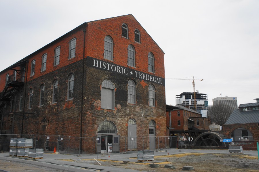
Stop 1: Tredegar Iron Works/Richmond National Battlefield Park Visitor Center (470 Tredegar St., Richmond, VA)
Your driving tour begins in Richmond, Virginia, a stone’s throw from the James River, at the Richmond National Battlefield Park Visitor Center at Tredegar Iron Works. Tredegar was the epicenter of iron manufacturing for the South during the war, and its centrality to the war effort played a key role in the decision to make Richmond the Confederate capital. In addition to exploring the remains of the iron works, start your journey at the Visitor Center, with offers information on Civil War sites in the area as well as several exhibits on the 1862 Peninsula Campaign and 1864 Overland Campaign. Next to the Visitor Center is the American Civil War Center, which is privately operated and costs $12 to enter. This museum provides an introduction to the Civil War, with an emphasis on the diversity of viewpoints on the causes and conduct of the war.
Note: Allot 2-3 hours to explore the site, including the exhibits at the Visitor Center and American Civil War Center.


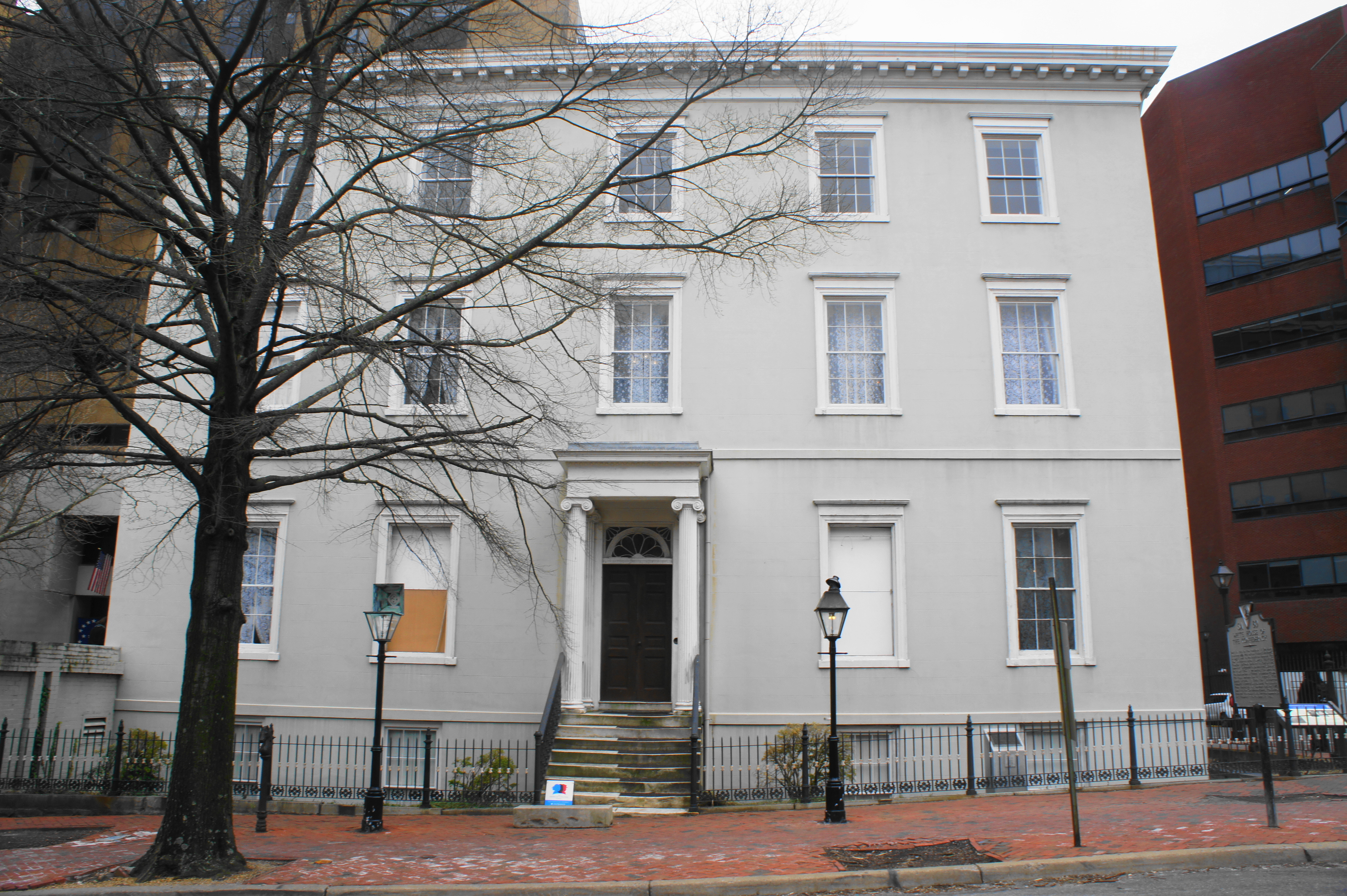
Stop 2: Museum and White House of the Confederacy (1201 E. Clay St., Richmond, VA)
Surrounded today by the massive VCU hospital complex, the White House of the Confederacy—home to Jefferson Davis during the war—remains intact and open to the public for daily tours ($18 for the tour and accompanying museum). It was from here that Davis directed the war effort. Next door lies the multi-story Museum of the Confederacy, which has exhibits on the Southern Army, home front, and the infamous Confederate flag. Besides the over-the-top Confederate memorabilia in the gift shop, the museum is largely respectful and is as relatively unbiased as it can be for a museum dedicated to the Confederacy. It also boasts an impressive collection, including the very uniforms, weapons, and personal effects used by the likes of Stonewall Jackson, Joseph E. Johnston, Robert E. Lee, and J.E.B. Stuart during the war.
Note: Allot 2-3 hours for the tour of the house and the museum. Plan to park in the VCU Medical Center parking garage down 12th St. Grab a late lunch in Richmond on the way out.


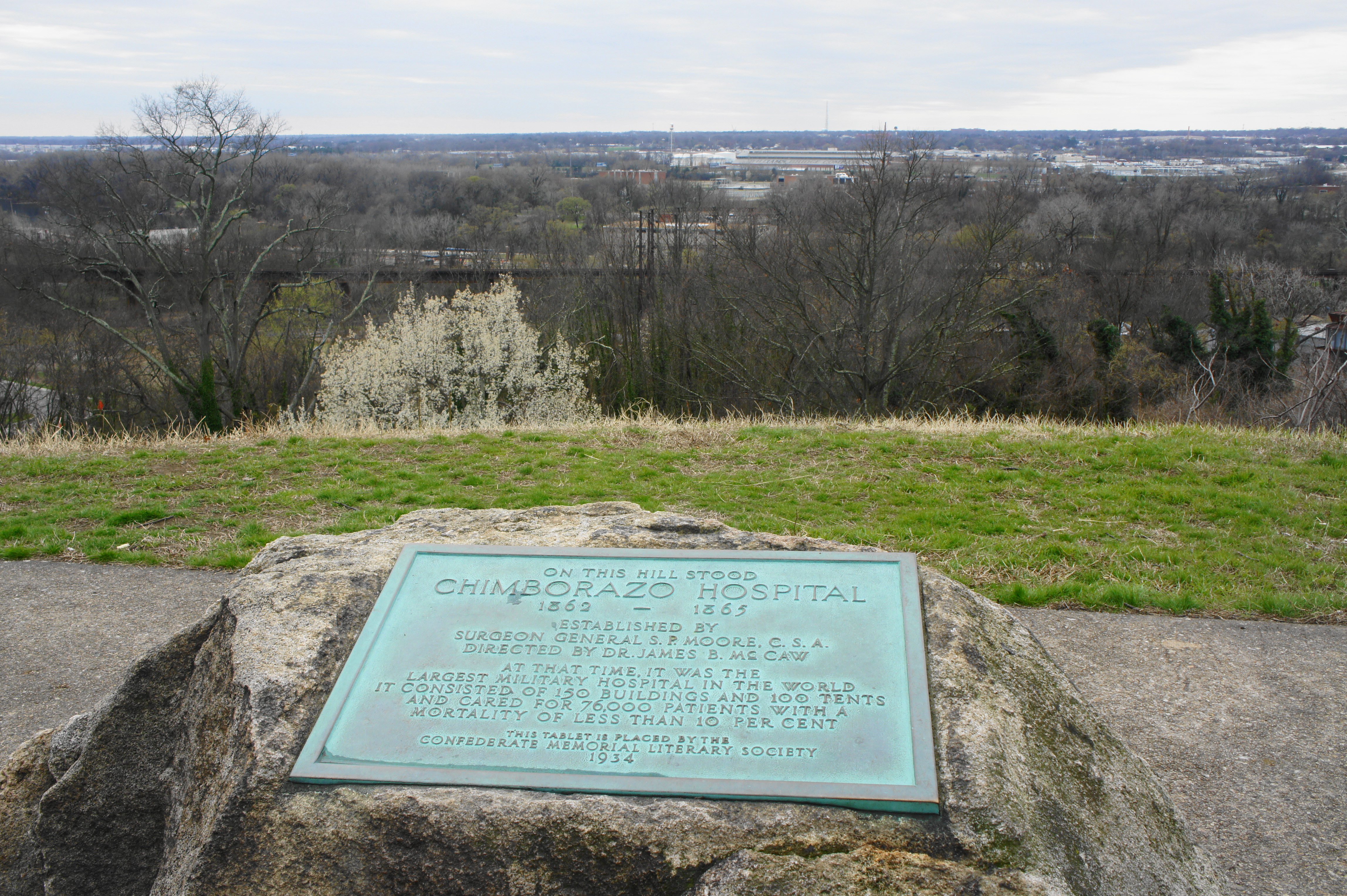
Stop 3: Chimborazo Medical Museum (3215 E. Broad St., Richmond, VA)
The Seven Days’ Battles produced scores of casualties for both sides, and a significant number of the sick and wounded Confederate soldiers ended up here, at the site of the former Chimborazo Hospital, one of the largest and most efficient wartime hospitals in the South. Though no original buildings remain, one can imagine thousands of patients spread out across the grassy knoll of Chimborazo Hill, largely in the care of a couple dozen surgeons. In the 1870s, Chimborazo Hill was refashioned as a city park, which still today offers excellent views overlooking the James River. There are several crisscrossing paths on the site, and the small Chimborazo Medical Museum offers a glimpse of what life was like at the hospital during the war.
Note: Allot 45 minutes-1 hour to tour the museum and walk the grounds.
Stop 4: Drewry’s Bluff (8041 Fort Darling Rd., Richmond, VA)
After spending much of the day in Richmond, travelers on the driving tour should leave the city by mid-afternoon to view the first battleground of the day. Drewry’s Bluff, situated along the James River a 20-minute drive south of Richmond, was the site of a Confederate defensive bastion throughout much of the war. On May 15, 1862, the Southern defenders atop the bluff turned back a Federal naval advance on the James River with a hail of artillery fire, badly damaging the lead ship USS Galena and thwarting McClellan’s plans to lay siege to Richmond by water. The earthworks at Drewry’s Bluff are accessible by way of a roughly 1-mile stem-and-loop trail that tells the story of the defenses and provides commanding views of the James River.
Note: Allot around 45 minutes-1 hour to walk the Drewry’s Bluff Trail. See my post on April 16, 2018 for a full trail description.

Stop 5: Seven Pines – McClellan’s First Line (31 E. Williamsburg Rd., Sandston, VA)
No longer able to wield naval power in his advance on Richmond, McClellan instead arrayed his land forces east of Richmond, straddling the banks of the Chickahominy River, a swampy tributary of the James. With the winding Chickahominy forcing McClellan to bifurcate his army, Confederate General Joseph E. Johnston sensed an opportunity in late May to deal a blow to the Union forces. On May 31, Johnston’s Confederates attacked the two isolated Federal corps positioned south of the river at Seven Pines, although confused orders and horrendous weather put the offensive several hours behind schedule. At around 1 pm, Confederate troops under the command of Maj. Gen. D.H. Hill launched an assault on McClellan’s first defensive line, manned by Union Brig. Gen. Silas Casey’s 2nd Division, along Williamsburg Road, a route that remains today.[i] The Battle of Seven Pines was born.
The drive from Drewry’s Bluff to the Seven Pines battlefield is around 20 minutes and enters the suburban town of Sandston, VA. Despite being one of the pivotal battles of the campaign, Seven Pines is probably one of the most poorly-preserved Civil War battlegrounds in the country. Virtually the entire field of battle has been overtaken by development. Yet there are a handful of tributes that remain, including the first of several Seven Pines sites on the tour: situated in front of a day care facility in Sandston, a tall white sign marks the (inaccurate) location of McClellan’s first defensive line, which was quickly overrun. (Note: Following Drewry’s Bluff, the next significant engagement chronologically was the Battle of Hanover Court House on May 27, but due its distance away from the other sites, this battlefield is instead included below in the “extra credit” section as part of the Stuart’s Ride tour.)
Note: Allot five minutes to visit the sign. Park in the lot across the street at the Sandstone Laundromat.

Stop 6: Seven Pines – McClellan’s Second Line (23 E. Williamsburg Rd., Sandston, VA)
The actual location of McClellan’s first defensive line laid slightly further east, up Williamsburg Road. The spot is marked today by a Civil War Trails sign in the parking area of the Sandston Public Library. It was here that Gen. Casey was forced to abandon his earthworks, facing what he called “the most terrible fire of musketry…that I have ever witnessed.” From here the Union forces would fall back to the second defensive line, with Brig. Gen. Samuel Heintzelmann’s Third Corps moving in to reinforce the beleaguered Union Fourth Corps.[ii]
Note: Allot five minutes for this site, situated just two blocks east of Stop 5. Park in the Sandstone Public Library parking lot.

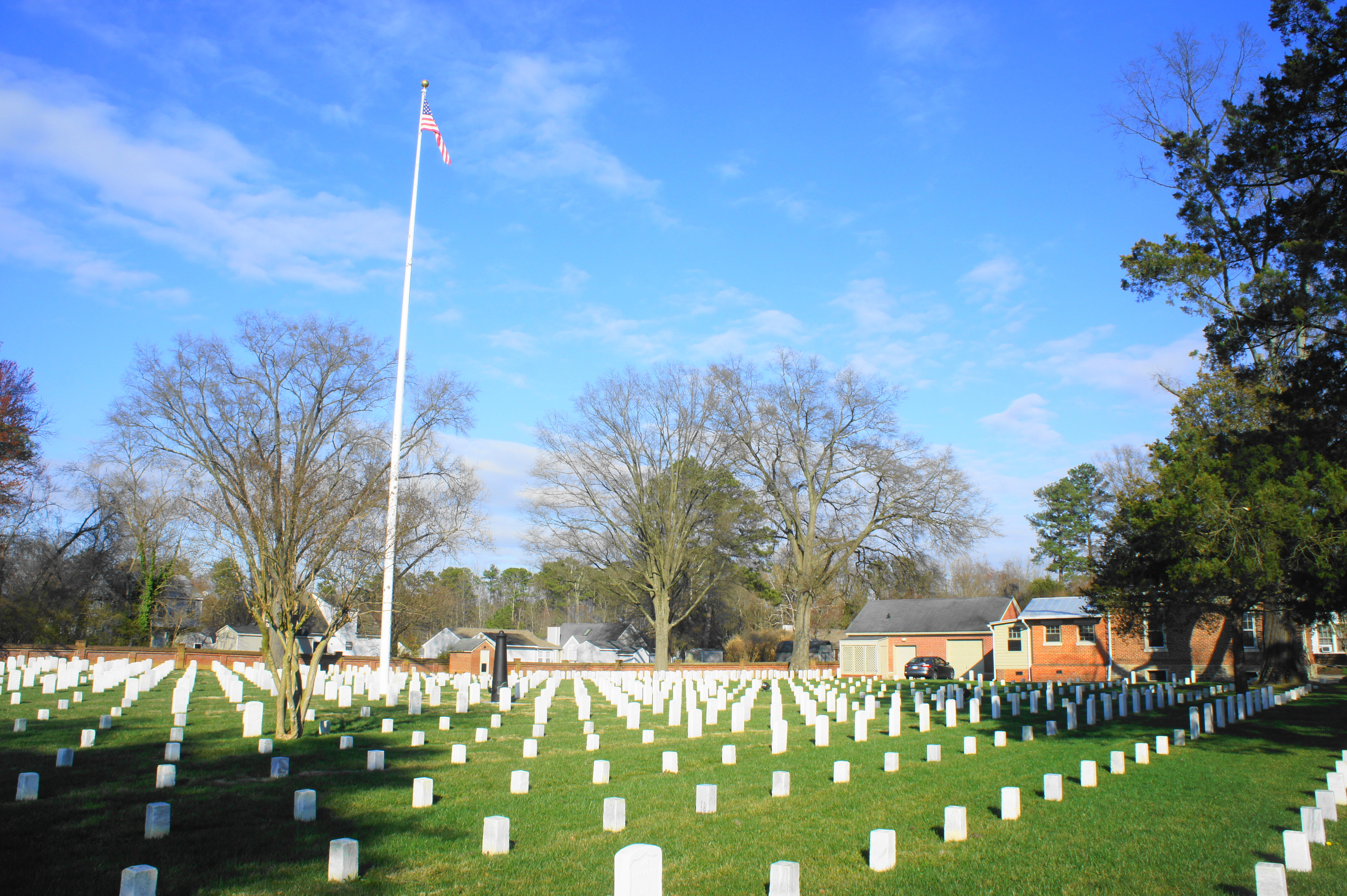
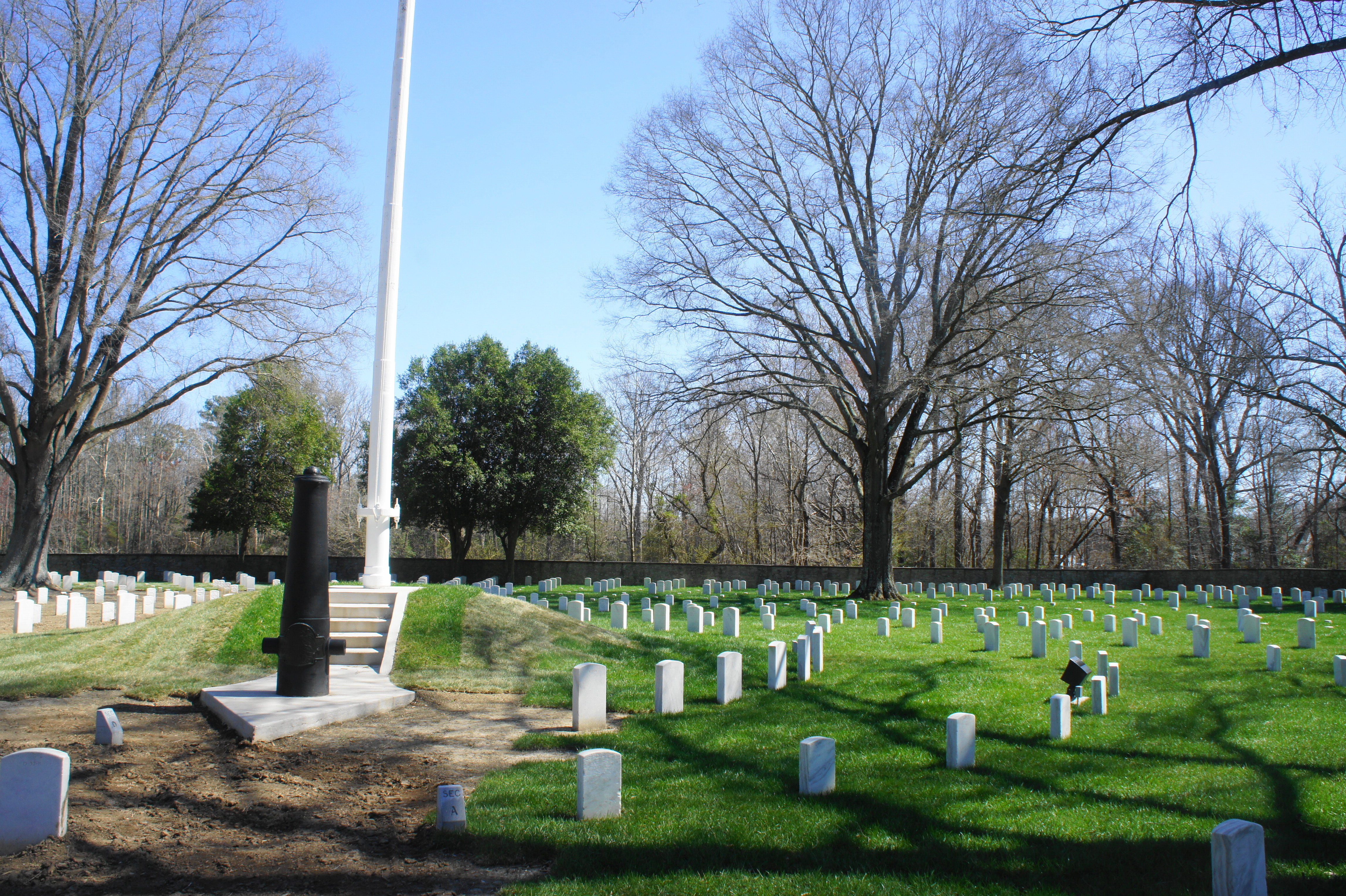
Stop 7: Seven Pines National Cemetery (400 E. Williamsburg Rd., Sandston, VA)
About ½ mile down Williamsburg Road, the attacking Confederates clashed with elements of Heintzelmann’s Third Corps and Brig. Gen. Erasmus Keyes’ Fourth Corps at McClellan’s second defensive line. As Johnston’s forces abandoned a frontal assault in favor of flanking movements, the Federal forces fell back, forming a defensive position at the intersection of Williamsburg Road and Nine Mile Road.
Today this spot is occupied by the Seven Pines National Cemetery, built in 1866 to hold the graves of Union soldiers killed in the Battle of Seven Pines and later engagements. Although more than 1,300 Union soldiers are interred here, only 150 are identified, with the rest of the identities unknown. It is possible to walk around the cemetery, although entering can be a tight squeeze for cars. Amid the gravestones are a flagpole and an artillery monument.
Note: Allot 10-15 minutes to explore the 2-acre cemetery.
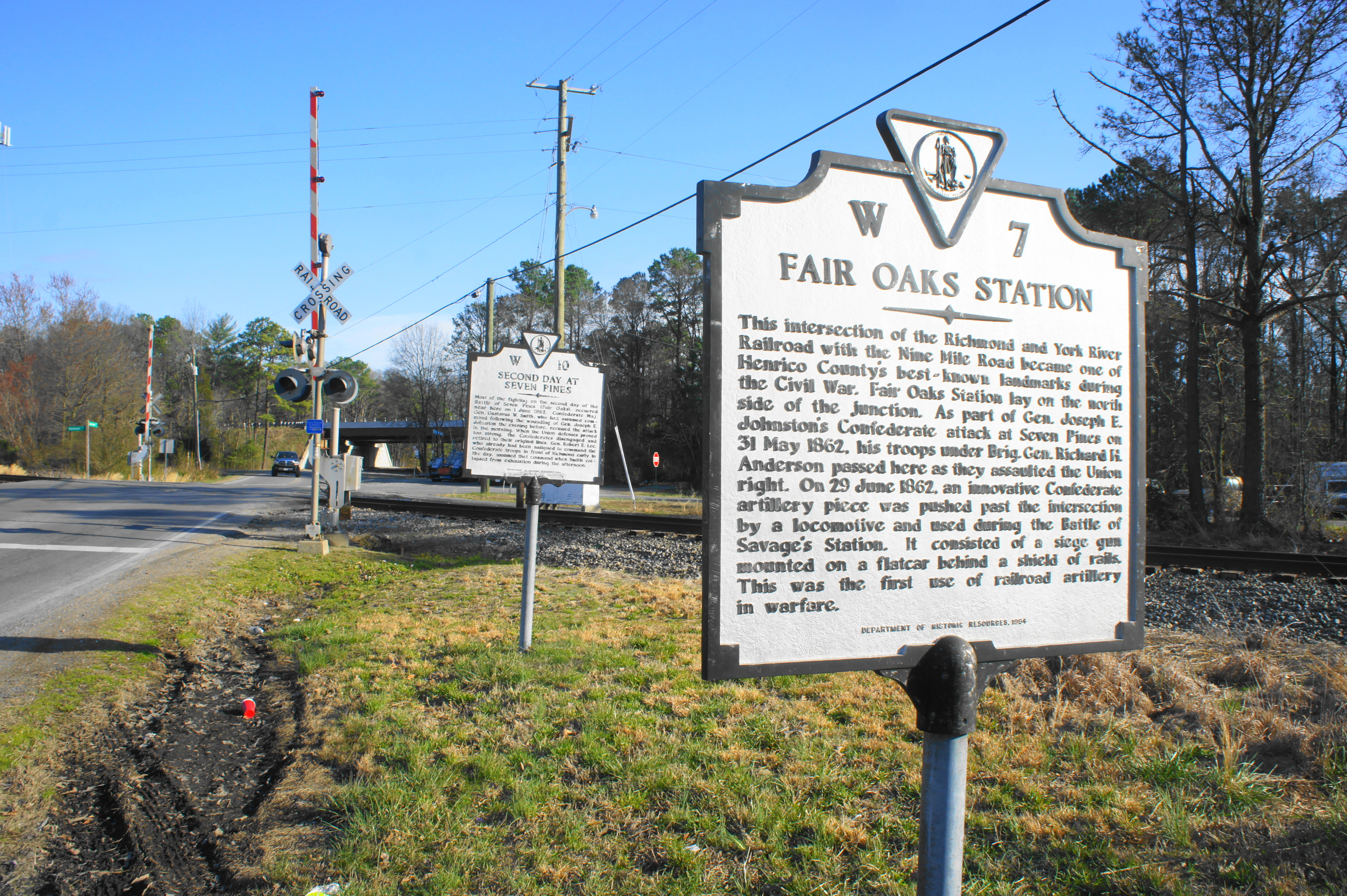
Stop 8: Fair Oaks (1838 E. Nine Mile Rd., Highland Springs, VA)
Even as darkness put an end to the day’s battle, the evening of May 31 brought one of the most consequential events of the war: it was near here, at Fair Oaks Station, that Johnston, overall commander of the Army of Northern Virginia, was severely wounded in the fighting. The Confederates would resume battle briefly the next day under the command of Confederate Maj. Gen. G.W. Smith, but the post fell soon after to Robert E. Lee, a former army engineer, a change that would give the Confederacy its military hero.
The Battle of Seven Pines effectively ended on June 1 in a draw, with both sides claiming victory. The final Seven Pines site is marked by two white signs, situated at the former site of Fair Oaks Station. This area saw heavy fighting on both days of the battle and, later in June, witnessed the passage of a Confederate locomotive mounted with a siege gun—the first piece of railroad artillery used in warfare.
Note: Allot 5 minutes for this site. Park in one of the parking lots across Nine Mile Road from the markers.
Stop 9: Oak Grove (5337-5301 Airport Dr., Richmond, VA)
As you approach Stop 9, the story fast forwards by 3 ½ weeks to June 25. During this respite period between battles, both sides regrouped and established new entrenchments in anticipation of future engagements. McClellan, per usual, was slow to follow through on his vows to President Lincoln that he would seize Richmond, privately accusing the president of withholding the necessary reinforcements from other Union forces further north to support his siege effort. Meanwhile, Lee was busy planning an aggressive defense of Richmond by way of counter-attack: after receiving vital intelligence on McClellan’s positions from J.E.B. Stuart’s cavalry, Lee planned to attack Union Brig. Gen. Fitz John Porter’s Fifth Corps north of the Chickahominy River on June 26. Before he could do so, however, McClellan’s forces broke from their idle position and launched an assault on June 25 against a portion of Lee’s Army south of the Chickahominy at Oak Grove. Darkness again ended the battle, with the Union forces gaining around 600 yards in exchange for hundreds of casualties.
Like Seven Pines, the Battle of Oak Grove has been nearly entirely lost to development, with most of the battlefield now covered by Richmond International Airport. Partly hidden in the trees, visitors can spot a single Confederate earthwork and an artillery piece when driving north on Airport Drive. It is extremely difficult to reach, however, because parking is not permitted along the shoulder of the road.
Note: Allot a few minutes to drive by the Oak Grove earthwork. This marks the end of the first day of the tour.
DAY 2: SEVEN DAYS’ BATTLES (JUNE-JULY 1862)
Stop 10: Chickahominy Bluffs (2302 Springdale Rd., Richmond, VA)
Despite the surprise offensive by McClellan’s forces at Oak Grove, Lee went forward with his plan to attack the Federal forces north of the Chickahominy on June 26. He aimed to send three separate columns—including Stonewall Jackson’s forces, fresh off a victorious campaign in the Shenandoah Valley—to converge on Union Gen. Porter’s Fifth Corps. The plan was relatively simple but risky: in massing most of Lee’s forces north of the river, he left his southern flank vulnerable to attack. McClellan, being McClellan, however, played along, remaining idle as the Confederates prepared for attack.
It was from here, at Chickahominy Bluffs, that Lee and Jefferson Davis oversaw the movement of Confederate forces across the Chickahominy to battle. While today trees obstruct the view, several earthworks remain—the bluffs formed a portion of the external defenses around Richmond, which wrapped in a half-circle around the city. The entrenchments were reinforced after the 1862 campaign, and gunners at this position would see brief action during Union Gen. Philip Sheridan’s raid on Richmond in May 1864.
Note: Allot 5-10 minutes for this site.

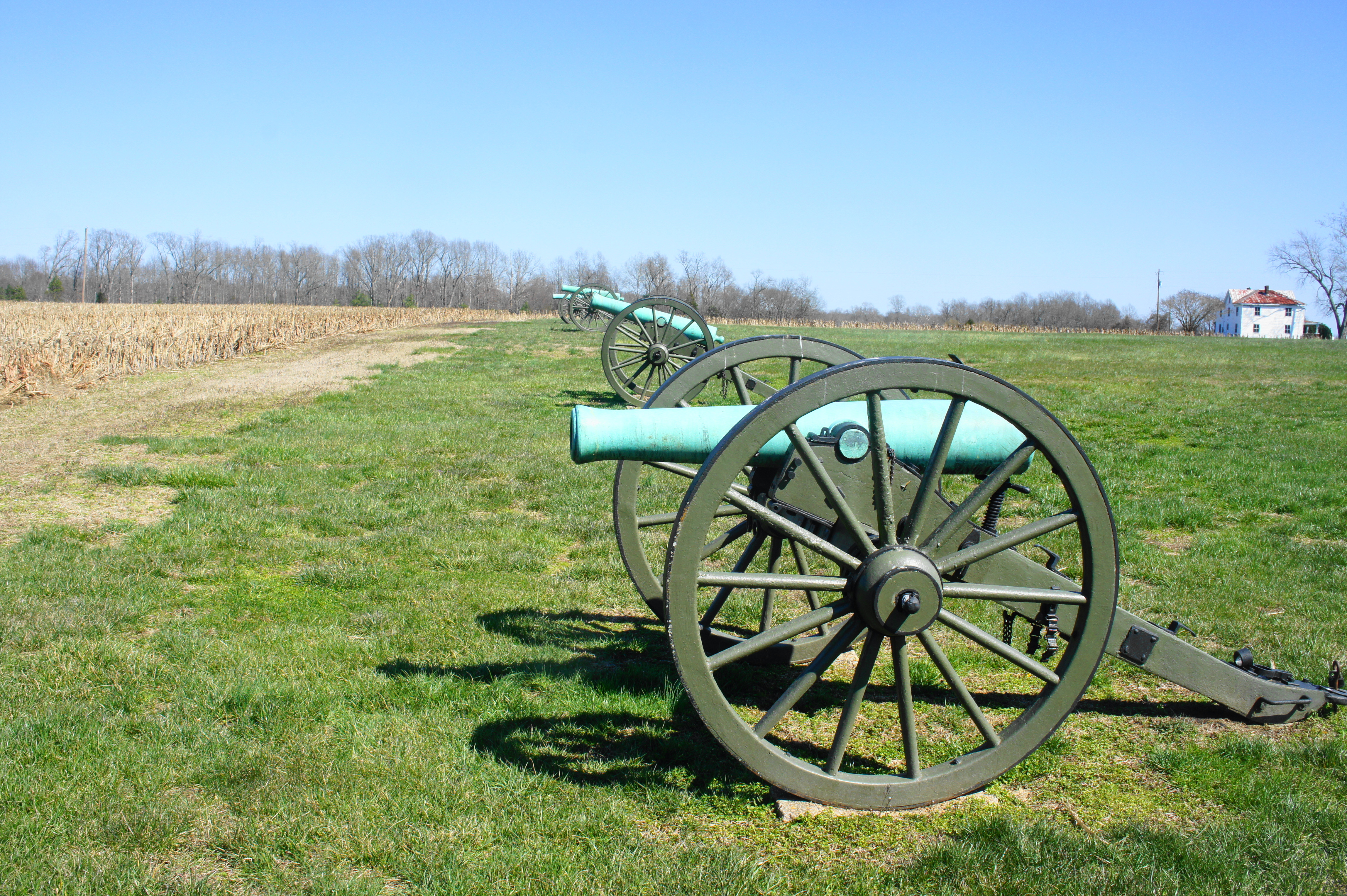
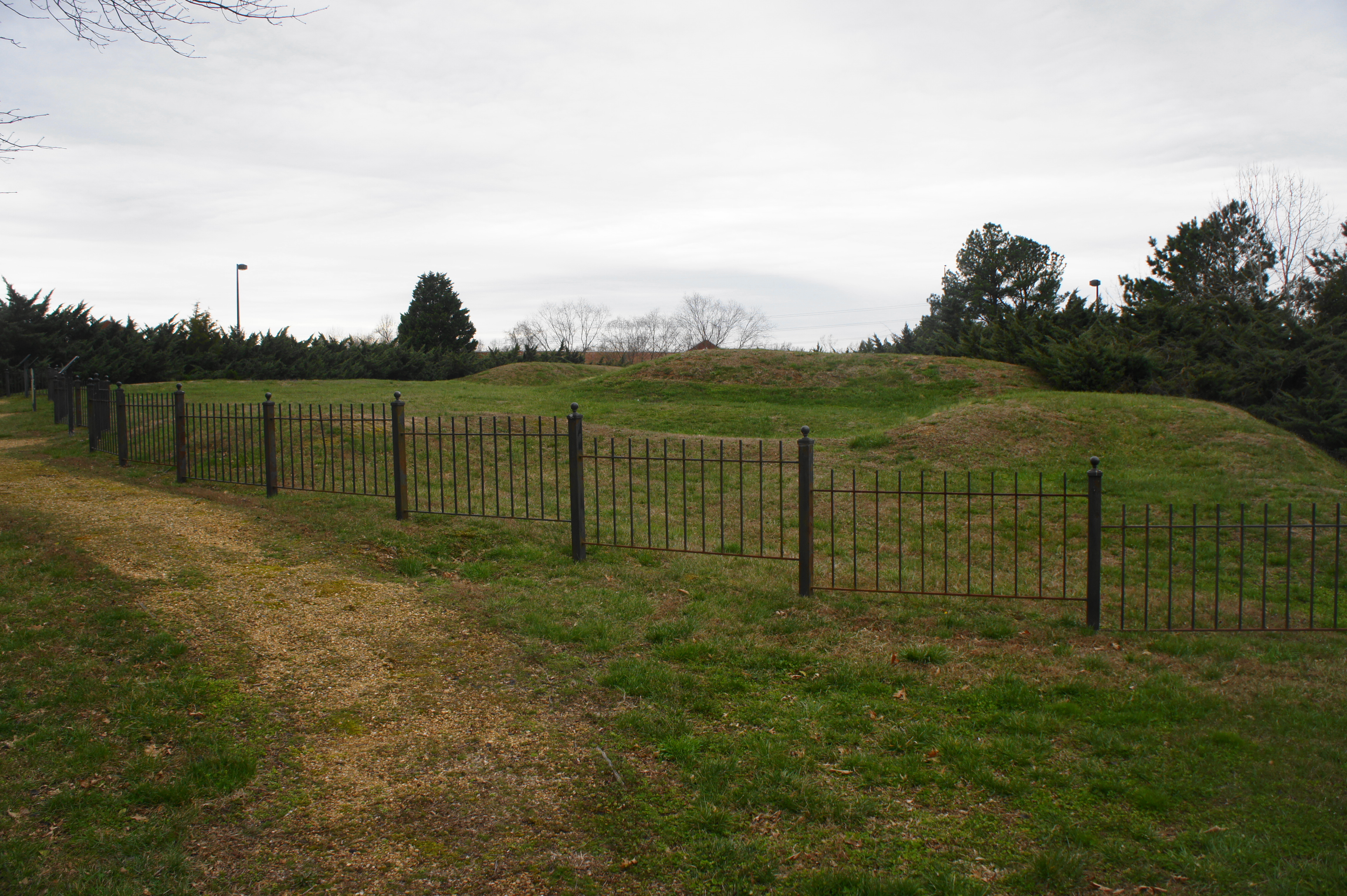
Stop 11: Beaver Dam Creek (7423 Cold Harbor Rd., Mechanicsville, VA)
Lee’s Army encountered its first Federal resistance at the Battle of Beaver Dam Creek on the afternoon of June 26. With elements of Porter’s Fifth Corps arrayed along the swampy barrier of Beaver Dam Creek, the Federals repulsed several Confederate brigades under the command of Maj. Gen. A.P. Hill. Although a tactical defeat for the Confederates, the engagement was a strategic victory, as it persuaded McClellan to withdraw his forces east and south to the James River. Unlike Seven Pines, this area is partly protected by the National Park Service; a lovely footbridge offers passage over Beaver Dam Creek, and a short, 2/10-mile out-and-back hike follows the historic Cold Harbor Road, ending at the former site of Ellerson’s Mill, which stood during the battle.
Note: Allot 15-20 minutes to explore this site. See my post on April 22, 2018 for a full description of the Beaver Dam Creek Trail.

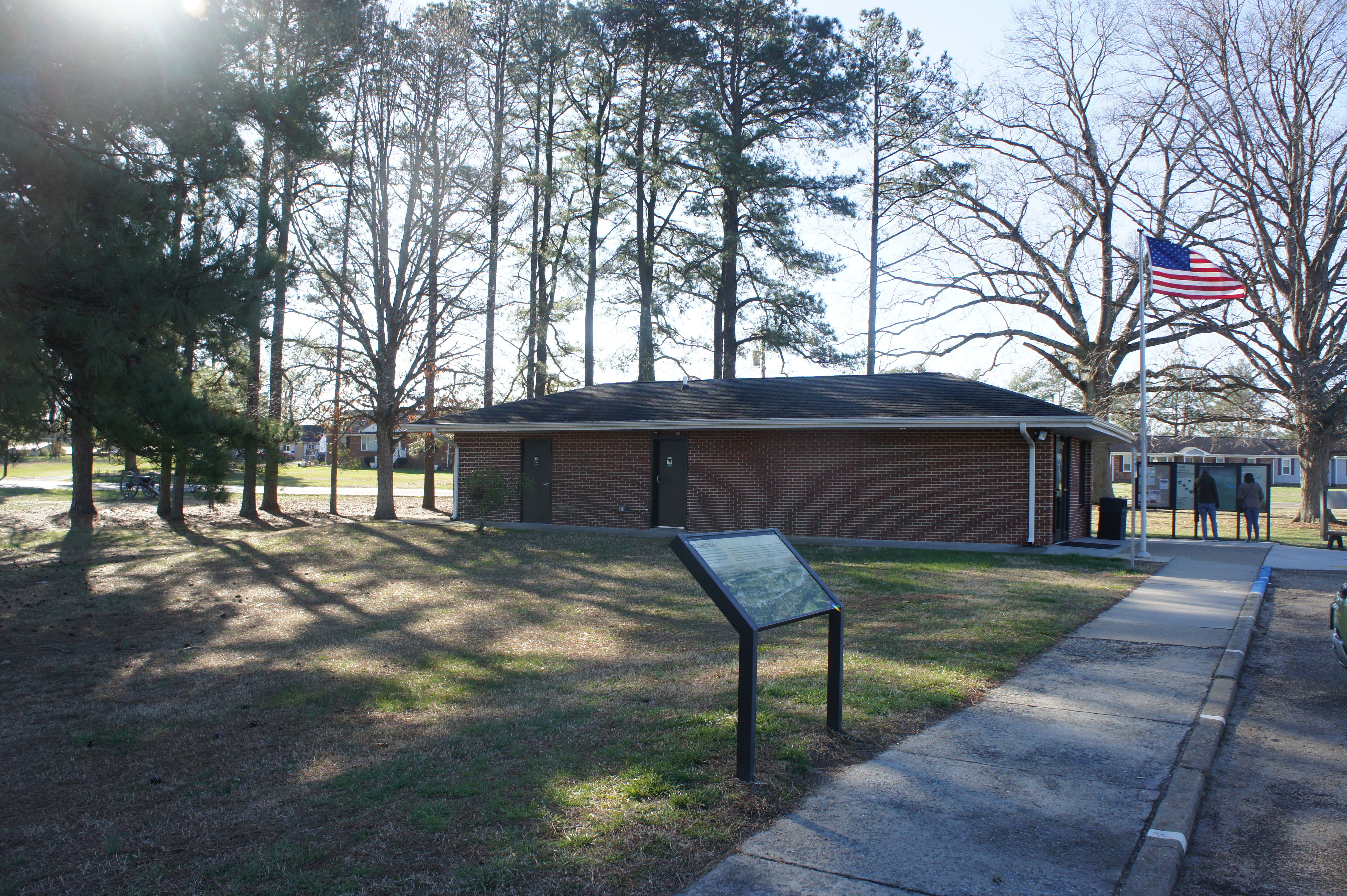
Stop 12: Cold Harbor Battlefield Visitor Center (5515 Anderson Wright Dr., Mechanicsville, VA)
A 10-minute drive from Beaver Dam Creek, Richmond National Battlefield Park’s Cold Harbor Battlefield Visitor Center offers an overview of the Seven Days’ Battles, as well as the 1864 Overland Campaign, which occurred in the same general area east of Richmond. The visitor center also offers information on ranger-led tours at Gaines’ Mill, your next destination…
Note: Allot 15-20 minutes to explore the exhibits and bookstore at the small visitor center.
Stop 13: Gaines’ Mill (6283 Watt House Rd., Mechanicsville Rd., VA)
With McClellan’s Army in retreat, the pursuit was on for the advancing Confederates. One day after Beaver Dam Creek, Lee won a decisive but costly victory on June 27 in the Battle of Gaines’ Mill. Here Lee sent the bulk of his forces against Gen. Porter’s Fifth Corps again near Cold Harbor. Although eventually succeeding in dislodging Porter’s troops, the Union’s strong position along the banks of Boatswain’s Creek produced scores of Confederate casualties, making the battle the Civil War’s second-bloodiest engagement to that point (behind only the Battle of Shiloh in April 1862).
The Gaines’ Mill Battlefield is protected as part of Richmond National Battlefield Park, just a mile southwest of the Cold Harbor Battlefield Visitor Center. An excellent 1-mile loop hike provides a tour of the grounds, now mostly covered in dense woods. Spur trails offer access to a monument for fallen soldiers, as well as an overlook of the area where Maj. Gen. James Longstreet’s division delivered the decisive blow that won the day for the Confederacy.
Note: Allot 1 ½-2 hours to explore this site and walk the loop trail. See my post on May 17, 2018 for a full description of the Gaines’ Mill Trail.

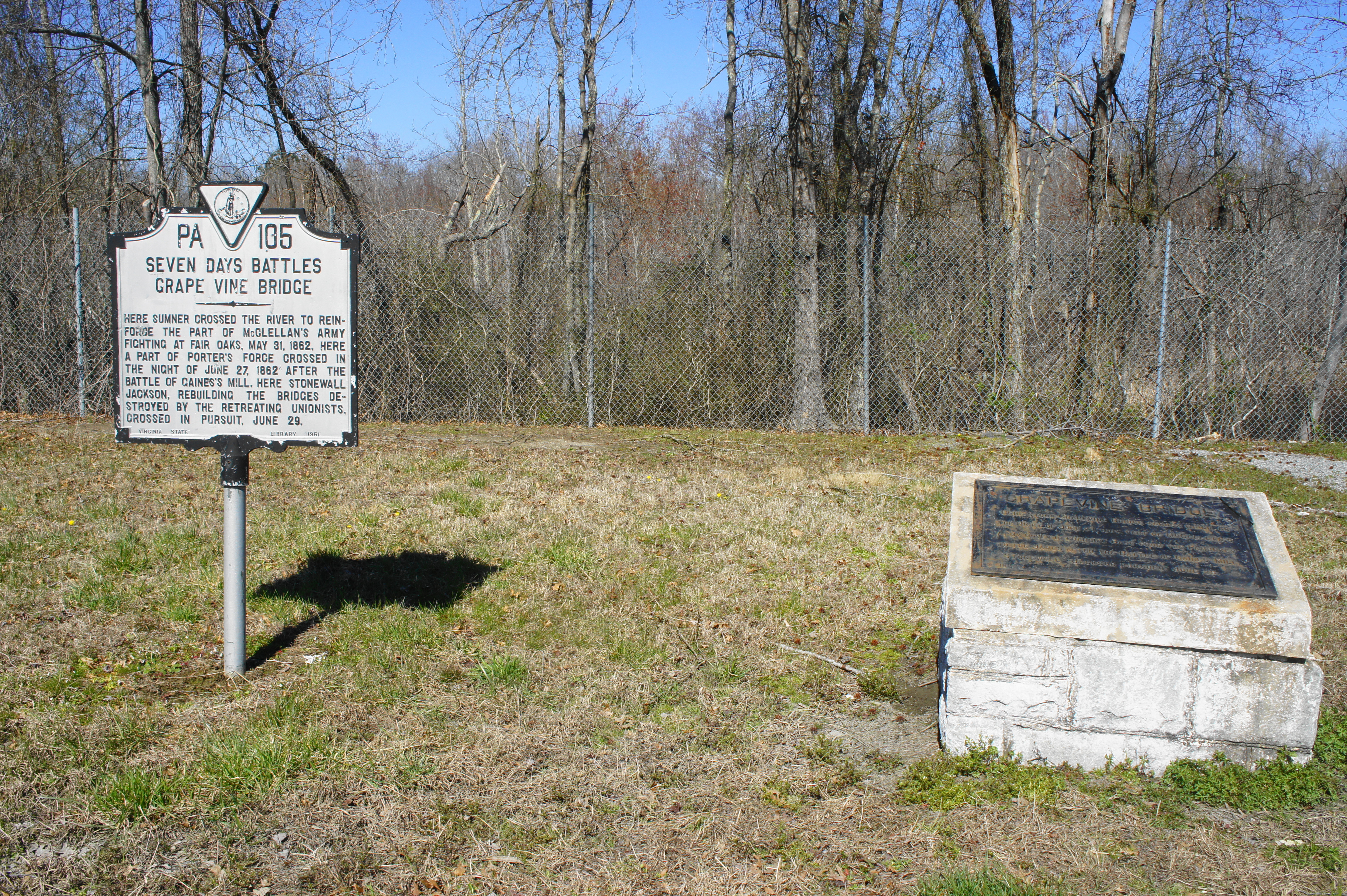
Stop 14: Grapevine Bridge (1352-1424 Hanover Rd., Sandston, VA)
McClellan, being a U.S. Army engineer himself, put the Army of the Potomac’s engineering corps to work in May and June constructing a multitude of bridges over the Chickahominy River. One such project was the so-called Grapevine Bridge, which would prove useful on several occasions: it was used first by Brig. Gen. John Sedgwick’s forces to reinforce the Union position at Fair Oaks on May 31, then the bridge served as an avenue of retreat for Porter’s Fifth Corps following the Battle of Gaines’ Mill on June 27. Two days later, after the bridge was destroyed by the fleeing Federals, the crossing was rebuilt by Stonewall Jackson’s division as it pursued McClellan’s Army.
Today, Virginia Route 156, a.k.a. Cold Harbor Road, traverses the Chickahominy at roughly the spot of the old Grapevine Bridge. A large parking area just south of the crossing offers serves as the start of a short trail to the river banks. (Note: This is also an entry point for the Chickahominy Water Trail.) There is also a pair of markers on the opposite side of the parking area that offer a short description of the strategic importance of Grapevine Bridge.
Note: Allot 10-15 minutes for this site.
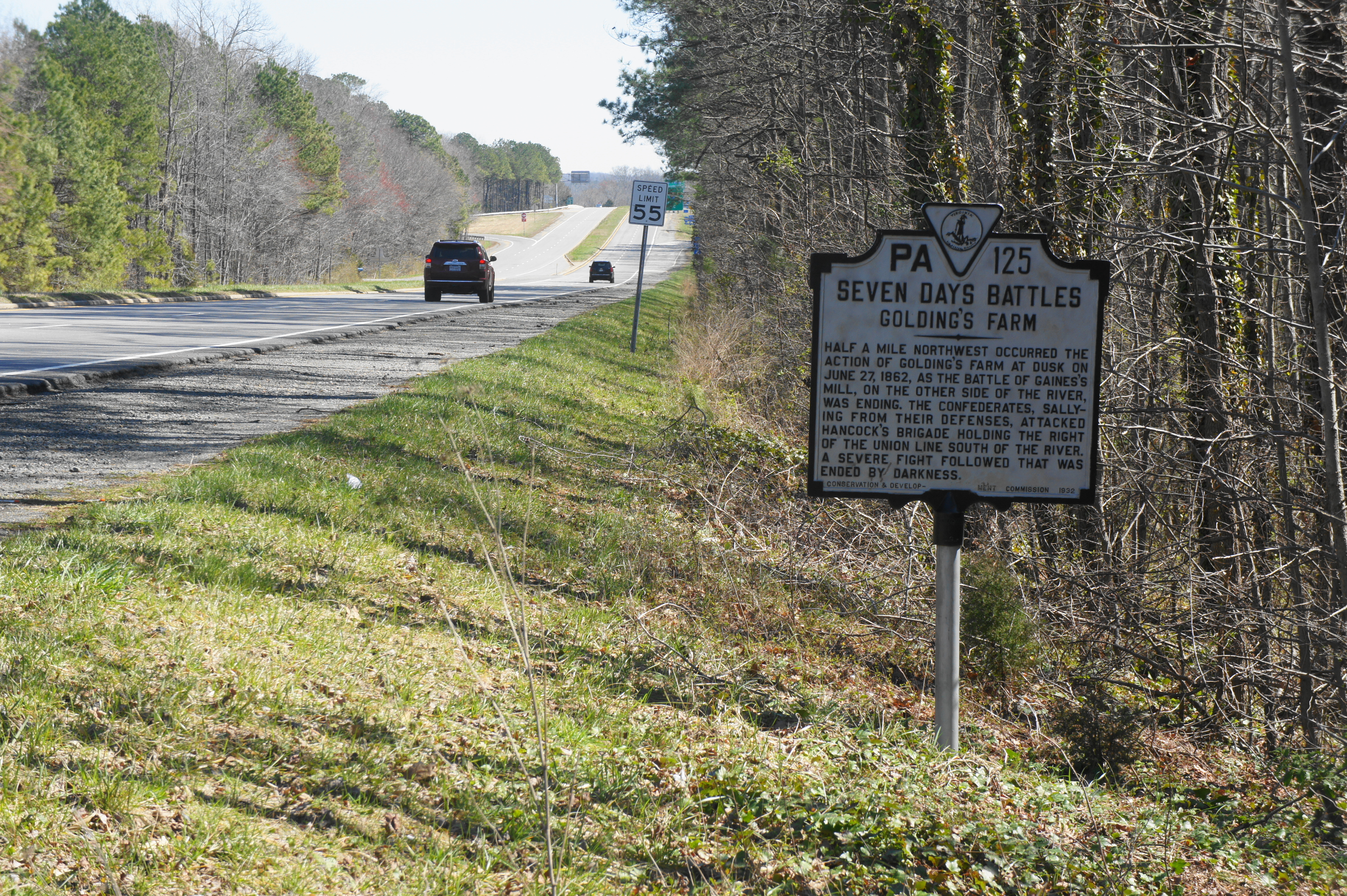
Stop 15: Garnett’s and Golding’s Farms (1501-1599 Old Hanover Rd., Sandston, VA)
The same day as the bloody battle at Gaines’ Mill, McClellan’s forces were under attack by a much smaller force led by Brig. Gen. Robert Toombs’ Georgian brigade at Garnett’s Farm. The strike was quickly repulsed, however, by Winfield Scott Hancock’s brigade as evening fell on the battlefield, and the Confederates suffered 271 casualties.[iii] The attack fueled McClellan’s (incorrect) perception, however, that he was being attacked by “greatly superior numbers” on both sides of the Chickahominy. Toombs engaged the Union forces the next day (June 28) at nearby Golding’s Farm but again was repulsed.
Garnett’s and Golding’s Farm have also been lost to development, and little trace of the battle remains, aside from a roadside historical marker at the corner of Route 156 and Hanover Road. The actual battle took place a good deal northwest of this sign; visitors can trace some of this terrain by driving along North Washington Street in Sandston, which traverses a quiet subdivision.
Note: Allot 5-10 minutes for the site. By now it should be around midday. Stop for lunch in the Sandston area, or bring a picnic to the Chickahominy.
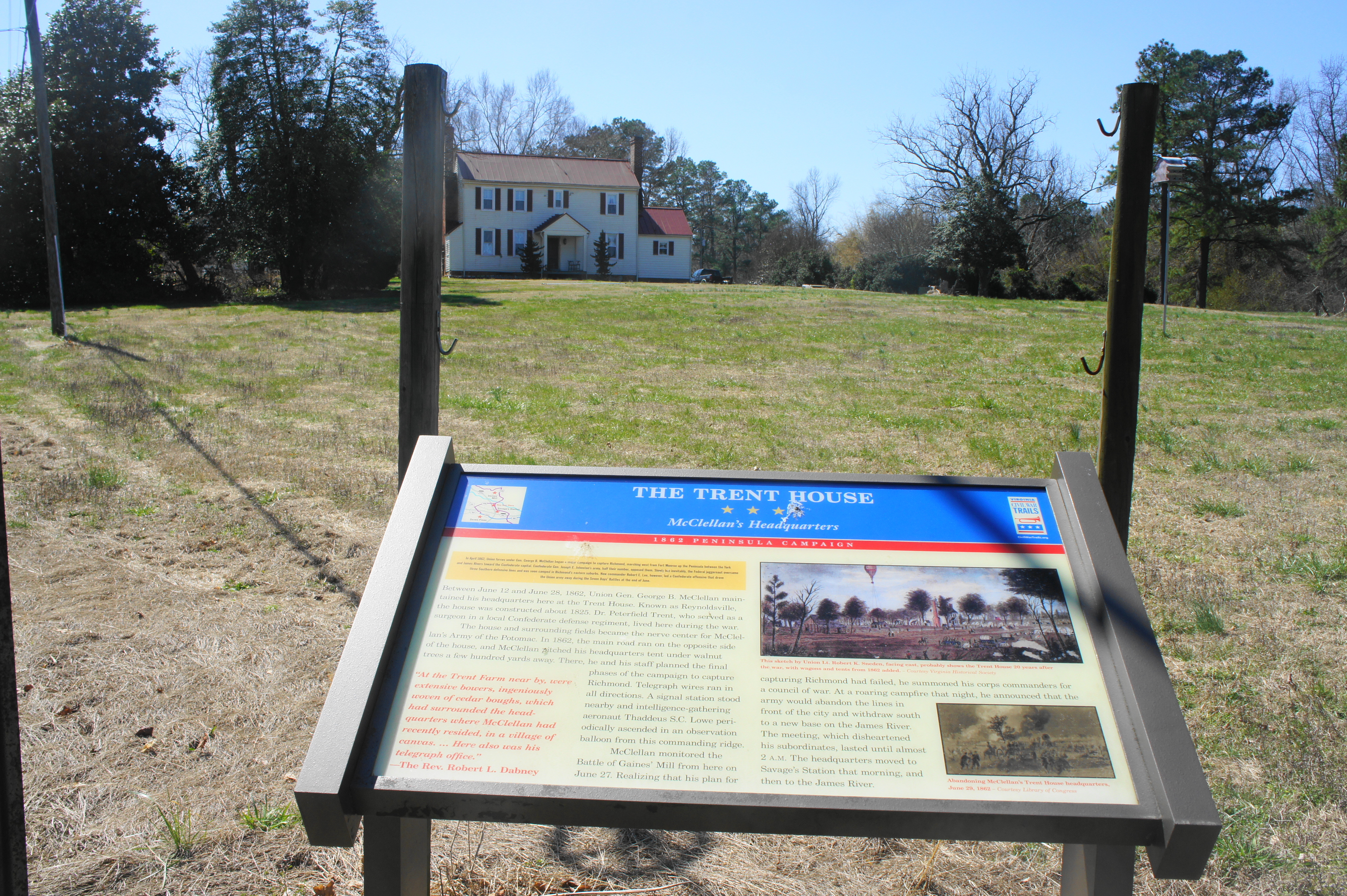
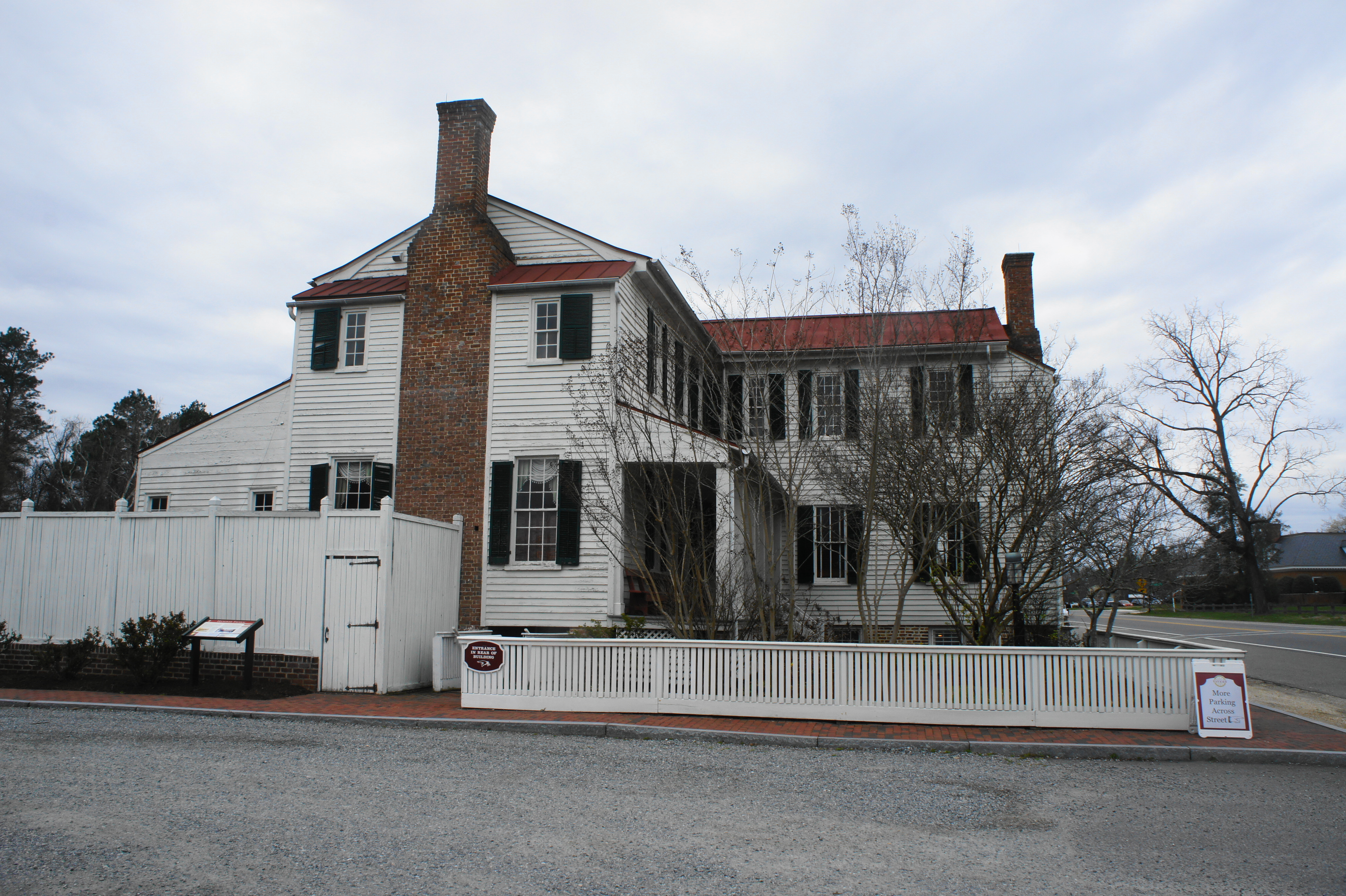
Stop 16: Trent House (1312-1200 Grapevine Rd., Sandston, VA)
Heading back toward Grapevine Road, hang a right on Old Hanover Road, then follow Grapevine Road south, roughly following the retreat route of McClellan’s forces as they made their way to the James. On your right you will encounter a Civil War Trails sign on the Trent House, which served as McClellan’s field headquarters from June 12-June 28, 1862. McClellan monitored developments at Gaines’ Mill and Garnett’s Farm from here on June 27; that night, the timid general told his commanders around a campfire that his offensive to capture Richmond had failed and announced his intention—already set in motion after Beaver Dam Creek—to complete a withdrawal to the James, where his forces would enjoy the protection of Union gunboats. After the meeting, McClellan sent a telegram to Secretary of War Edwin Stanton, reprimanding him for not sending reinforcements: “I have lost this battle because my force was too small…If I save this Army now I tell you plainly that I owe no thanks to you or any other persons in Washington – you have done your best to sacrifice this Army.”[iv]
Note: Allot 5 minutes for this site. The Trent House is now a private residence but is visible from the road.
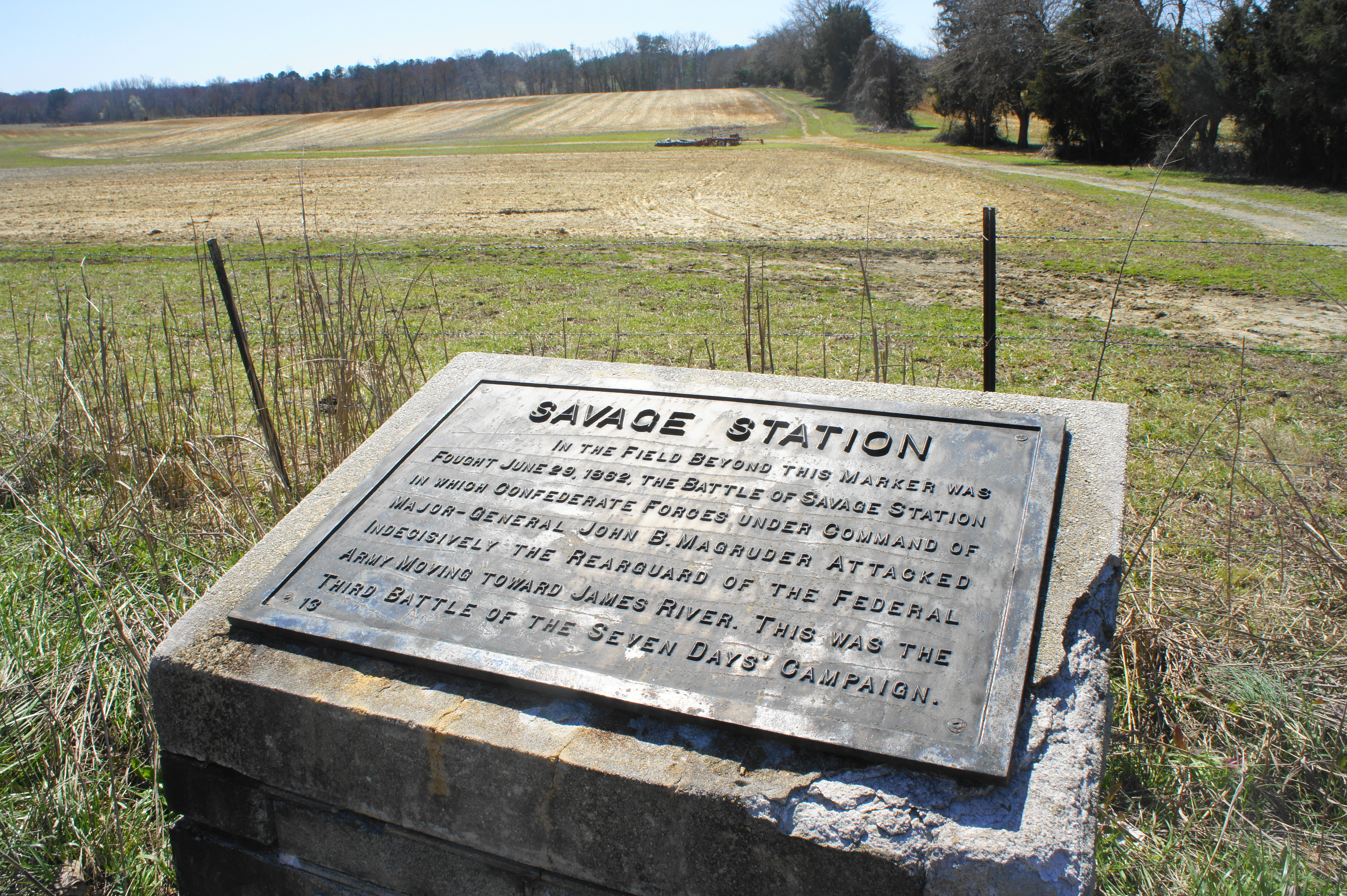
Stop 17: Savage’s Station (2700 Meadow Rd., Sandston, VA)
After abandoning the Trent House, McClellan established a new temporary headquarters at Savage’s Station, located around a mile to the southeast. Here the Army of the Potomac set up a field hospital for the thousands of wounded soldiers, who received care on June 28, the sole day of the Seven Days without a significant battle. McClellan picked up camp and began moving farther southward the next morning, but his rear guard was caught in another fighting retreat as they met Confederate Maj. Gen. John Magruder’s division in the Battle of Savage’s Station. The fighting produced more than 400 Confederate and 900 Union casualties before darkness put an end to the indecisive battle. However, the Confederates overran the field hospital at Savage’s Station, taking most of the 2,500 wounded Federal soldiers present as prisoners of war.
There are several roadside signs and a Civil War Trails wayside dedicated to the Battle of Savage’s Station at a pull-off near the junction of Grapevine Road and Meadow Road. Most of the fighting occurred in the fields to the south, with much of the battleground now covered by the highway interchange of I-295 and I-64.
Note: Allot 10 minutes for this site.
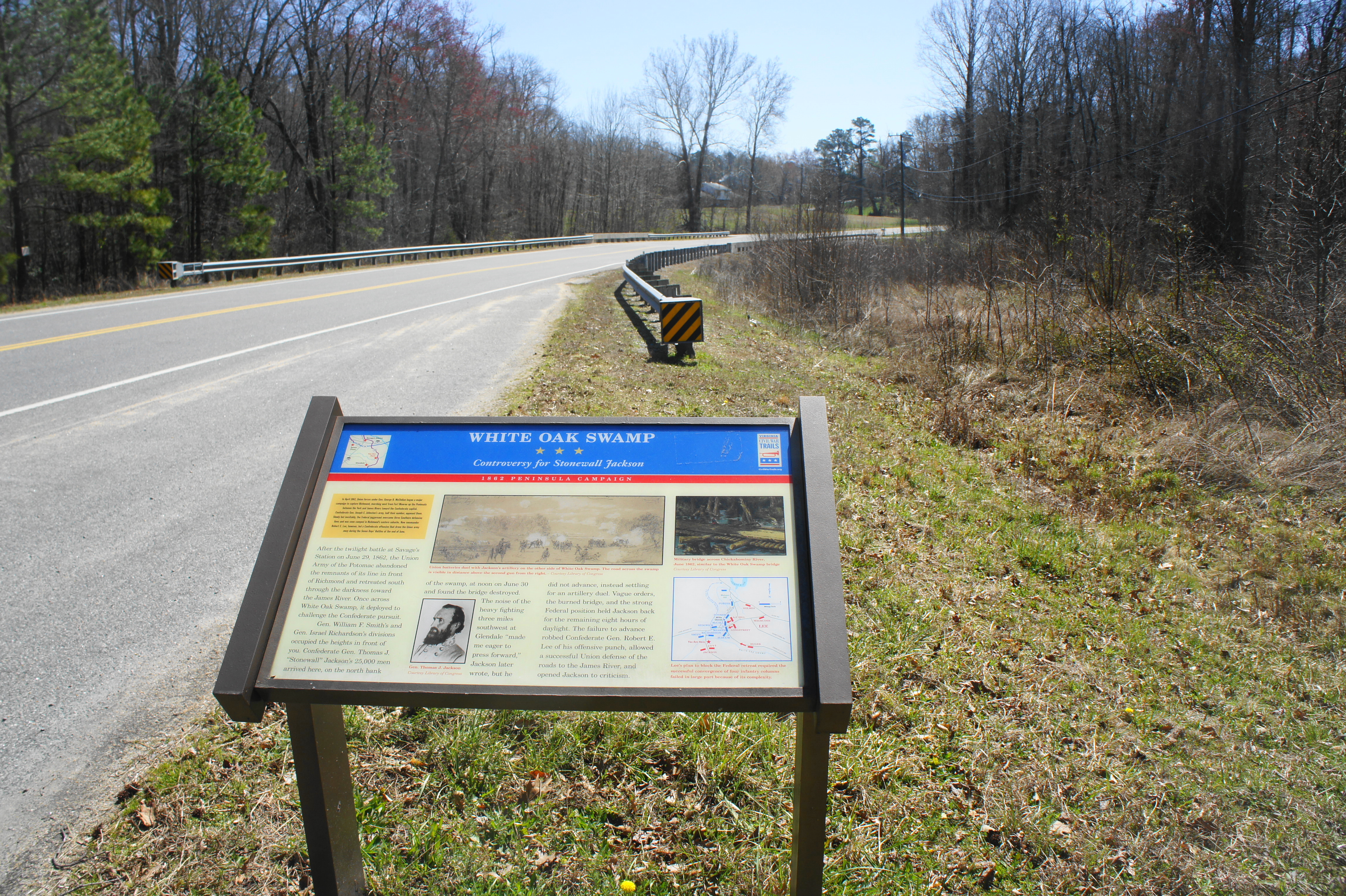
Stop 18: White Oak Swamp (7167-7041 VA-156, Sandston, VA)
As McClellan’s forces journeyed southward, Lee engineered plans to send his entire army to crush the Federal force as it passed through Glendale, an important crossroads on the route to the James. The attack called for a pincer movement on June 30 that involved three columns—led by Stonewall Jackson, Maj. Gen. Benjamin Huger, and Longstreet—converging on McClellan’s Army. Little went as planned, however, beginning with Jackson’s forces at nearby White Oak Swamp, a boggy stream northeast of the crossroads. Here they met the forces of Union Brig. Gen. William Franklin, who engaged the Confederates in an intense artillery duel that blunted Jackson’s advance, preventing his forces from joining the Battle of Glendale.
There a couple of historical markers, including a Civil War Trails wayside, at the point where Route 156 crosses White Oak Swamp. While most of the area is privately owned, one can peek over the bridge to see the swampy terrain that helped halt the Confederate advance; on the south side, you can see the high ground where Franklin’s artillery were placed during the engagement.
Note: Allot 5 minutes for this site.
Stop 19: Glendale Crossroads (6170-6100 VA-156, Henrico, VA)
Stop at the intersection of Charles City, Darbytown, and Willis Church Roads to visit the first of three driving tour sites for the Battle of Glendale. There are historical markers on both sides of the crossroads. This intersection was the prize for the advancing Confederates, as seizing it would effectively split the Union force in two. However, on the morning of June 30, the Federal rear guard had arrayed itself in a wide arc around the crossroads.
Note: Allot 5 minutes for this site.

Stop 20: Confederate Advance (5580 Longbridge Rd., Henrico, VA)
With both Jackson’s and Huger’s waylaid by Union obstructions, the Battle of Glendale (a.k.a. Frayser’s Farm) commenced behind schedule on June 30 with only Longstreet’s and Hill’s divisions advancing from the west. After initial success in piercing the Union line, the Confederate column was halted by Union counterattacks led by Brig. Gens. Joseph Hooker and Phillip Kearny. The Union success gave the Federals enough time to complete the movement of all its troops south to Malvern Hill, site of the final battle of the Seven Days’ on July 1.
Driving west on Darbytown Road from the Glendale crossroads, bear left on Carters Mill Road and then left again on Longbridge Road. Heading northeast on this quiet, forested drive, you are following the path taken by part of Longstreet’s division as it belatedly commenced the battle around 5pm on June 30. Some of the heaviest fighting occurred along this road, where Gen. Kearny moved in to reinforce Brig. Gen. George McCall’s division as it faced defeat by superior Confederate numbers. The Union line held, and the Confederates were disappointed again, missing perhaps its best opportunity during the war to destroy the Union Army.
There is a stone marker situated at the only left-hand bend heading northeast on Longbridge Road, and a gated road leads east into the woods to a hidden Civil War Trails sign. However, there is no parking allowed along the road, so the best most visitors can hope for is a drive-by.
Note: Allot 10 minutes for this loop drive.

Stop 21: Glendale National Cemetery (8301 Willis Church Rd., Henrico, VA)
Heading back to the crossroads, bear right on Willis Church Road, following the path of the Federal retreat toward Malvern Hill. About ¾ mile down the road, you will find the Glendale National Cemetery on the left. Like Seven Pines Cemetery, only a small fraction of the Union soldiers buried here in 1866 have been identified; the rest are of a nameless group of fighters who perished at the Battle of Glendale and, later, the Battle of Malvern Hill. The 2-acre site includes a flagstaff, a handful of plaques and monuments, and a main building that serves as a seasonal visitor center for Richmond National Battlefield Park.
Note: Allot 15-20 minutes to explore this site.
Stop 22: The Parsonage (8945-8955 Willis Church Rd., Henrico, VA)
The final two destinations cover the Battle of Malvern Hill, the last of the Seven Days’ Battles and the Union’s only clear victory of the campaign, which ensured safe passage for the Federal Army south to the James River. Malvern Hill is one of the country’s best preserved Civil War battlefields, a mix of sunny fields and thick woods crisscrossed by a set of hiking trails. The remains of the Parsonage—once a house but now just a set of brick chimneys—served as the staging point for Confederate forces in their last bid to destroy McClellan’s Army before it reached the safety of its gunboats on the James. Looking out across the fields to the east, the subtle rise of the terrain gave the Union a significant defensive advantage, which proved decisive in turning back the South’s frontal assault. The Parsonage is also the best starting point for a 2-3 mile loop hike that offers the best way to tour the battlefield.
Note: Allot 5 minutes for this site, or—if you complete the hike—1.5-2.5 hours. The hike will also take you past the final destination, the Union line on Malvern Hill. See my post on June 3, 2018 for a full trail description.

Stop 23: Malvern Hill (Henrico, VA)
From the Parsonage, continue south across the heart of the Malvern Hill Battlefield, turning right at the NPS sign near the white West House. Here lies a line of Union guns, in the same position where they were placed during the Battle of Malvern Hill. Visitors can survey the area where the Confederates threw thousands of infantrymen at the Union line, to no avail. For the second time in two days, McClellan’s forces on July 1 were able to stave off defeat. By the next day, the Federals reached the James River, and McClellan established his new headquarters at Harrison’s Landing. While McClellan entertained resuming the battle, President Lincoln in August ordered the Army of the Potomac to return to Washington, just in time to meet a new Confederate campaign engineered by a newly confident Robert E. Lee.
Note: Allot 15-20 minutes for this site. This marks the end of the 2-day driving tour. If you have a third day, however, consider the following “extra credit” options, including a half-day driving tour tracing the path of J.E.B. Stuart’s famous cavalry ride around McClellan in June 1862 and/or a visit to Harrison’s Landing along the James River, where McClellan set up his new base following the failed Peninsula Campaign.

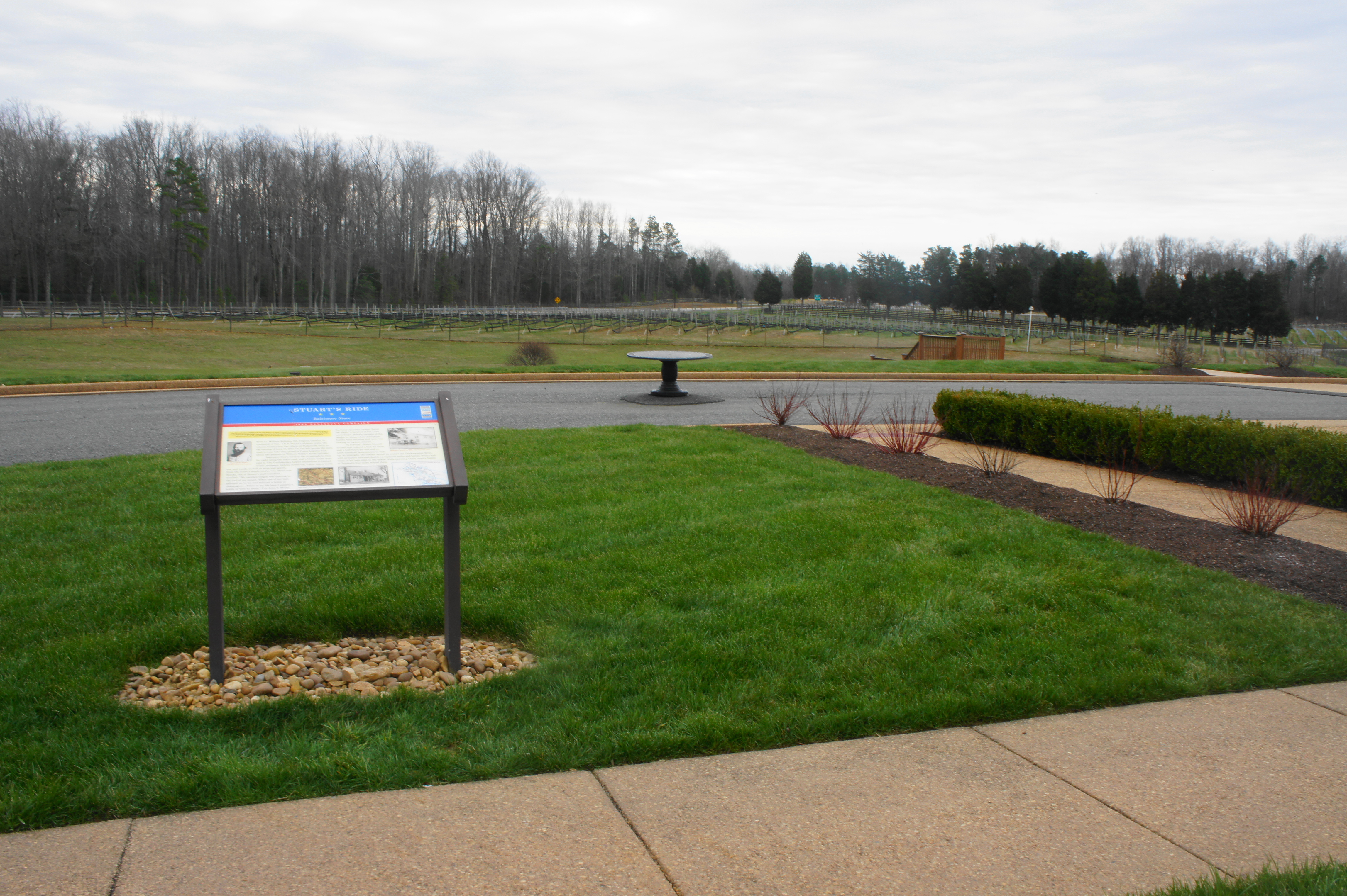
EXTRA CREDIT I: STUART’S RIDE (JUNE 1862)
Stop 24: Dabbs House (3812 Nine Mile Rd., Henrico, VA)
As Lee planned his offensive in early June 1862, he needed reconnaissance and intelligence gathering on his enemy. To do this, he entrusted James Ewell Brown (J.E.B.) Stuart, a 29-year-old Virginian who led Lee’s cavalry brigade and would go on to be one of the Confederacy’s most famous and celebrated commanders. On June 10, Lee directed Stuart in a meeting at Lee’s headquarters at the Dabbs House, east of Richmond, to scout the area northeast of Richmond to ensure that Stonewall Jackson’s troops, fresh off a campaign in the Shenandoah Valley, would have a clear path to join the offensive north of the Chickahominy. The Stuart, ever-confident and ambitious, advocated going a step further: why not do a complete circuit around McClellan’s army, returning to Richmond from the south? While Lee’s response is unknown, it is clear he did not prohibit Stuart’s idea. And thus Stuart’s famous “Ride Around McClellan,” a vital reconnaissance mission during the brief respite from battle in mid-June, was born.[v]
The half-day driving tour tracing the path of Stuart’s Ride begins at the Dabbs House, Lee’s field headquarters for most of June. The historic home now houses a museum and the Henrico County Tourist Information Center; guided tours are offered Wednesday-Sunday from 9am-5pm.
Note: Allot 5 minutes to read the historical markers and waysides in front of the Dabbs House and up to 1 ½ hours if touring the house and museum.

Stop 25: Confederate earthworks (5890 Brook Rd., Richmond, VA)
At 5 am on June 12, Stuart and 1,200 of his cavalrymen took off from camps north of Richmond, passing through the Confederate earthworks here, part of the exterior defenses guarding the Confederate capital. These fortifications, constructed with slave labor, would come under attack three times between 1863 and 1864. Despite being surrounded by commercial development, the earthworks are remarkably well-preserved.
Note: Allot 10 minutes for this site.
Stop 26: Hanover Tavern (13181 Hanover Courthouse Rd., Hanover, VA)
From Richmond, Stuart’s cavalry rode north around Ashland and east to Hanover Court House, itself the site of a minor battle two weeks prior. On May 27, 1862, Union Gen. Fitz John Porter’s Fifth Corps, tasked by McClellan with clearing out a suspected Confederate contingent in the area, drove away a Southern force with superior numbers, enough for McClellan to claim a great victory for the Federals. While the battle took place south of the modern-day town of Hanover, there is a Civil War Trails marker in the parking lot of the Hanover Tavern that describes both the battle and Stuart’s arrival on June 12.
Hanover Tavern, which now boasts a ritzy restaurant and theatre, was briefly the home of famed Virginian Patrick Henry of “give me liberty or give me death” lore; in 1760, Henry opened his first law office here, helping to launch his career as an eventual politician, orator, and delegate to the Continental Congress in 1774-75. There are a handful of exhibits in the tavern, and guided tours are offered at 2pm on Wednesday-Friday.
Note: Allot 5 minutes to read the Civil War Trails sign or spend 1-2 hours touring the historic tavern.
Stop 27: Old Church (3263 Old Church Rd., Mechanicsville, VA)
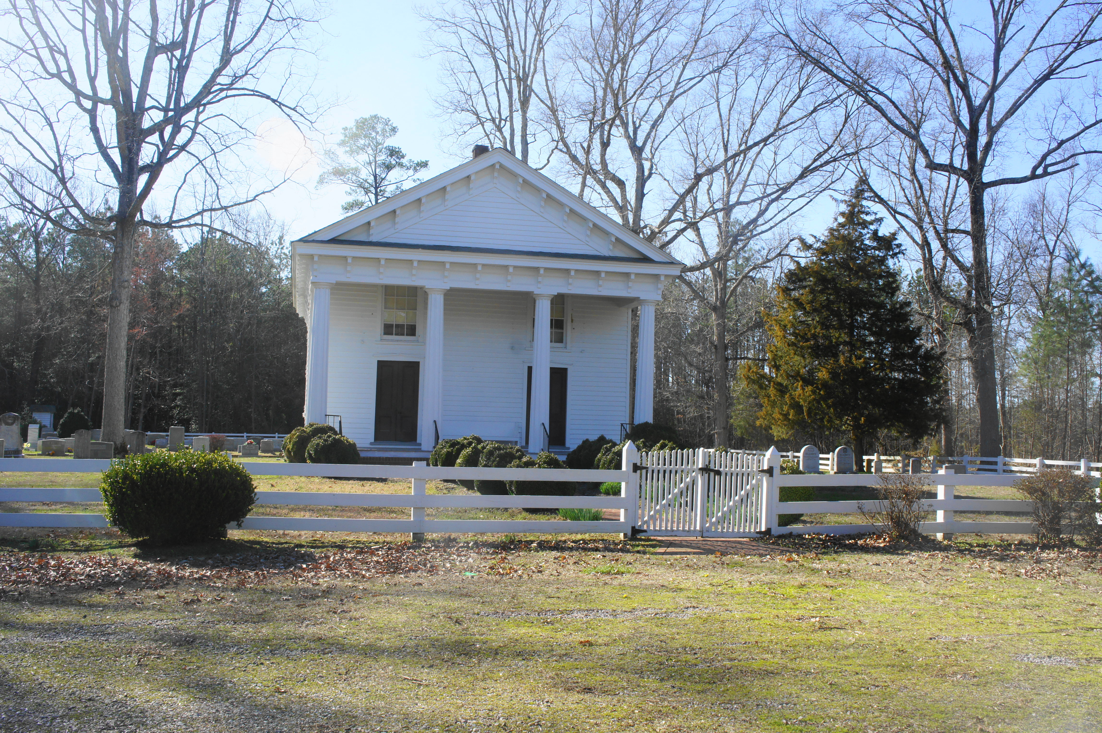
Bearing southeast from Hanover Court House, Stuart’s men encountered several Yankee pickets on June 13 and pursued the 5th U.S. Calvary to its base at Old Church, a small community northeast of Richmond. The outnumbered Federals stood little chance, and their camp was set ablaze by the 1st Virginia Calvary, led by Col. Fitzhugh Lee. A Civil War Trails sign, situated in the parking area for Immanuel Episcopal Church, tells the story of the engagement. The first church here was constructed in 1684, but the present building—remodeled in the Gothic Revival Style—dates to after the war in 1881.
Note: Allot 5 minutes for this site.
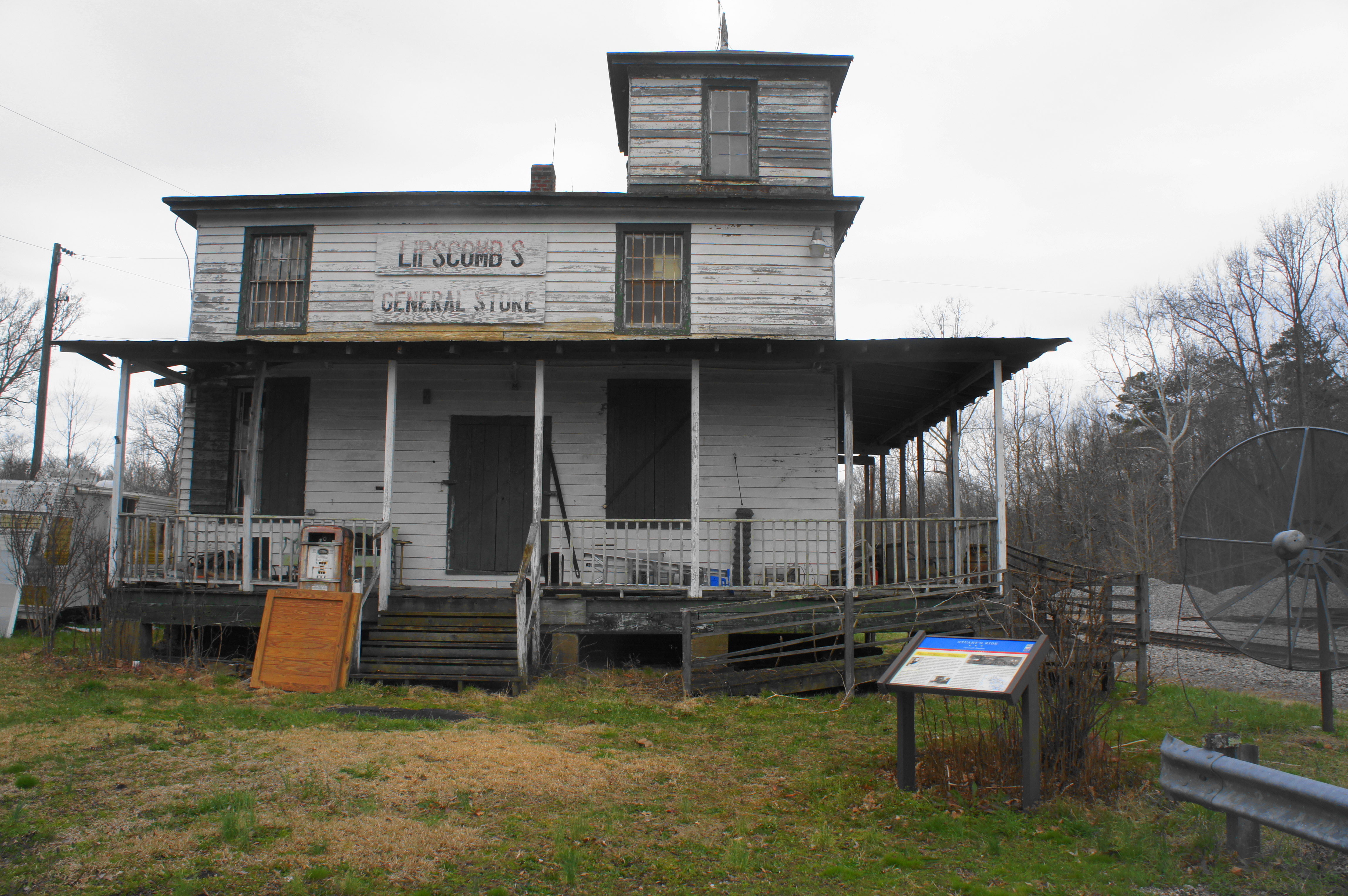
Stop 28: Tunstall’s Station (11040 Tunstall Station Rd., Quinton, VA)
After the engagement at Old Church, Stuart had covered enough ground to satisfy Lee’s original task: to scope out the Union Army to clear a path for Jackson to arrive from the northwest. Determined to complete the circuit around McClellan’s Army, however, Stuart pushed onward, continuing southeast. He and his men arrived at Tunstall’s Station, situated along the Richmond and York River Railroad, in the late afternoon on June 13. Quickly seizing the station from Federal guards, Stuart’s men opened fire on a passing train that was carrying 200-300 Union soldiers. The locomotive passed safely, arriving at the Federal supply base at nearby White House Landing—itself a tempting target for Stuart, though he followed his better judgment in avoiding a potential fight against a well-defended target.[vi]
Tunstall’s Station—later turned into a general store—now sits at the end of a dead-end road alongside the old railroad. The building that remains is run-down, poorly-preserved, and littered with modern yard junk. There is a Civil War Trails sign at the site, however, that gets travelers up to speed on the progress of Stuart’s Ride.
Note: Allot 5 minutes for this site.
Stop 29: Baltimore Store (8400 Old Church Rd., New Kent, VA)
As dusk approached, Stuart’s cavalry strolled through Talleysville, Virginia and raided the ample stocks of the Baltimore Store, manned by a Union sutler. Helping themselves to food and bottles of champagne, Stuart’s men enjoyed a few hours of rest before picking up again at midnight on June 14. Union cavalry, led by Stuart’s father-in-law General Philip St. George Cooke, pursued the Confederate riders, but remained several miles to the north. Baltimore Store was situated near the modern-day property of New Kent Winery, which today hosts a Civil War Trails sign in its parking lot.
Note: Allot 5 minutes for this site—or more if you are visiting the winery.
Stop 30: Bethany Church (8101 Adkins Rd., Charles City, VA)
In the morning, Stuart’s cavalry encountered its greatest obstacle of the ride: a high and fast-flowing Chickahominy, which waylaid the riders for several hours as they built a bridge over the river. By 1 pm on June 14, all of Stuart’s men had successfully crossed, just as a Yankee scouting party had caught up to them, lobbing a few volleys at Stuart’s rear guard.[vii] After the crossing, Stuart’s cavalry was largely free from harm, welcomed by friendly company in several towns between the Chickahominy and the James. In the late afternoon, Stuart passed this spot at Bethany Church, a few hours before he left his men and rode back to Richmond to report back to Lee.
Note: Allot 5 minutes for this site. There is a small Civil War Trails sign in front of the modest, white Bethany Presbyterian Church along Adkins Road.
Stop 31: Rowland’s (4800 John Tyler Memorial Highway, Charles City, VA)
After multiple nights with little sleep, Stuart stopped for a strong cup of coffee at Richard S. Rowland’s house in Charles City, Virginia. Eager to report to Lee about the successful mission, Stuart and his small escort party rode through the night to reach Richmond on the morning of June 15. Rowland’s old house—now a quaint bed and breakfast—is within striking distance of the James River and the final stop on the Stuart’s Ride tour. A small Civil War Trails sign wraps up the story of one of the war’s most famous reconnaissance missions.
Note: Allot 5 minutes for this site. The Rowland’s marker is a short drive from Berkeley Plantation, the start of the second “Extra Credit” driving tour.

EXTRA CREDIT II: HARRISON’S LANDING
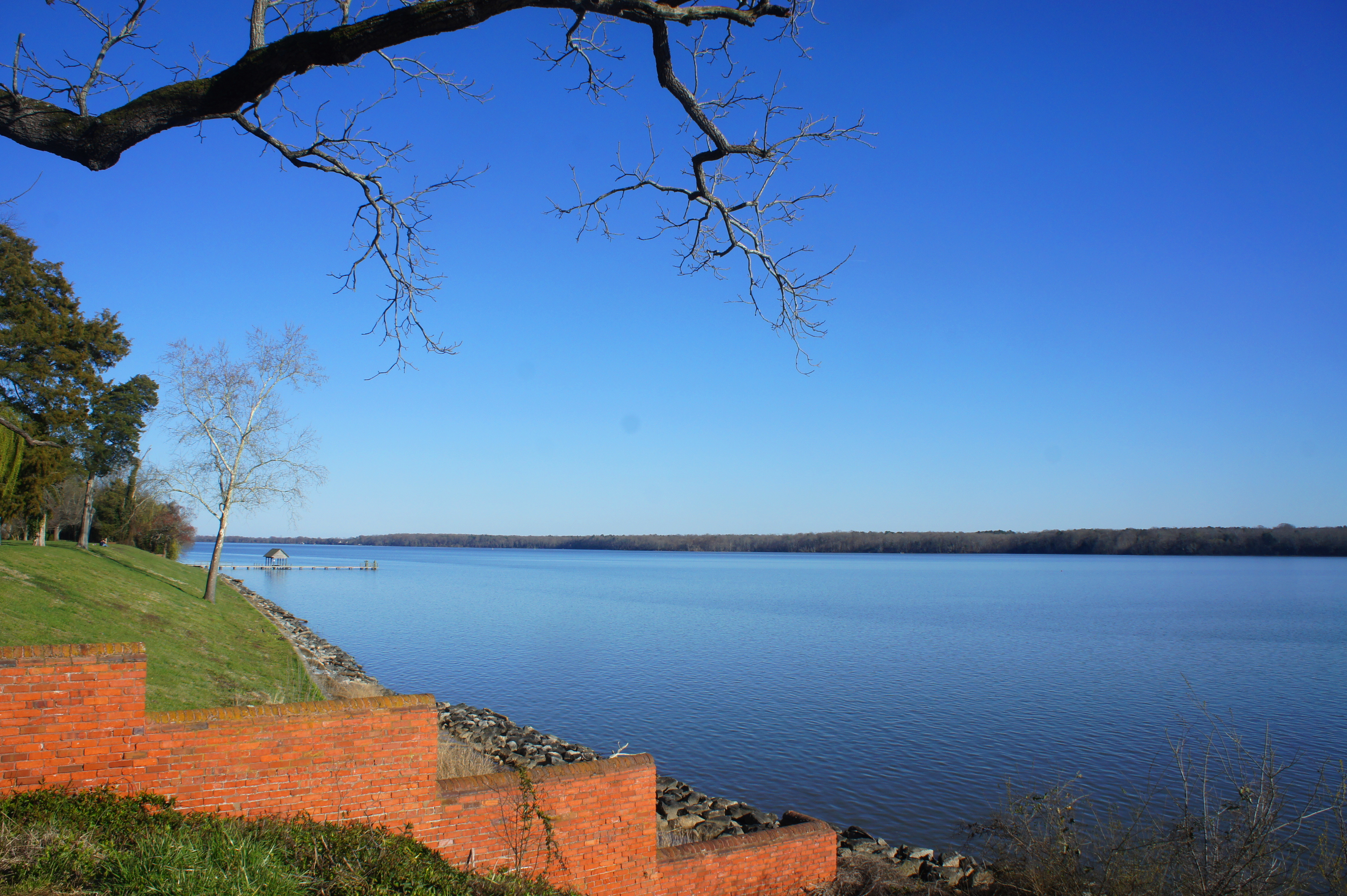
Stop 32: Berkeley Plantation (12602 Harrison Landing Rd., Charles City, VA)
There are only two destinations on this second, “extra credit” driving tour. It is possible to spend a half-day, however, exploring the two sites and relaxing along the banks of the James River. The first stop is Berkeley Plantation, the birthplace of President William Henry Harrison and ancestral home of President Benjamin Harrison but also a prominent feature of the Peninsula Campaign: the anticlimactic end of McClellan’s Peninsula Campaign.
Abandoning Malvern Hill shortly after winning the final battle of the Seven Days on July 1, McClellan’s Army of the Potomac settled here, at Harrison’s Landing on the banks of the James, where the Northern soldiers were protected by Union gunboats. This was officially the culmination of McClellan’s “change of base”—but for all intents and purposes, it was the final resting place after a failed offensive, a campaign that lasted more than three months and cost more than 25,000 Federal casualties (including those wounded or captured).
The Union camp spanned more than four miles, including Berkeley Plantation here and Westover Plantation to the east. The Berkeley grounds are open daily from 9:30am to 4:30pm; adult admission of $12 includes the museum, film, and guided tour of the main residence. While much of the history here focuses on the Harrisons and the colonial period, there are a handful of Civil War relics, including a cannonball that remains wedged into one the outbuildings. This was lodged by J.E.B. Stuart’s men (who else?) as they conducted a brief reconnaissance mission on July 3, 1862. Lincoln himself arrived here on July 8 to consult McClellan—a month later, Lincoln recalled the Army of the Potomac back to Washington.[viii] McClellan’s vague notions of another offensive on Richmond never came to fruition, and Lee—despite his personal frustrations for failing to destroy the Union Army—became known throughout the Confederacy as the hero who saved Richmond.
Note: Allot 1 1/2-2 hours tour the house, museum, and grounds.

Stop 33: Westover Plantation (7000 Westover Rd., Charles City, VA)
A short drive from Berkeley, Westover Plantation is the second and final stop of the tour. This 18th century estate today boasts impressive gardens and a fine view of the James River, a nice place to stop for a picnic. Admission is $5 for adults. The plantation marked the far eastern stretches of McClellan’s camp at Harrison’s Landing.
Note: Allot 30 minutes-1 hour to tour the grounds. From Westover, it is a 45-minute drive back to Richmond, an hour drive to Newport News, or a 2 ½ hour journey to Washington, DC.
[i] Michael Weeks, The Civil War Road Trip Volume I: A Guide to Northern Virginia, Maryland & Pennsylvania 1861-1863 (Woodstock, VT: The Countryman Press, 2011), 154.
[ii] Weeks, Civil War Road Trip Volume I, 155-56.
[iii] Stephen W. Sears, To the Gates of Richmond: The Peninsula Campaign (New York: Ticknor & Fields, 1992), 247.
[iv] Sears, To the Gates of Richmond, 251.
[v] Sears, To the Gates of Richmond, 167-68.
[vi] Sears, To the Gates of Richmond, 172.
[vii] Ibid.
[viii] Weeks, Civil War Road Trip Volume I, 186-87.

Pingback: Peninsula Campaign Driving Tour – Part 1 | Live and Let Hike
Pingback: Civil War Driving Tours: Lesser-Known Virginia Trips – Civil War Vacations!