
The Crater Lake Trail (no, not that Crater Lake) is a pleasant—although not particularly inspiring—loop hike in a remote section of Delaware Water Gap National Recreation Area on the New Jersey side. Access to Crater Lake requires a lengthy drive on unpaved roads, which helps thin out the crowds in an otherwise crowded park, although its location just off the Appalachian Trail (AT) offers the possibility that you will run into some AT through-hikers in the summertime. The circuit hike offers access to the AT, some limited views of the surrounding mountains, and, of course, Crater Lake. (Note: The Crater Lake Trail is sometimes combined with hikes to nearby Buttermilk Falls and Hemlock Pond.)

The hike
The Crater Lake picnic area is situated at the end of 2-mile Skyline Drive, which is a rough, unpaved road but passable to standard, 2-wheel drive cars. Skyline Drive is itself accessed from the more improved Blue Mountain Lakes Road, deep in the heart of Delaware Water Gap National Recreation Area. Crater Lake sits in a depression along Kittatinny Mountain, a lengthy ridgeline that is closely followed by the Appalachian Trail (AT) as it runs through New Jersey.
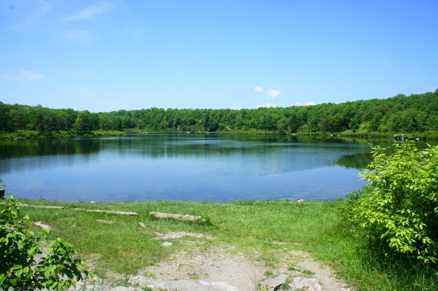
From the parking area at the Crater Lake picnic area, it is a handful of steps to the edge of Crater Lake, a still, blue pool surrounded by shrub-lined shores. The lake is a remnant of an ancient glacier that receded roughly 22,000 years ago, leaving behind a basin hemmed in on nearly all sides by high ground. A handful of picnic benches offer a place to eat lunch by the lake.

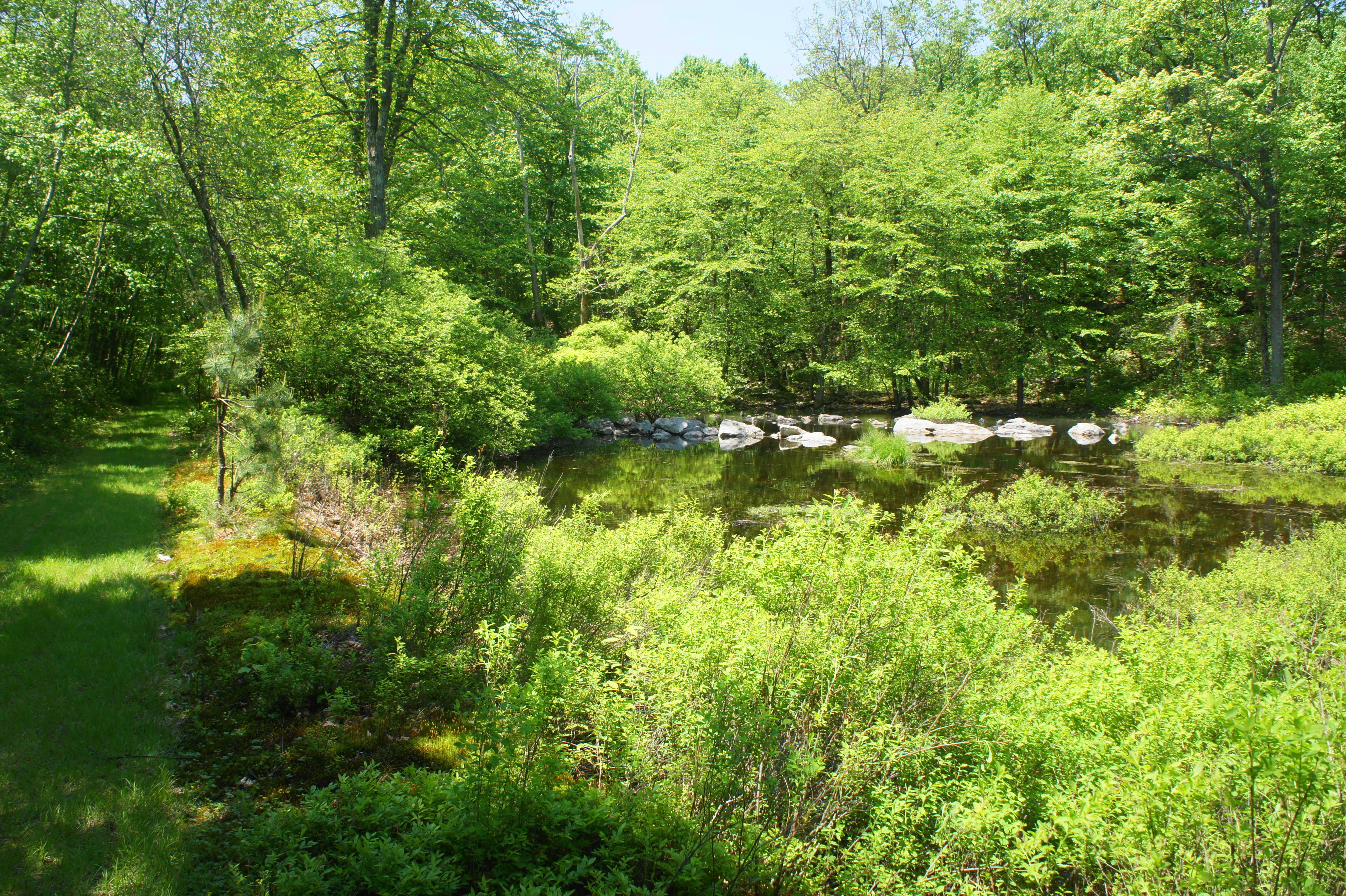
Begin the Crater Lake Trail by backtracking from the lakeshore and heading south on a wide, orange-blazed path through the woods. While Crater Lake is not visible, the grassy path passes swampy Lake Success on the left about 150 yards down the trail. In the early 20th century, the shores of Crater Lake and Lake Success played host to a popular summer cottage community that was eventually torn down in the 1970s.

Just beyond the first views of Lake Success, a narrow social trail on the right offers access to Crater Lake. At about 250 yards, the Crater Lake Trail begins to climb a minor hill amid a grove of beech trees. The gradual uphill is mild and eventually flattens out as more social trails head off to the left and right. Although hikers still cannot see Crater Lake from the trail, they can spot a rock wall, which towers over the lake, on the right in the distance at about 4/10 mile.
At the ½-mile mark, the trail reaches a four-way junction, with the white-blazed Appalachian Trail cutting across the main path. Stay straight on the orange-blazed Crater Lake Trail, which quickly passes a small rock-hewn pond on the right. After about 2/3 miles of hiking, the trail rounds a right-hand bend and begins a modest climb that surmounts a low ridgeline. The path, now an old road bed, follows the ridge before joining again with the AT, which comes in from the right and combines with the Crater Lake Trail for a short distance.
Directly opposite the merger is a spur path leading to one of the only real viewpoints on the hike. Here hikers can get partly obscured views to the west and north, overlooking the Blue Mountain area in the direction of the Delaware River.

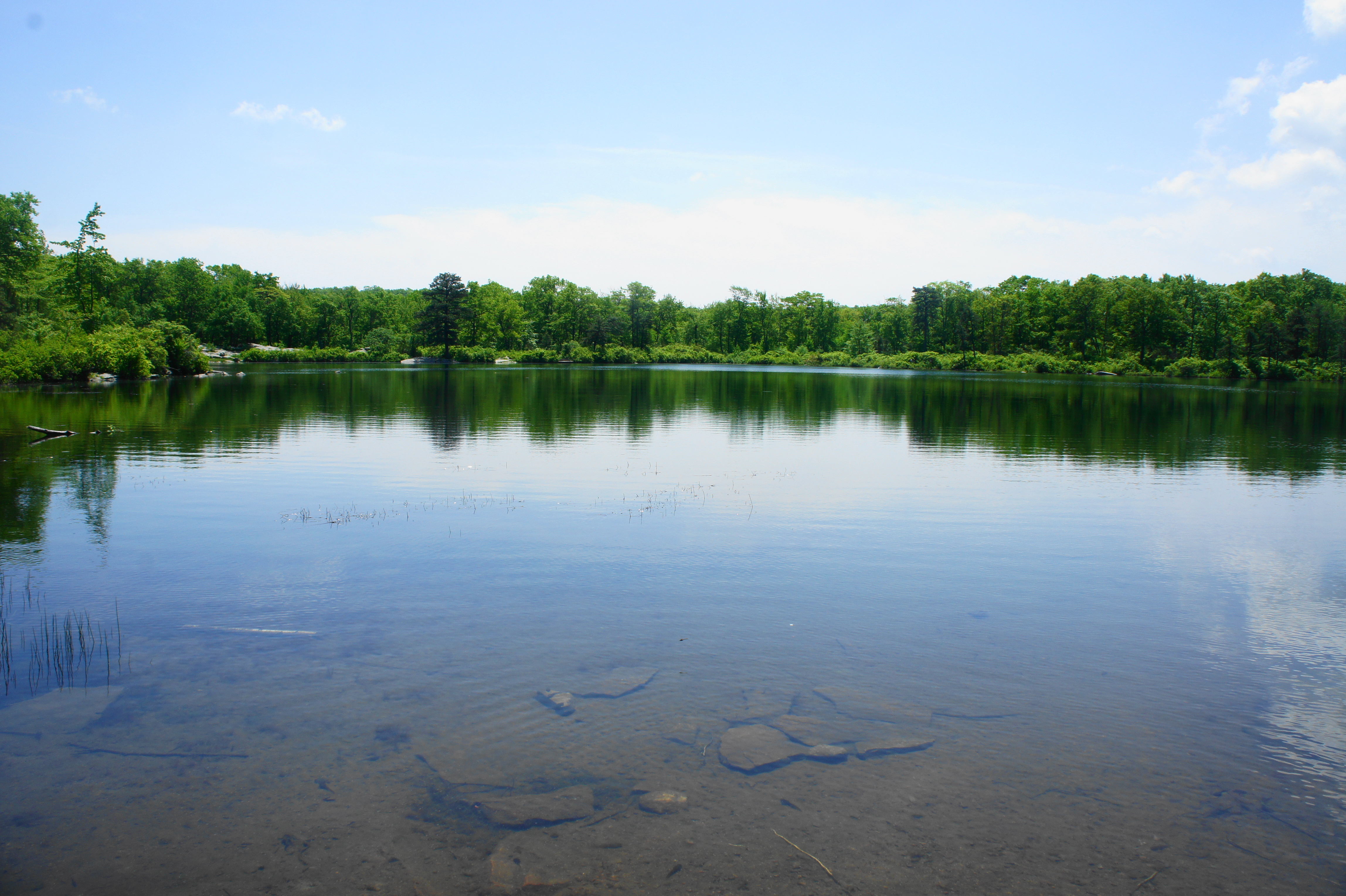
The trail climbs to its highest point shortly thereafter and splits at 1.15 miles, with an unmarked spur trail heading right. Stay left, then bear right at the next junction 1.2 miles, where the AT bears off to the left. (Note: This is also the access trail for Hemlock Pond.) From here the Crater Lake Trail begins to shed elevation, and the same unmarked spur trail comes in from the right. Crater Lake returns to view, and a narrow social trail at about 1.3 miles offers access to the sunbaked shores.
From here the main trail leaves the lakeside again and empties out onto a gravel road below a set of power lines. Bear right on the road and follow it to its end as it bobs and weaves up and over a series of minor slopes. The road—and hike—ends at around 1.5 miles, back at the parking area.
Allot around 45 minutes to an hour for this easy loop hike with some minor elevation change.
