Situated roughly a 30-mile drive from Steamboat Springs, Hahns Peak (10,839’) is one of Colorado’s most enticing summits. While not one of the state’s tallest mountains—or even the highest in the Elkhead Mountains—the volcanic peak nonetheless stands out for its prominence: a lonely, rocky bald visible from miles away, the guardian of the grassy valley below. The panorama from the top is exquisite, spanning as far north as the Wyoming border and south to the vicinity of Steamboat, with the snowy Park Range dominating the horizon to the east. It can often feel like it takes as much time and energy to reach the trail to Hahns Peak by car as it does to actually hike, but the relative ease and brevity of the 3.8 mile out-and-back to the summit makes Hahns Peak one of the more popular hikes in the area.

The hike
Hahns Peak is situated at the eastern fringe of the Elkhead Mountains, a relatively rarely-visited range that runs east-west in north central Colorado, less than an hour’s drive from Steamboat Springs. Visible from miles down the road, unobscured by other peaks, the mountain entices hikers to conquer its pointy summit.
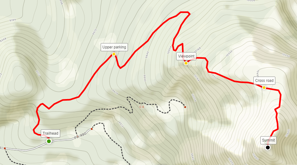
Reaching the trailhead, however, can be a challenge, especially for vehicles not built for rough roads. From Steamboat, bear north on US Route 40, then turn right onto Route 129 as it approaches the peak and cuts through a narrow gap laced with aspens. At the site of the Columbine General Store, turn right onto the unpaved Forest Road 490. Follow the gravel route for nearly a mile, then bear left at the junction. From here, the route gets rougher—while four-wheel drive is not necessary, it is recommended that you have a vehicle with high clearance. After another 1/3 mile, bear left as the road climbs a tree-studded hillside. Within a quarter-mile, the surprisingly large parking area appears on the left. (Note: Allot at least 20 minutes for this slow and rocky approach. It is possible to shave off the first half-mile of the hike by continuing up the rocky road, but the traverse requires 4WD, and there is limited parking at the upper lot.)

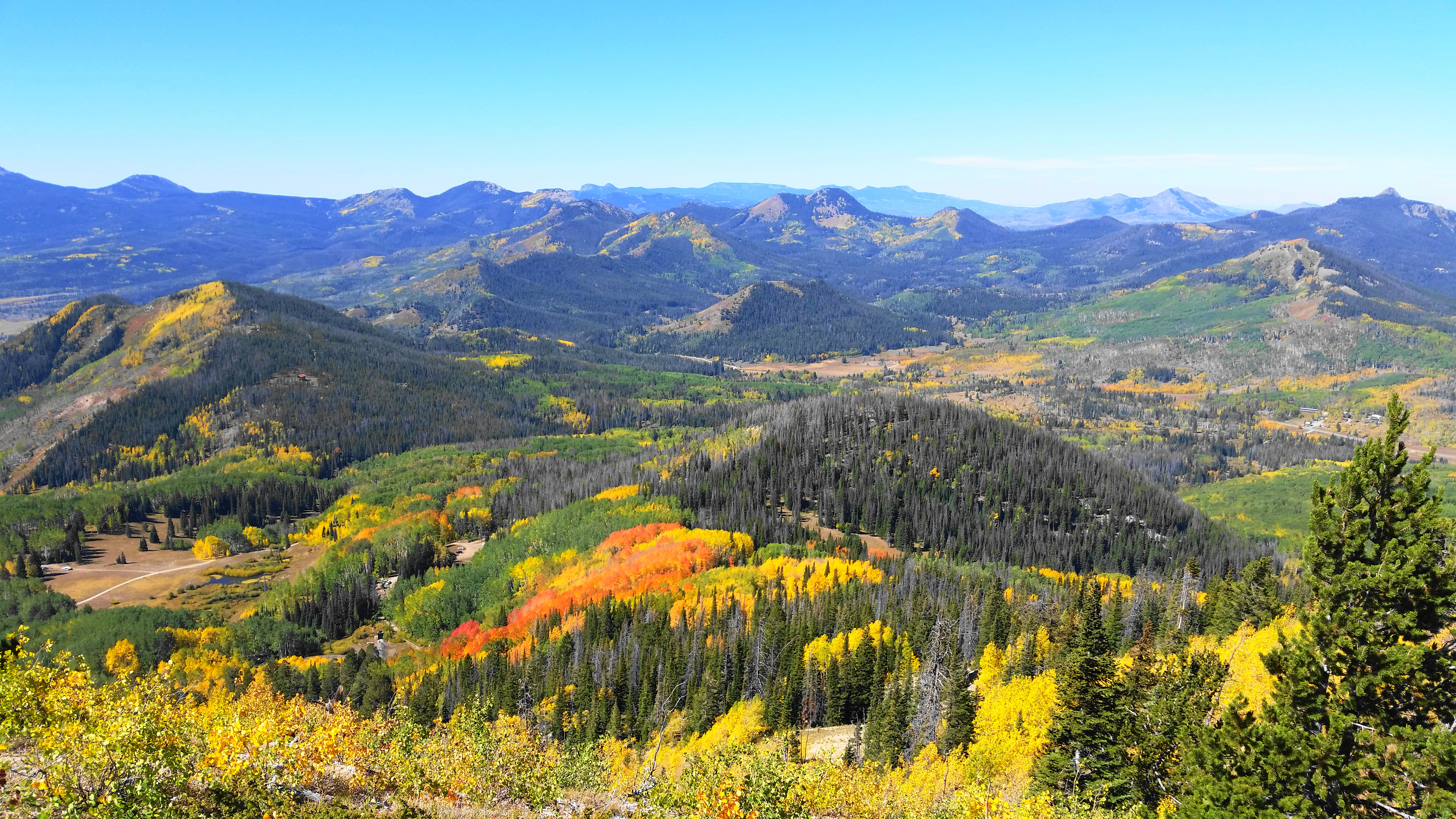
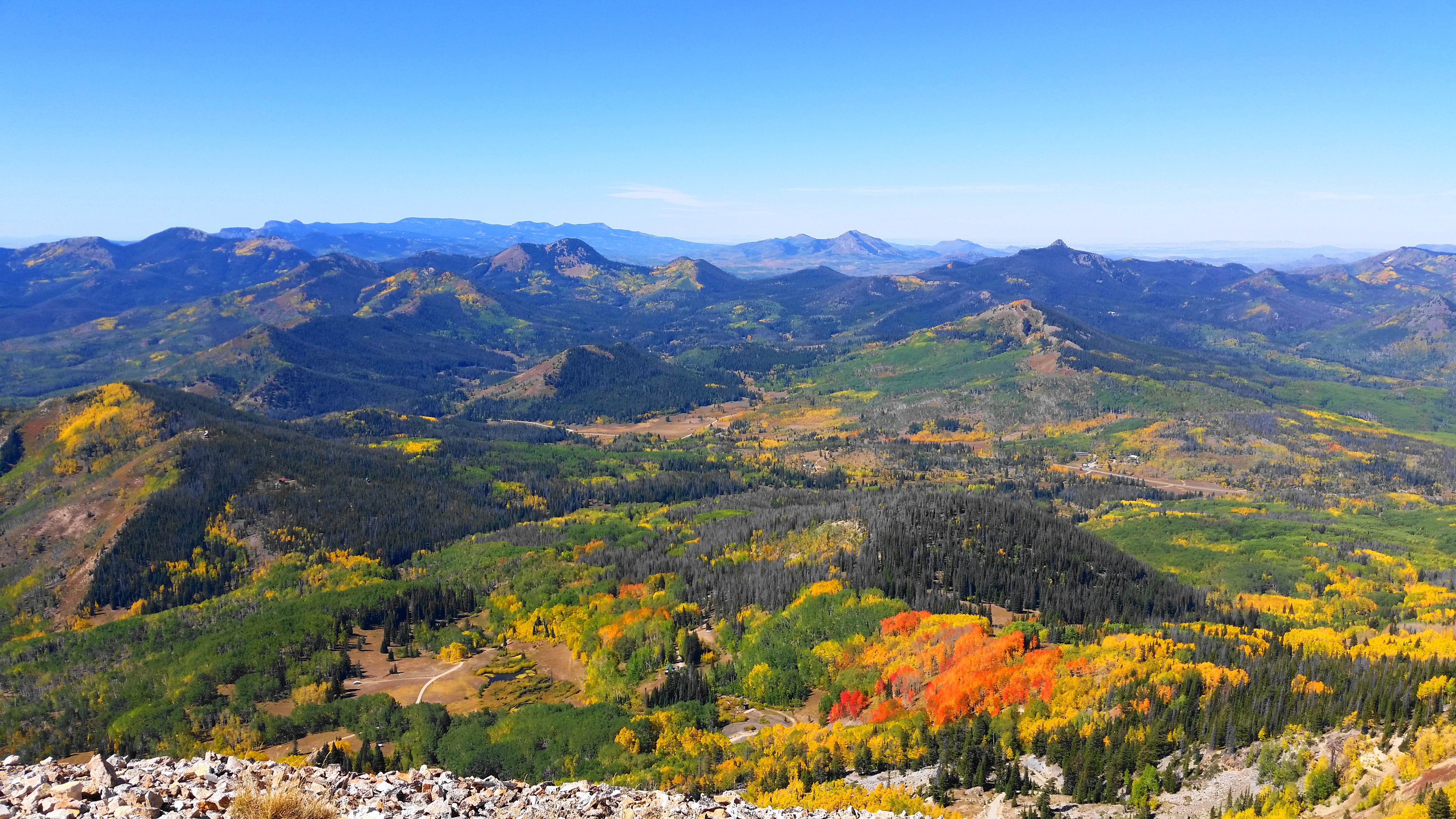
Unlike many hikes, the destination—the hulking mass of Hahns Peak—is visible in full display from the trailhead. The trail, however, begins by heading the opposite direction: from the parking area, look back west to spot the start of the hike; a Forest Service sign signals the start of the Hahns Peak Trail. The first half-mile follows a gravel, 4WD road, beginning with a sharp ascent as the path bends north and east around a long bend. After initial huffing and puffing, the route levels out before the quarter-mile mark, then bears mildly to the northeast along a low crest. Aspens and pines dominate the landscape, while intermittent breaks in the woods provide excellent views of the Elkheads to the west—Nipple Peak (10,324’), Iron Mountain (9,725’), Shield Mountain (9,921’)—and beyond.


At around 4/10 mile, the road begins to noticeably climb again, although the grade remains relatively mild. About ½ mile from the start, hikers reach the upper parking lot—relatively rarely used because of the intense difficulty of the 4WD road to this point. Look for a sign marking the start of the single-track to Hahns Peak—leave the road here.
Now on a narrow trail, hikers will face a steeper incline as the path climbs a tree-studded ridge. After an initial switchback, the ascent eases slightly, and the Hahns Peak Trail hugs a grassy hillside interspersed with outstanding views to the northwest toward the Elkhorn Mountains and Little Snake River area. (Note: The Wyoming state line lies just beyond.)

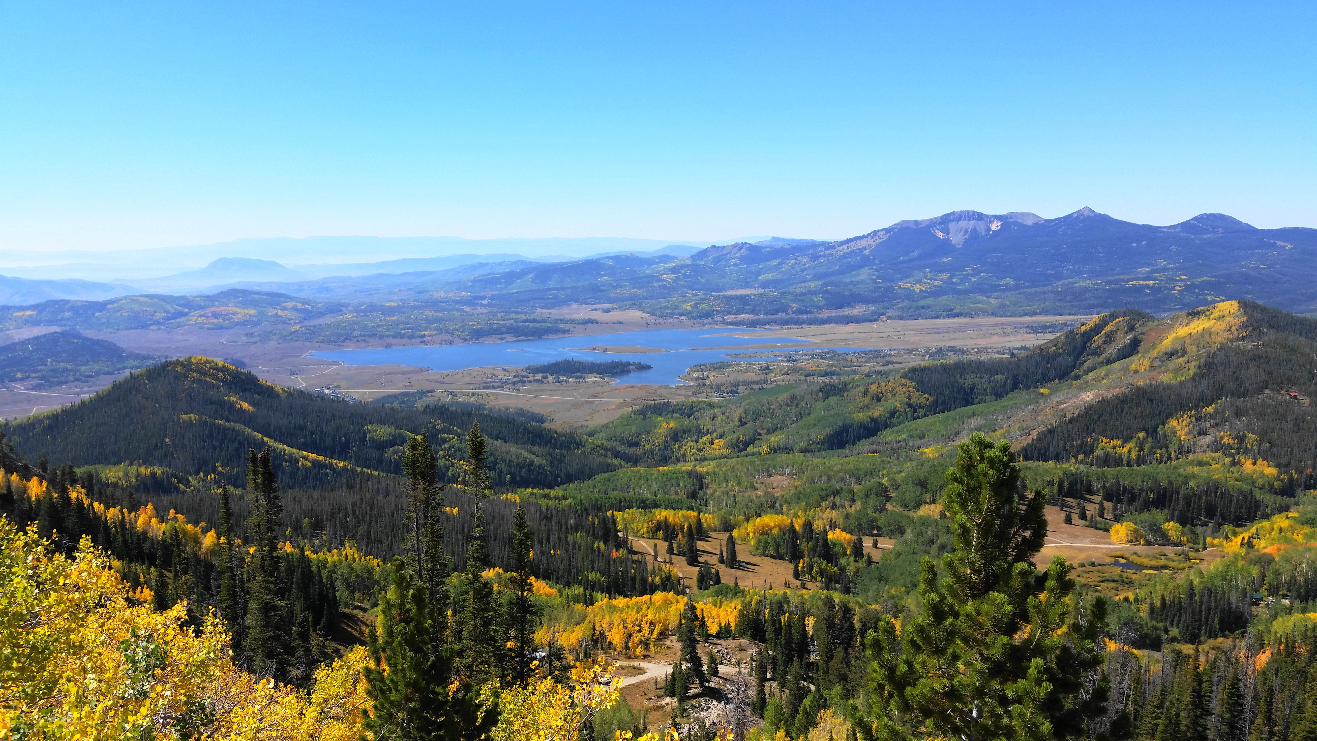
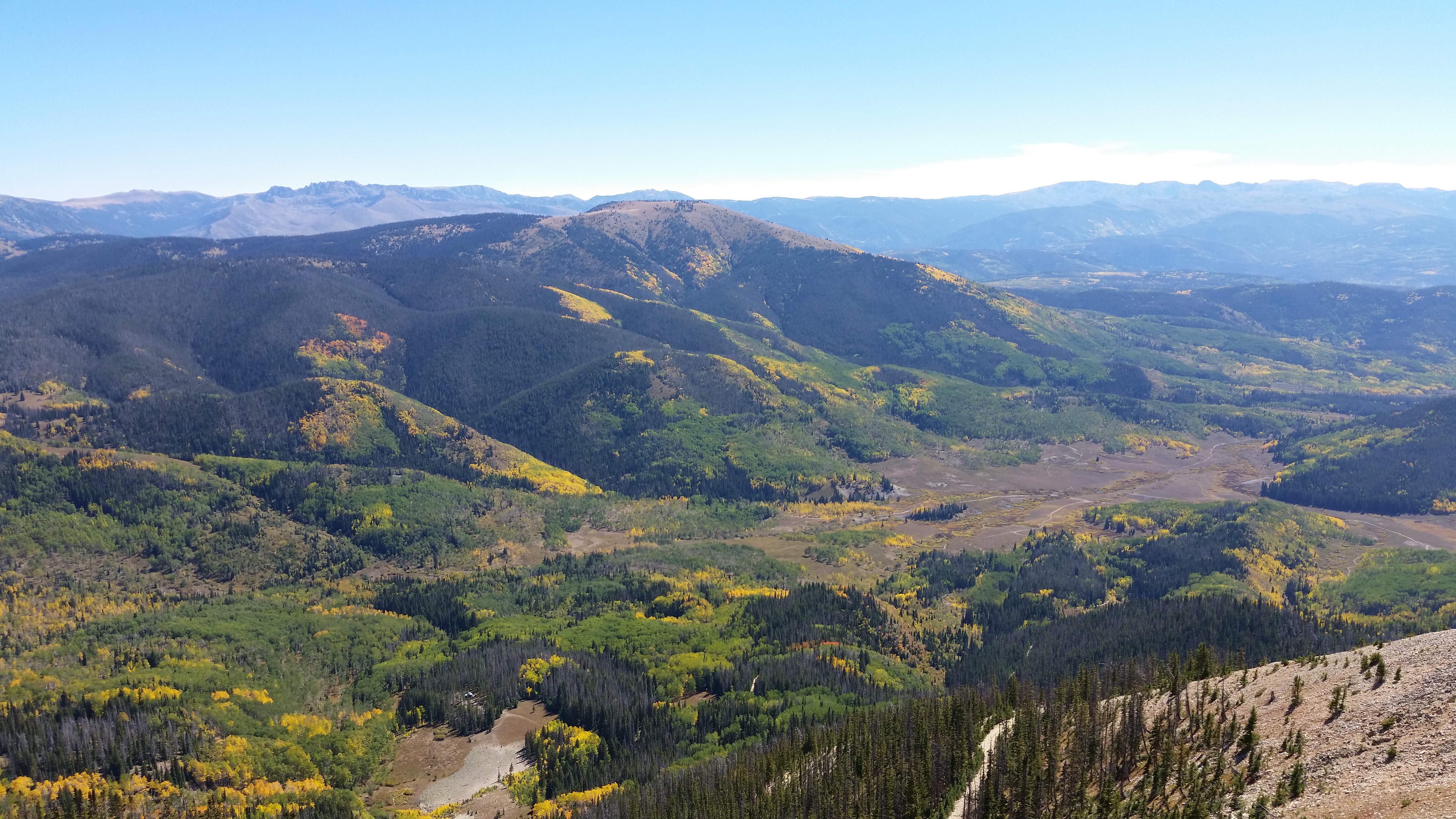
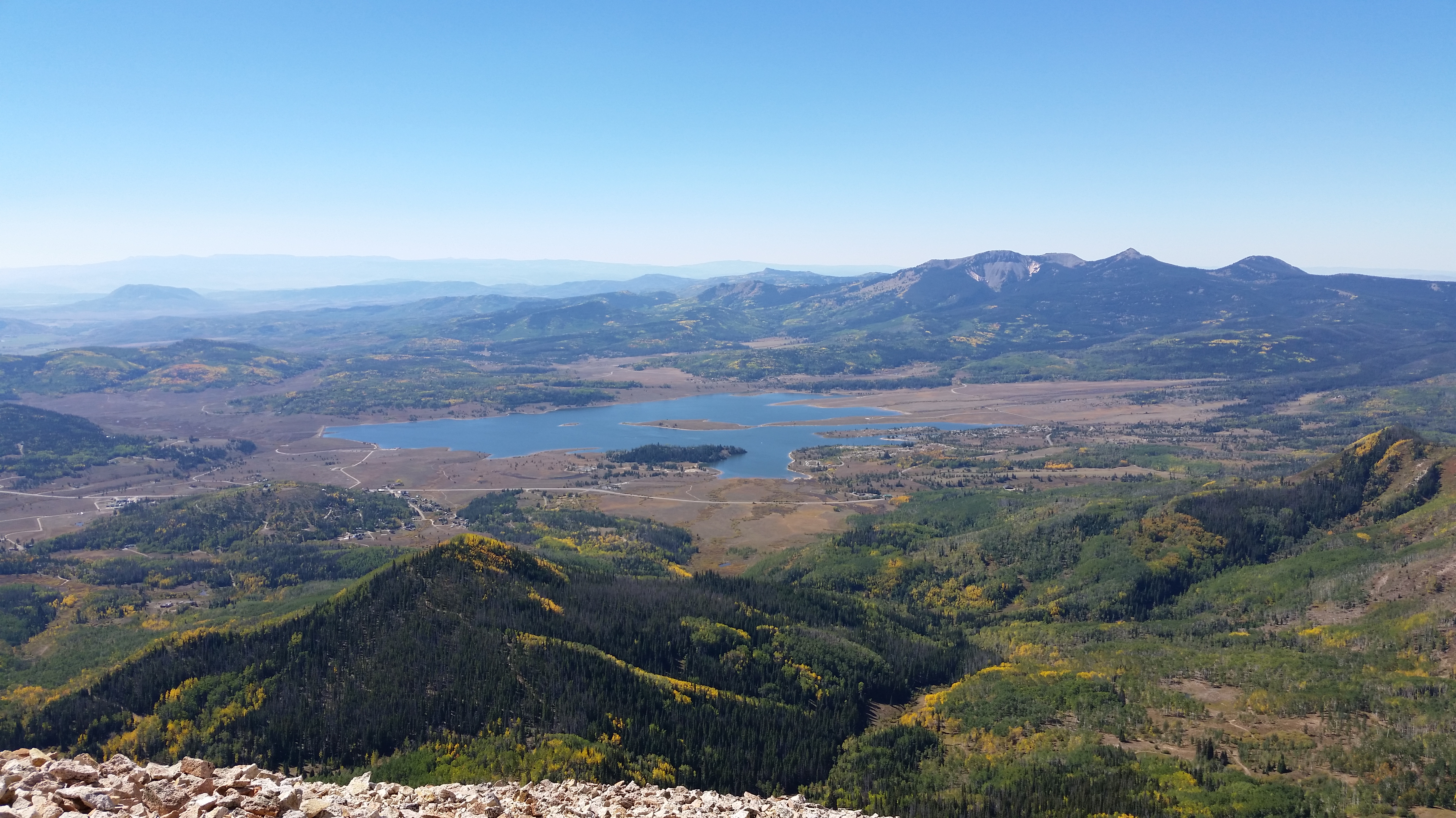
At around 9/10 mile, the trail rounds a right-hand bend and bears southward amid towering pines and, in some months, wildflowers. After a pair of additional switchbacks, the trees give way to an excellent vista, arguably the best of the hike, as it captures both the peak and the unfolding landscape to the south, including glimmering Steamboat Lake and mighty Sand Mountain (10,714’). In fall, visitors are rewarded with a view of fiery streaks of yellows and oranges that light up the forests below.

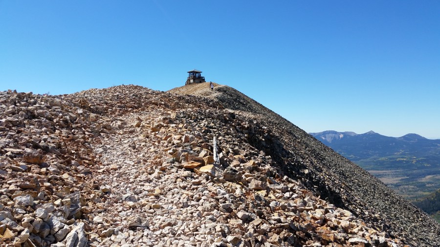
Ahead to the east is Hahns Peak, now considerably less intimidating as the summit appears within reach. Atop the summit, hikers can see a small tower: this is the fire lookout and terminus of the walk. A gravel road switchbacks up the rocky bald—this is not the trail, but it intersects the path at a later point.

Proceeding onward from the viewpoint, the trail cuts across a sunny slope, leading to a sharp climb, the steepest of the hike. Upon leveling off again, the path enters a long straightaway, then gently swerves before coming across the gravel road—an extension of an old mining track—that was visible back at the viewpoint.
By now, hikers have travelled 1.5 miles, and the remaining 1/3 mile cuts through a jumble of loose rock, largely lightly-colored rhyolite sometimes stained with red iron deposits. At the base of the rock pile, the trail splits—either path is fine, as long as you ignore the road bearing left down the north slope of the peak. The two routes converge farther up the hillside, and the trail is marked by large, man-assisted rock piles complete with tall wooden stakes. The views back to the north get better and better as the trail approaches the summit.
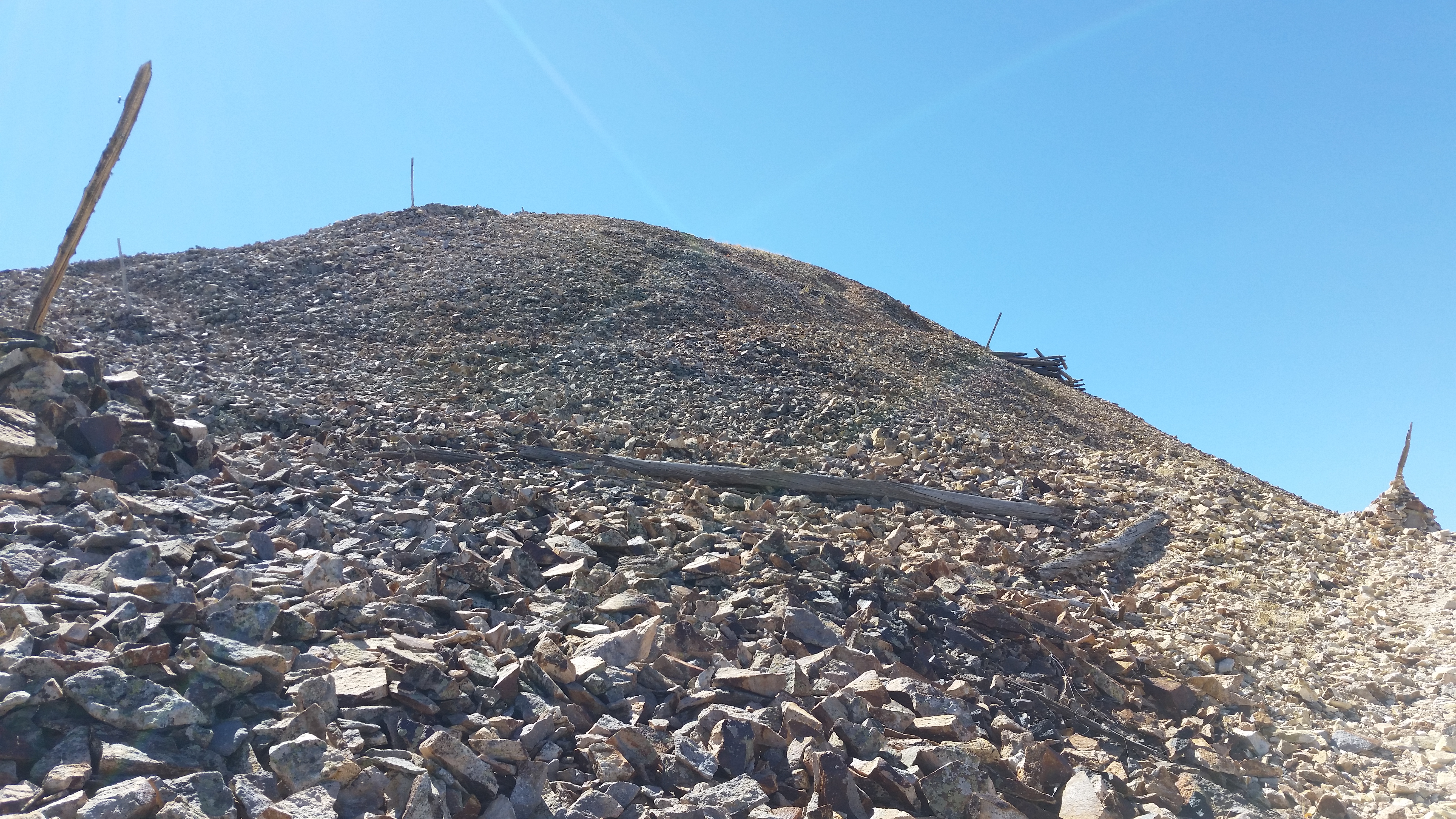


At long last, the Hahns Peak Trail crests the mountaintop at about 1.9 miles, and the fire lookout provides some respite from the often-furious winds. The summit offers a true panorama—unobstructed views in all directions, from the Elkheads to the west and Sierra Madre and Park Range to the east. The high peaks of the Park Range are higher than Hahns, headlined by Mount Zirkel (12,180’) and Flattop (12,118’). Steamboat Lake unfolds to the south, as does the smaller and partially hidden Pearl Lake. Route 139 heads off into the distance toward Steamboat Springs.
The summit of Hahns Peak lies at the heart of an eroded volcanic plug, itself part of a broader range of volcanoes once active between 10-12 million years ago.


Most hikers will require around 1 ½ hours to reach the summit—but the descent is considerably easier. Be sure to check the weather before ascending, as the peak is extremely exposed in the case of lightning.

Lucky you
Wish I were there. Call me when you are in town and let’s take a hike.
Happy New year
LJ
Great pictures!
Pingback: Top 10 Hikes in 2018 | Live and Let Hike