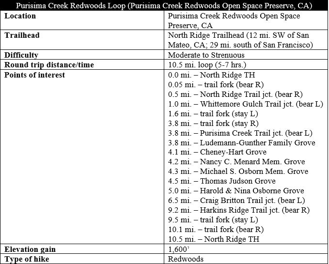
The San Francisco Bay Area in northern California is a fantastic launching point for redwood hunters, with accessible groves of these mesmerizing trees within an hour and a half both north and south of the Golden Gate. While the largest groves lie further north, the Santa Cruz Mountains between the Bay Area and Santa Cruz offer an ample selection of redwood hikes. Purisima Creek Redwoods Open Space Reserve, a regional park, is one of the closest places to encounter impressive stands of second-growth redwoods, as well as sweeping views across the chaparral hillsides that descend to the Pacific Ocean. The 10.5-mile, full-day jaunt described below hits the highlights of the park, starting high in the oak/bay forest before dropping down through coastal scrub and returning via the redwood-studded Purisima Creek and Craig Britton Trails.

The hike
The 10.5-mile circuit described here begins and ends at the North Ridge Trailhead along Skyline Boulevard because of its relative proximity to San Francisco and the Silicon Valley suburbs, but it is also possible to start at the Higgins Road Trailhead at the end of Purisima Creek Road, coming in from the coast along Highway 1. Coming from the city or San Mateo, follow Interstate 280 to exit 34, then take Route 35 (Skyline Boulevard) for 7.3 miles to the North Ridge Trailhead at Purisima Creek Redwoods Open Space Reserve. The parking area is relatively large, and good signage at the trailhead provides a map and information about the park.
North Ridge and Whittemore Gulch (3.8 miles)
Heading off down the initial fire road, past the bathrooms on the right, hikers are immediately confronted with a choice: stay straight on the steep but straight road—open to hikers, bikers, and horseback riders—or bear right on the narrower, hikers-only track. Hikers craving speed can continue straight, but those up for a more natural feel should stay right on the single-track path.
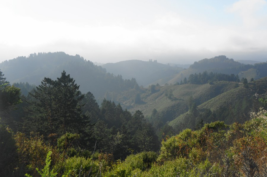
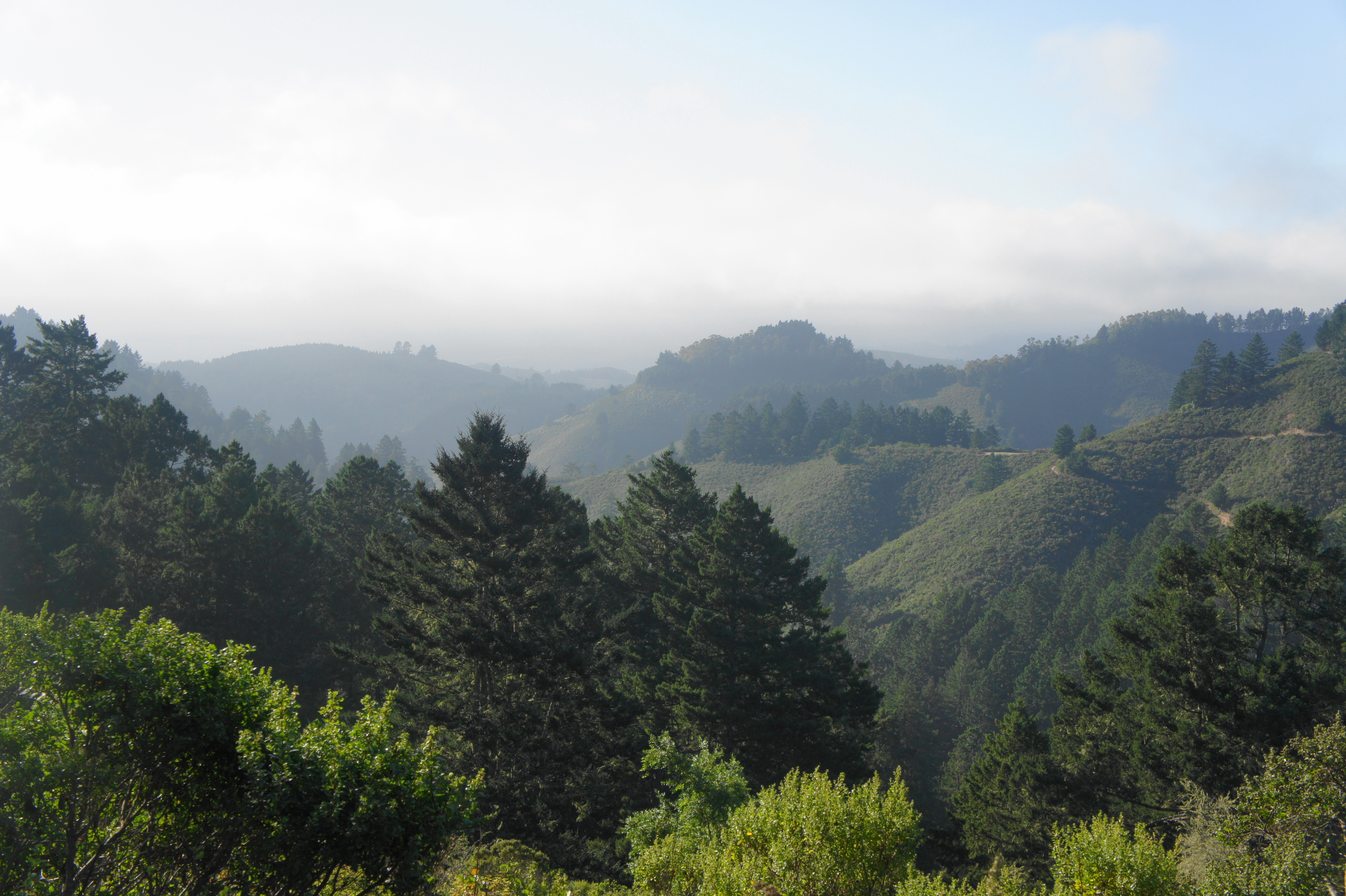
The winding hikers-only trail weaves gradually down a woody hillside, studded with moss-laden oaks and bay trees that tower above. At 2/10 mile, hikers will get their first views of the hike: a look north, across Arroyo Leon, to Cypress Ridge, which is located outside the park on private property. From here, the single-track snakes back to within view of the fire road before cutting away again, descending a set of mild switchbacks.
At 1/2 mile, this pleasant diversion ends at a four-way route junction. The fire road comes in from the left, while the Harkins Ridge Trail begins a sharp descent straight ahead. (Note: The latter will be your return route later on.) Instead, take a right on the wide North Ridge Trail, which weaves gradually through a conifer woodland during its westward course.
Follow the largely broad, flat, and easy North Ridge Trail for a half-mile, reaching the junction with the narrower Whittemore Gulch Trail. This smaller track will be your guide for the majority of the descent to Purisima Creek; take a left and follow it through the wooden hiker’s gate.
For the first 1/3 mile, the Whittemore Gulch Trail closely follows the trace of the continuing North Ridge Trail, situated slightly downhill on the right. At 1.2 miles, hikers will get their first views toward the distant Pacific Ocean: the ravine ahead of you is the trail’s namesake, bounded to the north by McGovern Ridge. On fogless days (a rarity), it is possible to view the ocean. It’s also possible to spot a section of the Harkins Ridge Trail on the hillside to the south. (Note: You will be on this trail on the return journey.)

After a left-hand switchback, the trail descends a sun-soaked slope through low shrubs to another junction at 1.6 miles. A connector trail heads right from here to the North Ridge Trail again; instead, stay left on the path to Whittemore Gulch. (Note: Follow signs to “Higgins Purisima Parking 2.2 miles.”) After another sunny stretch, the trail drops into the shade, where you will spend the next several miles.
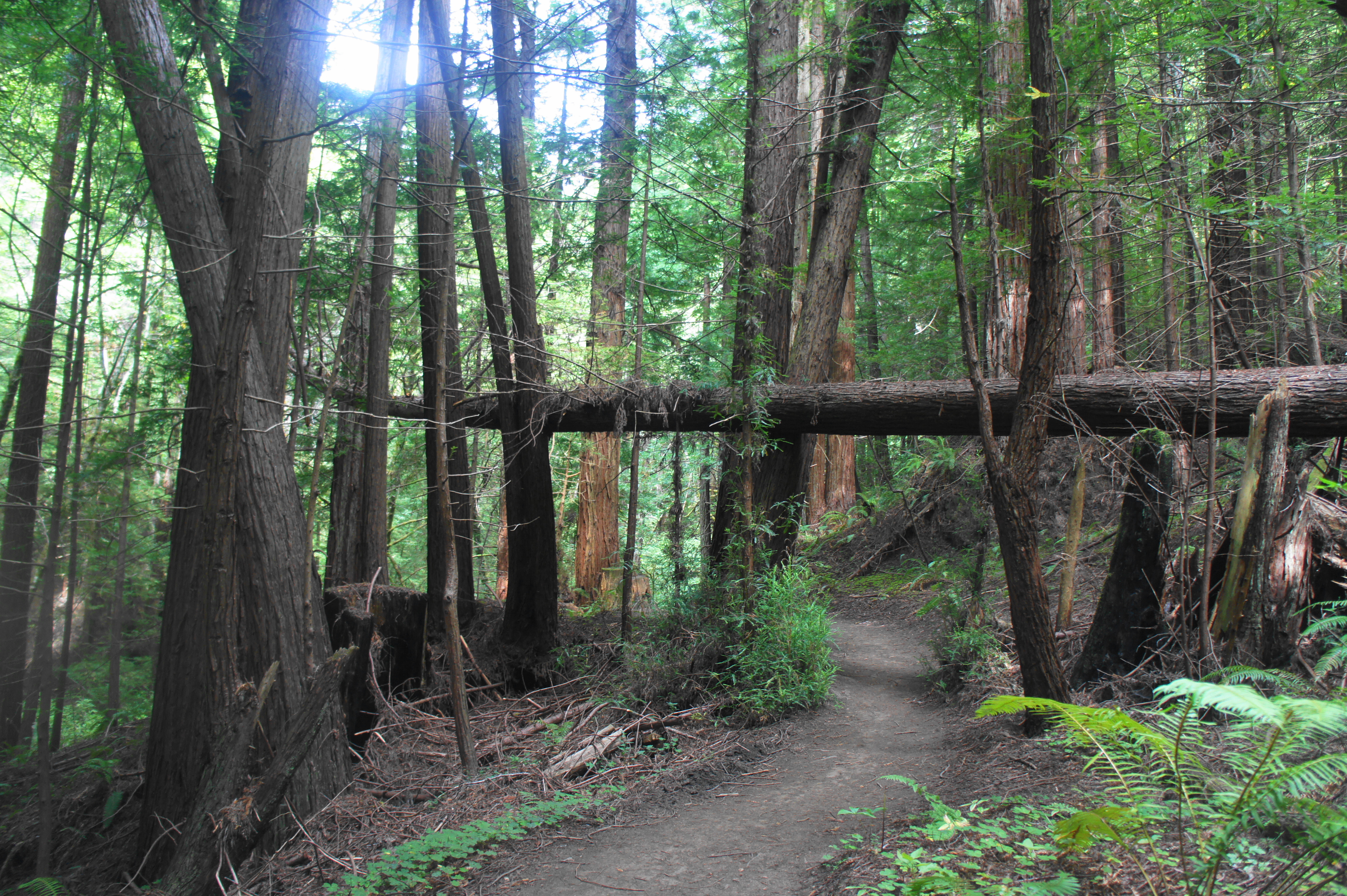
At 1.8 miles, the Whittemore Gulch Trail enters a section best described as a series of “wiggles”: sharp and frequent switchbacks that shed more than 200 feet in elevation in about 1/3 mile. Amid the vegetation, one will begin to notice the first small redwood groves—second-growth trees that are smaller than their old-growth cousins but nonetheless still alluring. (Note: Large stumps can be spotted occasionally, the remnants of old-growth redwoods that used to populate this area.)

The wiggles end around 2.2 miles, after which the trail bears west, still well above the stream that carved Whittemore Gulch and gives life to the increasingly prominent redwoods. At 2.7 miles, the trail cuts right abruptly, then descends to cross the trickling creek. The rest of the Whittemore Gulch Trail remains on the south bank.
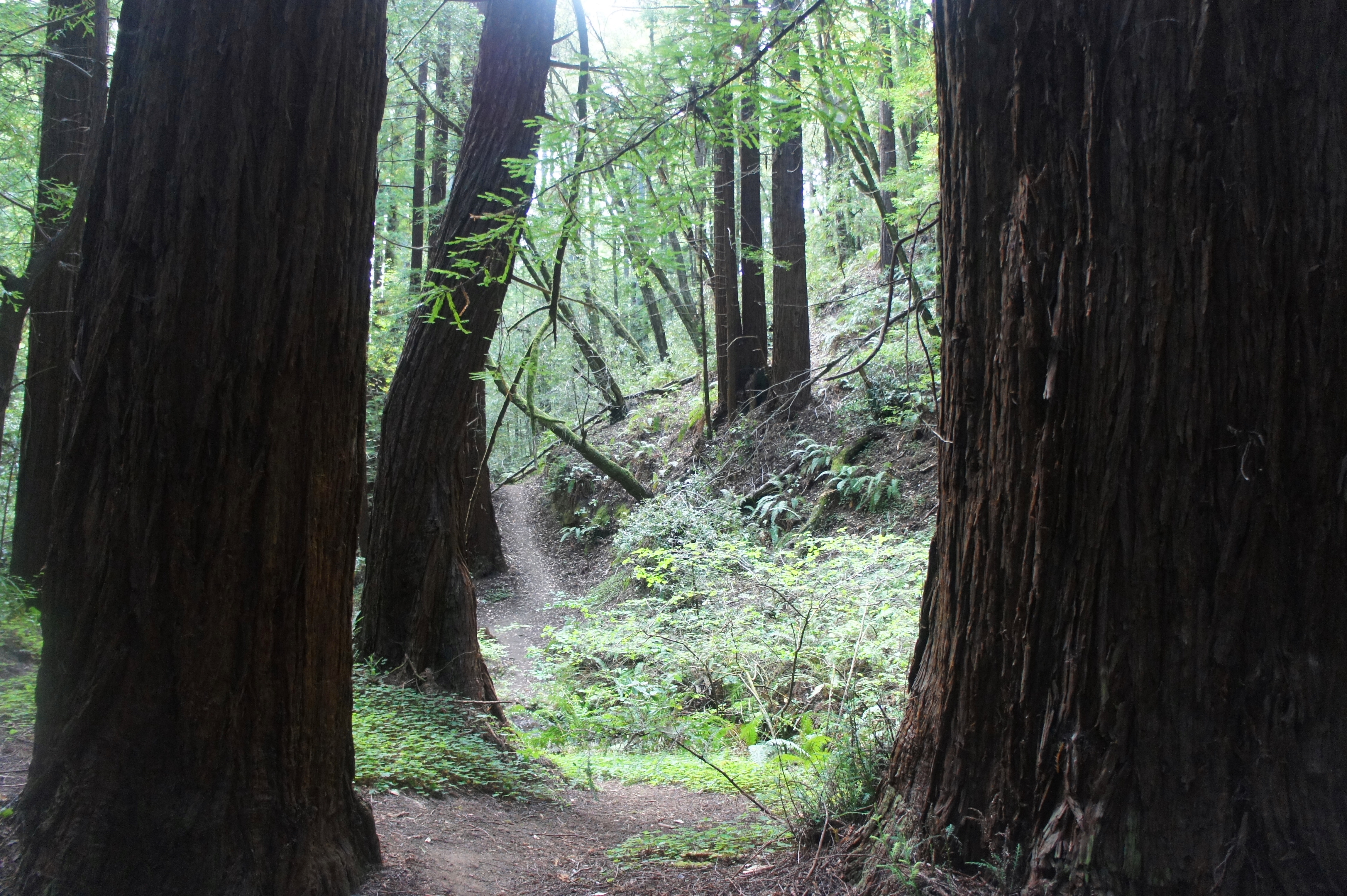
As the hike progresses, hikers encounter increasingly dense patches of towering redwoods, some so high and thin that they sway in the wind. Ferns and other dense greenery form a robust undergrowth, adding to the mystical quality of the valley. The trail descends more than 300 feet in elevation but does so gradually over the course of a mile, allowing hikers to admire the bucolic setting.
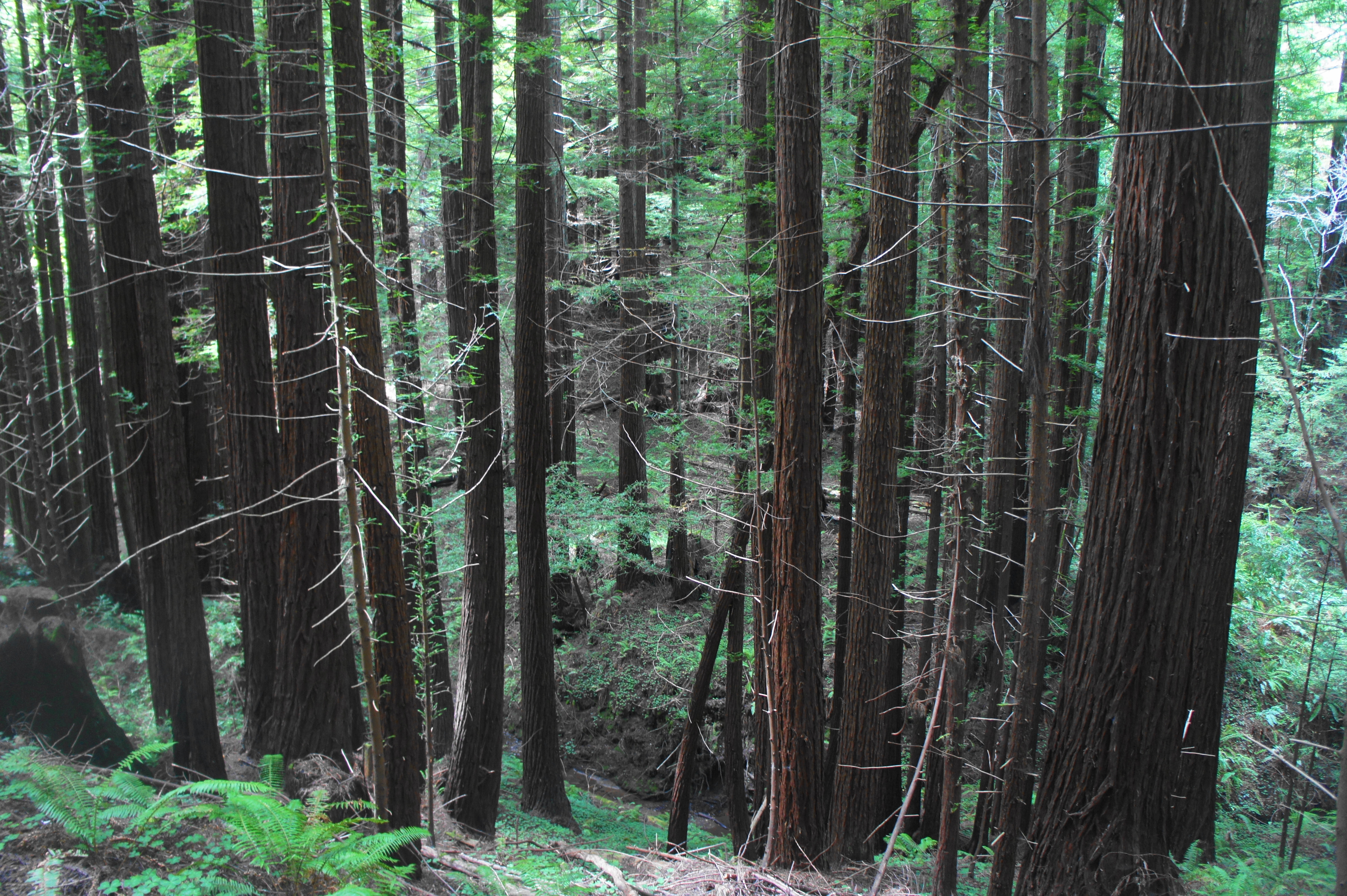
By 3.7 miles, the Whittemore Gulch Trail finally descends to streamside, which boasts an impressive stand of redwoods, the largest seen yet. From here it is a short walk, out of the wooden entry gate, to the next junction. Here the Harkins Ridge Trail bears left, while a bridge leads right. Traverse the bridge over Purisima Creek, then stay left at the parking area—this is the Higgins Trailhead area, the lowest point of the hike.

Purisima Creek Trail (2.6 miles)
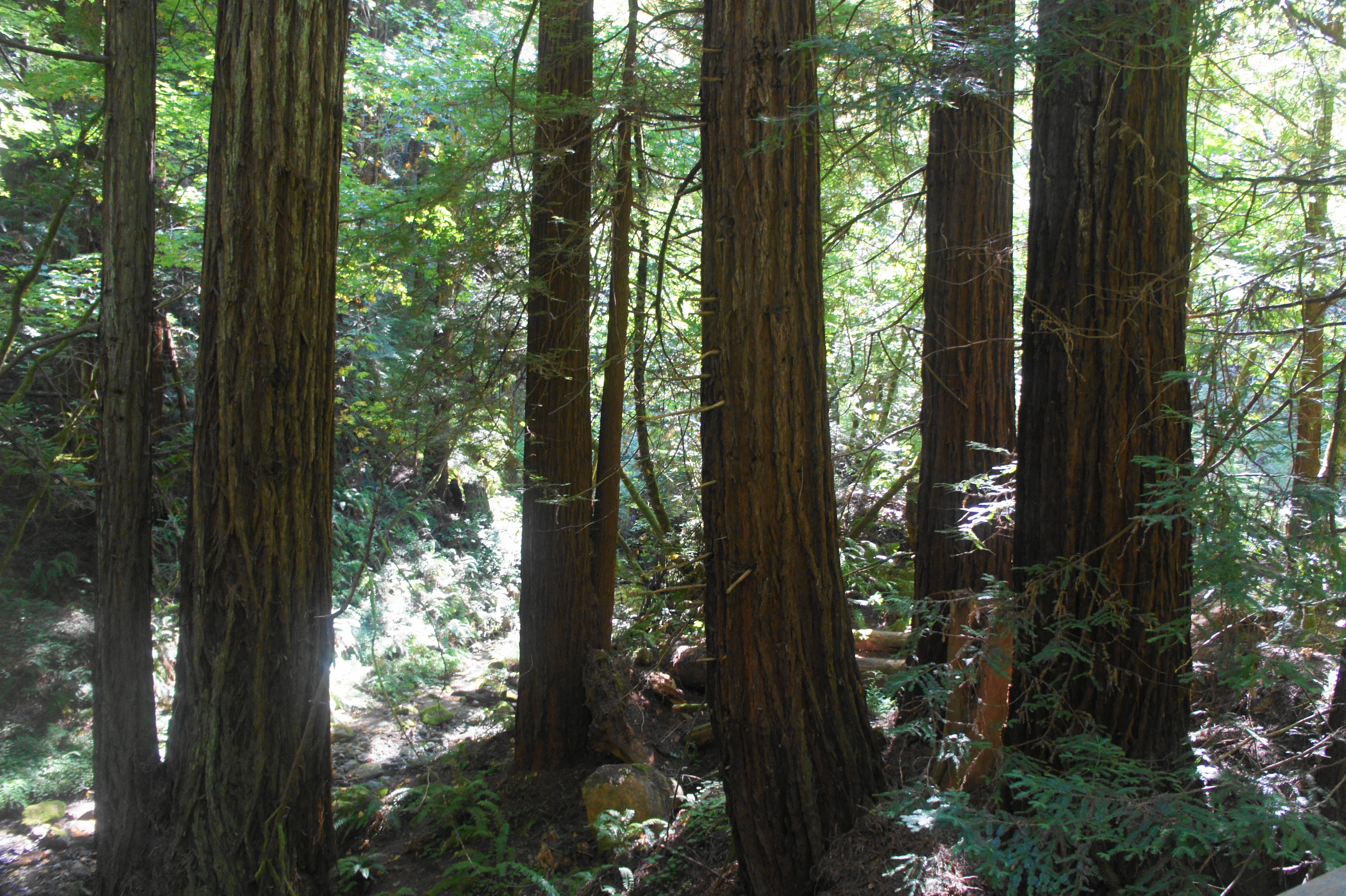
It turns out the redwoods of the Whittemore Gulch Trail were only an appetizer. The towering trees along the Purisima Creek Trail are larger, denser, and more picturesque than anything found in Whittemore Gulch. Almost immediately, hikers are struck by the magnificent beauty: the initial patch—dubbed the Ludemann-Gunther Family Grove—includes trunks so large that it is hard to believe these trees are second-growth, born after an initial period of logging that decimated the area.

After this opening grove, a tributary of Purisima Creek comes in from the right. The next cluster of trees is the Cheney-Hart Grove on the left. Here the ripping creek adds to the charm of the densely-packed redwoods.

Around a minute further, hikers reach the Nancy C. Menard Memorial Grove, where it is possible to cross the creek to the other side. Each grove appears more alluring than the last, inviting visitors to stop to admire the scenery.


After crossing a second tributary at 4.2 miles, the path follows a fern-laced hillside on the right. Michael S. Osborn Memorial Grove is the next redwood patch of note. The trees here are some of the most impressive in the valley.


At 4.5 miles, a sign marks the Thomas Judson Grove on the right—a reminder that redwoods need not be clustered right along the water. The trees stretch up the hillside as far as the eye can see. Just beyond, a spur leads left to the banks of Purisima Creek, where there is a small cascade. At about the hike’s 5-mile mark, there is another named section on the left: the Harold and Nina Osborne Memorial Grove.

Beyond this point, the redwoods get smaller but no less frequent. Stay left at the trail junction at the Osborne Grove, where the Borden Hatch Mill Trail heads up the slope on the right. Stay left again about 250 yards later, where the Grabtown Gulch Trail too veers off to the south. At 5.2 miles, the Purisima Creek Trail crosses a wooden bridge to the north side.
In the subsequent mile, the incline of the ascent increases and the valley gradually narrows. Dense stands of redwoods dot the opposite slope, but they tend to be small and thin. There is a nice grove again at the 6-mile mark, where the trail crosses the creek again to the south bank.
At 6.2 mile, a social trail bears off to the right into another small grove of redwoods, and the main trail crosses Purisima Creek for a final time. (Note: This time the water is routed through an underground pipe.) After several miles of relatively mild incline, the Purisima Creek Trail steepens considerably as it climbs back westward. At 6.5 miles, hikers reach another junction: this time, leave the Purisima Creek track behind, instead bearing left on the Craig Britton Trail.
Craig Britton and Harkins Ridge (5.0 miles)
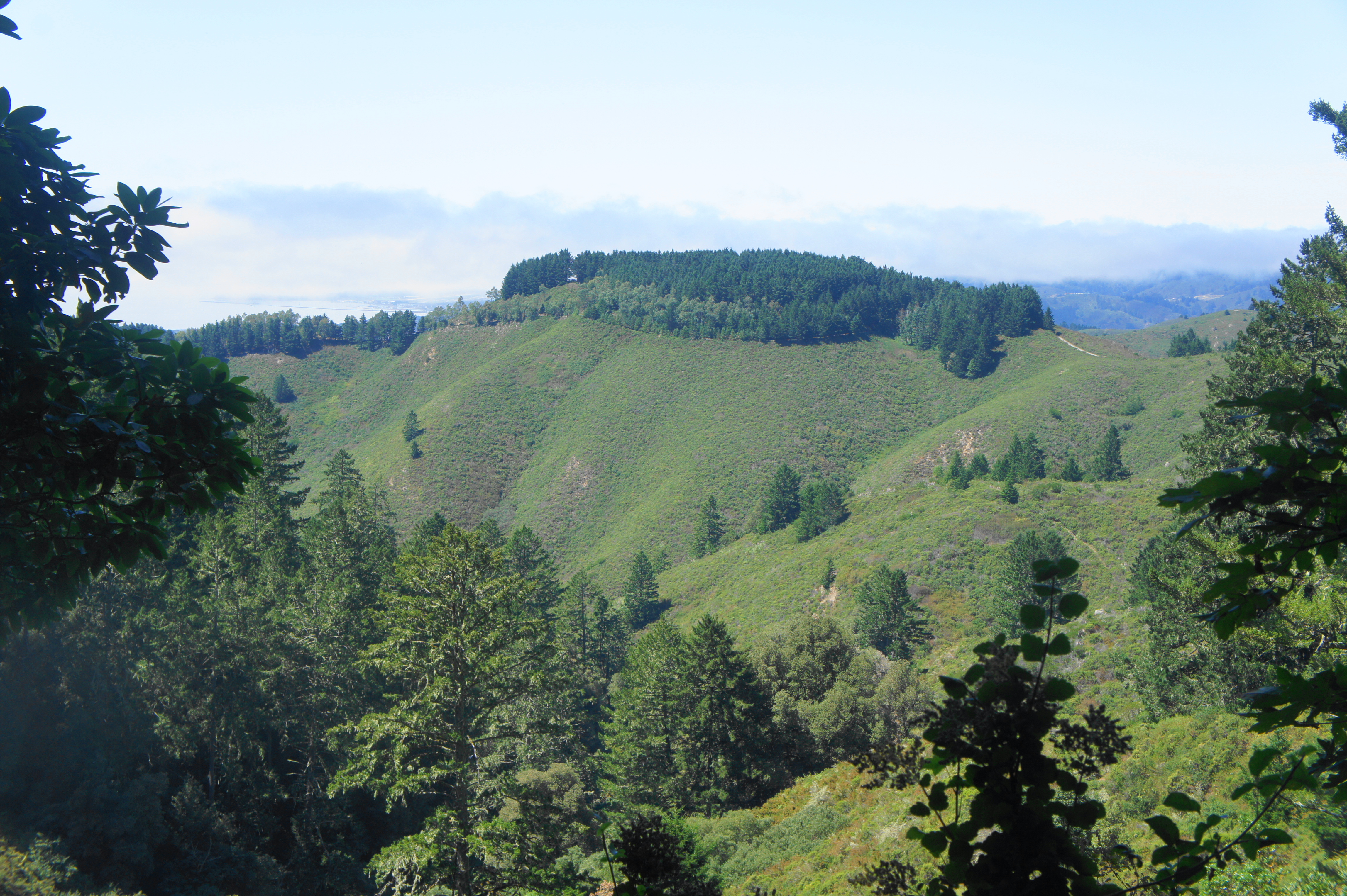
The Craig Britton Trail, named for a longtime steward of the area’s public lands, continues the hike’s near-constant scenery despite its relative distance from the largest redwoods. Staying well above the creek, the trail traces northward to clear a beautiful side ravine, then continues northwest at a mild incline to emerge out of the forest and back into the brushy chaparral. Along the way, there is no shortage of appealing redwood patches, surprisingly large considering their distance well above the valley floor.


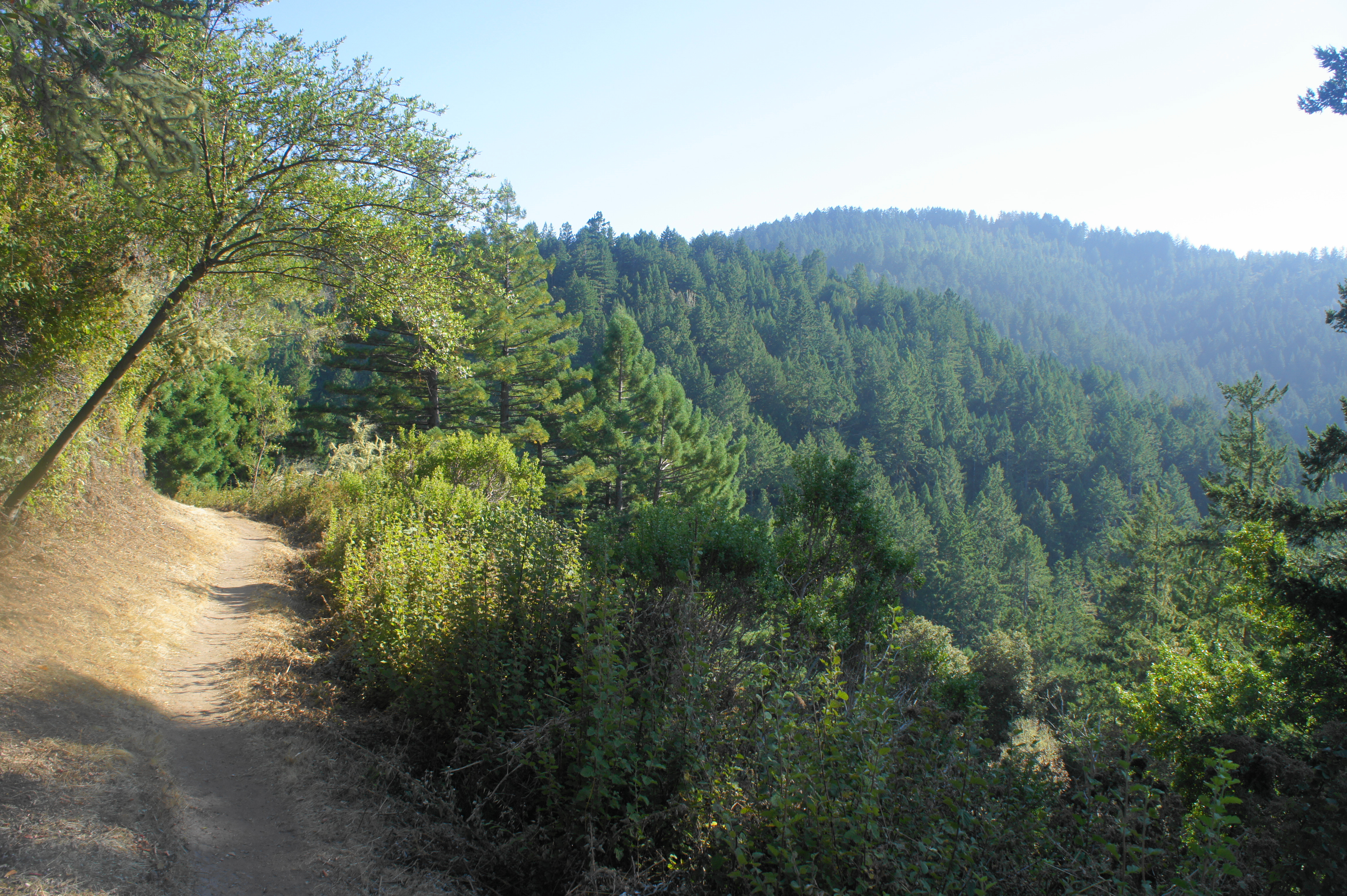
After clearing a large ravine in Soda Gulch, the trail begins to leave the forest behind at about 8.4 miles. Redwood views are replaced with overlooks across the tree-lined valley to the south. At 8.5 miles, the trail begins a snaking climb through a mix of oak woodlands and brushy coastal scrub. Depending on the season, the baking sun is either welcomed or dreaded. This section can be brutally hot in the summertime, in contrast with the cool valleys.


After climbing about 250 feet in a half-mile, the Craig Britton Trail ends at the junction with the broad Harkins Ridge Trail, which was seen from a distance earlier in the hike. Bear right on this path, which immediately begins the steepest ascent of the entire loop. The next 1/3 mile is brutal, with hikers heartened only by partial shade. At 9.5 miles, stay left at the junction—a private road bears right toward a radio tower.
From here, the trail actually descends, with intermittent views of Whittemore Gulch and the North Ridge area. The Harkins Ridge Trail loses about 100 feet in elevation before, beginning at 9.8 miles, it makes it up again with another ascent. Rounding the upper fringes of Whittemore Gulch, the trail climbs back to the initial four-way trail junction at 10.1 miles.

Bear right on the fire road, or continue straight on the initial half-mile winding hikers trail. Both lead back up to the trailhead. The fire road is shorter and thus likely the preferred option, although it comes with a price: a brutally steep climb for about 1/3 mile. Finally, after nearly 10.5 miles of hiking, the circuit ends back at the North Ridge Trailhead.
While most of the lengthy circuit is easy or moderately difficult, the final climb can be strenuous for some. In any case, plan to spend most of the day hiking and to come back with sore feet. But the work is worth it: this diverse walk, just an hour’s drive from the city, is one of the best on the Peninsula.

Pingback: Top 10 Hikes in 2019 | Live and Let Hike
Pingback: Phleger Estate – Huddart Park Loop (Golden Gate National Recreation Area, CA) | Live and Let Hike