

Unless you are a resident of Elko, Nevada—the nearest major town—chances are that you have not heard of the Ruby Mountains. Yet, at times, this spectacular range in northeast Nevada rivals the mountain scenery of the better-known Sierra Nevada or Colorado Rockies. From the jumping-off point at Lamoille Canyon, hiking trails take off in several directions, but the most appealing is to the head south, following the 36-mile Ruby Crest Trail through the heart of the range. While the entire Ruby Crest is best reserved for backpackers, day hikers can bite off a small chunk of it with the 4.4-mile round-trip climb to Lamoille Lake, an alluring glacial tarn situated just above the timberline.


The hike
The hike begins at the end of the Lamoille Canyon Scenic Byway, which snakes through its namesake canyon for 11 miles in Nevada’s Humboldt-Toiyabe National Forest. The spectacular, U-shaped valley is the product of glacial retreat and, at least at the upper reaches, still spends much of the year socked in snow. Two trails take off from the end of the road: the short, two-mile trek to Island Lake, located to the northwest, and the aforementioned Ruby Crest Trail, which heads uphill into the alpine meadow to the south. The latter trail will be your guide to Lamoille Lake, a 2.2-mile journey.
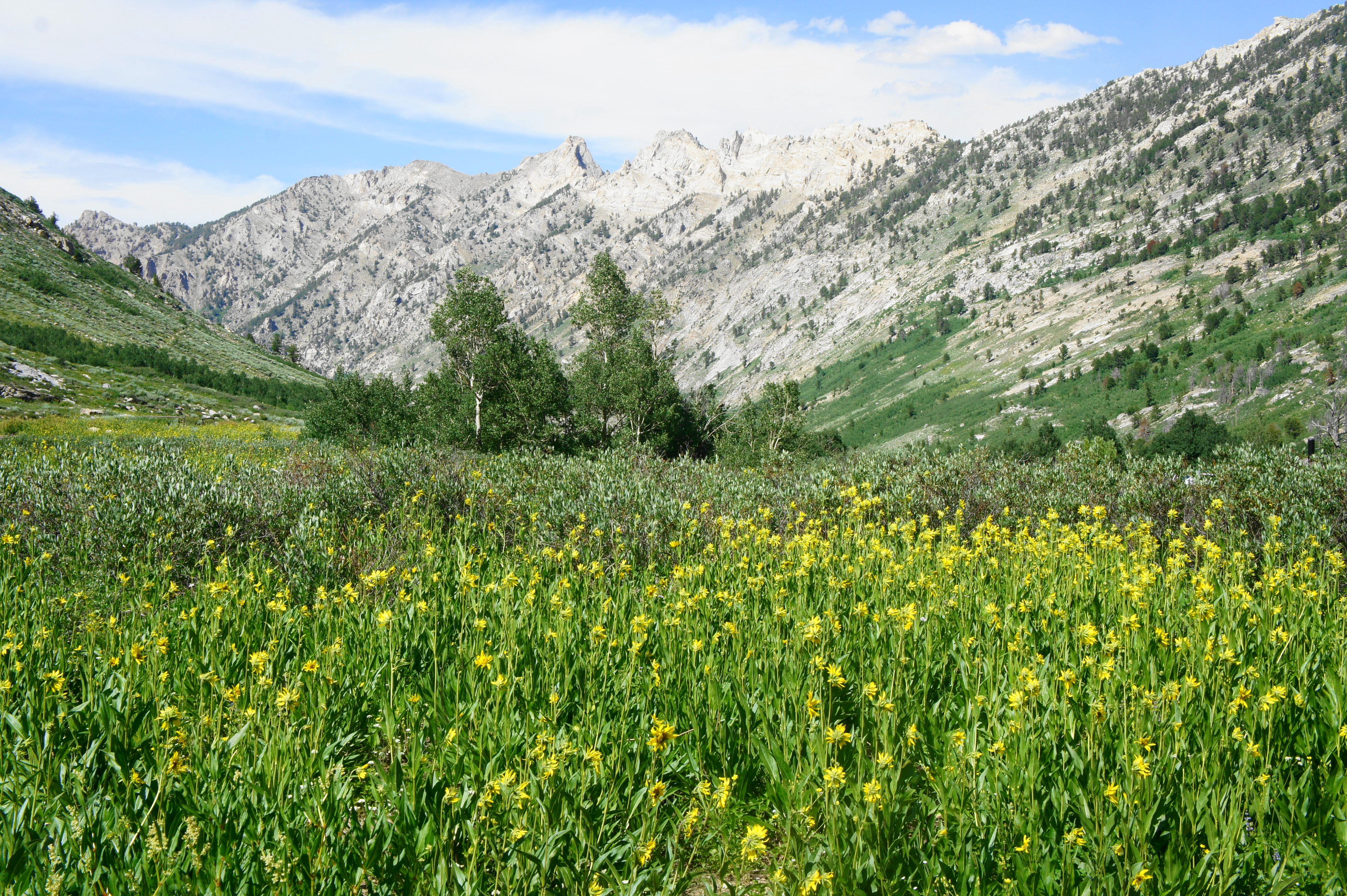
The Ruby Crest Trail begins with open views right away: ahead are the nameless peaks that make up the first mountain divide, each more than 10,000 feet in elevation. (Note: The trail begins at about 8,800 feet; Lamoille Lake is at around 9,750 feet.) To the west, the high temple towering above the rest is Snow Lake Peak (11,137’); to the east, the imposing wall of steep granite mountains also stays consistently above 10,000 feet.

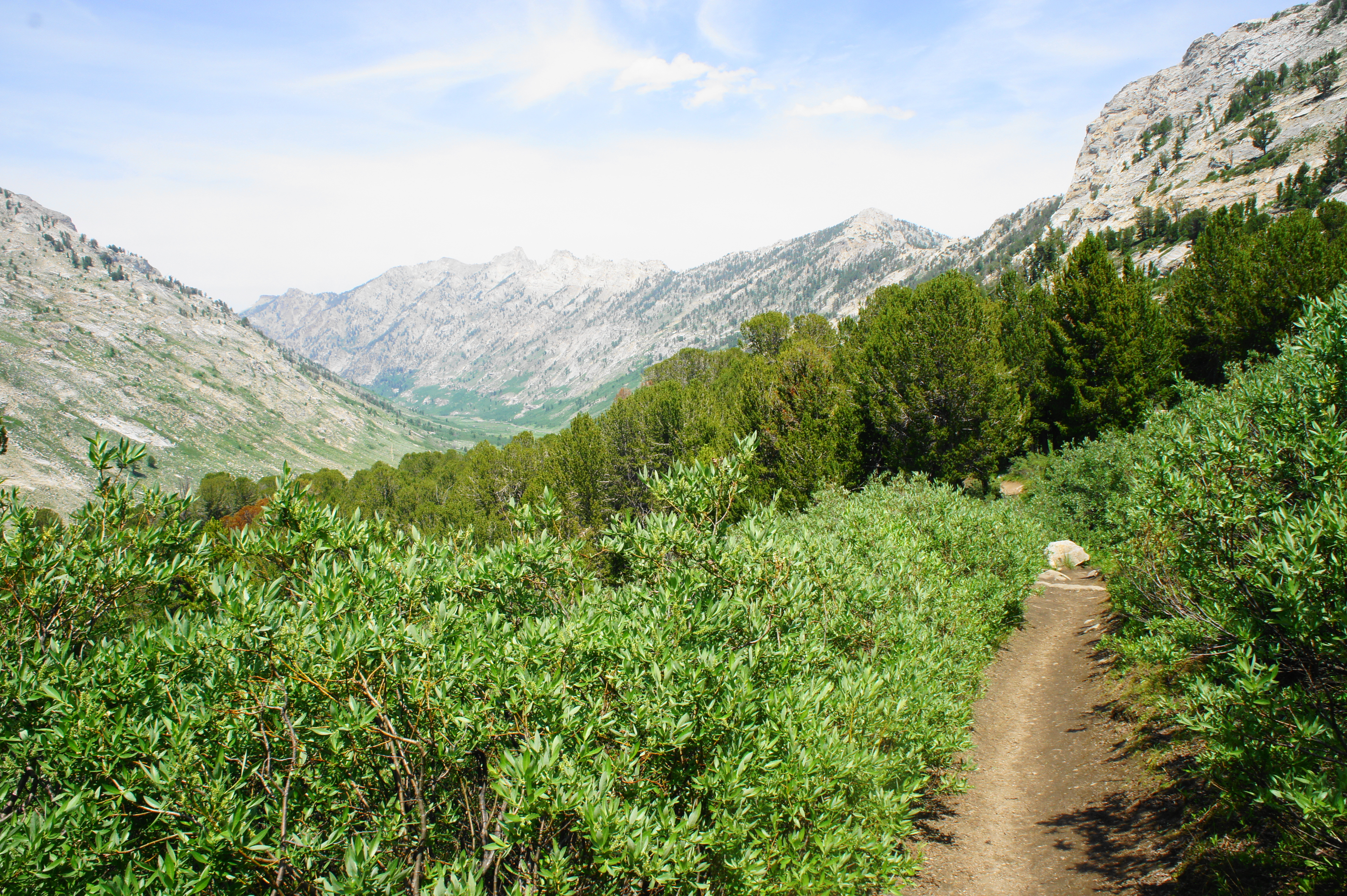
After passing through an initial field of wildflowers, the Ruby Crest Trail crosses a fork of Lamoille Creek, then enters a patch of woods with the main stream on the left. Rocky outcrops begin to replace the grassy patches, and hikers encounter a second stream crossing at about 4/10 mile. As the trail steadily ascends, brief breaks in the woods offer views of the high peaks to the west.

After an abrupt switchback left at 6/10 mile, the trail climbs to clear a sloping ridge and then drops to clear another tributary. The climb out of the ravine is initially steep before a sharp right turn puts hikers back on a more mild, but steadily uphill course through a mix of meadows and conifers. A large fallen log in the shade offers a natural rest point at 8/10 mile.
Views begin to open up again in the next 100 yards, and the trail appears heads east toward the base of the granite walls. The Ruby Crest Trail climbs at a steeper rate as it rounds a pair of switchbacks, then heads south again along the base of stony pitches at around 1.2 miles. As hikers negotiate the next set of switchbacks, the vistas down-canyon are excellent: the valley curves westward, with Verdi Peak (11,074’)—one of the highest in the Ruby Mountains—on the horizon.
After several switches in short succession, the trail begins to level off, having cleared the hurdle of reaching the upper shelf of Lamoille Canyon. At 1.5 mile, arguably the best overlook of the hike awaits on the right: an unblemished, 180-degree view of Snow Lake Peak, Lamoille Canyon, and Verdi Peak. One can make out the tiny specks of the parking area, more than 800 feet below.

Just beyond, hikers must traverse a relatively fast-flowing stream: this flow drains the two Dollar Lakes, marshy but peaceful sights worth a visit on the left. Above the Dollar Lakes are Favre Point (10,879’) and an unnamed mountain that tops out at 10,865 feet.

The flat and easy trail crosses two more streams around 1.6 miles: this area, below the first of the Dollar Lakes, is crawling with bushy shrubs. After passing a smaller pond on the left, hikers get a great view of the second Dollar Lake, with Liberty Pass beyond.

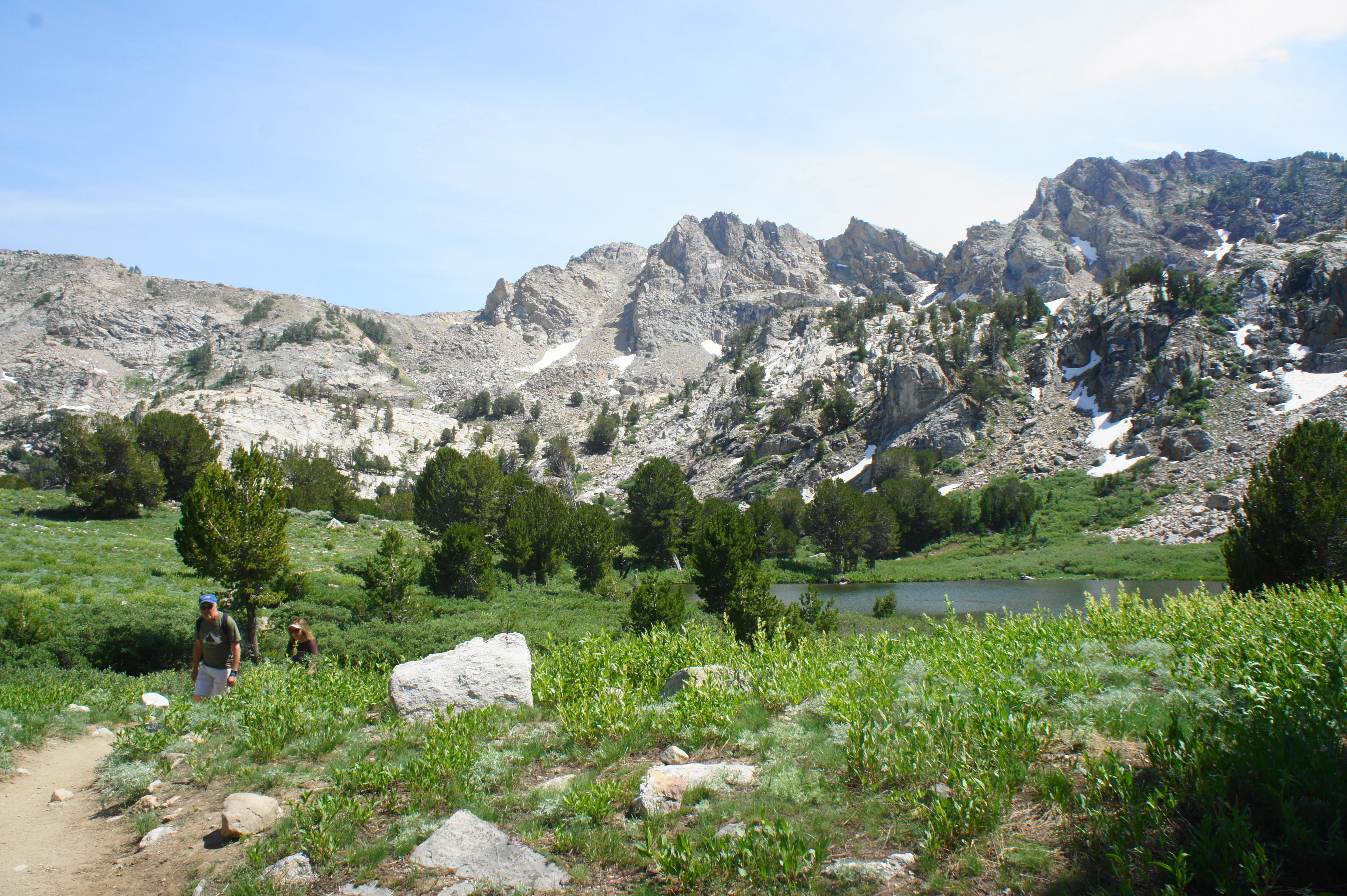
By now, day hikers are likely to be antsy to reach the end, but there is nearly a half-mile to go. Fortunately, aside from a mild climb after the second Dollar Lake, the path is mostly flat and straightforward. Stay left at the junction at 2.1 miles as a stock trail comes in from the right. Just beyond, hikers get their first views of the blue-green waters of Lamoille Lake, the final destination.


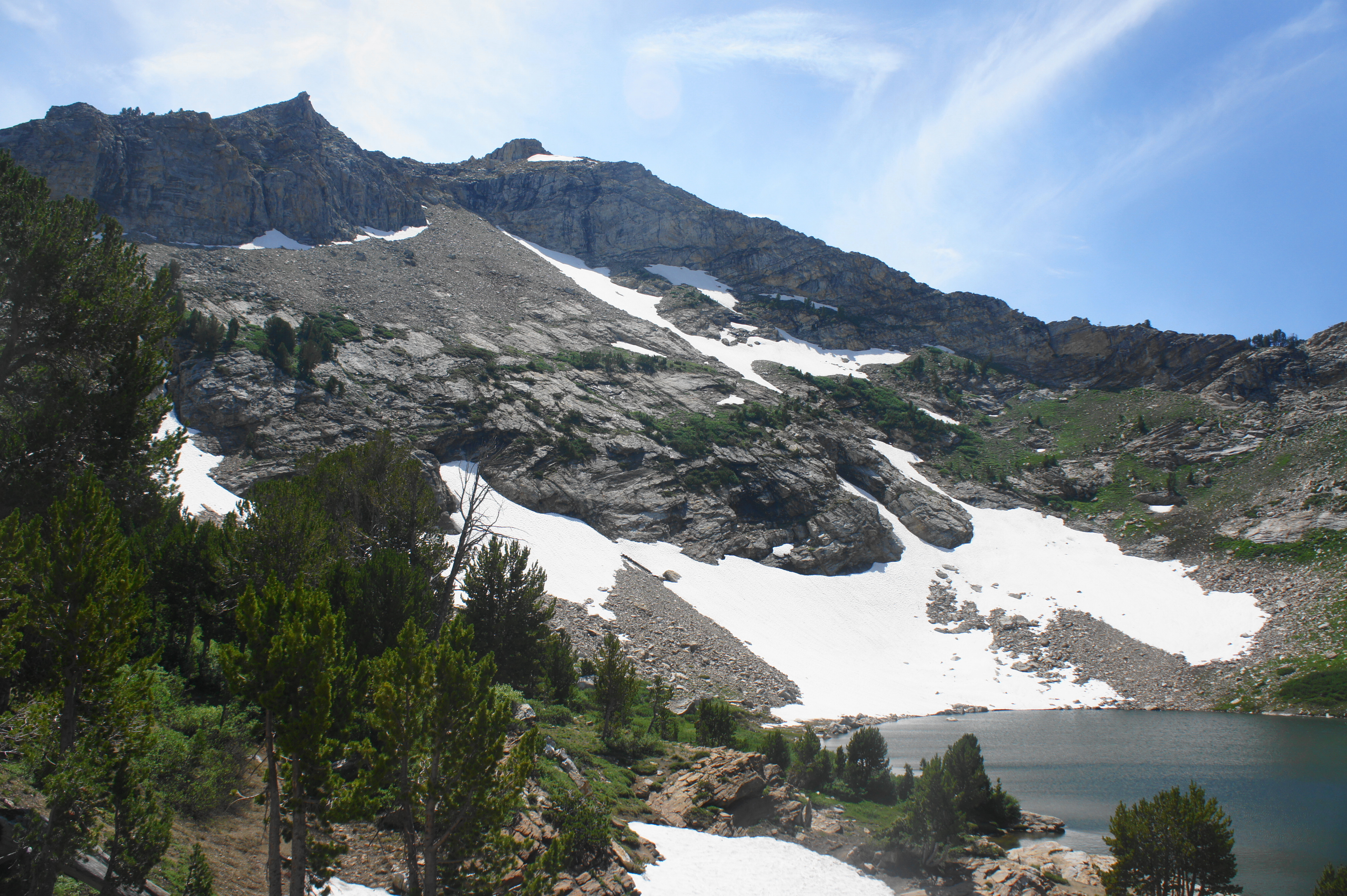
Signs around the lake warn hikers against weaving off the trail, but staying on rock outcrops offers a safe lookout point without damaging the soil. Squirrels around the lake have seen a visitor or two and thus are likely to be nipping at your heels as you peer down at the majestic glacial tarn. For much of the year, snow on the south slope flows right into the lake. The ridgeline beyond leads into the Ruby Mountains Wilderness. The lake itself is a popular destination for fly fishers, in search of brook trout.
At 2.2 miles, this is the turnaround point for the day hike as described—although ambitious hikers can continue on the Ruby Crest Trail to Liberty Pass, Liberty Lake, and Favre Lake. For those returning, the hike back to the Lamoille Canyon parking area is fortunately almost all downhill, a welcome relief after a challenging (though not overwhelming) ascent.
Allot around 3-4 hours for the round-trip hike, including time to soak in the views of this isolated but majestic mountain range in an oft-forgotten corner of Nevada.

Pingback: Top 10 Hikes in 2019 | Live and Let Hike