
Phleger Estate, the southernmost unit of Golden Gate National Recreation Area, is a quiet, serene tract of land on the eastern slopes of the Santa Cruz Mountains that boasts one of the closest redwood groves to San Francisco. Although not as stunning as nearby Purisima Creek Redwoods, this once heavily-logged area has recovered nicely, filling the valleys and hillsides with second-growth California redwoods of decent size. While its eastern neighbor—Huddart County Park—is a popular destination for residents of San Mateo County, Phleger Estate is relatively untraveled. The featured hike below covers the estate from end-to-end, combined with a multi-mile descent through Huddart Park to form a nearly 8-mile loop. The highlight is a lush, streamside walk along the Miramontes Trail, which hosts the largest and most impressive groves in the two parks. Save for passing under a few power lines, the entire hike is wooded, making this a good foggy-day option on the San Francisco Peninsula.

The hike
Once a vast, privately-owned tract of more than 1,000 acres, Phleger Estate passed into the hands of the National Park Service in 1993, thanks to the efforts of the Peninsula Open Space Trust, Save the Redwoods League, and matching funds from U.S. Congress. It is one of the few units of Golden Gate National Recreation Area with no active roads running through it, although it is relatively easily accessed from Skyline Boulevard (Route 35) and Huddart County Park in the Mid-Peninsula.
There are thus a variety of options for where to start a hike into the estate. Most choose to enter through Huddart County Park, a roughly four-mile drive from Interstate 280 in suburban Woodside. However, the drive is considerably more scenic if one starts along Skyline Boulevard. Heading south from San Mateo or San Francisco, take Route 35 toward Half Moon Bay, then bear left as Skyline Boulevard bears southward and climbs Kings Mountain in the northern reaches of the Santa Cruz Mountains. While there are open views of the Bay and Pacific Ocean from the drive, the road enters dense forest as it climbs higher.
There is an access point at the Kings Mountain Fire Brigade building, 5.8 miles south of the intersection of San Mateo Road (Route 92) and Skyline Boulevard (Route 35), but this is often hard to find. Even though it makes the hike slightly longer, I recommend continuing onward to the south parking lot for Purisima Creek Redwoods Open Space Preserve, 6.5 miles down Skyline Boulevard. (Note: See Google Maps here.) There are a handful of parking spots on the west side of the road.
Huddart County Park section (3.6 miles)
While this is a popular trailhead for hikes into Purisima Creek Redwoods to the west, hikers headed for Huddart County Park and Phleger Estate should cross Skyline Boulevard and then bear south for 50 yards to catch a fire road that enters Huddart on the left. Pass through the gate and immediately come upon the first of many, many junctions—(almost) all impeccably signed. This first junction is a four-way fork. Since you want to make your northward toward Phleger Estate, bear left…but which left? Both the Skyline Trail and Summit Springs Trail head north from the junction. Taking either is fine for now, as they meet up again at a second junction after about 1/10 mile. This time, bear right on Summit Springs Trail for sure, as it provides access down into the heart of Huddart Park. (Note: Hikers will return, hours later, on the Skyline Trail.)
Thus begins the main loop portion: hikers should proceed counterclockwise, dropping first down through Huddart Park, then saving the more interesting ascent through Phleger Estate for the second half. The Summit Springs Trail is a wide, gradually descending track that immediately passes several batches of towering redwoods. These trees are a lesson in resilience: while the largest members of the old growth forests were heavily logged starting in the latter half of the 19th century, these second-growth redwoods have survived as a result of preservation efforts: some were small and forgotten during the logging period; others have sprouted and grown in the past several decades. Redwoods are also famously resistant to wildfires, boasting chemical tannins and thick barks that retard the fire’s progress.
The Summit Springs Trail hugs the wooded hillside, then traverses the upper reaches of McGarvey Gulch and approaches another junction at 6/10 mile. Bear right here, ditching the wide Summit Springs path for the narrower Crystal Springs Trail, a main thoroughfare through Huddart County Park. (Note: It is technically shorter, though less interesting, to proceed straight and then follow Richards Road down to the Miramontes Trail.)
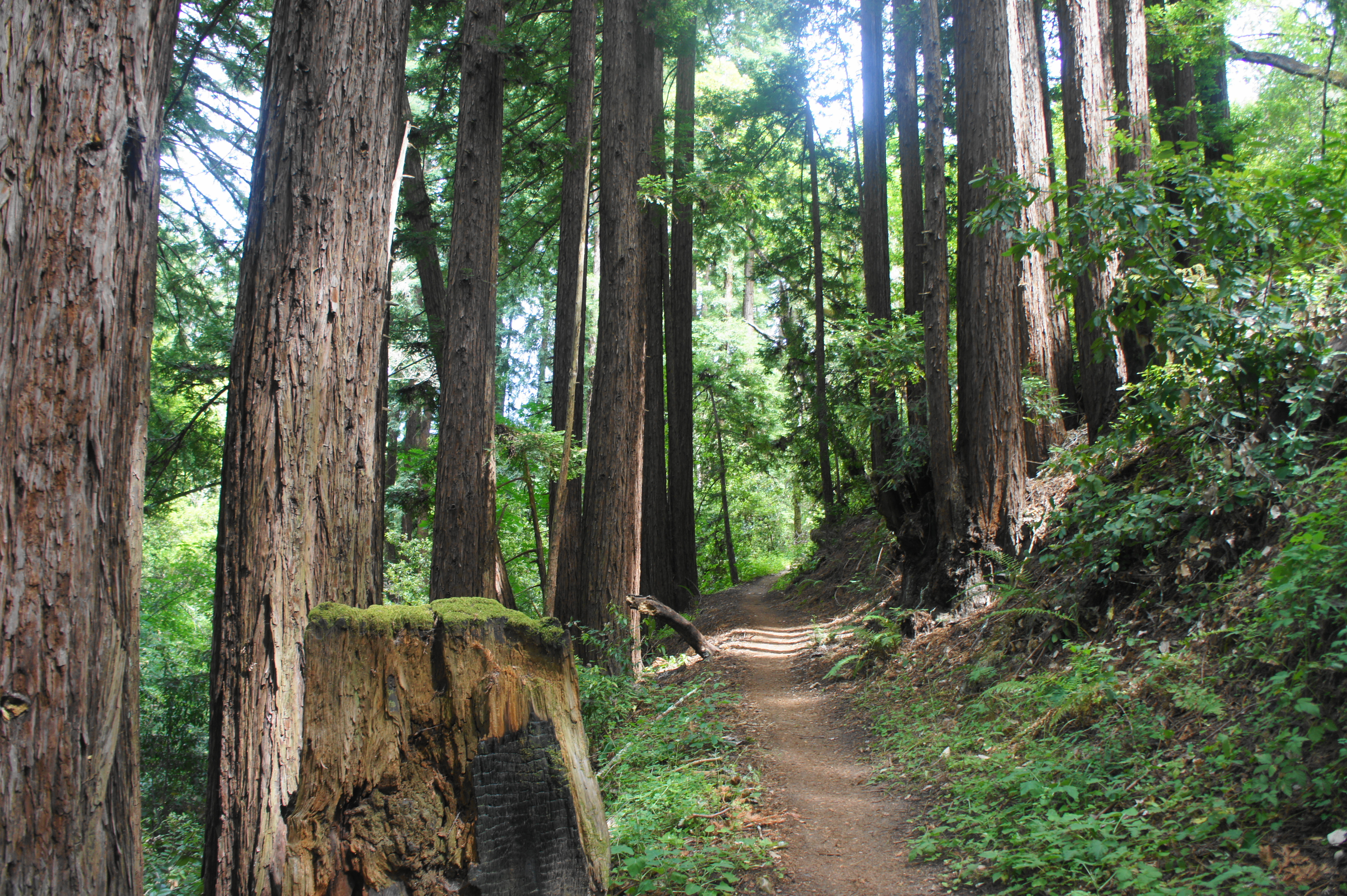
The Crystal Springs Trail begins as a relatively uninteresting, though pleasant, walk through a mix of bay, oak, and chestnut trees. Beautiful reddish-bark madrones, a cousin of manzanita, become increasingly common as the trail gradually descends a wooded hillside. At 9/10 mile, the woods are interrupted abruptly as the trail passes under power lines.

Reentering the woods, the descent continues, dropping down a set of switchbacks, then the trail bears northeast. Passing under the cover of wily madrone, the Dean Trail enters from the right at 1.4 miles. Stay left on the Crystal Springs Trail, entering the prettiest stretch yet, a shaded gully with nice stands of second-growth redwoods, mixed with leaning bay trees and madrone, with limited underbrush.

After clearing the ravine, the trail descends a series of winding bends with more frequent redwoods and firs. At 1.9 miles, the track passes again under power lines, this time allowing for some distant views of the San Francisco Bay, with the East Bay hills and Mount Diablo beyond. From light to dark, the onward trail returns back to dense redwood cover, then drops down a pair of switchbacks to cross the Campground Trail, a wide, old road. By now the crowds are likely to be more apparent—you are within striking distance of the Toyon Group Camp at Huddart, and within a couple miles of the main parking areas for the county park.


Passing under power lines along the Crystal Springs Trail 
Nifty twist
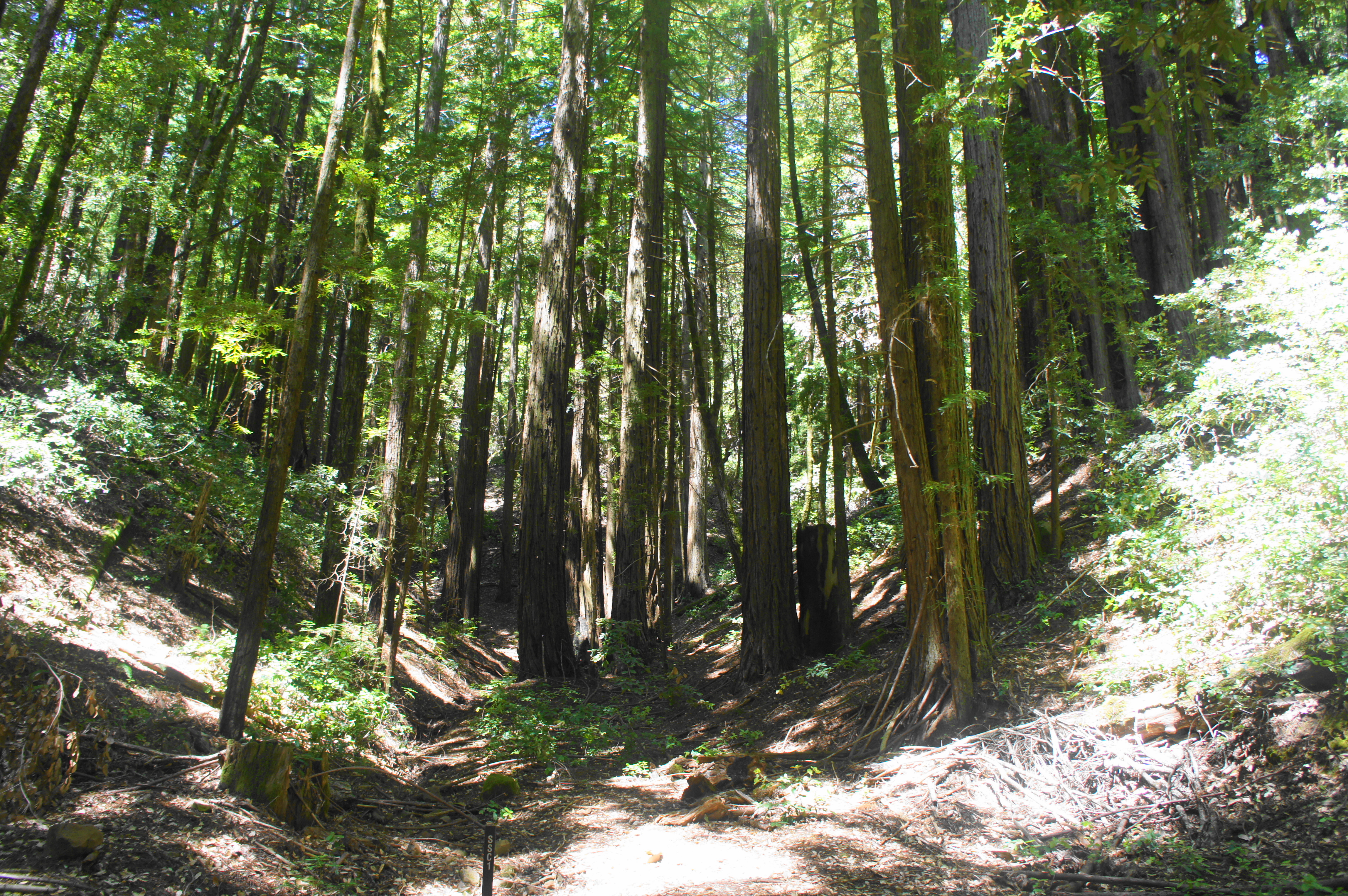
Continue straight on the Crystal Springs Trail, which drops through another nice grove of redwoods. Stay right at the next two junctions (signs #8 and #9). By now hikers are used to the gradual, winding path with seemingly endless, though mild, switchbacks. The trail descends into the lower reaches of McGarvey Gulch, passing two more junctions (#14 and #15), crossing under more power lines, and culminating at a series of three wooden bridges. Here the Crystal Springs Trail crosses a seasonal creek, followed by another fork, 3.4 miles from the trailhead.


Redwoods along the Crystal Springs Trail 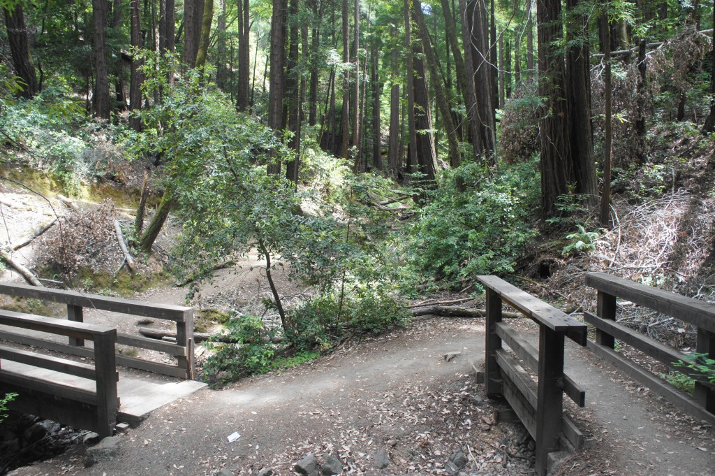
Wooden bridges in McGarvey Gulch
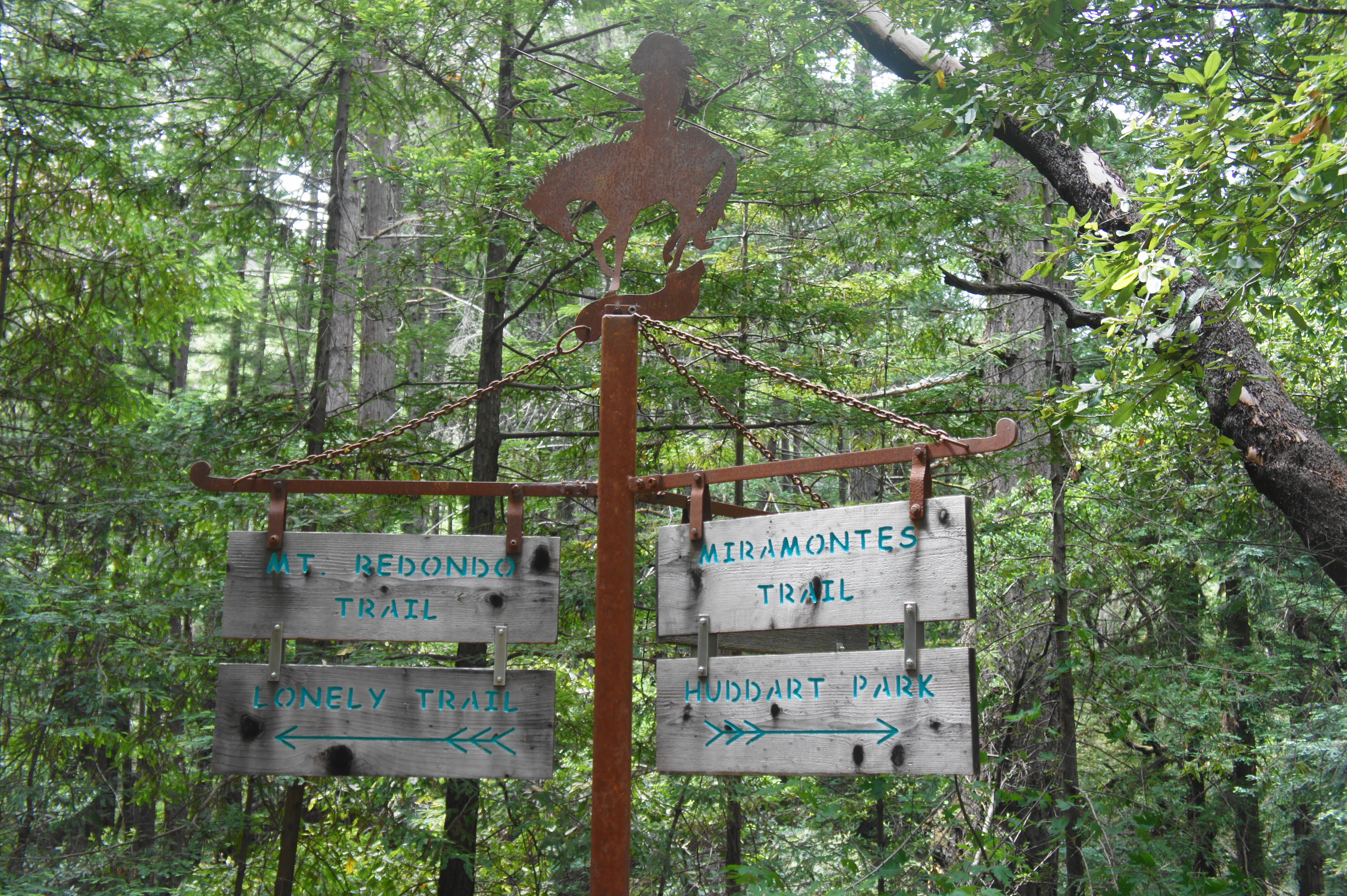
This time, at post #13, bear left on the Spur Trail, leaving the Crystal Springs Trail behind. This track follows the right flank of McGarvey Gulch, then ends at another junction at 3.5 miles (signpost #12). Follow the wide Richards Road left, across the creek. Thereafter the route does something it hasn’t done all hike to date: it ascends (!), though mildly, for 1/10 mile. At 3.6 miles, look for a turnoff on the right—this is the start of the Miramontes Trail, the highlight of the walk, which leaves Huddart Park and enters the jurisdiction of the National Park Service.
Phleger Estate section (3.7 miles)
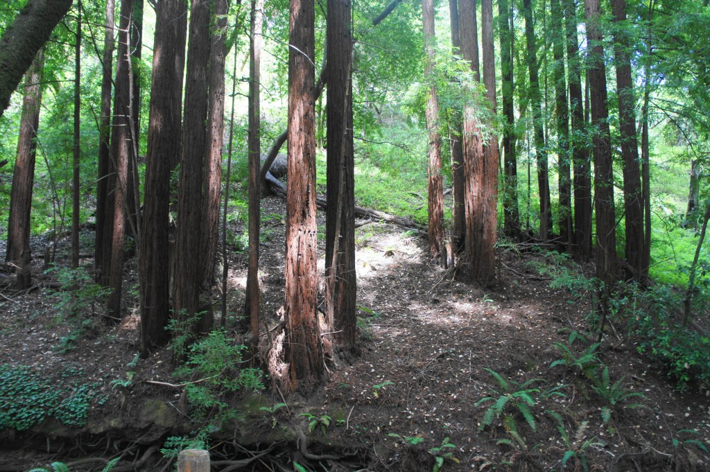
It’s hard to believe, but the hike is not yet half done. The improved scenery of the following section, however, makes the wait worthwhile. After the Miramontes Trail makes a hard left around a bend, it drops to the banks of West Union Creek, a seasonal but oft-flowing stream that feeds an impressive clutch of redwoods. The landscape here feels considerably lusher and greener than the hilly descent through Huddart Park, with clover and ferns blanketing the riparian slopes.

Start of the Miramontes Trail 
Following West Union Creek in Phleger Estate
At 3.9 miles, hikers pass a towering sign for the Miramontes Trail, with a metal plaque on the right that briefly tells the story of the estate’s acquisition. The shady walk beyond is the best part of the hike—the redwoods are taller and denser, inviting passersby to stop, reflect, and gaze up at the hearty trees.


Signage and plaque 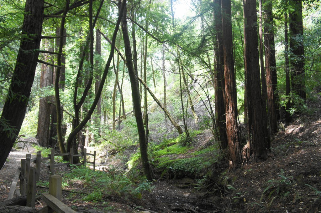
Redwoods along West Union Creek
One also notices, after passing into Phleger Estate, the impressive trail work: the route is neatly manicured, with impeccably-built stone steps, bridges, and rock walls. The signs, of course, are also a standout: the trail markers rise to more than 8 feet and resemble old lampposts, topped by a carveout of a rider on horseback.

At 4.1 miles, the trail crosses a bridge over a tributary stream. Even as the redwoods in this section are impressive, there are also less savory signs of the old logging days: large stumps are visible in several areas, a reminder of the massive giants that once dotted this landscape, growing for centuries before being felled by human settlers in the quest for a quick buck in the late 1800s and early 1900s.
Redwoods across the creek 
Miramontes Trail
At 4.3 miles, West Union Creek enters private property, and the Miramontes Trail abruptly cuts left around a switchback, bearing southeast from the park boundary. The mild uphill climbs through batches of redwoods, then the trail levels off again as it renews its westward course. The redwoods briefly dissipate before reappearing again as one skirts a series of minor ravines.
A junction at 4.9 miles—again nicely adorned with fantastic signage—marks the end of the Miramontes Trail. Both the Raymundo Trail (which bears right) and Mount Redondo Trail (which bears left) end up in the same place, but the latter is slightly shorter.
Head left as the Mount Redondo Trail climbs steadily, following the left flank of a broad gulch, dotted with small redwoods nearly all the way. At 5.5 miles, the trail crosses to the west side of the ravine, then switchbacks up a slope. While not particularly steep, the ascent is persistent, making up for the significant loss of elevation during the first few miles of the loop.

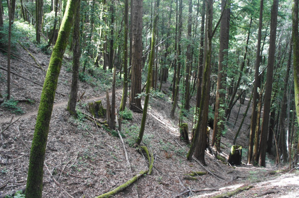
At 5.7 miles, there is another fork, as the Raymundo Trail rejoins from the right. Head left on the curious-but-aptly-named Lonely Trail, a quiet and pleasant single-track that climbs back to Skyline Boulevard and the top of Kings Mountain. After an initial ascent, the path levels off briefly as it bears south, passing a series of redwood-filled ravines. There is a minor clearing with a bench at 6.2 miles, followed by a steady ascent to larger ravine at 6.5 miles with another bench.

Lonely Trail 
High grove along Lonely Trail
The subsequent section is the steepest of the hike, gaining steadily until topping off at about 2,000 feet at 6.9 miles. Stay left as an unmarked spur bears off to the right. By now one can hear the road traffic on Skyline Boulevard. At mile 7, stay left at an unmarked junction—heading right leads back to Skyline but about a mile north of the parking area. The onward trail briefly descends, then climbs again, passing another spur at 7.1 miles. Stay left again, coming within sight of Skyline Boulevard. There is a spur here to a small parking area. But the route back to the loop’s start continues onward. At 7.3 miles, exit Phleger Estate and return to Huddart Park, greeted with another junction.

Return to Trailhead through Huddart Park (0.6 miles)
At the junction, stay right on the Skyline Trail as it passes through a nice redwood grove, flanked on the left by a modest meadow of scrubby underbrush. There is another junction at 7.7 miles; you have been here before—the Summit Springs Trail bears off to the left. Stay straight this time on the Skyline Trail, wedged between Summit Springs and the road. Stay right again at the next junction, then return to the initial four-way intersection. Heading right, pass back through the entrance gate and cross Skyline Boulevard to return to the parking area.
Skirting a ravine along the Lonely Trail 
Beautiful grove along Skyline Trail in Huddart Park

This 7.9-mile trek, almost entirely wooded, covers more than 1,400 in elevation gain, but—lacking any truly daunting ascents—can be considered moderately difficult. Hikers looking for a truly inspiring experience should venture west into the more impressive Purisima Creek Redwoods, but the Phleger Estate – Huddart Park Loop isn’t half bad.

I would love to go explore California’s nature it looks so beautiful!
Pingback: Top 10 Hikes in 2020 | Live and Let Hike