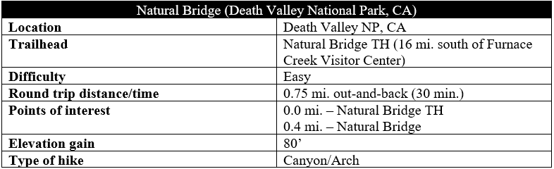
California’s Death Valley National Park sports many natural archways, but there is none more prominent than the natural bridge in Natural Bridge Canyon, which slices through the Black Mountains south of Furnace Creek and Artists’ Drive. The natural bridge is easily accessible by way of a short trail, with roughly 80 feet in elevation gain. Here a series of flash floods over the centuries has carved a gaping hole in the canyon, one of the largest natural bridges in the region.

The hike
The trailhead for Natural Bridge is situated roughly 16 miles south of Furnace Creek Visitor Center in Death Valley National Park and six miles south of the entry for Artists’ Drive, just off Badwater Road. The rocky but 2WD accessible Natural Bridge Road provides visitors access to the trail’s start. There is ample parking here, as well as several interpretive panels on the hike and local geology.
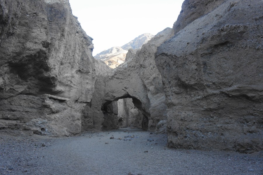
The short hike to the natural bridge begins by skirting a left-hand bend, climbing surprisingly steeply—like seemingly every other side drainage in Death Valley—into the mouth of Natural Bridge Canyon. Here the region’s periodic rains have carved a relatively shallow channel into the mostly reddish Furnace Creek Formation, composed of cemented gravel, silty mud, and ash from the Black Mountains volcanic field. This conglomerate rock layer is extremely thick, at least 5,000 feet deep, and not particularly graceful—a sharp contrast from the smooth and picturesque sandstone found in much of southern Utah.

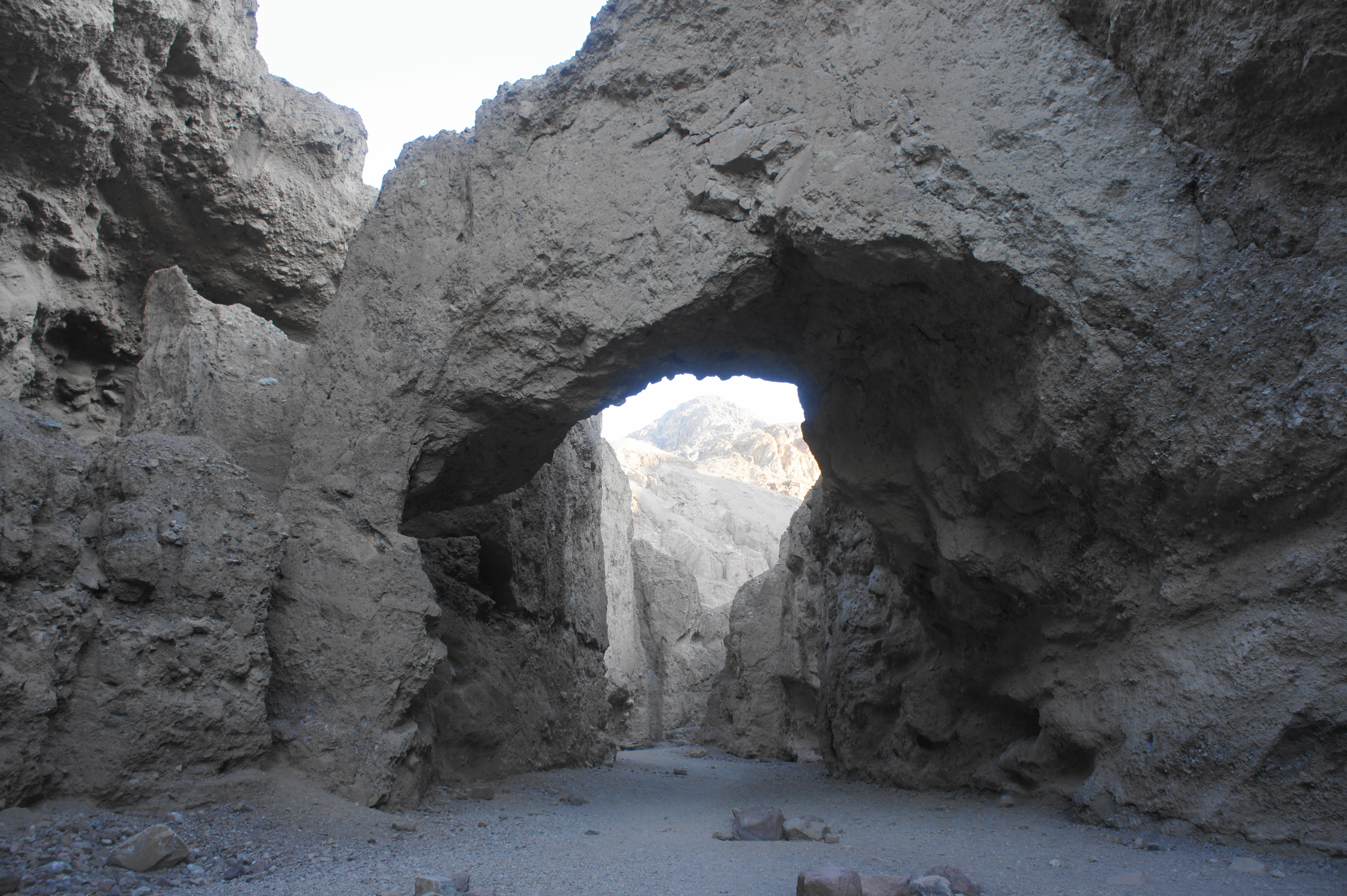
The canyon is nonetheless enjoyable, with the walls gradually constricting as a social trail climbs a sandy bench on the right (before prompting dropping back into the wash). Follow the dry stream bed for about ¼ mile to reach the natural bridge, an impressive sight with an aperture at least 30-40 feet high. Unlike arches, natural bridges are formed by waterways, this one sculpted by flood waters that cut through a weakness in the thick rock.


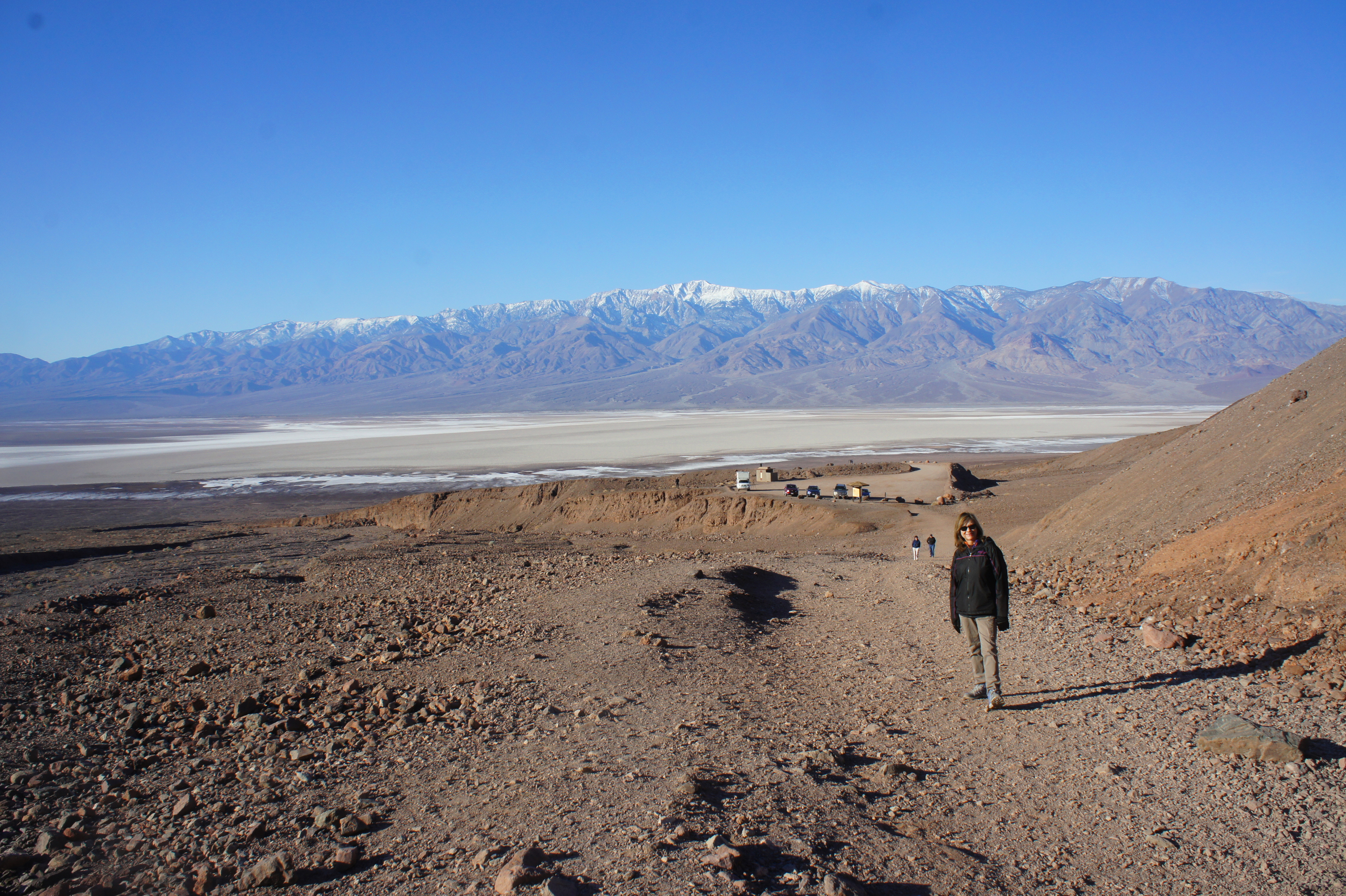
It is possible to continue for another ¼ mile beyond the natural bridge, where passage ends at a dryfall, but most visitors will turn around at the bridge, descending back to the parking area with terrific views across Death Valley and Badwater Basin, the lowest point in North America.
Allot about a half-hour for this easy and brief out-and-back journey.

Pingback: Golden Canyon, Badlands Loop, and Gower Gulch Trail Loop, including Red Cathedral & Zabriskie Point (Death Valley National Park, CA) | Live and Let Hike