Carving a dramatic gorge hundreds of feet deep in the Grapevine Mountains, Fall Canyon is a relatively popular destination in California’s Death Valley National Park. The hike through the lower reaches of the canyon is moderately difficult but climbs relentlessly, a common trait of canyons in the area, tilting upward from the vast expanse of Death Valley. Along the way, hikers are rewarded with views of snaking narrows and highly-streaked walls, ending at a dryfall at 3.2 miles. A sketchy bypass on the south side of the canyon provides onward passage beyond the pour-off, but most visitors turn around here.

The hike
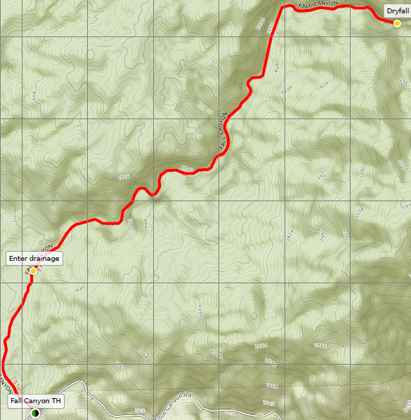
The hike to Fall Canyon begins at the end of the two-way section of the Titus Canyon Drive, a rough but 2WD-accessible road situated off the Scotty’s Castle Road in Death Valley National Park. (Note: The trailhead is located roughly 35 miles northwest of the Furnace Creek Visitor Center.) The Titus Canyon Drive itself climbs 800 feet in elevation from the base of Death Valley or, alternatively, travelers can visit Fall Canyon after driving the length of the one-way section of the road, which winds through Titus Canyon and begins outside the park near Beatty, Nevada.
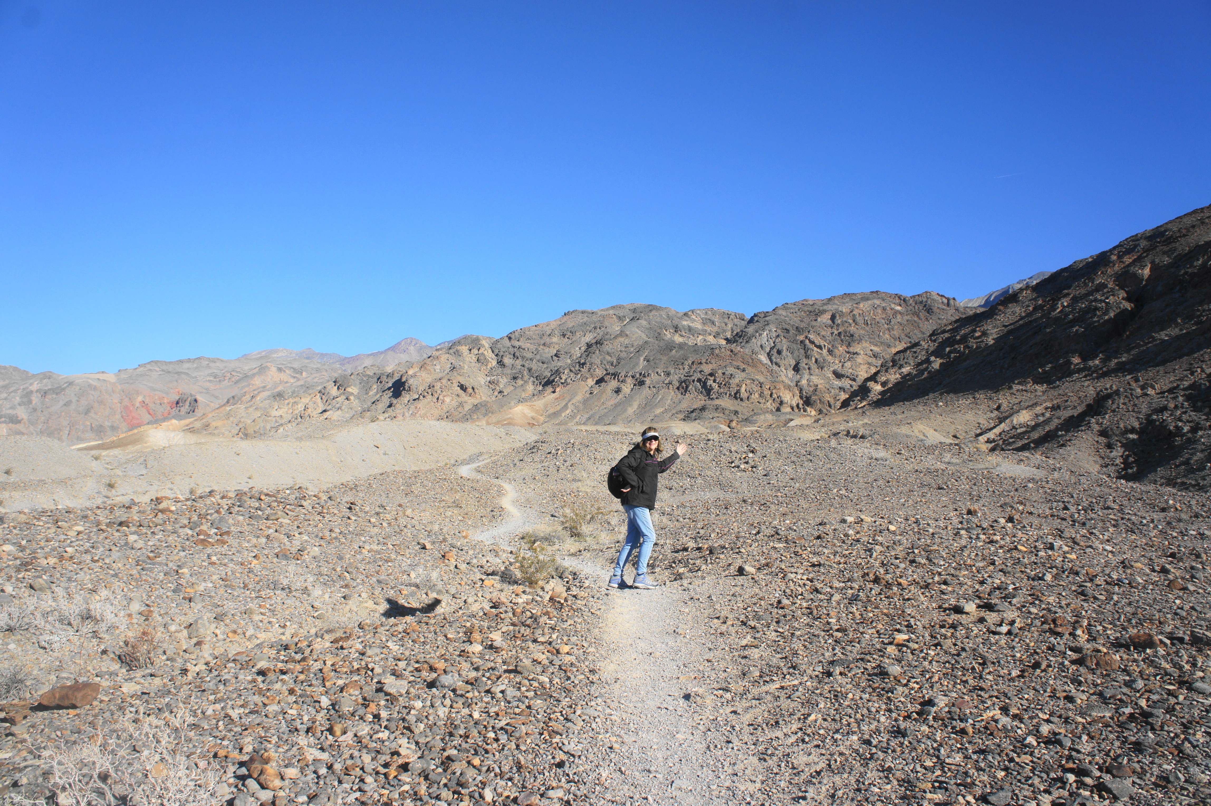
The route to Fall Canyon begins next to the restrooms at the parking area, skirting the western flank of a crumbly hillside. The first section of the hike traverses an alluvial fan, formed by the accumulation of deposits from the nearby canyons and mountainsides, sloping ever-steadily down into Death Valley. At 1/3 mile, the single-track trail enters a wash, then follows the left fork before climbing up to a high platform with unobstructed views of Death Valley and the Cottonwood Mountains beyond.
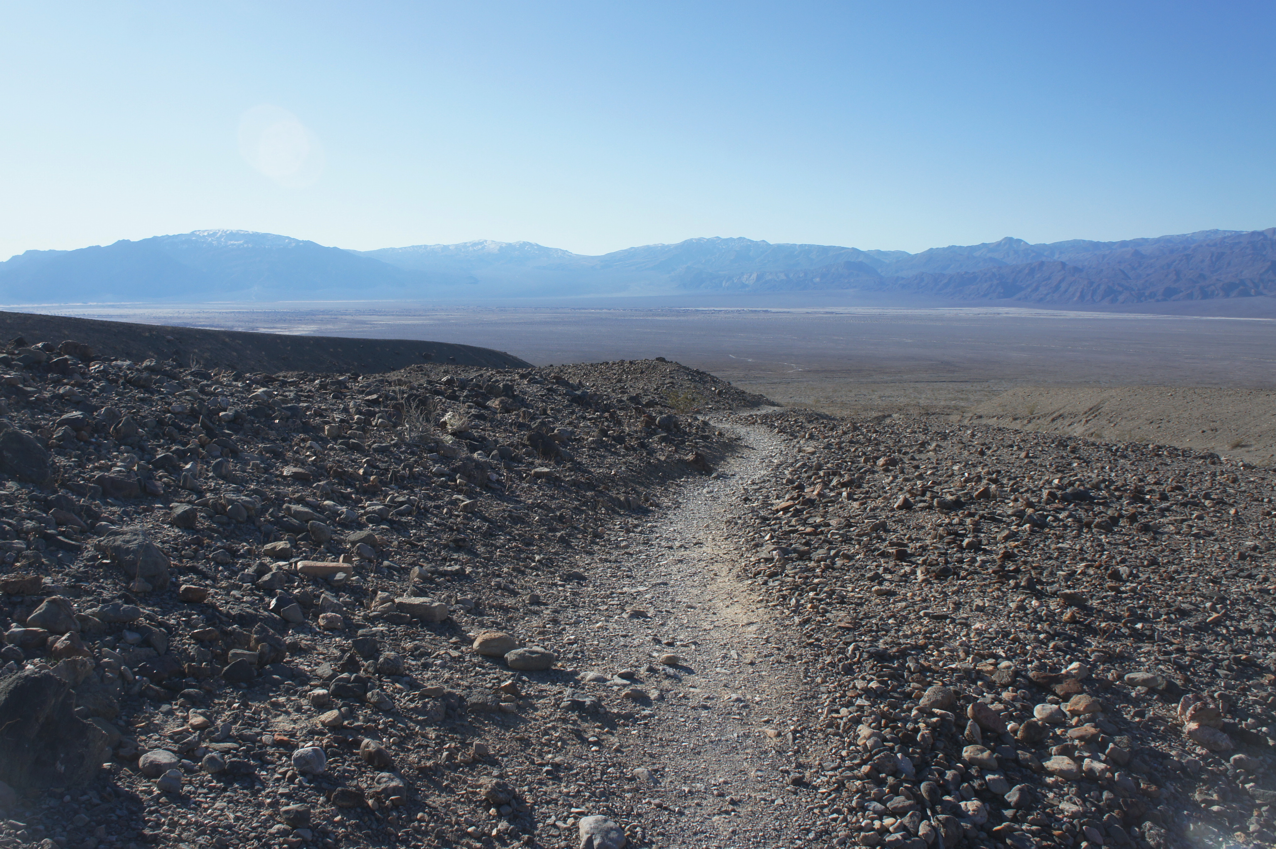
Nearly ½ mile from the trailhead, the route descends sharply into another dry creek bed, then follows the arroyo up again to a rocky ridgeline. From here, one can see down into a third, much larger wash: this is the drainage for Fall Canyon, reached by way of a steep descent at about the 7/10-mile mark.
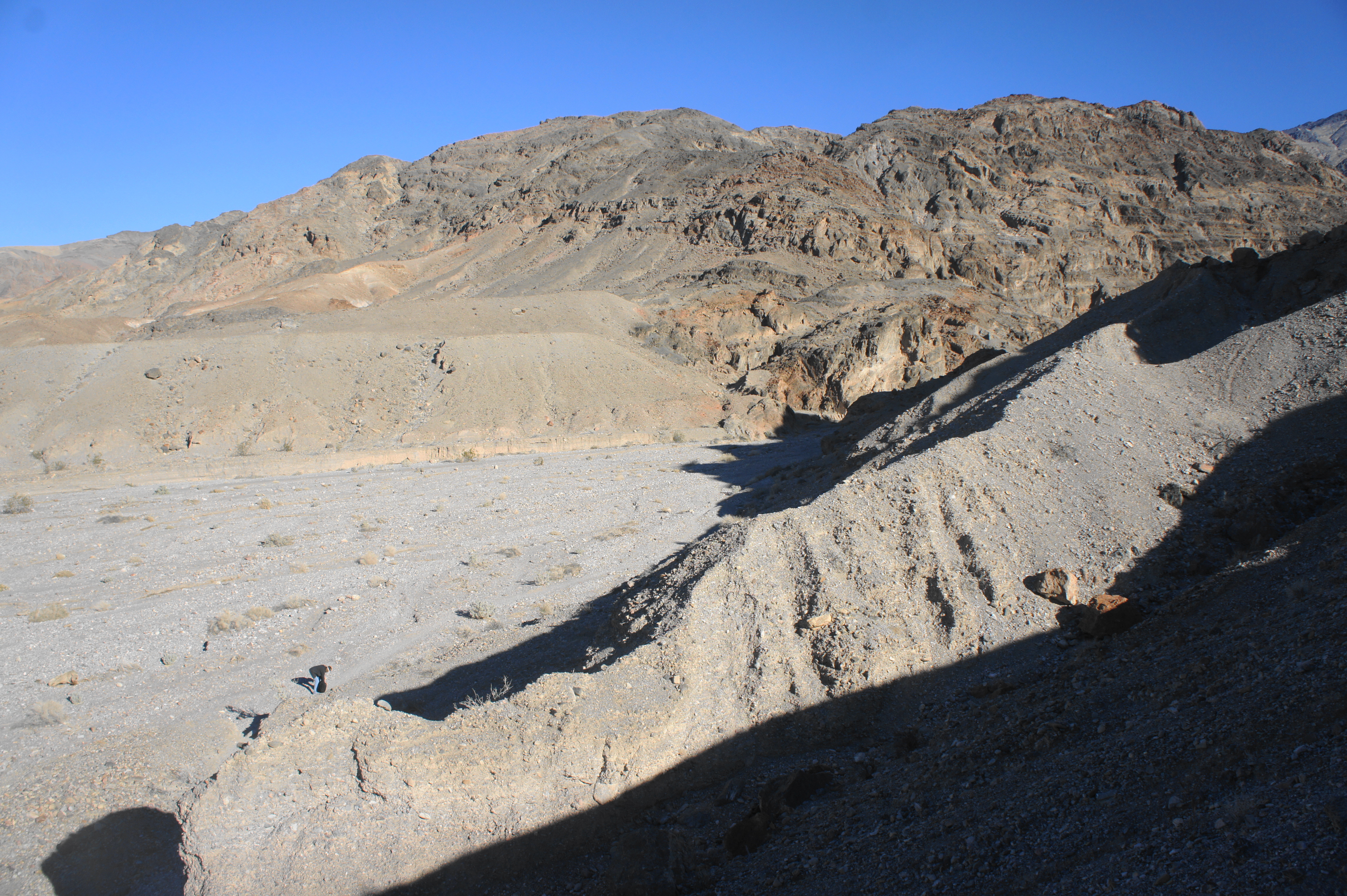
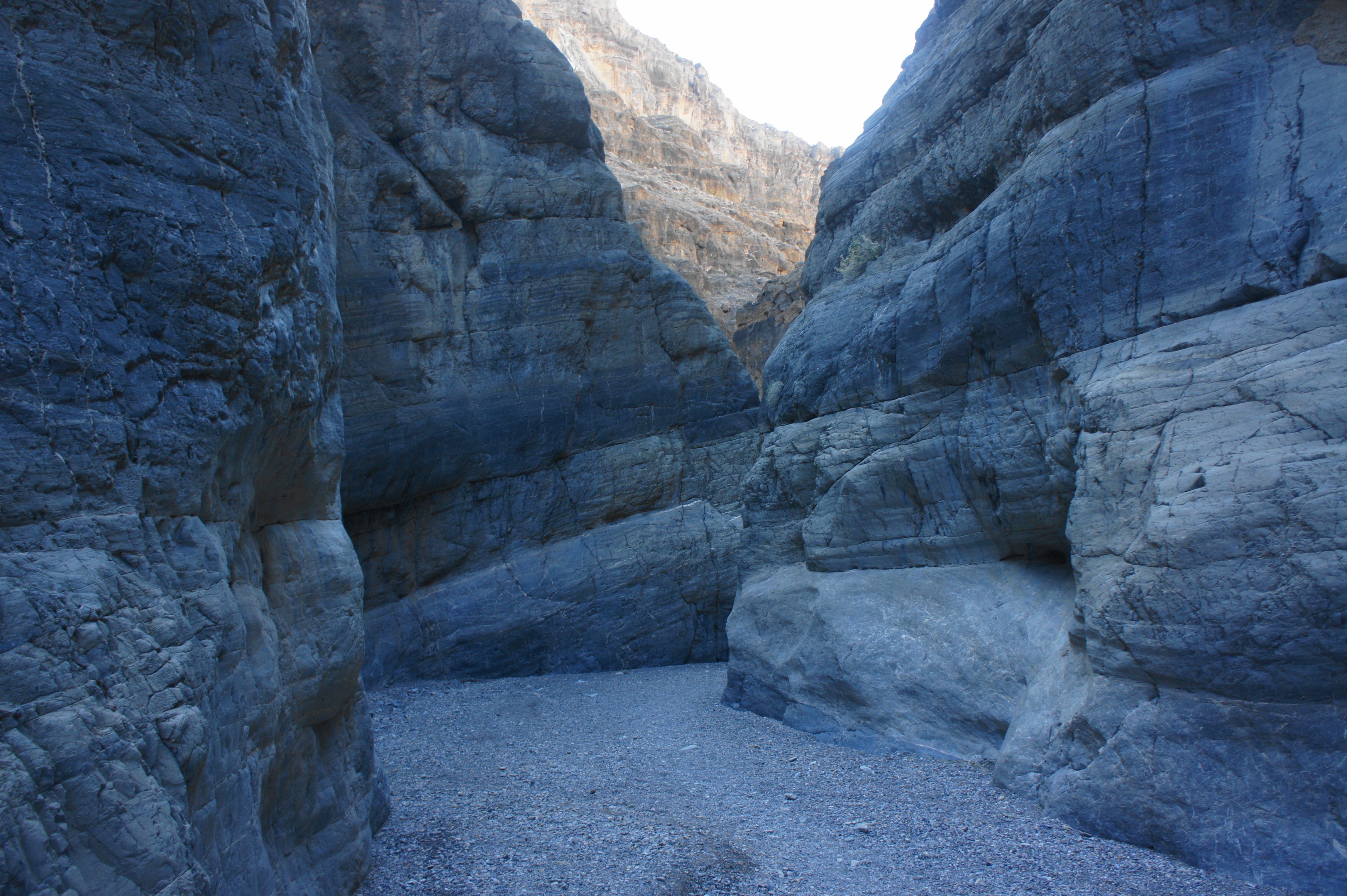
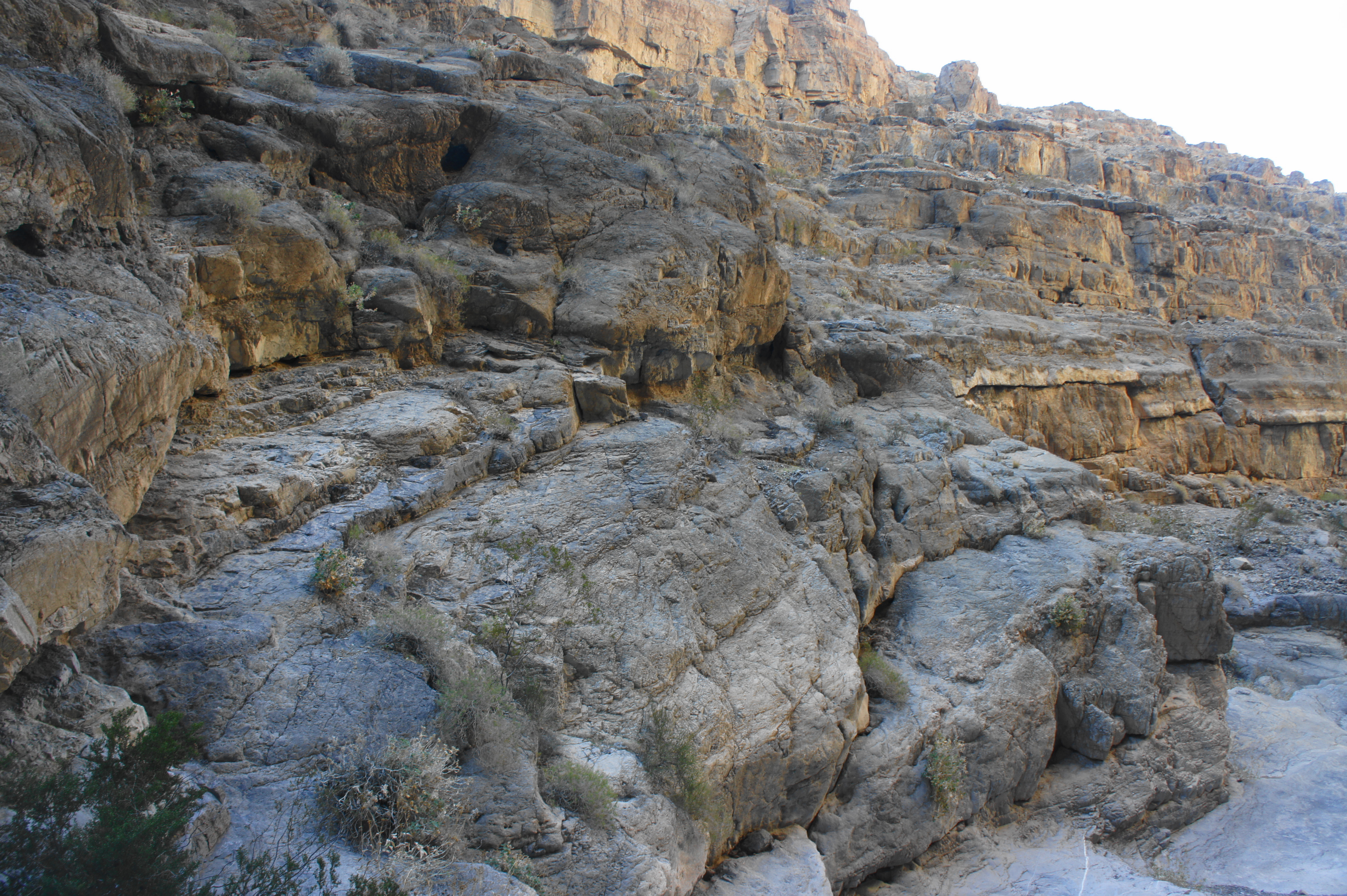
Once in the broad gulch, head east as the drainage cuts into the Grapevine Mountains. This is the start of Fall Canyon. As the walls begin to take form, hikers start to notice streaks, ridges, and mosaic patterns in the stony breccia, part of the broader, Cambrian-era Bonanza King Formation, one of the thickest rock layers in Death Valley National Park. At the one-mile mark, the canyon narrows for the first time to a width of roughly 40 feet across. Following a right-hand bend and broader left turn, the canyon further constricts at 1.25 miles, forming orange- and gray-tinted narrows. Vegetation in the area is sparse, largely confined to hearty sagebrush.
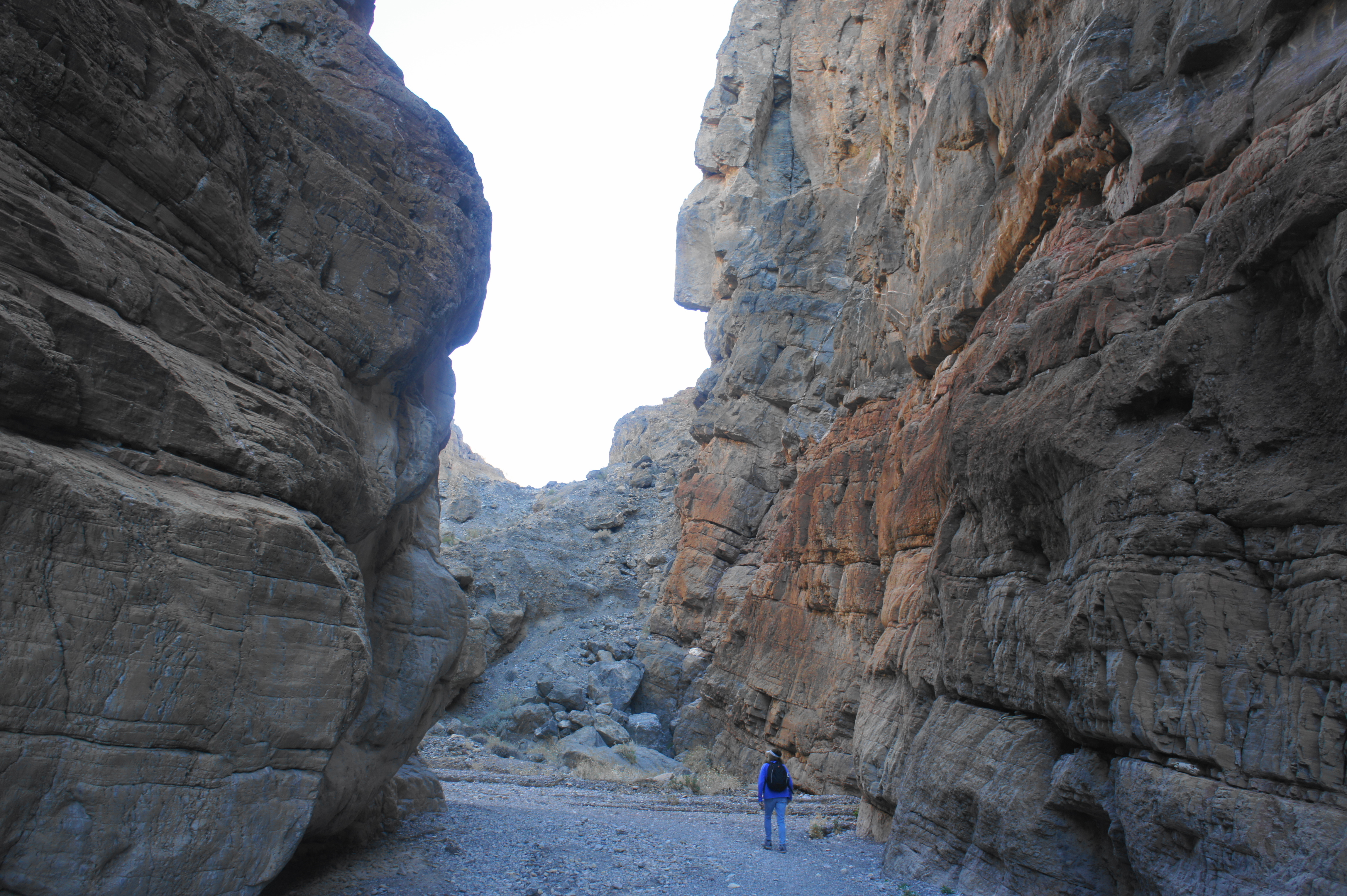
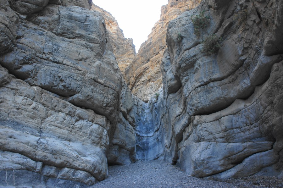
As the canyon opens up again at around 1.5 miles, the vertical cliffs rise more than 500 feet in either side. The next set of narrows at 1.8 miles are as little as 15 feet wide, and the undulating walls, partly stained with iron oxides, make for some of the best scenery on the hike.
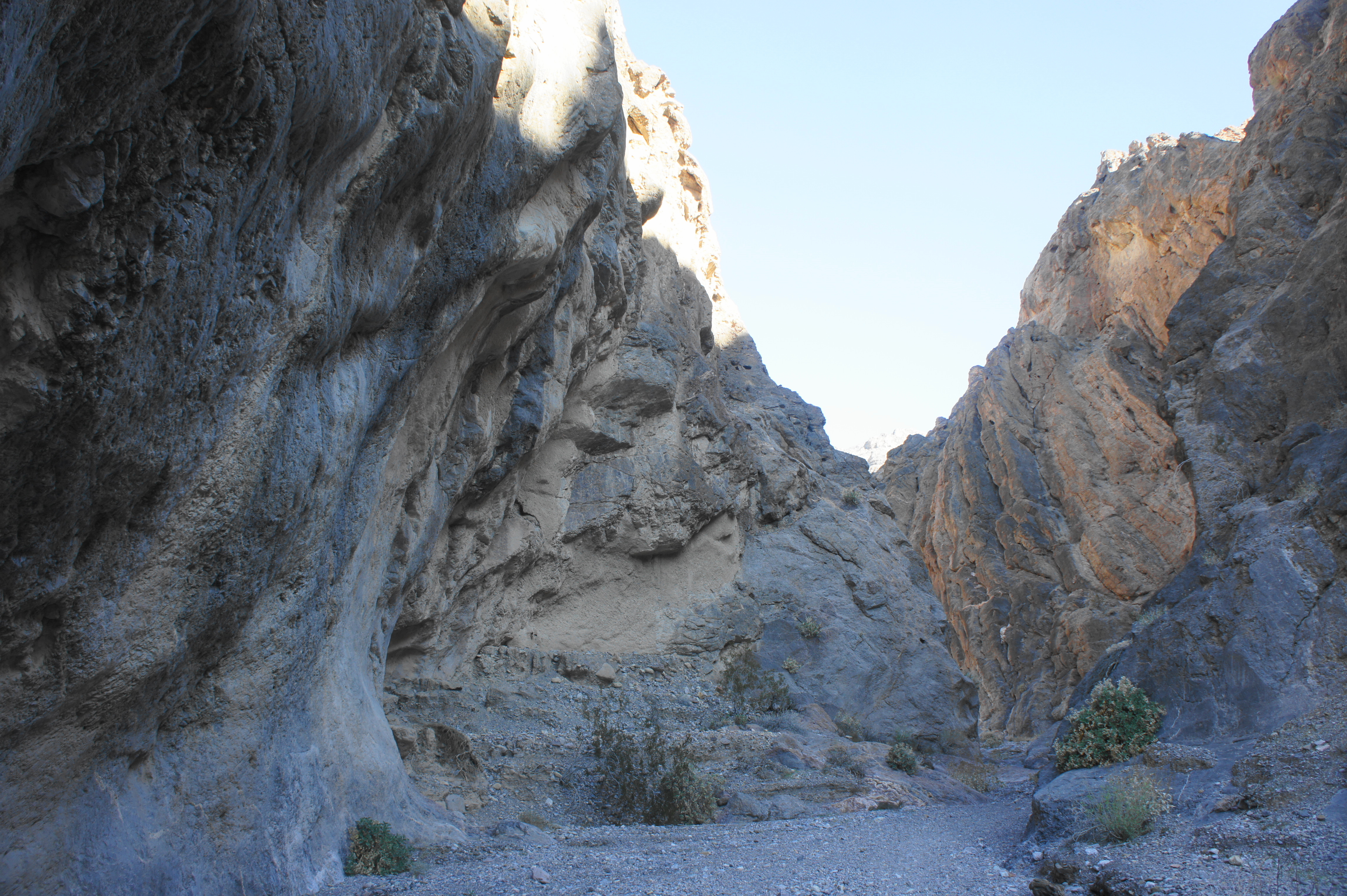
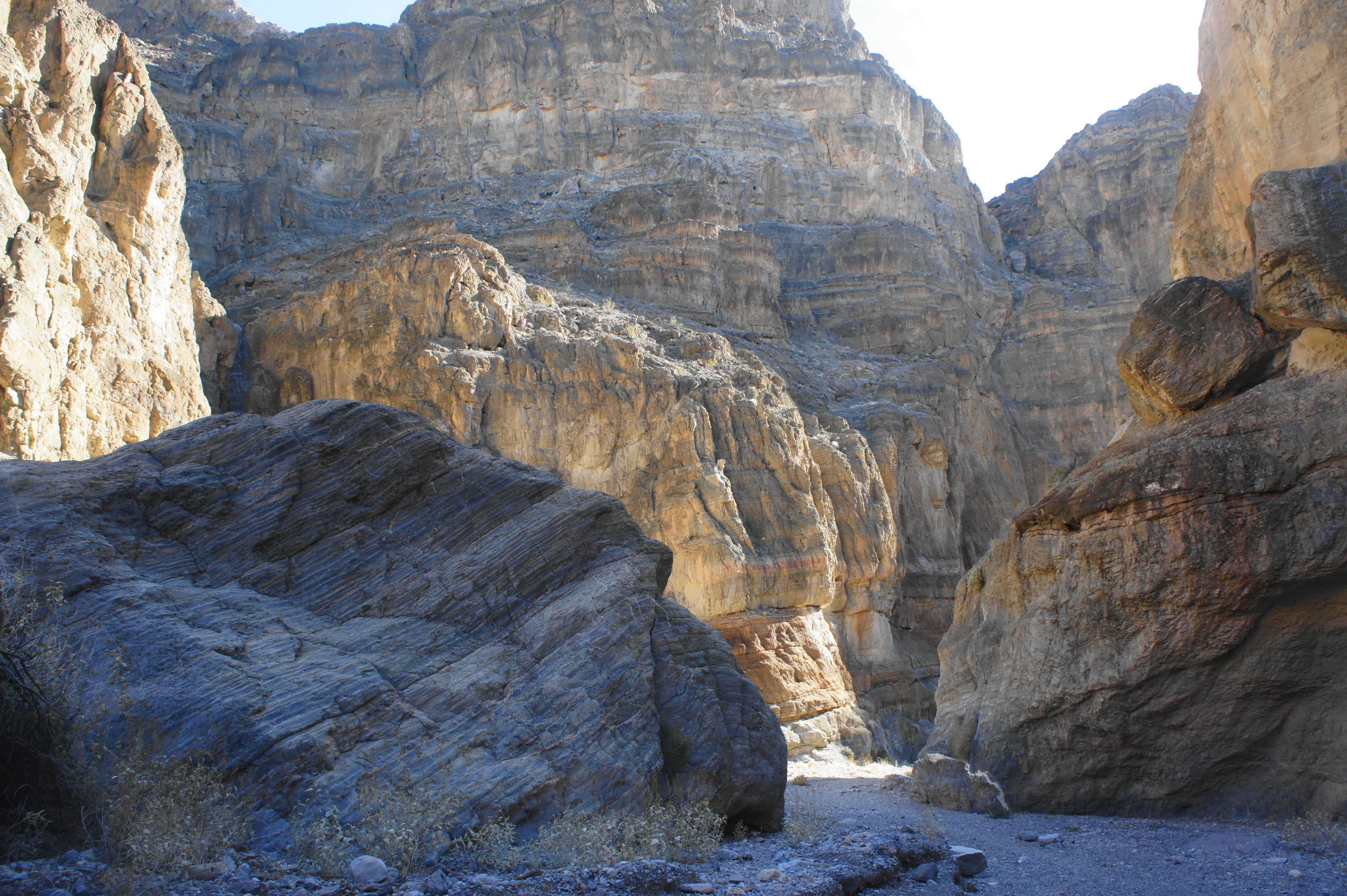
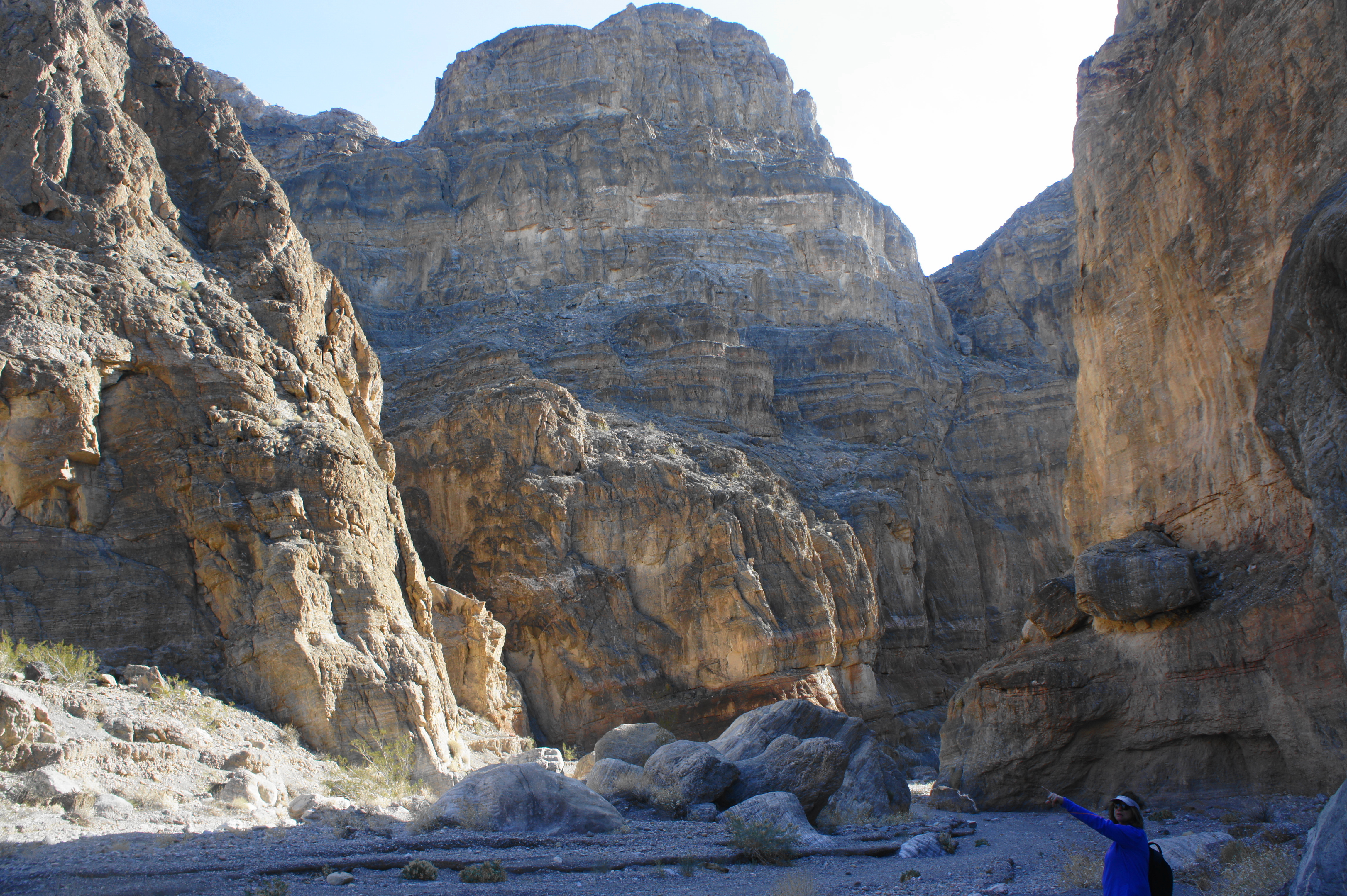
The gorge opens to the sunshine again at the two-mile mark, and a large side canyon comes in from the left (it quickly ends at an impassable dryfall). Ahead is a stony monolith, more than 100 feet high, marking the onward passage up-canyon. Soon enough, the walls constrict again, and a left-hand turn reveals an unusual feature on the south-facing rock wall that resembles a swirl of fudge in a bowl of chocolate ice cream.


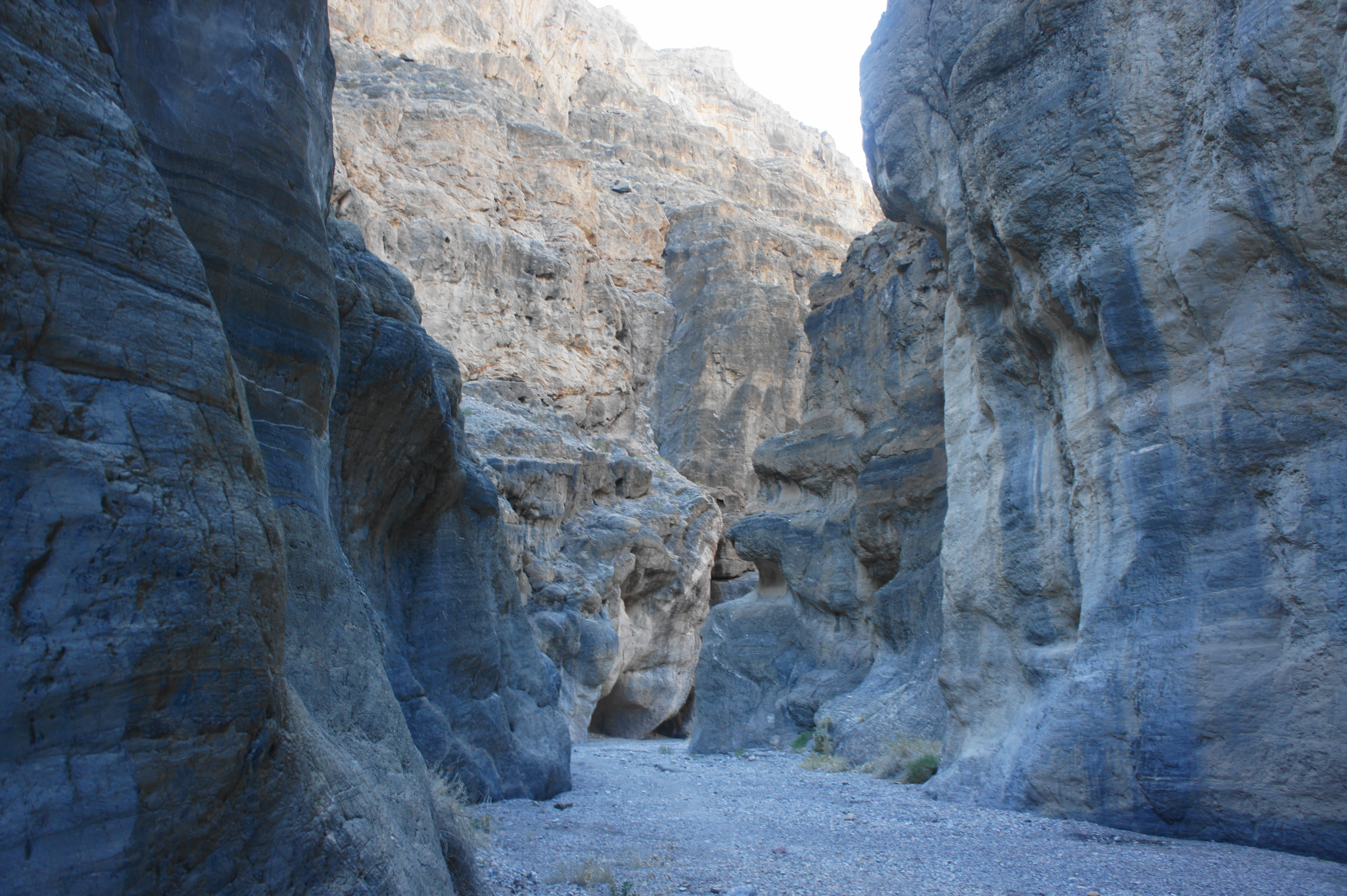
Not to be outdone, a larger and grander version of the swirling rock is visible around the corner, with distinct, dark ridges leading upward into the mountains. The walls here are now more than 800 feet tall, with the mountaintops continuing even higher. By now there is also more vegetation in the canyon, with the usually dry basin and cliffs supporting occasional creosote bush or even cactus.
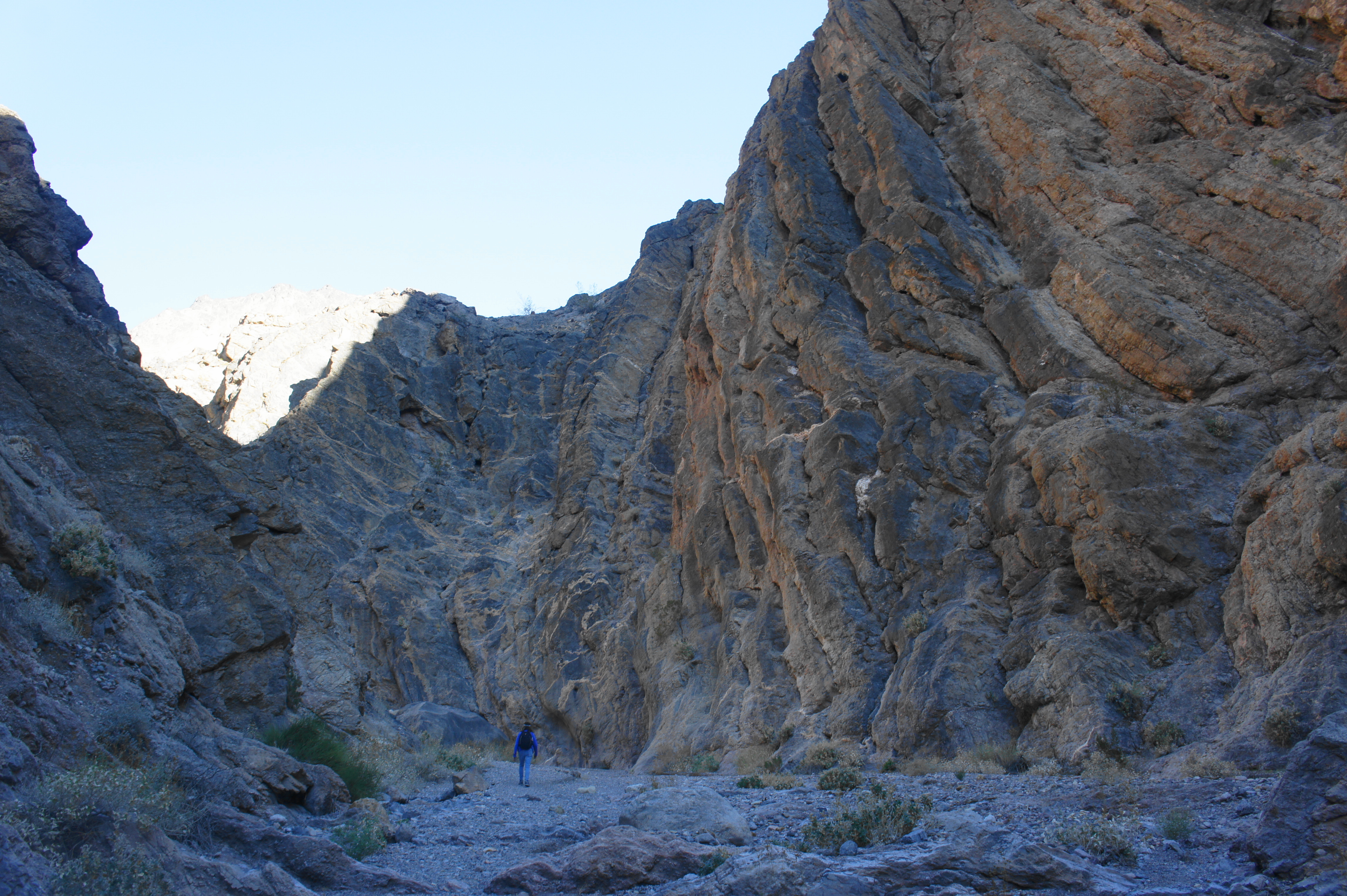
After a straightaway in the sun, the canyon yields right at 2.7 miles, cutting through low narrows that constrict to around eight feet. Ahead the canyon is varied and ledge-like, with distinct streaks on the protruding walls. In the final stretch, a smooth layer of gray dolomite rock begins to blanket the sides of the canyon, indicating another narrowing of the route.


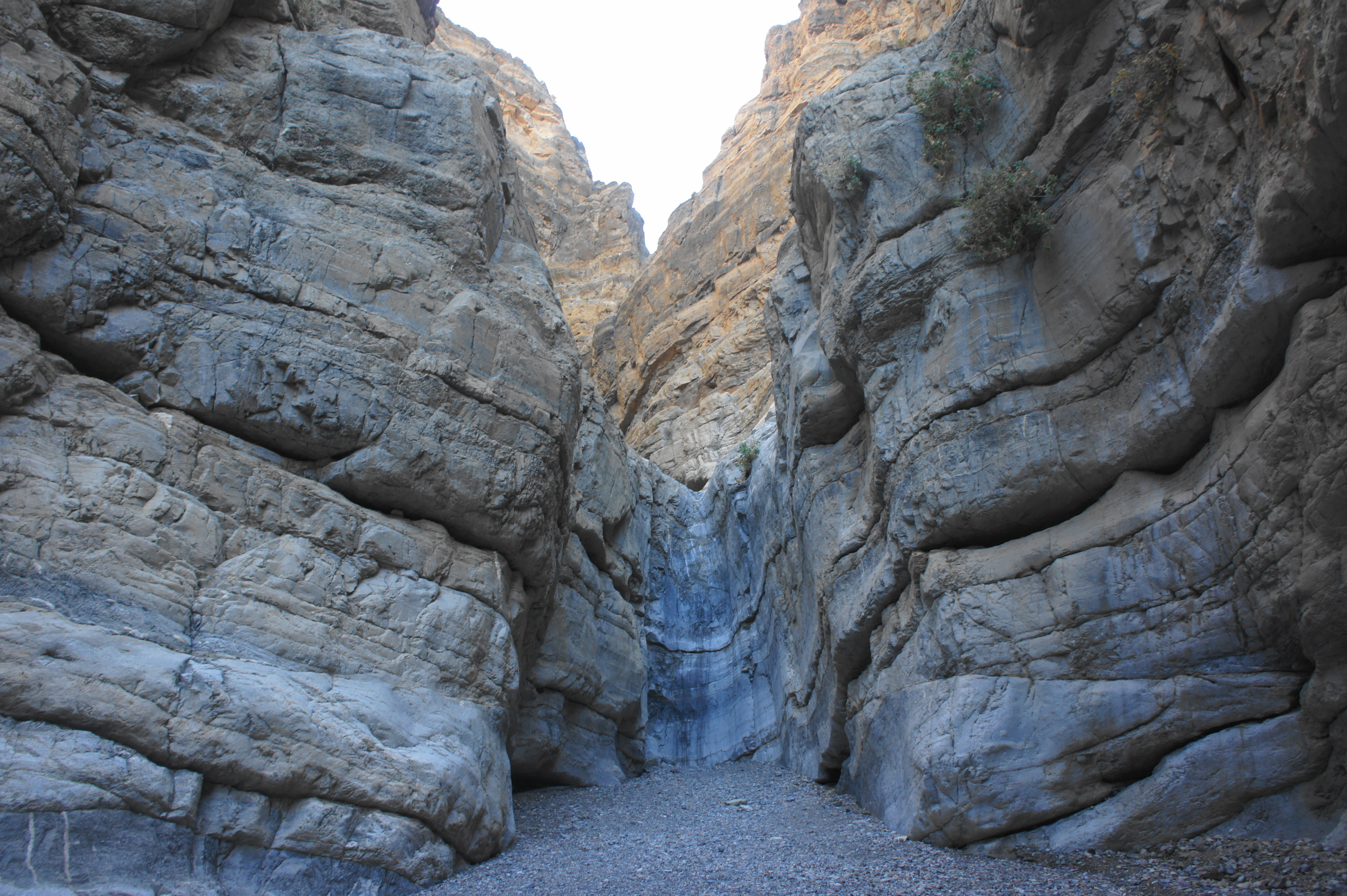
At last, the hike ends (for most) at the appearance of an 18-foot dryfall at 3.2 miles. It is possible to continue onwards by backtracking about 50-75 yards and taking a potentially marked bypass on the south side of the canyon. The route is sketchy, however, with serious exposure. (Note: A bummer, since evidently some of the canyon’s best narrows are just beyond.) All but the bravest will head back down canyon from this point, returning the way you came.
The return is significantly easier than the initial journey to the dryfall. While lacking any particularly steep drops (except for the dryfall), Fall Canyon is positioned on a steady incline, with inward hikers gaining more than 1,300 feet over the course of 3.2 miles. On the return route, this gain becomes 1,300 feet in elevation loss, helping to provide additional momentum, like having wind at your back.
All told, a journey up Fall Canyon to the dryfall and back covers 6.4 miles and should take 3-4 hours.

I’ve hiked there.
Thank you!
Pingback: Golden Canyon, Badlands Loop, and Gower Gulch Trail Loop, including Red Cathedral & Zabriskie Point (Death Valley National Park, CA) | Live and Let Hike
Pingback: Top 10 Hikes in 2020 | Live and Let Hike