
Desolation Wilderness spans around 64,000 acres of the Sierra Nevada in northern California’s Eldorado National Forest, including dozens of alpine lakes, towering granite peaks, and glacial streams. The wilderness, due to its close proximity to Lake Tahoe, is known today as perhaps the state’s most popular backpacking area, but there are also several rewarding day hikes, including a 7-mile out-and-back trek to Twin Lakes, Boomerang Lake, and Island Lake. Together these four alpine lakes pack a spectacular punch, each nestled against the backdrop of the craggy granite slopes of the Crystal Range. The moderately difficult hike is relatively easily accessed from Placerville and the Sacramento area to the west and South Lake Tahoe to the east. (Note: Although easily done as a day hike, this hike is also a popular overnight backpack as well.)


The hike
The hike to Twin Lakes, Boomerang Lake, and Island Lake begins and ends at the Twin Lakes Trailhead in the Wrights Lake area of Eldorado National Forest, accessed by way of Highway 50 and the paved Wrights Lake Road on the west side of the Sierra Nevada. (Note: The Twin Lakes Trailhead, situated just beyond a series of summer/vacation homes at the east end of Wrights Lake, is notoriously small, so hikers may have to park instead at the Wrights Lake parking area about one mile back to the southwest. From here one can follow the Wrights Lake Trail along the lakeshore to the Twin Lakes Trailhead.)
Wrights Lake and the Twin Lakes Trailhead are situated in a marshy floodplain at the base of the Crystal Range, an area teeming with wildflowers and tall grasses during much of the summer season. From the parking area, head down the graveled road bearing northwest, then bear right on the Twin Lakes Trail, a well-trafficked single-track which provides access to the wilderness area.

Take the path to the south bank of a marshy stream, where there is a bulletin board and four-way junction. One can head straight across the bridge known as Chapel Crossing, but the quickest route toward Desolation Wilderness heads right, skirting the creek and passing wet meadows on the left. The trail crosses a short bridge over a tributary and then courses northward to a junction at the base of the hike’s first prominent granite outcrop.

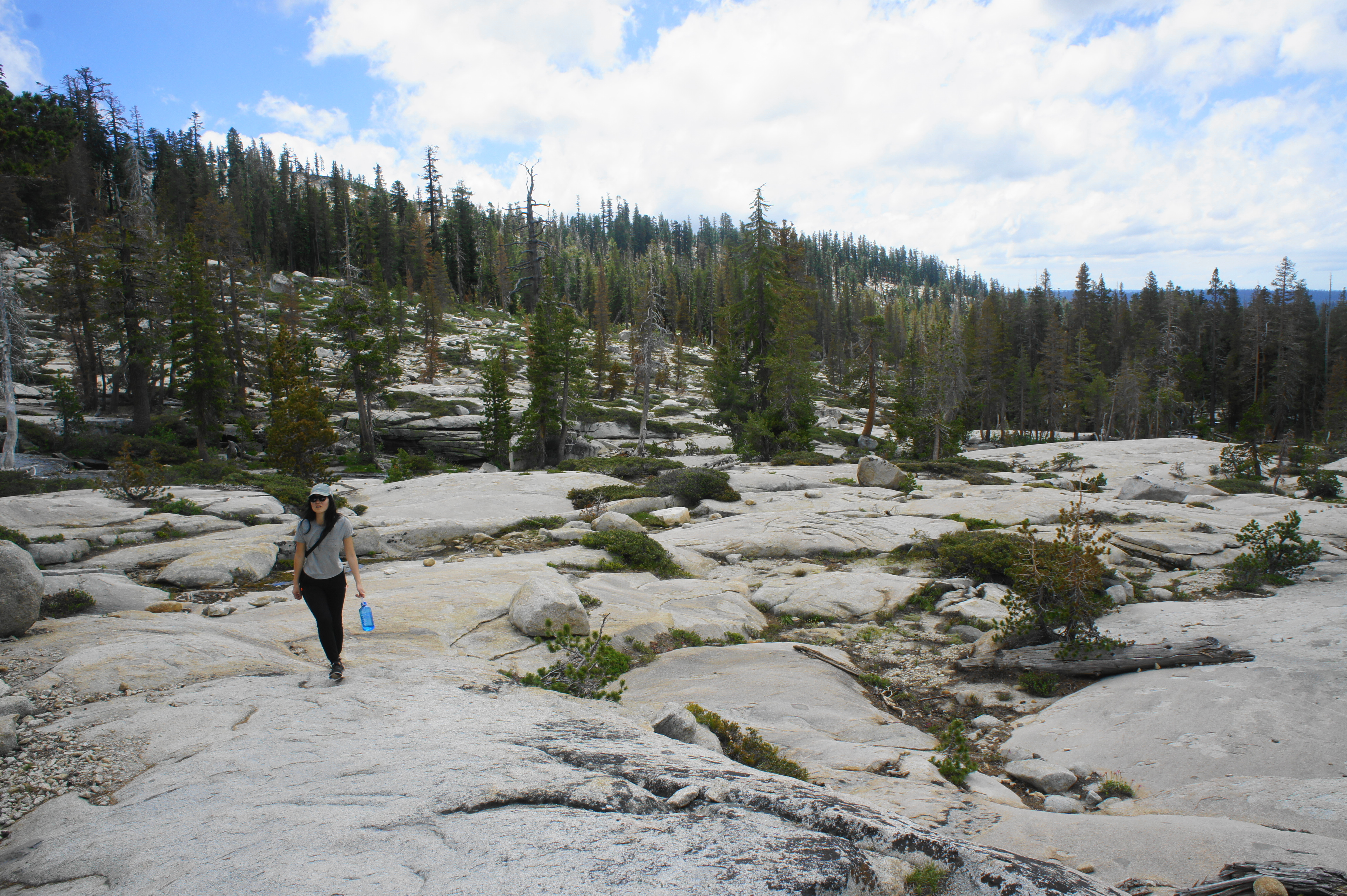
Bear right and, shortly after the fork, begin the first significant uphill of the hike, climbing stairs to mount a boulder field and edge closer to the alpine tundra. Traversing dirt and slickrock, the trail provides a brief respite from the ascent at about ¾ mile, then proceeds to climb again, mounting a scrubby hill line with decent views of the surrounding area.
After more climbing through largely wooded terrain, the trail comes streamside at about 1.25 miles. Quickly thereafter, the Twin Lakes Trail enters Desolation Wilderness and then rises steadily, reaching a trail junction at 1.5 miles. Another popular hike leads right to Grouse, Hemlock, and Smith Lakes, while the featured trail continues left. From here the trail to Twin Lakes makes its way northward toward a granitic ridge, traversing a series of minor drainages and slickrock slopes (marked by rock cairns).
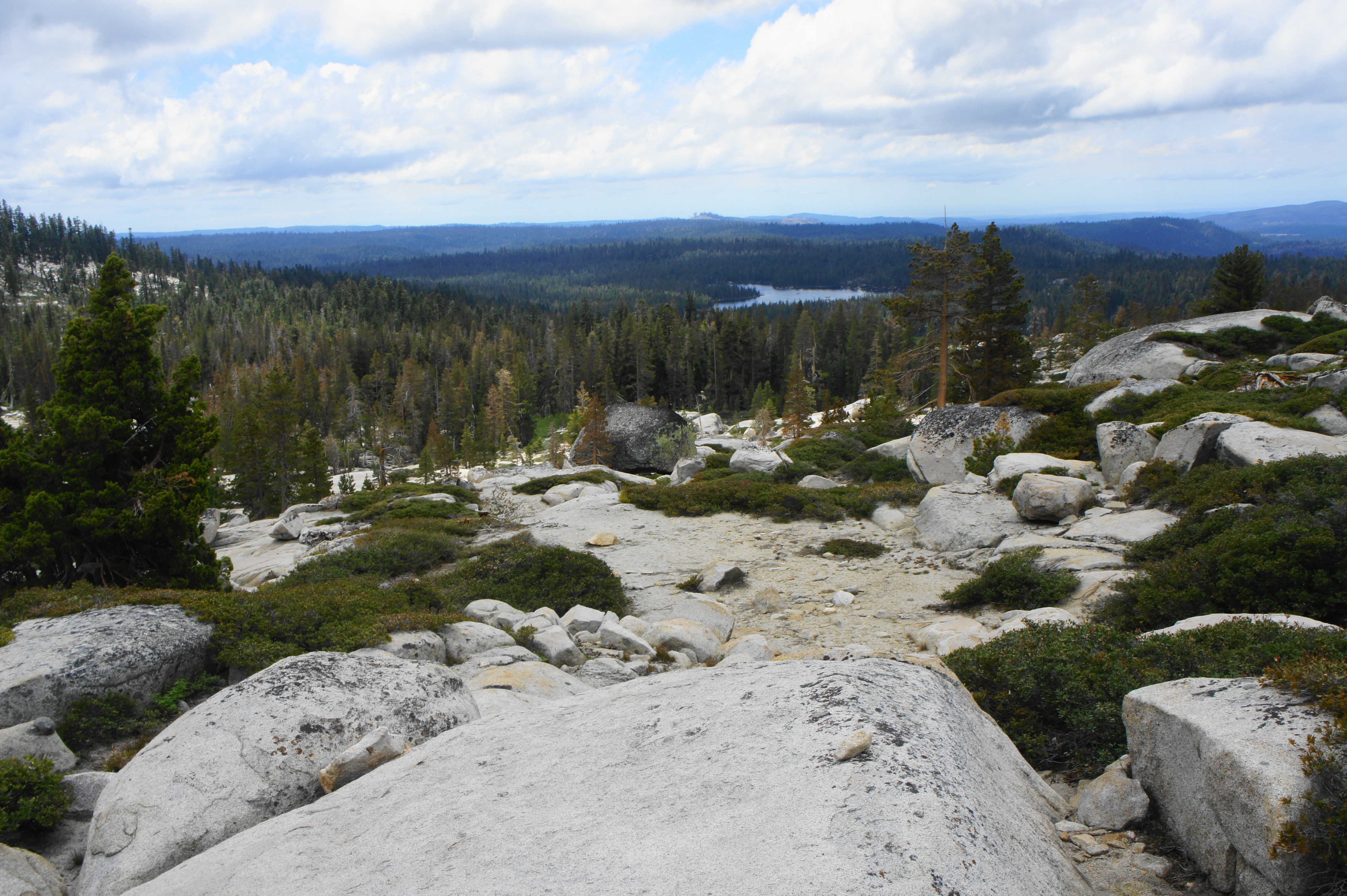
At about 1.8 miles, the hike reaches its first prominent views back over the moraine to Wrights Lake, with blankets of conifers and the Sierra foothills beyond. A nice overlook at around this point makes for a decent place to stop for lunch or a snack.
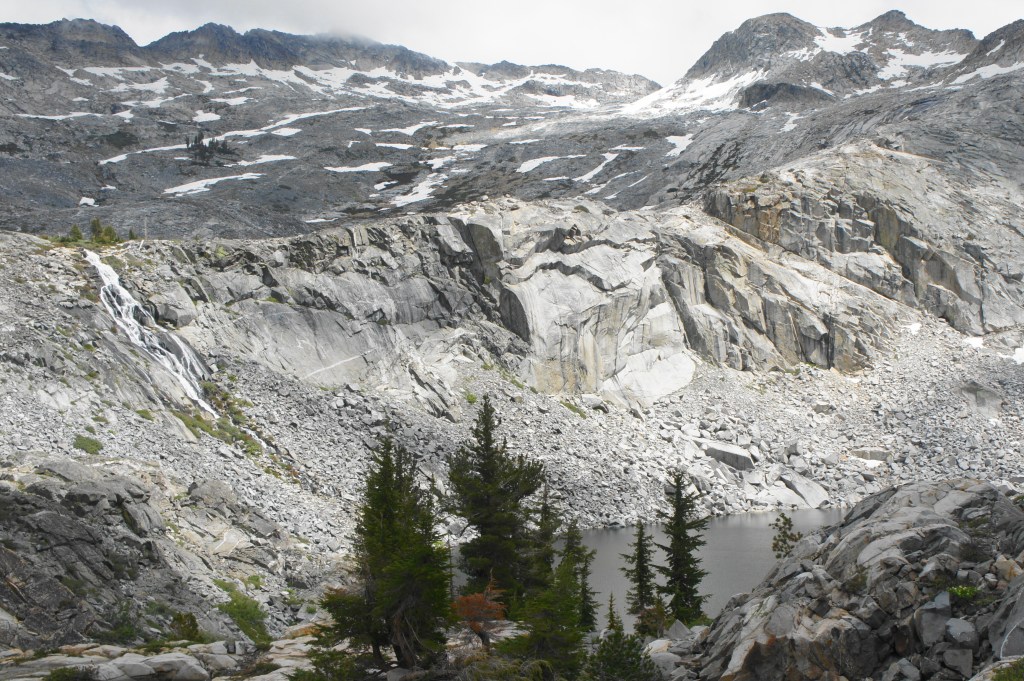
Beyond, the trail crests a ridgeline and then descends to another drainage, this one fed by Twin Lakes, which still remain out of view. After passing a roughly 10- to 12-foot cascade on the left, the trail rises to the edge of a narrow flume at about 2.4 miles, where the creek tumbles down a sharp waterfall wedged between granite slabs.
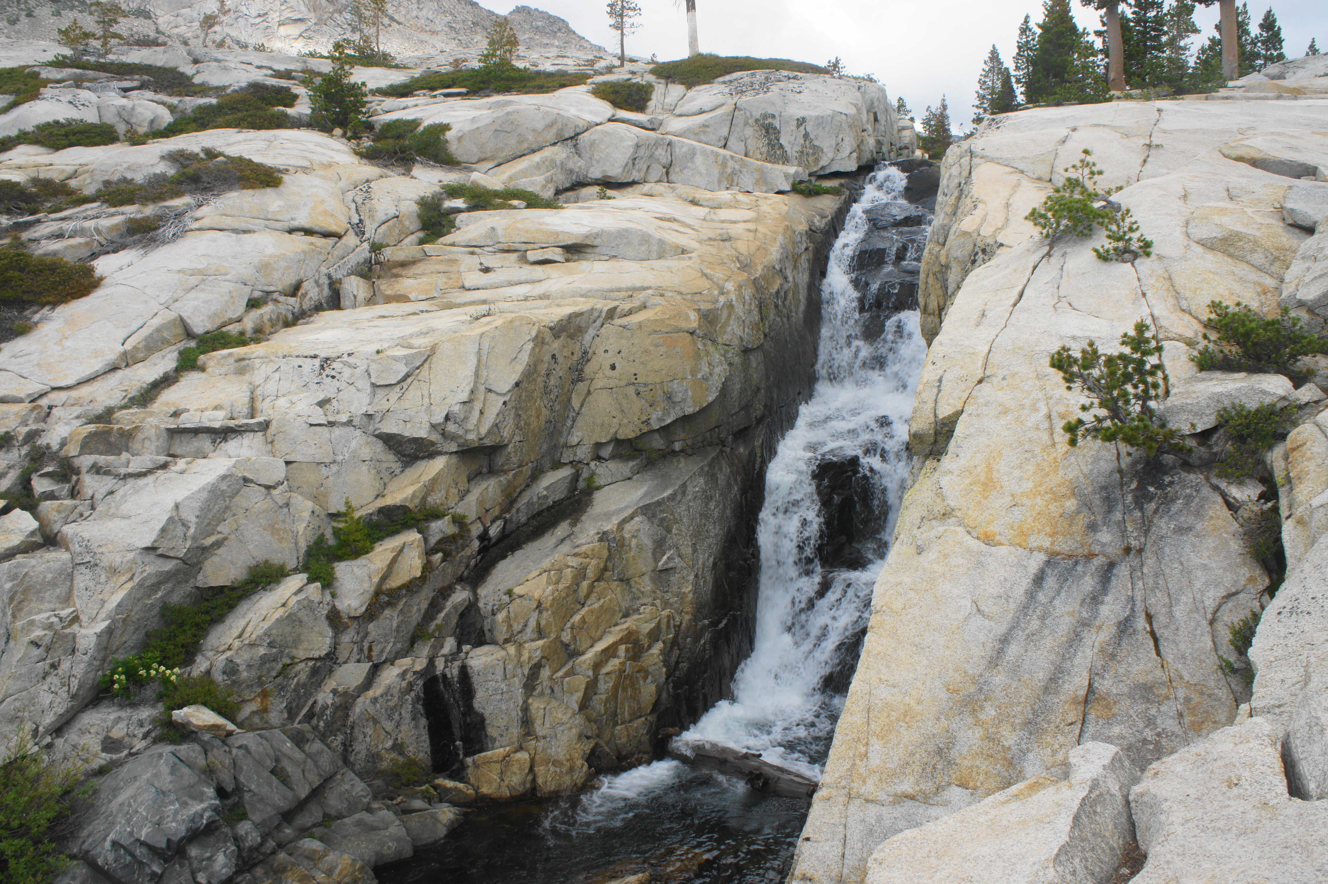
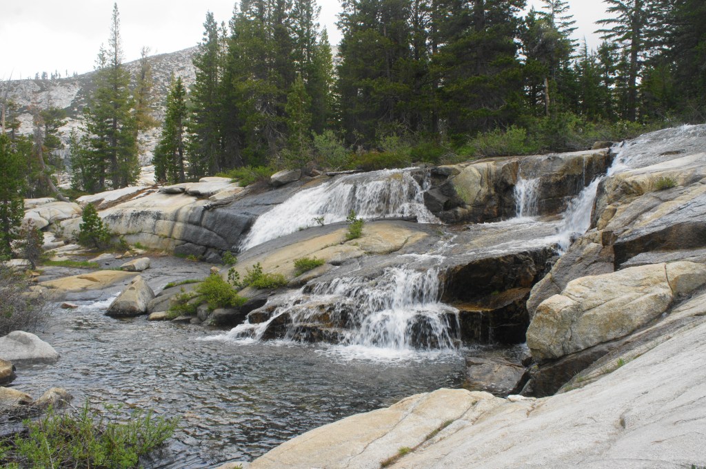
Small cascade 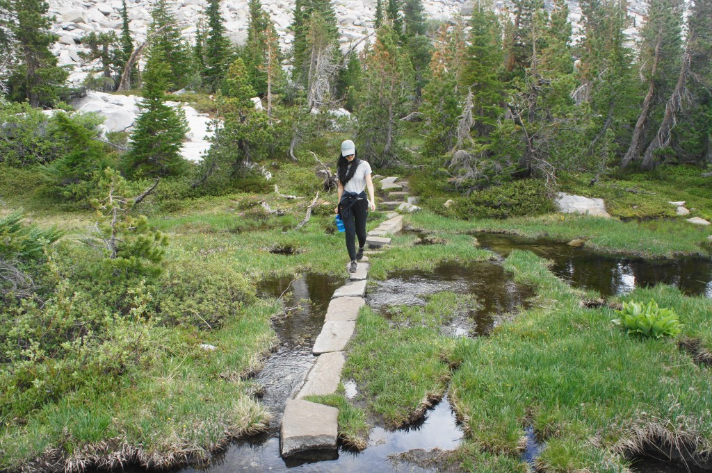
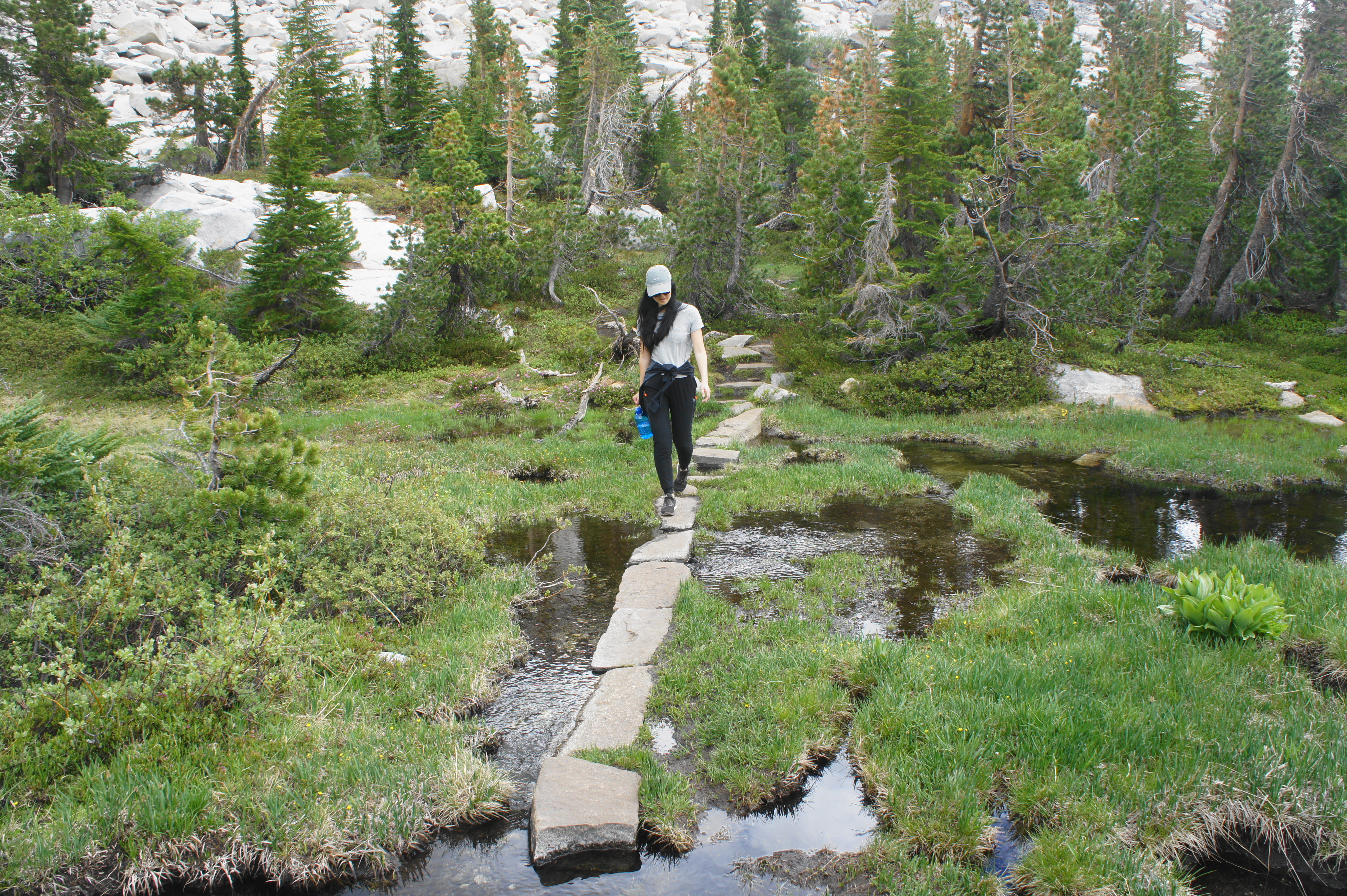
Crossing boggy meadow

From here the onward route rises to a vista overlooking a bowl of granite ahead, after which the trail drops to streamside again, traversing a coniferous moraine that includes meadows, marshes, and small pools from the seasonal snowmelt.

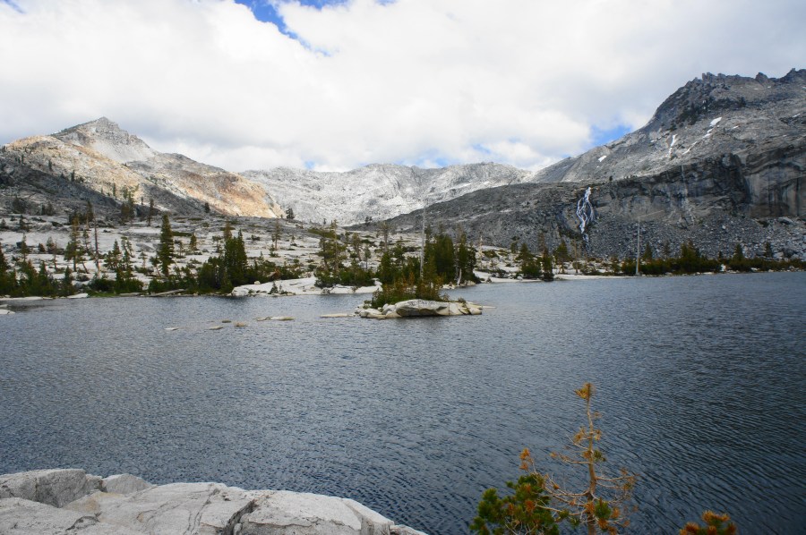
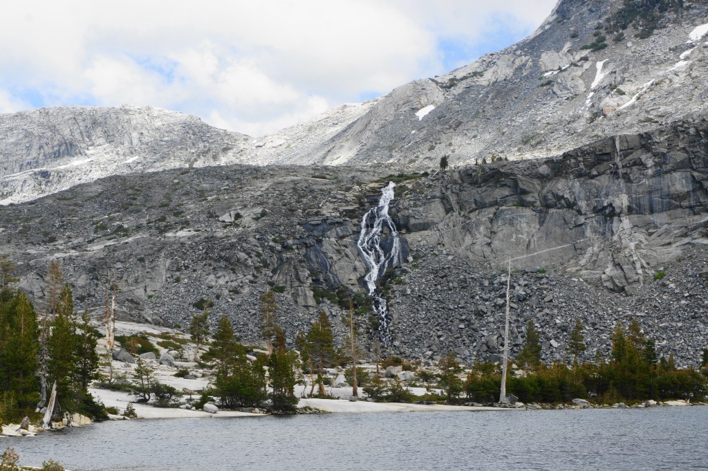
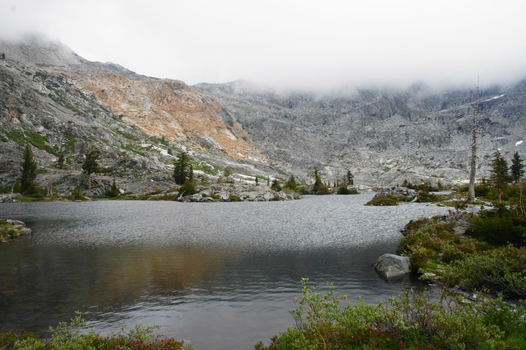
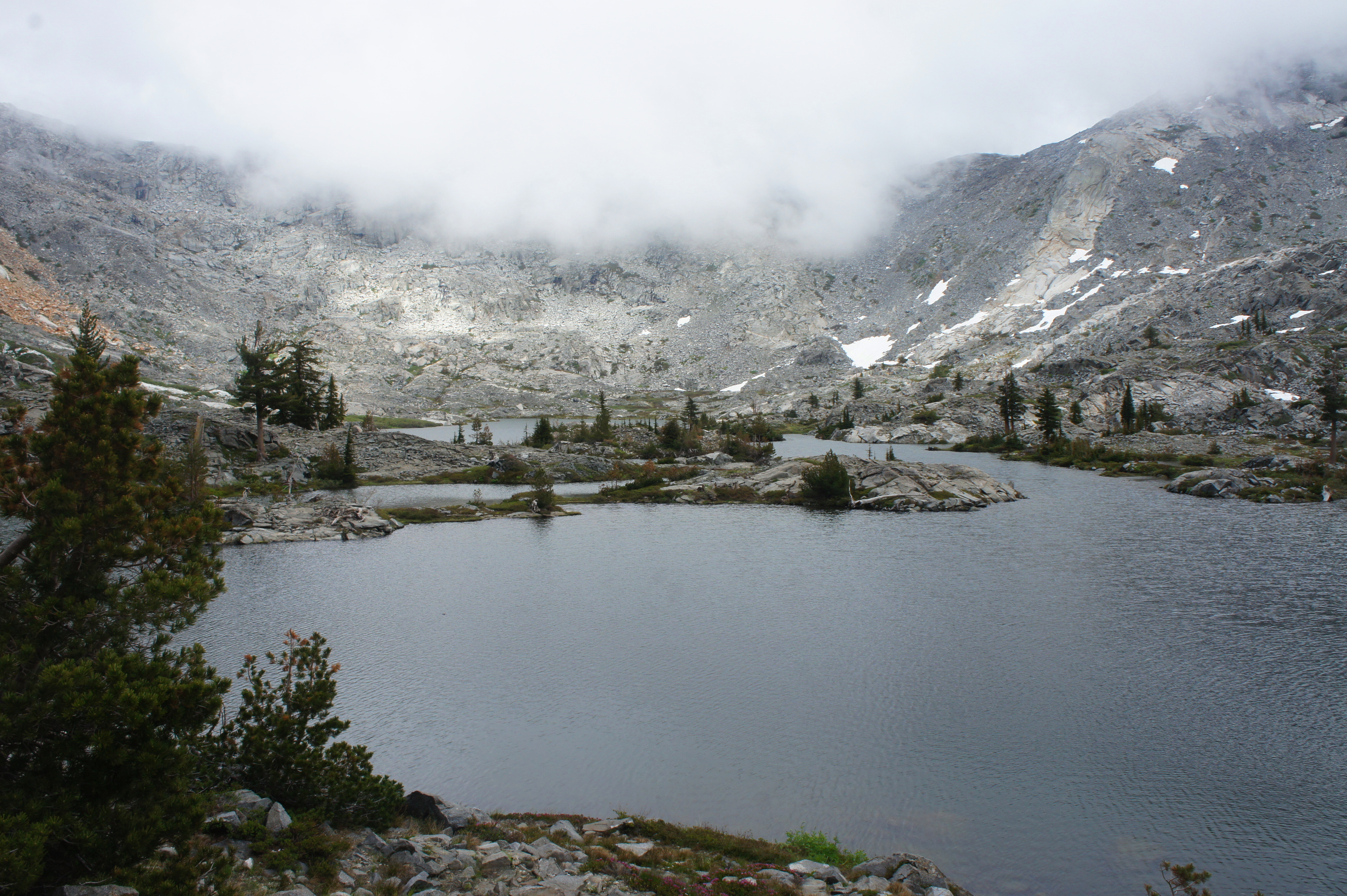
At around 2.8 miles, the trail emerges at the shores of Twin Lakes—Lower Twin Lake to be precise. This broad and majestic lake is rimmed by thin smatterings of trees and an imposing ridge to the east, with the peaks of the Crystal Range beyond. In spring and early summer, a stunning waterfall carries a large volume of water down the flank to the east, pouring into Upper Twin Lake (which is just out of view).

Some hikers may choose to turn around here, but there are more fine lakes and vistas to be seen, so onward travelers should proceed to the mouth of Lower Twin Lake, where a stream crossing is required. After traversing the stream via rock- and log-hopping, the trail skirts an inlet and then climbs a modest hill to clear a notch at about 3.1 miles.
Waterfall above Twin Lakes 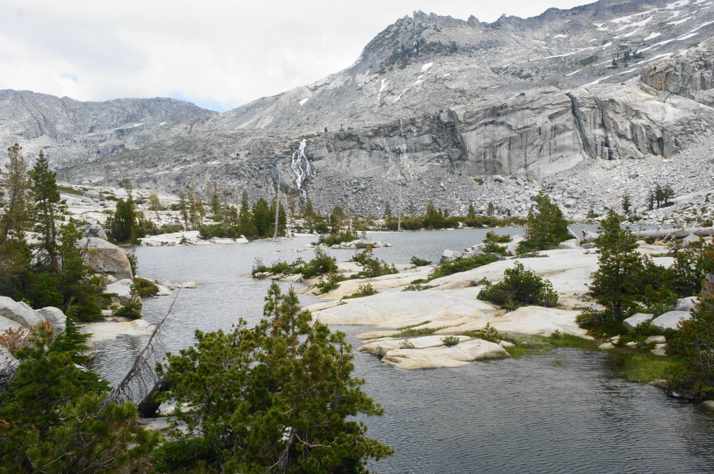
Outlet of Lower Twin Lake


Just beyond, the trail descends to the shores of Boomerang Lake, a modest but beautiful pool nestled amid the granite. The trail drops to hug the shoreline of the lake, one of the hike’s highlights.

Waterfall and Upper Twin Lake 
Boomerang Lake

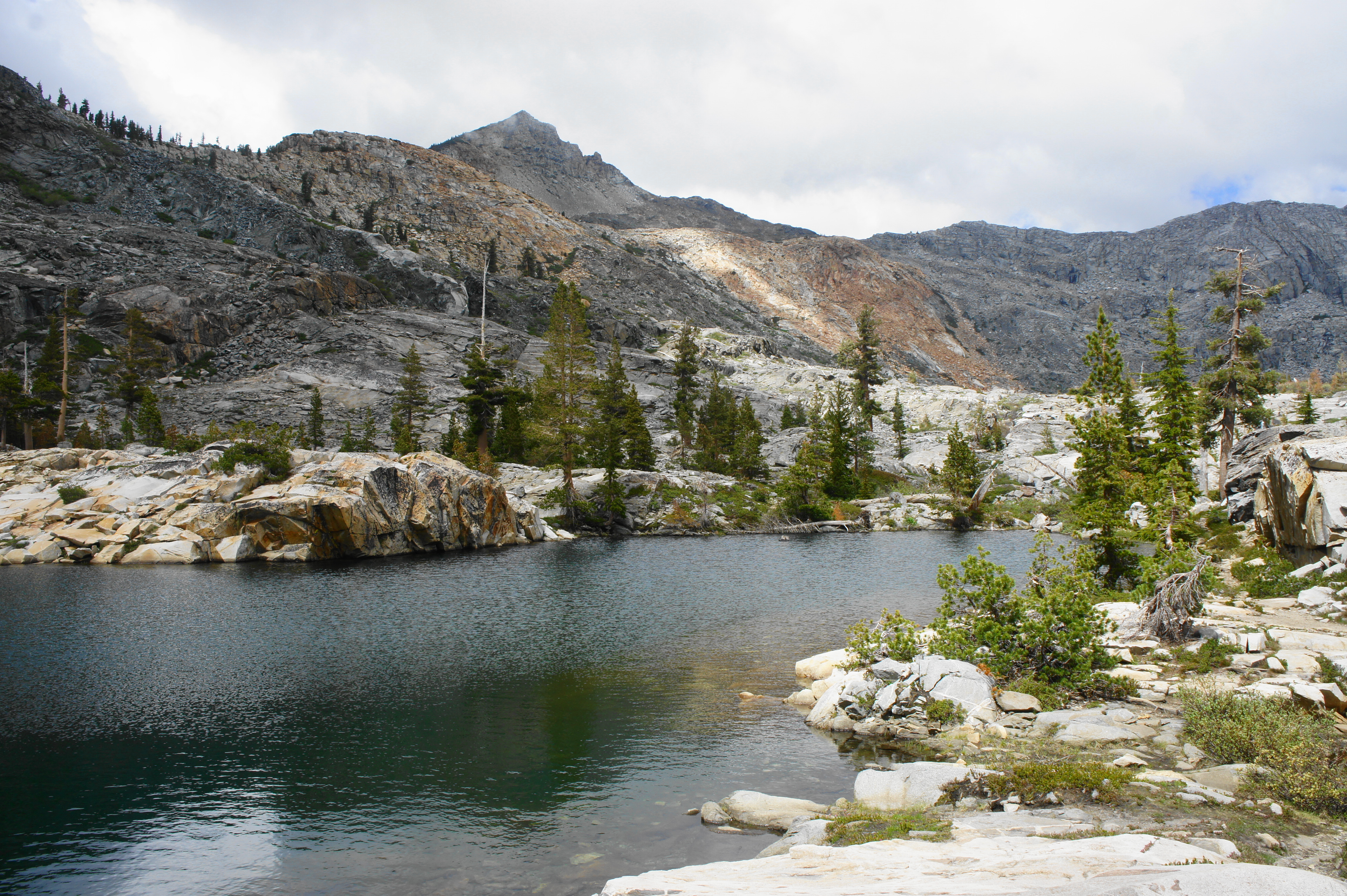
After Boomerang, the trail becomes a little harder to follow, with social trails heading off in different directions, although the main track continues northeast, passing between Boomerang and an unnamed lake with a view east toward Upper Twin Lake and the waterfall. Stay left at the next two pools after Boomerang Lake, descending to a marshy plain before rising again in the final push up to the shelf overlooking Island Lake.
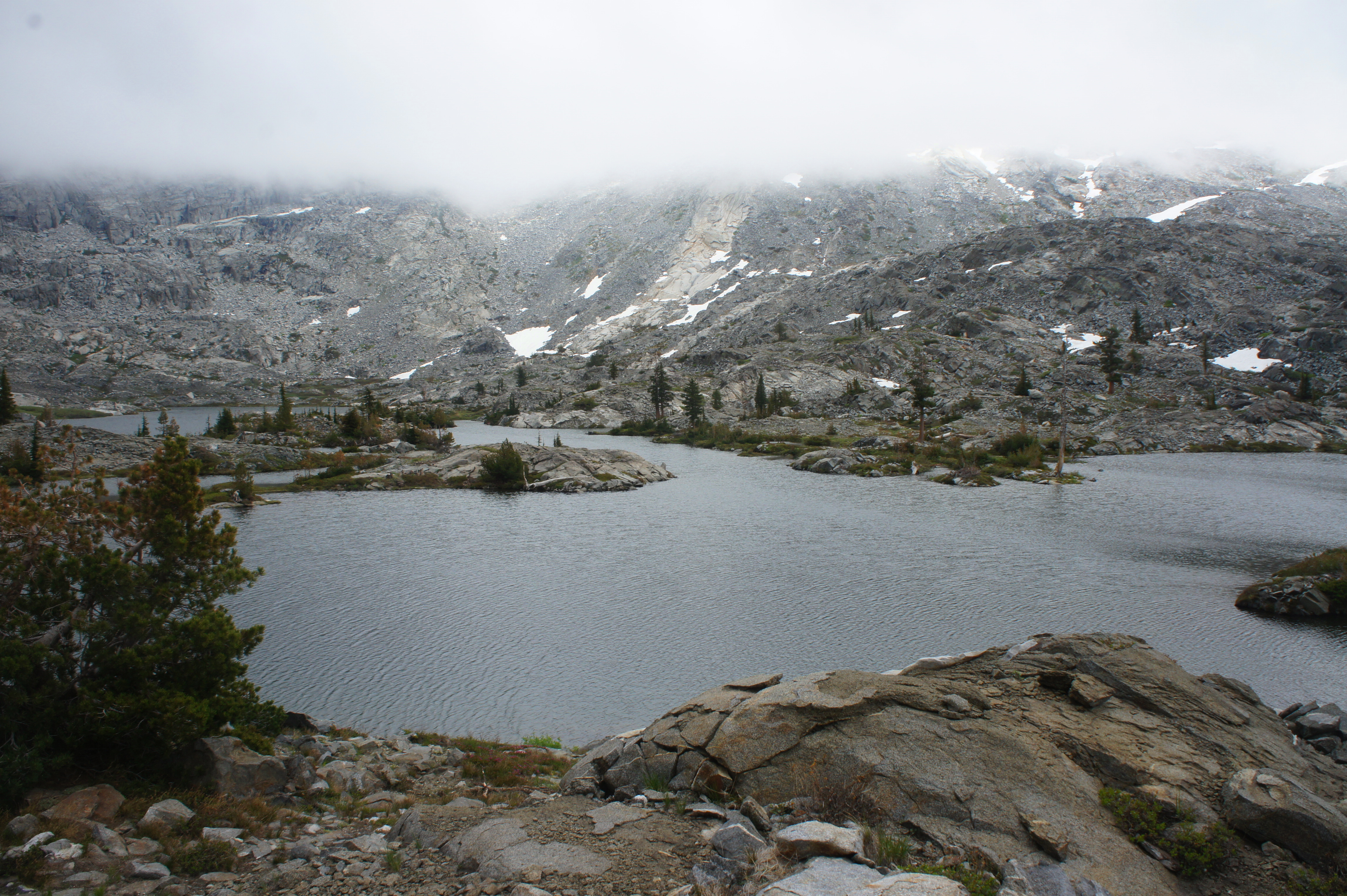
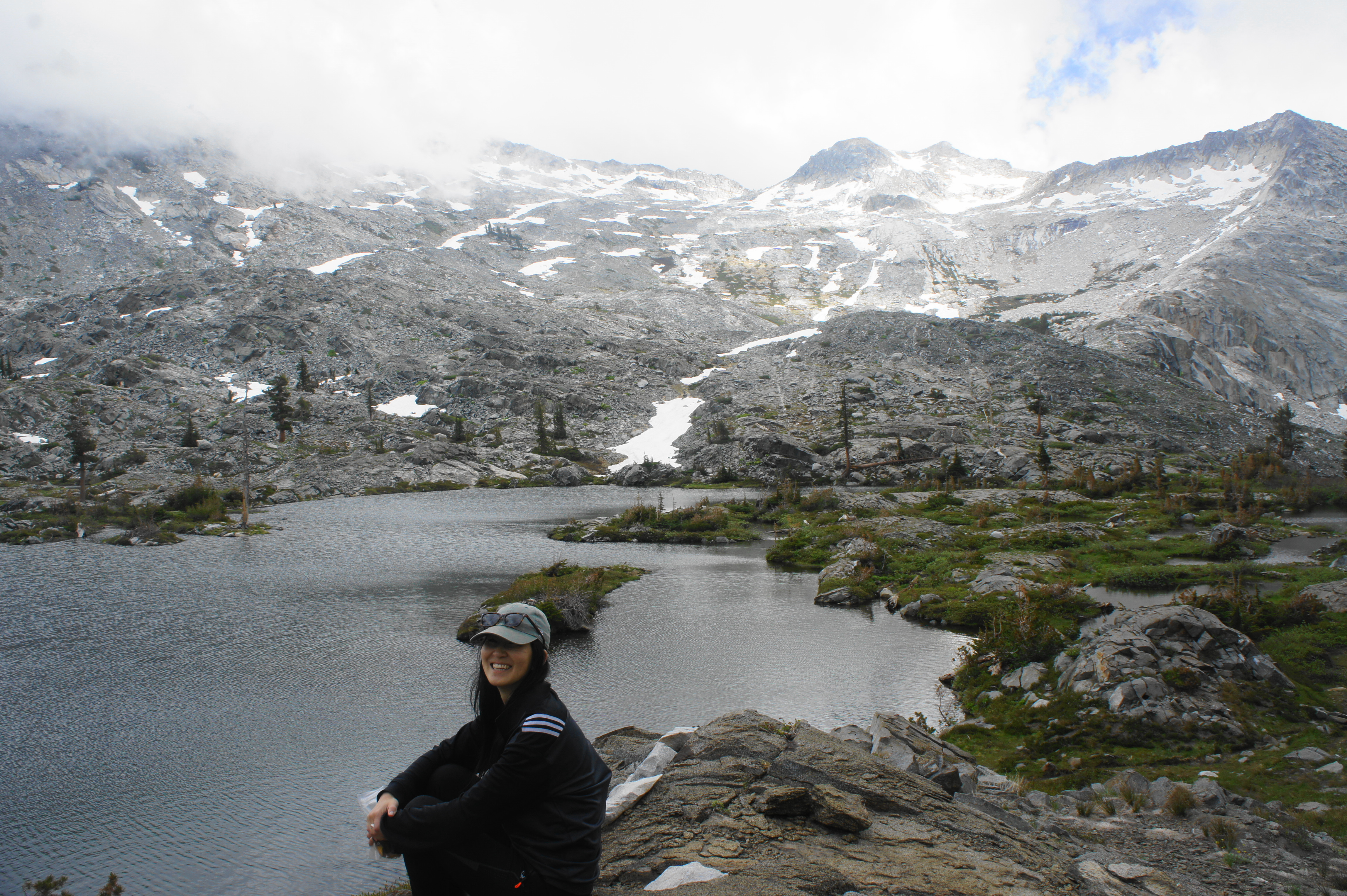
Island Lake 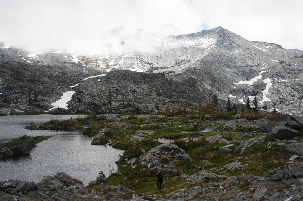
Lower end of Island Lake

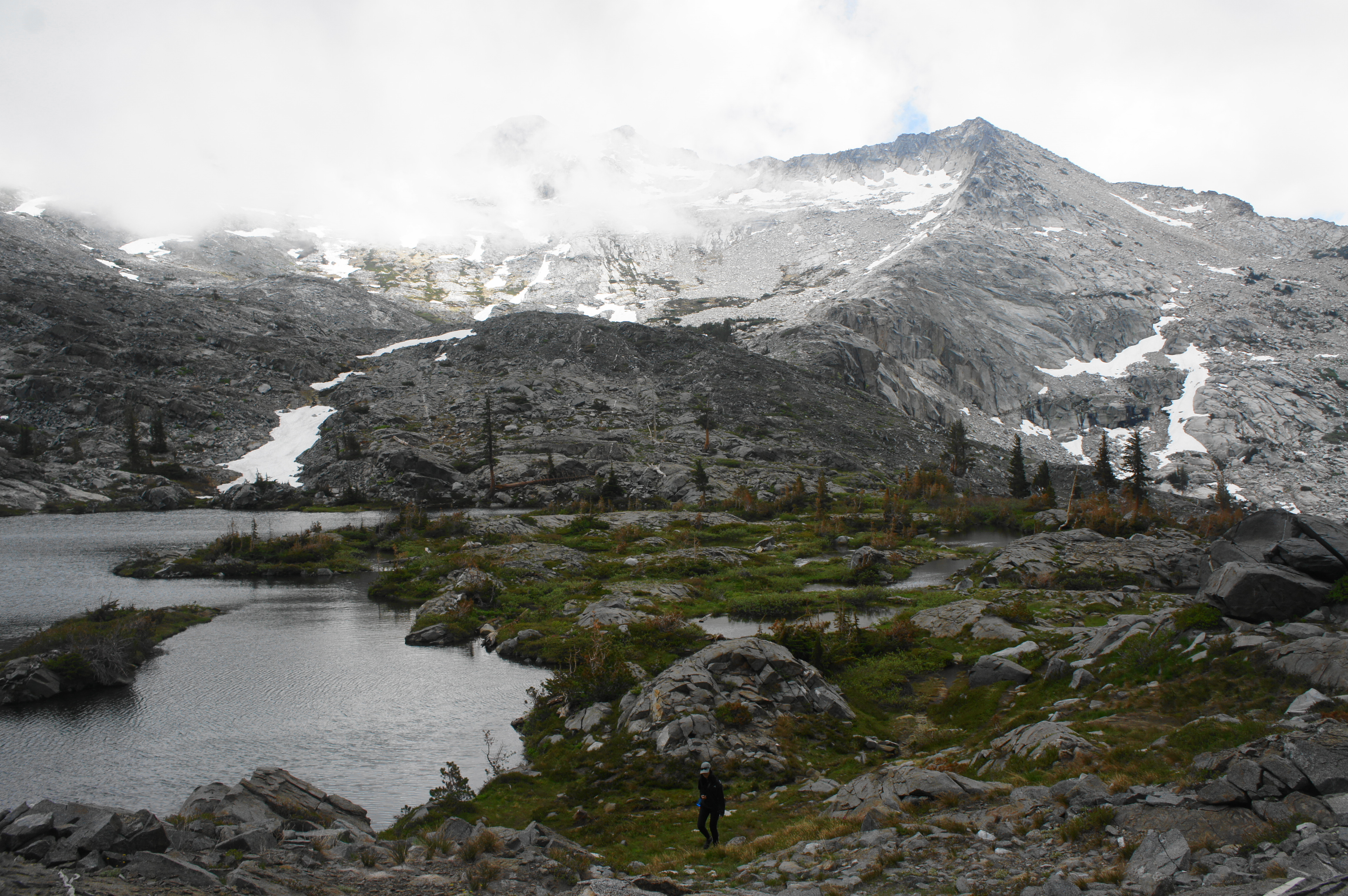
Island Lake is the largest lake (besides Wrights Lake) visited on the hike and is named for its various islets scattered across the water. The lake’s eastern shores signal the end of the trail, with onward passage obstructed by high walls and scree fields. This lake is situated deep in the Crystal Range, surrounding on three sides by towering peaks and knobs rising to nearly 9,500 feet above sea level. Although still relatively low elevation by Sierra Nevada standards, this looks and feels like high alpine terrain.
After enjoying Island Lake, return the way you came, retracing your steps back past the other bodies of water. Continue as the trail descends back toward Wrights Lake, eventually returning to the Twin Lakes Trailhead, completing the 7-mile round-trip hike. All told, this hike can be done as an overnight backpacking trip but also as a day hike lasting about 3-5 hours.

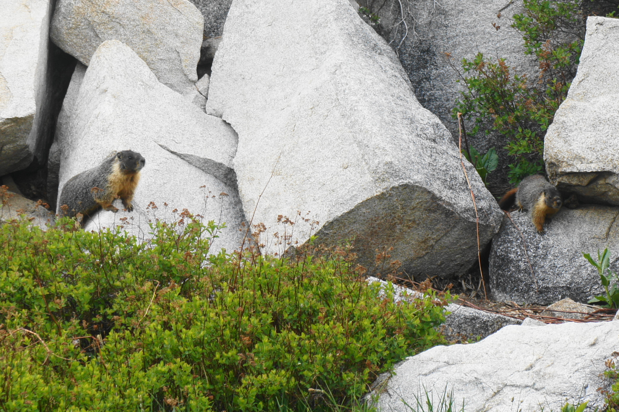
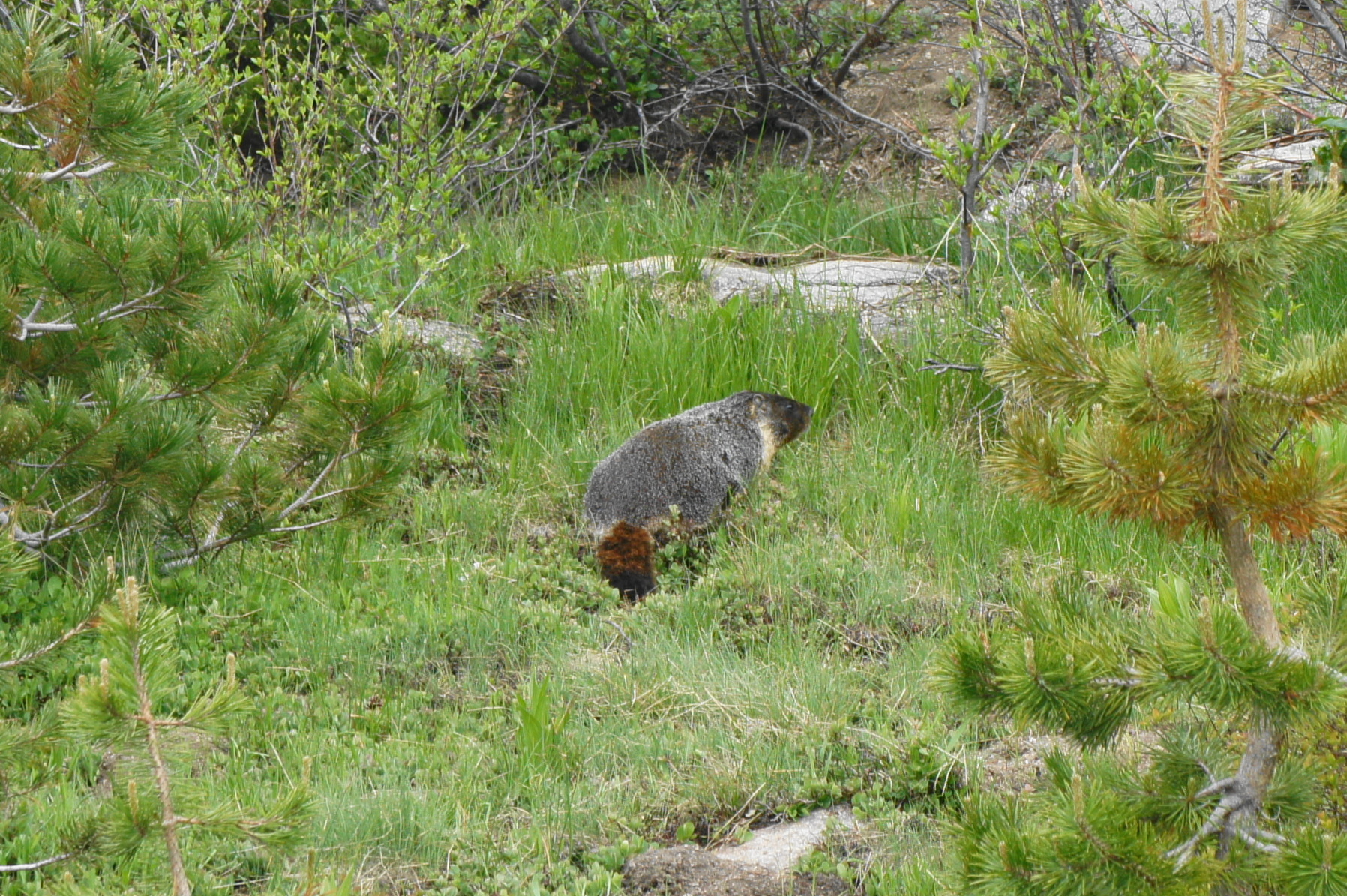
Yellow-bellied marmots 
Marmot pics!

Beauty! Is dispersed camping along the trail doable (without being too exposed), or are the campsites shown on the side trails the best bet? Thanks for sharing!
Hi Mark, we saw folks camping along some of the spur trails off of the main trail at Twin Lakes and Boomerang Lake. The latter had some nice sites on the opposite side of the lake. As long as you have a backpacking permit and camp in a previous disturbed area, you should be good.
Stop blowing up our spots up here! I know these are readily available to read about in books but that’s the magic. Grab a trail book and search out your adventure… But now the internet is full of people geotagging these places making them crowded and trashed. This place is magical and has been for years… And always will be. Now when I go up there I take home more trash then I want to carry. #stopgeotagging
Ali, thanks for reaching out; I appreciate the sentiment and of course agree that overcrowding and trash on trails is an issue, but I don’t necessarily agree with your approach of shaming. You’re basically asking me to stop blogging, which is silly. Feel free to reach out via email (liveandlethike@gmail.com) to continue the discussion in a more appropriate forum.
Pingback: Top 10 Hikes in 2021 | Live and Let Hike
Note that the map you’ve used shows two campsites at Grouse Lake. This lake is officially closed to all camping.
Ok this is taken from AllTrails, which I used to do the map. Perhaps they will update.
Beautiful, and are these ladies fishable
I assume so yes