
Kings Canyon National Park, Sequoia’s adjacent sister park to the north, boasts skyscraping mountains, majestic granite formations, serene valleys, and spectacular wilderness best explored on a multi-day backpacking trip (such as the Deadman Canyon Loop, Rae Lakes Loop, or John Muir Trail). But for those without the time or energy to commit to overnighting, do not despair! There are also a handful of scenic day-hike destinations, lighter forays into the granite-topped wilderness, where the streams and lakes are plentiful and wildlife abundant. One such option is the 8-mile out-and-back to Mist Falls, a thundering cascade on the South Fork of Kings River and guardian of the peaceful Paradise Valley beyond. The first three-quarters of the hike are mild, with limited elevation gain, but the final mile packs a punch, ascending a hot and strenuous slope to the base of the falls. Cool off in the namesake mist, which—in spring and early summer—blankets hikers who get too close to the splendid waterfall. Expect a good chance of spotting black bears, marmots, and other local critters over the course of the hike.


The hike
Although the drive is paved and well-marked the entire way, the journey to Road’s End Trailhead in Kings Canyon is an adventure in itself. There is effectively only one way in and out: following the winding and circuitous Route 180 as it drops from Grant Grove and the Kings Canyon Entrance Station into a profoundly deep gorge cut by the South Fork of Kings River. (Note: The drive briefly leaves the park, traversing national forest land, before reentering Kings Canyon National Park. Allot an hour from Grant Grove to reach the trailhead.) Once down at the base of the valley, drive past Cedar Grove—where there is a campground, store, and small visitor center—and follow Route 180 to Road’s End, parking near the ranger station and wilderness permit office. This is a popular trailhead for both day hikers and overnighters, who venture east and north into the wilderness.
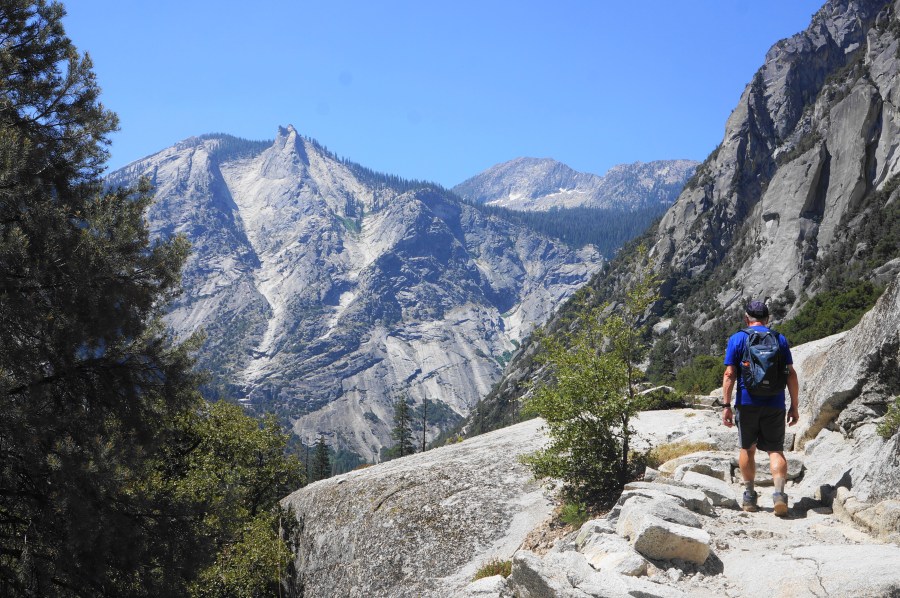
The route to Mist Falls is effectively a four-mile dogleg left, following the Kings River valley as it wraps around Buck Peak (8,776’). The riparian landscape makes this a very pleasant hike with plenty of water, though the relatively low elevation (5-6,000 feet) can mean blistering summer temperatures. Be prepared for sun and heat, which may not feel debilitating during the hike’s easy first two miles—but can catch up with you when the route suddenly starts climbing fast.
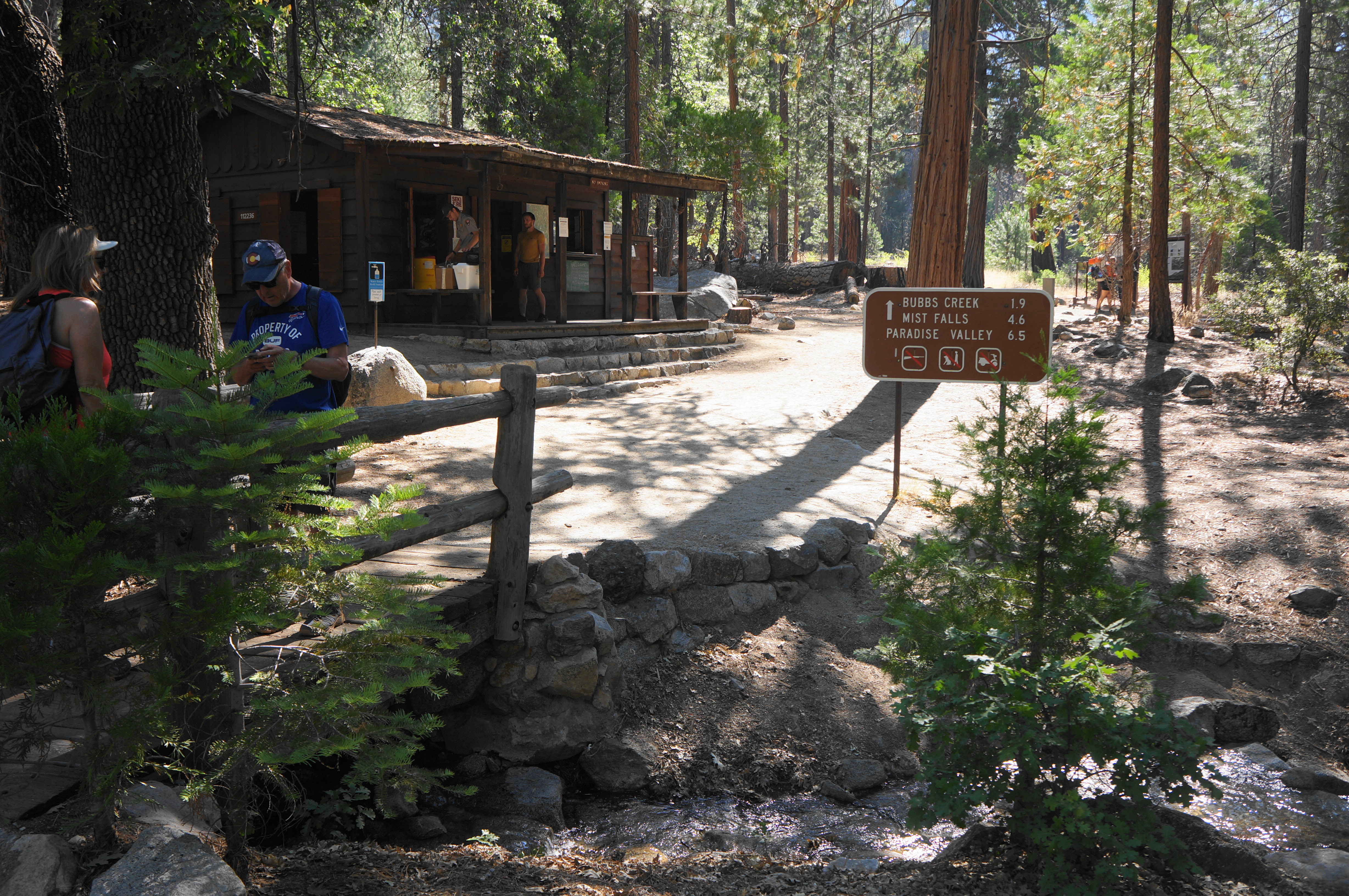
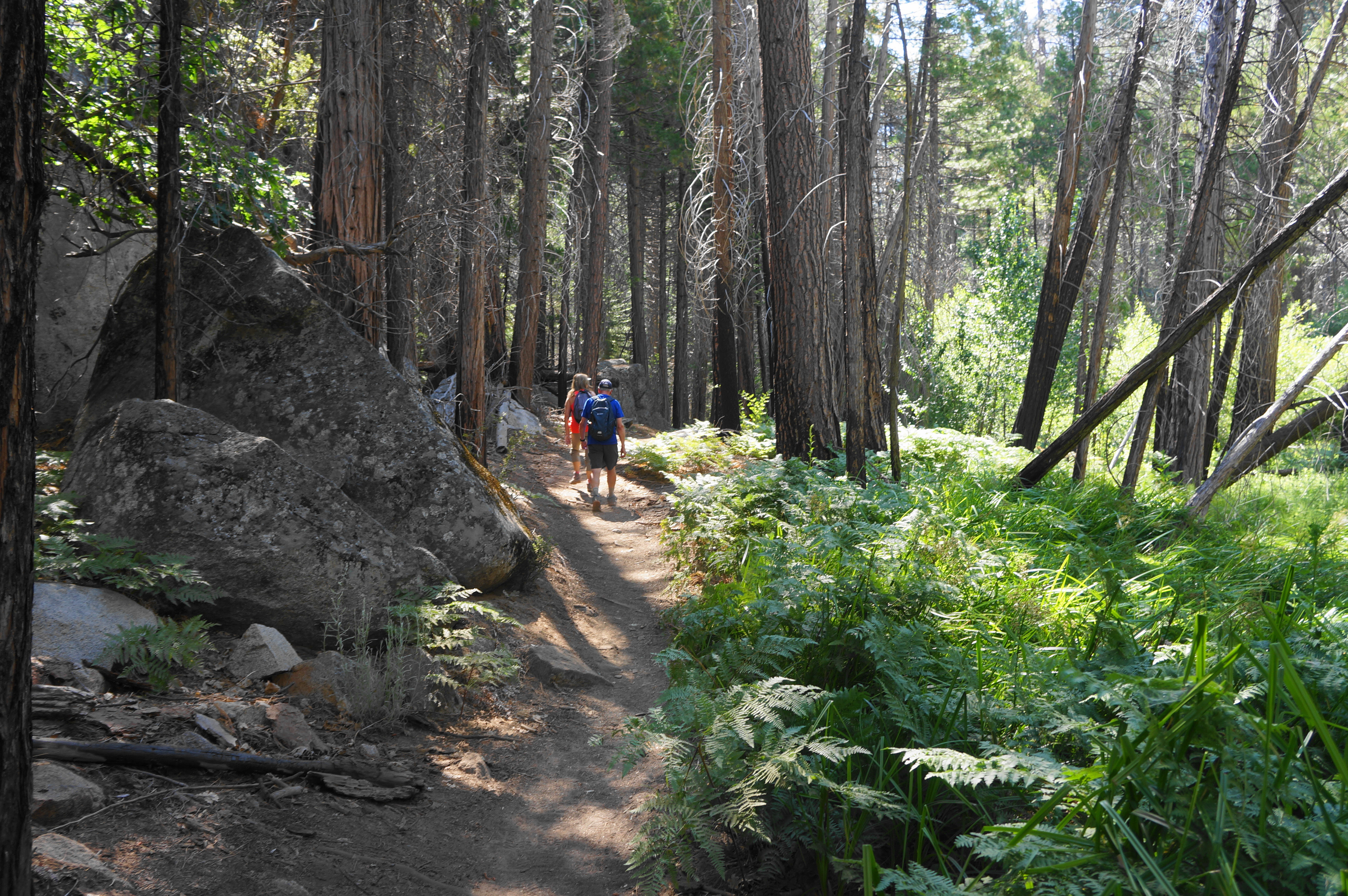
From the ranger station, positioned just left of the Paradise Valley Trail, head east, following signs for Bubbs Creek and Mist Falls (the distances, however, seem to be incorrect, overestimating the length to the falls by about 8/10 mile). The shaded path quickly traverses a short bridge over Copper Creek at 1/10 mile, then continues on a level floodplain above the Kings River. Sporadic open meadows afford initial views of the granite canyon walls to the south and east, revealing a version of Yosemite Valley (with a fraction of the crowds).
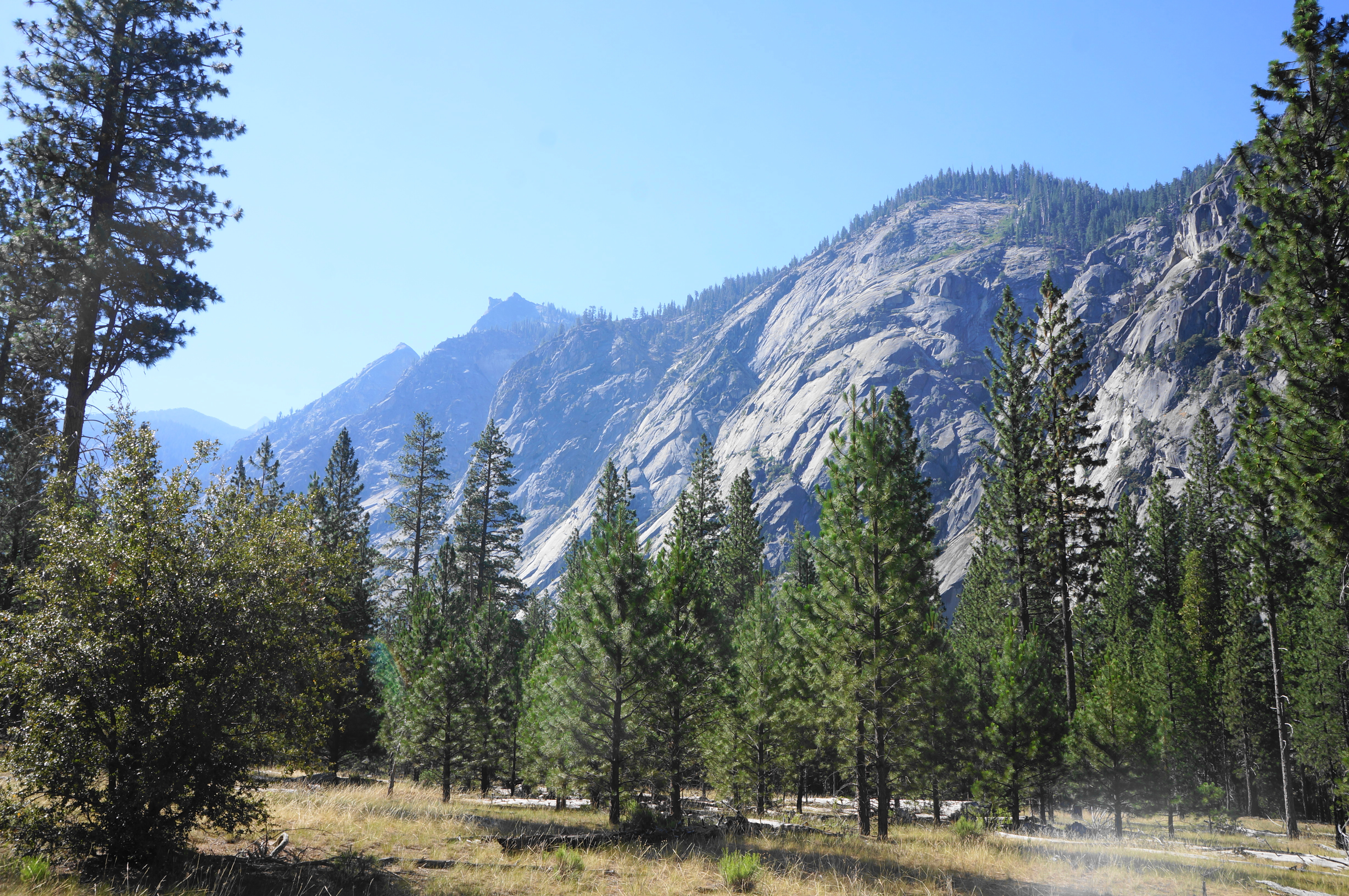
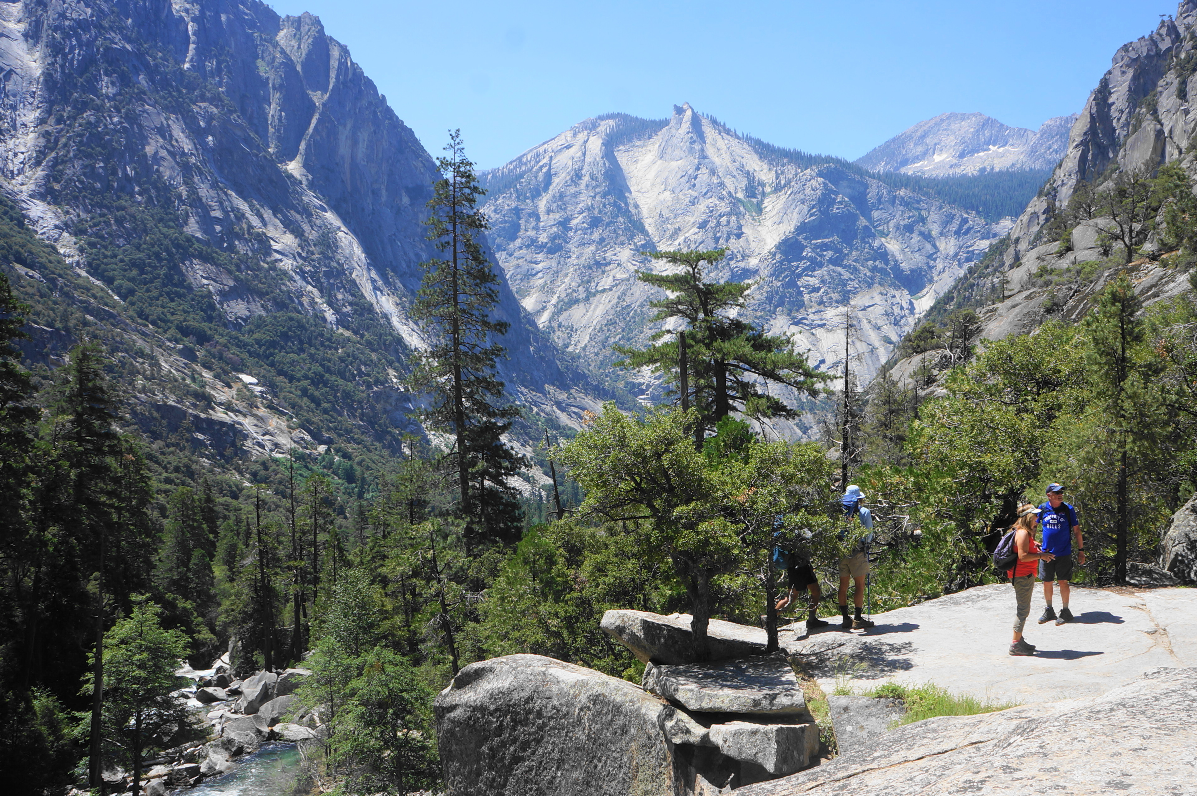
Continue amid ponderosa pines and boulder chunks, out of view (but not earshot) of the river, as the trail edges eastward. Cross a manzanita-studded meadow at around the one-mile mark, by which point a named feature—The Sphinx (9,146’)—has come into view up-river.
By around 1.5 miles, hikers enter a mild descent amid shady cedars and clumpy boulderstones. Here the trail gradually begins to turn north, traversing a lovely, shaded flat with horsetail and ferns on the right (but also mosquitoes!). Cutting through the fernscape, the Paradise Valley Trail passes outcrops on the left and eventually finds its way to a trail junction. The wider track bears right, eventually dropping to a bridge over the Kings River—this is the Bubbs Creek Trail, which connects with the Kanawyer Loop Trail and offers access, many miles ahead, to Vidette Meadow, Glen Pass, and the John Muir Trail.
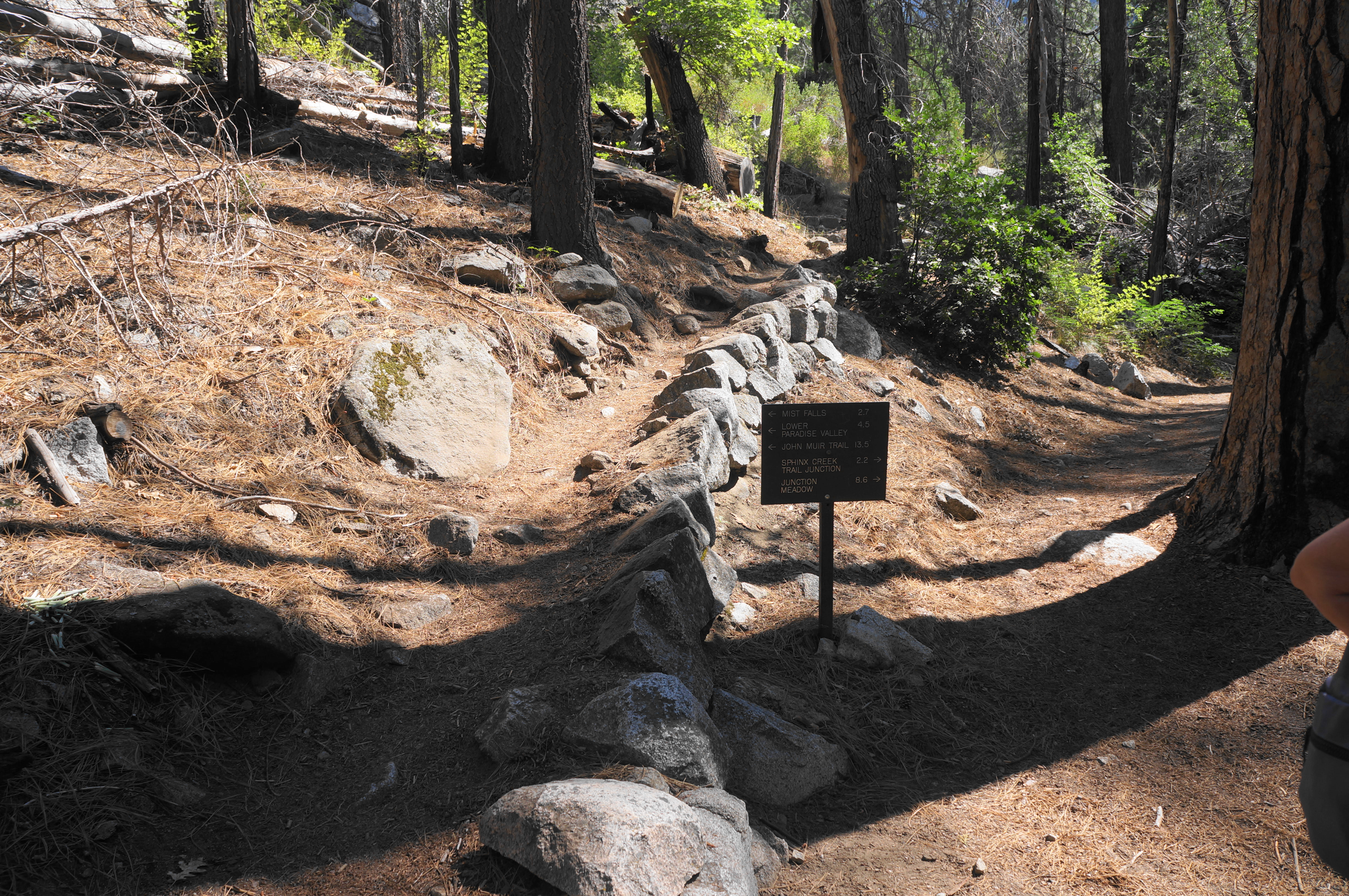
The route to Mist Falls, however, continues left, on a much narrower track that begins to ascend right away, a bit of a jarring change after nearly two miles of very easygoing walking. After a set of stairs, the incline eases and even descends again, coming back within reach of the South Fork. Here the river is cascading and crowded with fallen timber; stop here for a snack and rest before continuing on to the more challenging section beyond.
After another 1/3 mile of lovely walking through a riparian environment, the Paradise Valley Trail cuts through a small boulder field then returns to woods with less undergrowth. Paralleling the now-roaring river, the trail begins to ascend at a greater clip around 2.75 miles.

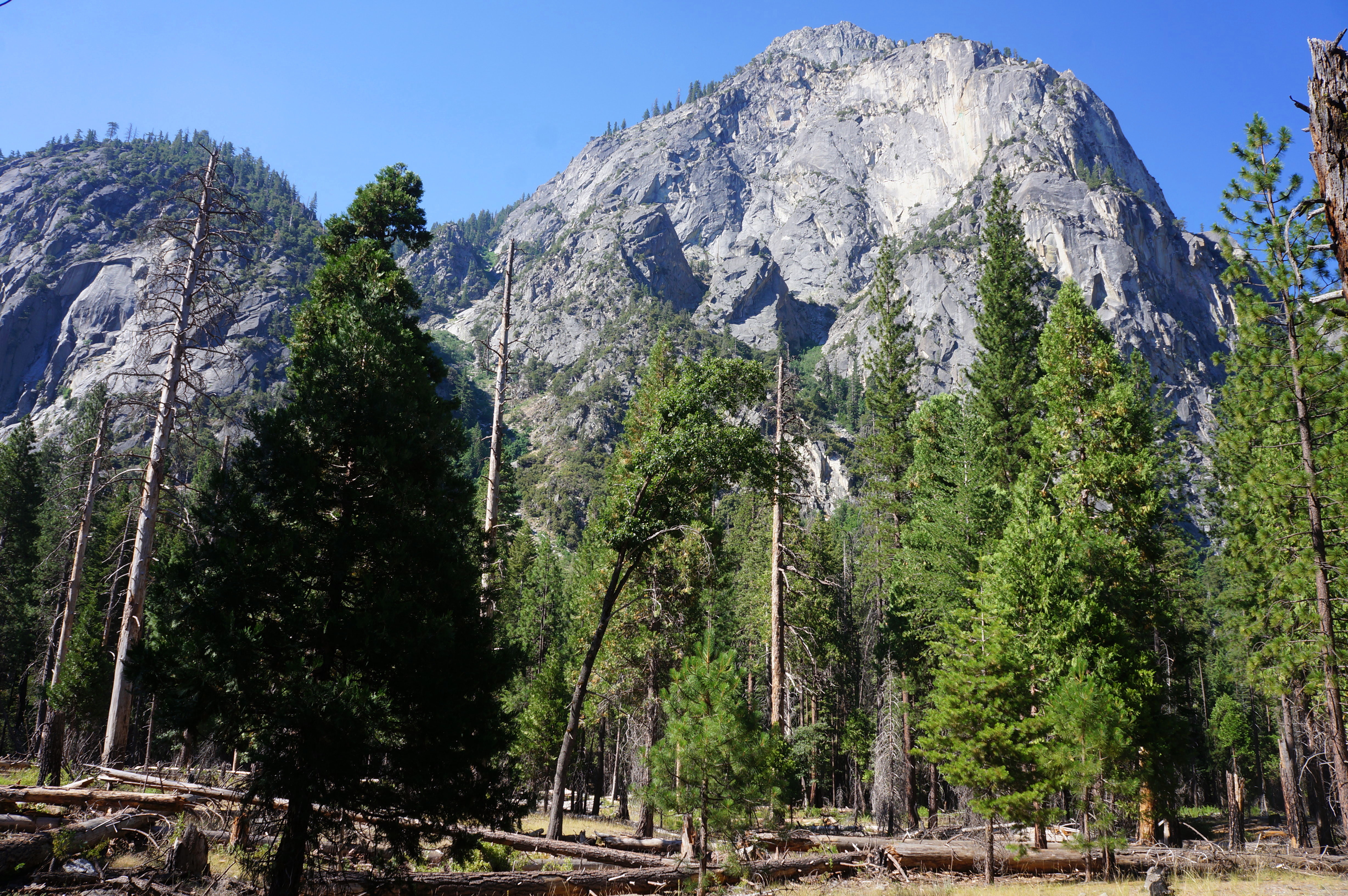
The real work begins around mile 3, when the trail ascends steadily and suddenly comes parallel to a thundering set of cascades on the right. This vantage point is worth checking out but is only a taste of what is to come.


Rise up a set of stairs to a beautiful area with small turquoise pools and intermittent cascades, then, steps further, enter an open section where one can start to make out the contours of the canyon ahead.

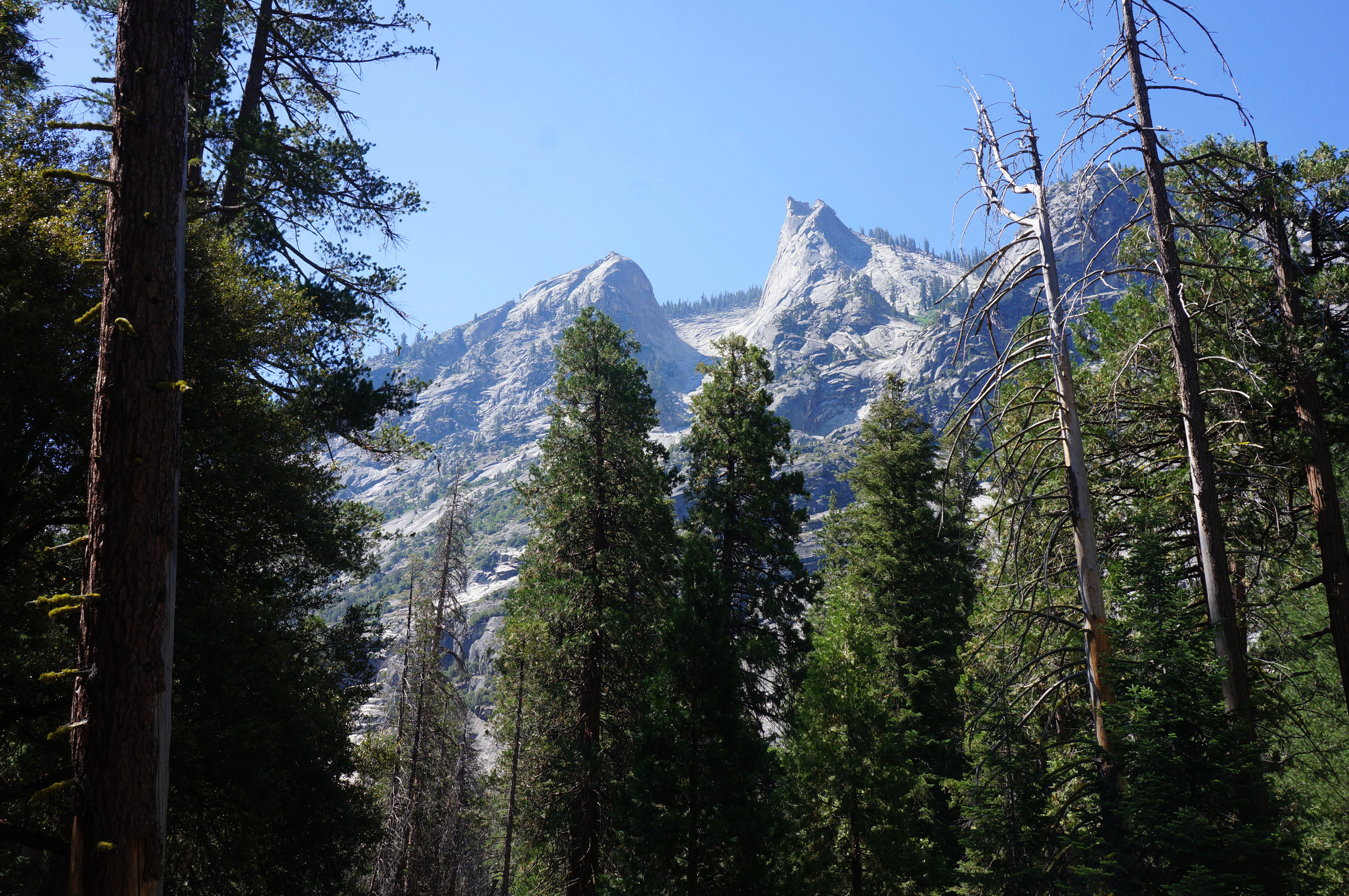
This marks the beginning of arguably the most stunning portion of the entire trip: after swinging back and forth toward and away from the river, the trail rises up a slickrock slope with the hike’s best views back to the valley to the south. The V-shaped canyon perfectly frames the granite knobs of The Sphinx, a highly photogenic sight.
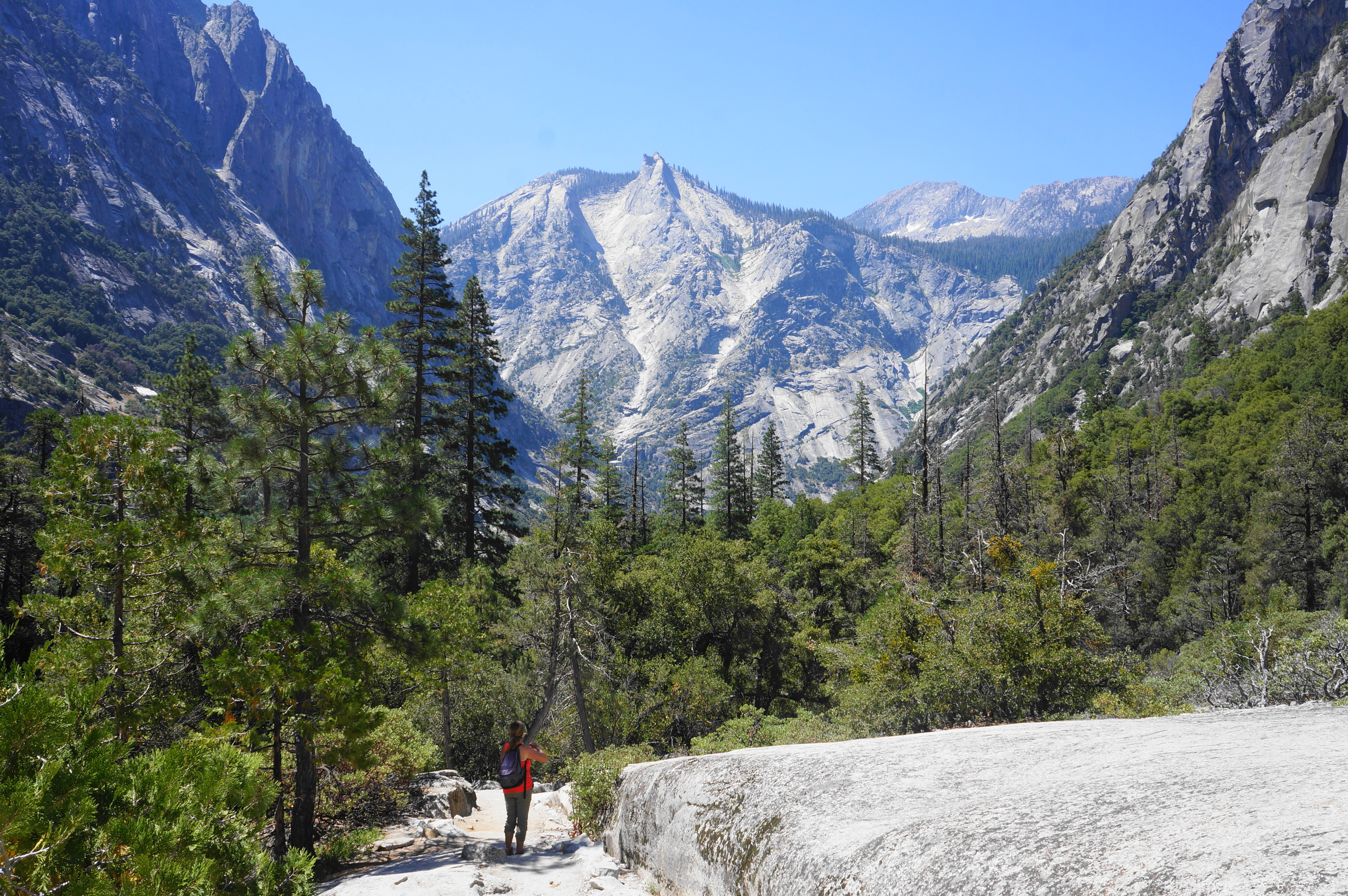


The vistas continue to improve as hikers work their way higher, offering motivation amid the challenging climb. Past the slickrock section, the track ascends to an outcrop overlooking a booming drainage chute, an impressive (but unnamed) waterfall in itself. This is not Mist Falls, though it rivals the hike’s destination in power, volume, and roar.

Beyond this initial fall, the incline eases a bit, and the thick shade returns. It is about ¼ mile from here to the first look at Mist Falls, the terminus for the day hike. A small sign on the right marks the spot where a social trail begins, descending to the west bank of the river, set below the roaring waterfall.

Explore this area with caution, as the namesake mist blankets the rocks with moisture, making for slippery footing at best. In the dry season (late summer and fall), the flow at Mist Falls dissipates to a set of twin drops, but much of the year the water courses together into a thunderous flow. Look across the river for another drainage coming in to meet it—this is Gardiner Creek, which too boasts a set of smaller but still bellowing cascades.

Mist Falls will be the turnaround point for most, although ambitious day hikers can continue on, ascending another 700 feet to Paradise Valley, a tranquil spot popular with backpackers. For those content with returning to the trailhead, find your way back to the main trail and walk for 3.8 miles (this time largely downhill) to reach Road’s End.


All told, this challenging day hike should take 4-6 hours, leaving enough time in the day to do a little more exploring in the Cedar Grove area before heading back up Highway 180 to Grant Grove and beyond. Better still, spend a few days in Kings Canyon exploring some of the other trails.

Oh wow, this looks like a stunning hike!
Pingback: Top 10 Hikes in 2024 – Live and Let Hike