
This marks the first of a long series of posts from a cross-country haul in July-August from northern California to Washington, DC. Alas, after five years in California, it was time to return to the east coast. After heading north from the Bay Area, day two brought me back to the magical spruce-studded headlands of the Oregon Coast, which I had partly explored three years ago in a splendid winter getaway.
Pushing north past Brookings, Gold Beach, and the Samuel H. Boardman State Scenic Corridor, the next notable destination is Humbug Mountain State Park. The main attractions here are the large coastal campground and lovely beach on the Pacific Ocean. However, it is also possible to stretch your legs on the moderately-challenging Humbug Mountain Trail, which summits the park’s namesake, one of the state’s highest ocean-abutting peaks.
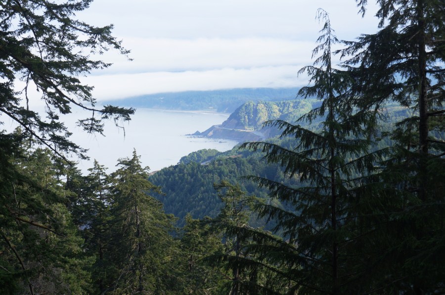
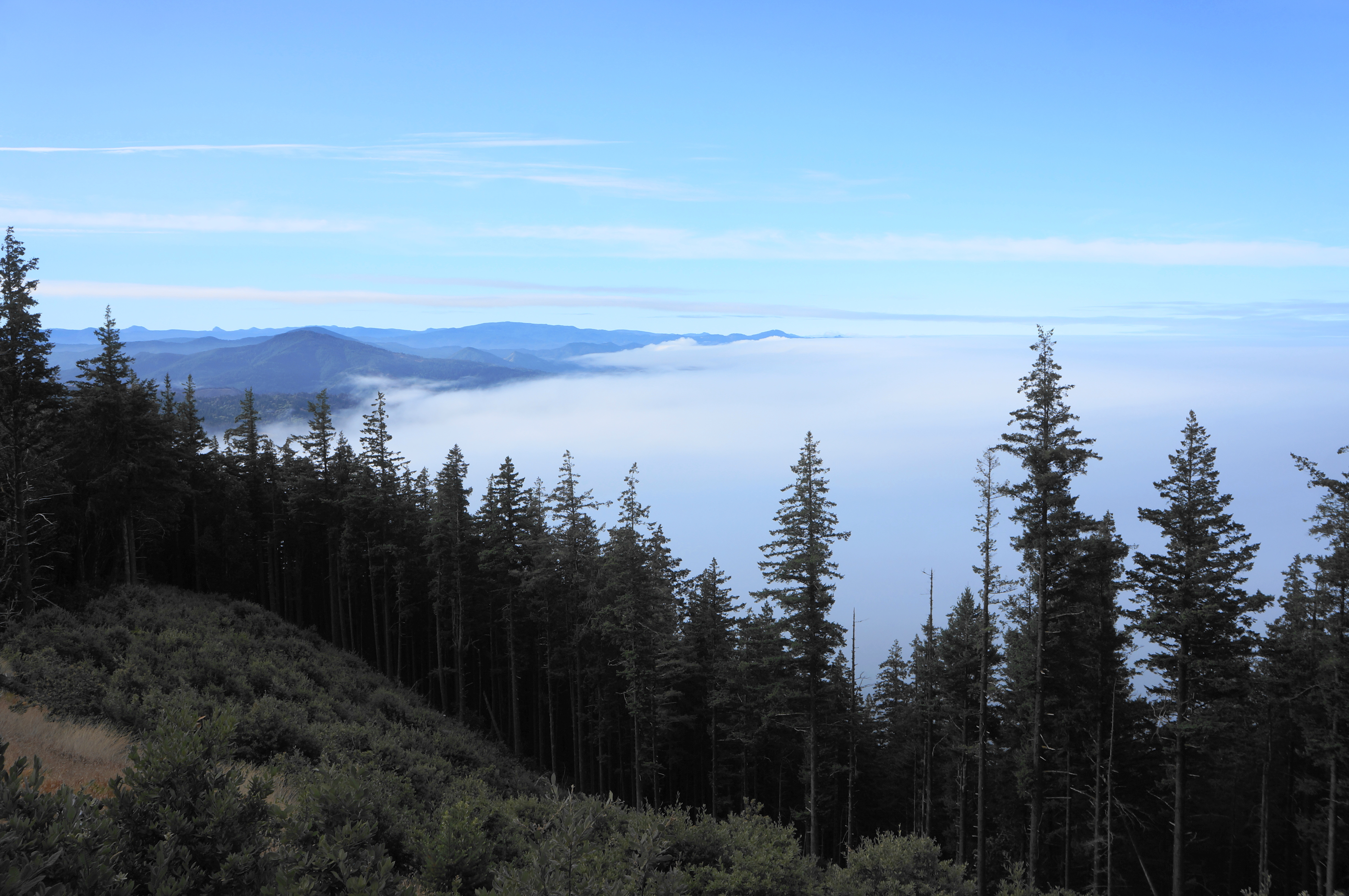
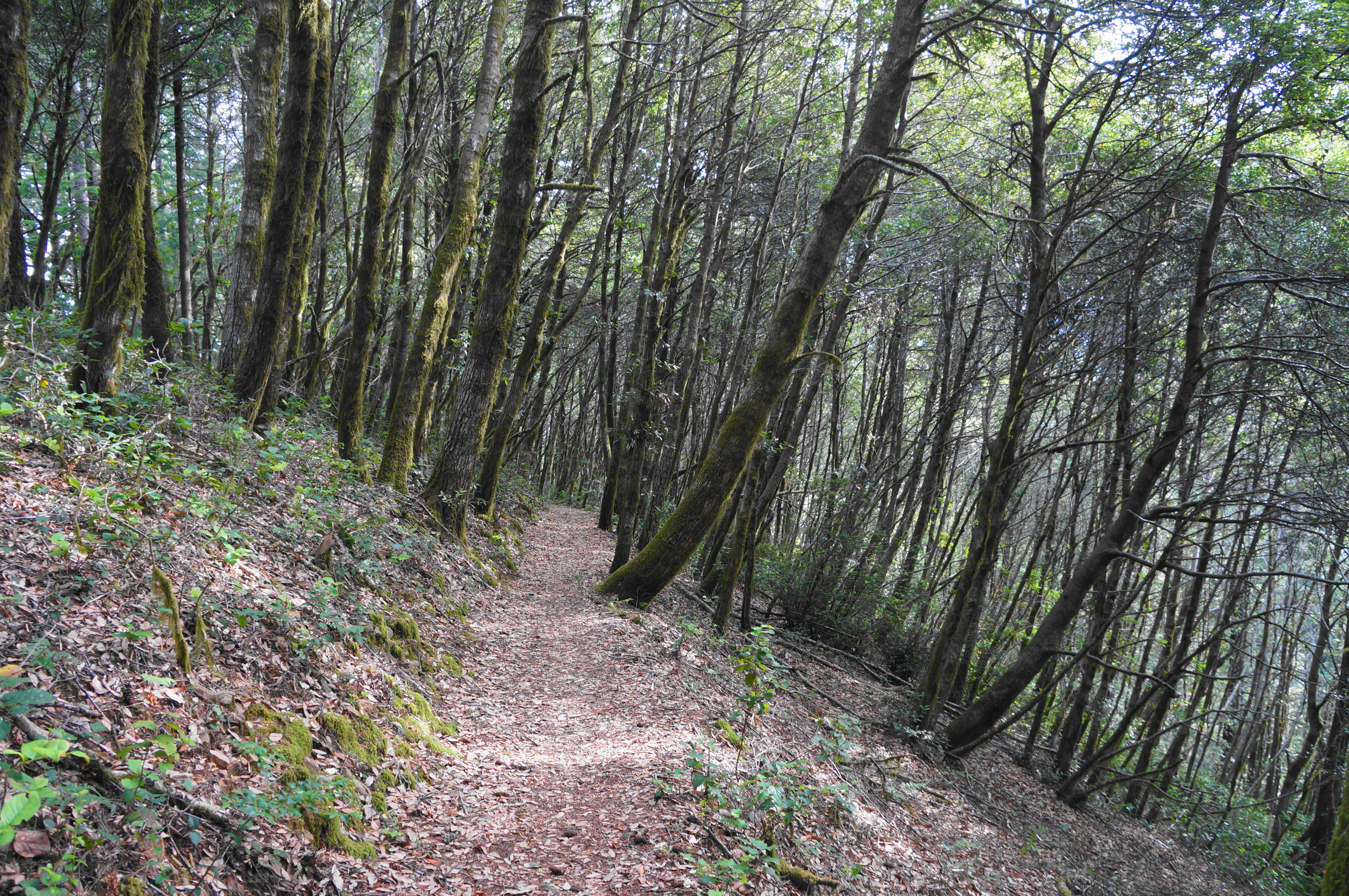
On (the somewhat rare) sunny days, hikers enjoy terrific south-facing views toward Ophir and Gold Beach. But the largely-wooded hike is enjoyable on its own for its lush collection of conifers, maples, and ferns. Expect to break a mild sweat on the stem-and-loop, which gains and loses more than 1,700 feet.


The hike
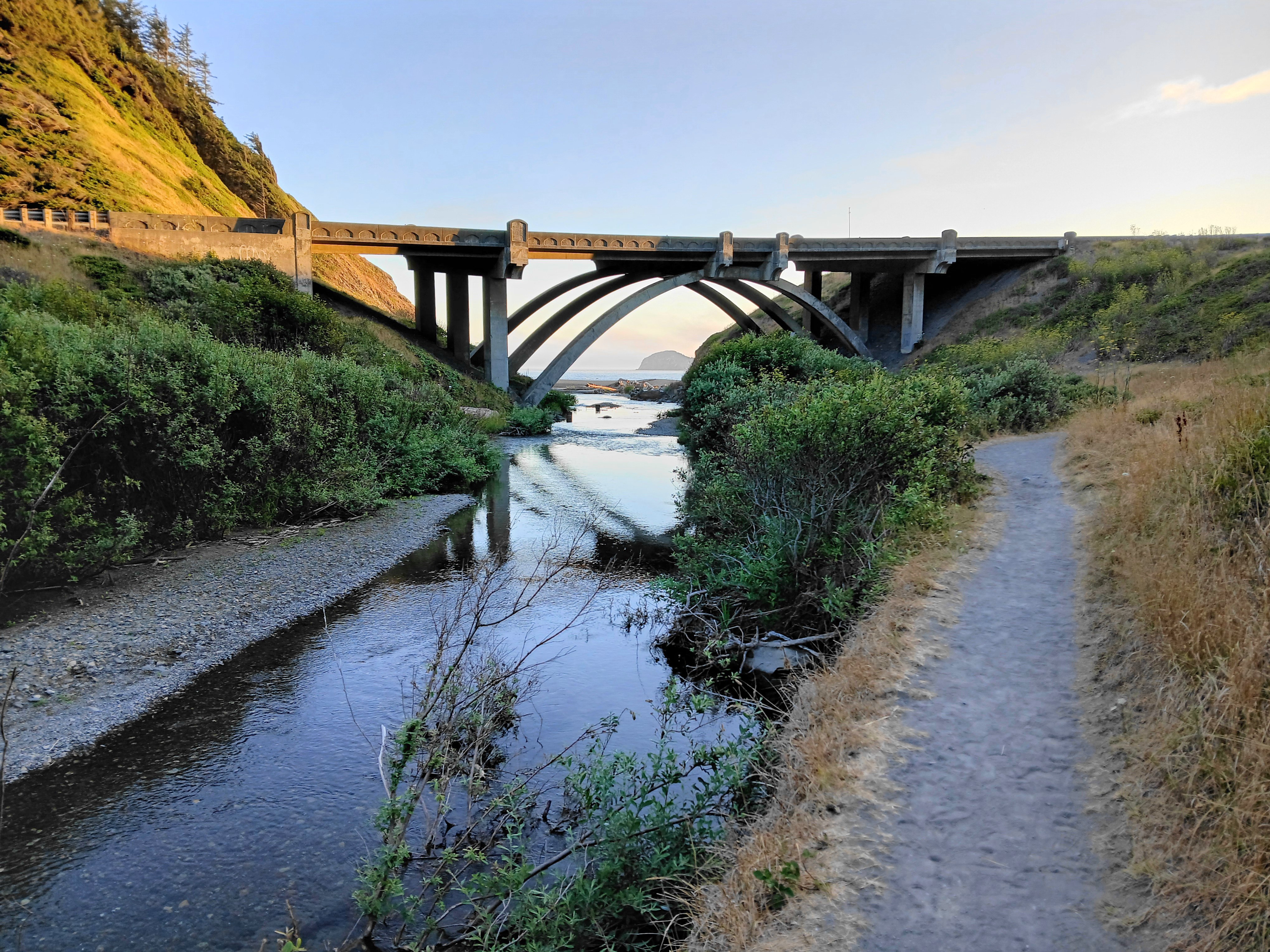
Highway 101—the Oregon Coast Highway—runs straight through Humbug Mountain State Park, following the Brush Creek drainage as it flows from the Coast Range into the ocean. The trailhead and campground are a six-mile drive from Port Orford and 23-mile journey from Gold Beach, both quaint seaside hamlets known for their fresh seafood and misty weather. Once in the park, look for a marked trailhead on the south side of the highway as 101 cuts through the heart of the park (west of the main entry to the campground). (Note: Or, if staying at the campground, there is a short connector route that leaves from a spot just east of Site 95.)

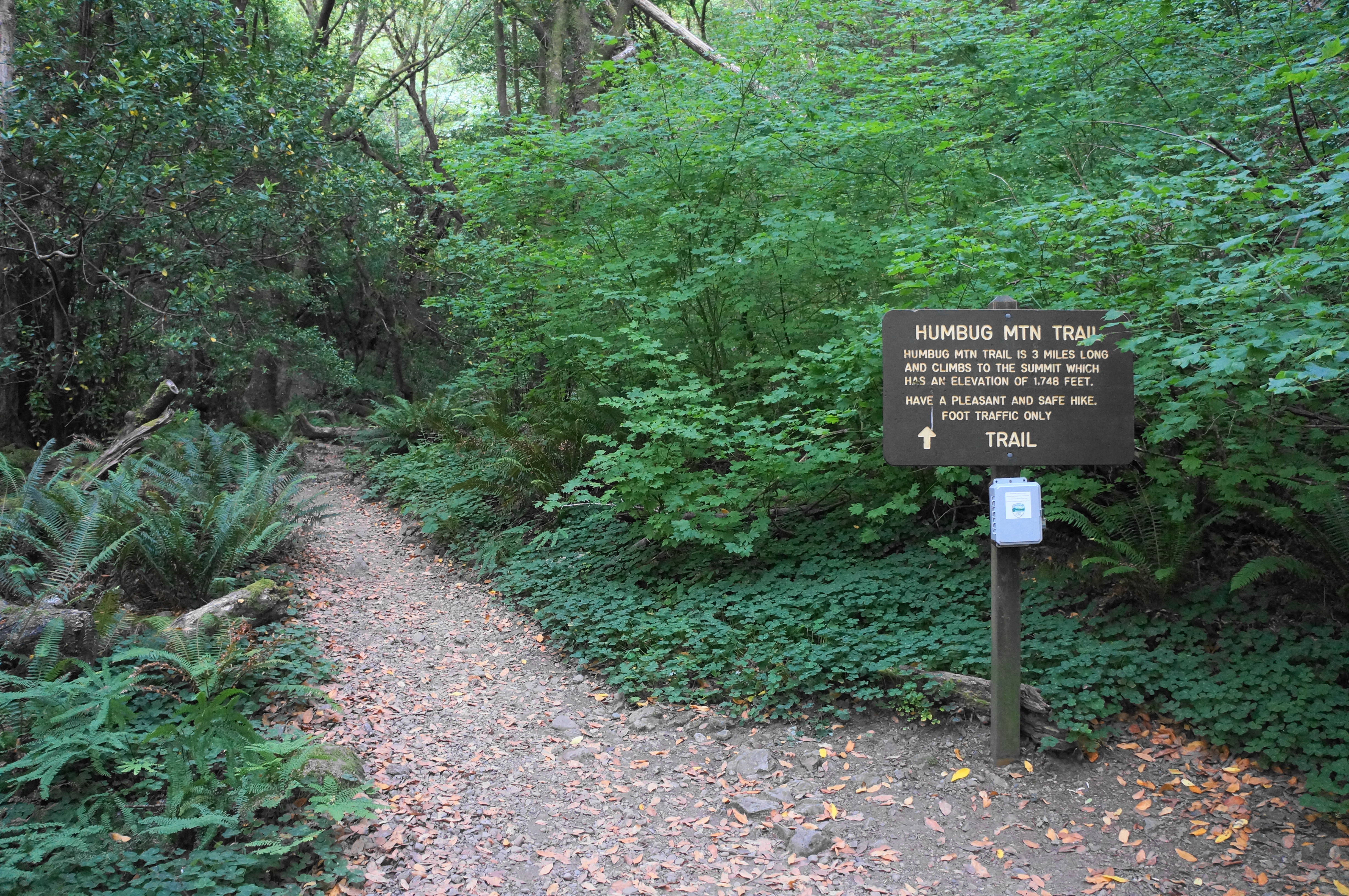
The Humbug Mountain Trail begins and ends from this gravel lot. Head up the dirt singletrack as it enters the dense forest, passing a trailhead kiosk, the campground connector path, and a sign indicating that the trail is “3 miles long.” (Note: This is a little deceptive, as the full loop makes it shorter, amounting to about a 5-mile round-trip.) Rising from about sea level, the 1,700-foot climb sounds daunting but, in reality, comes relatively gradually—enough to get the heart pumping but not to push hikers to a point of exhaustion.

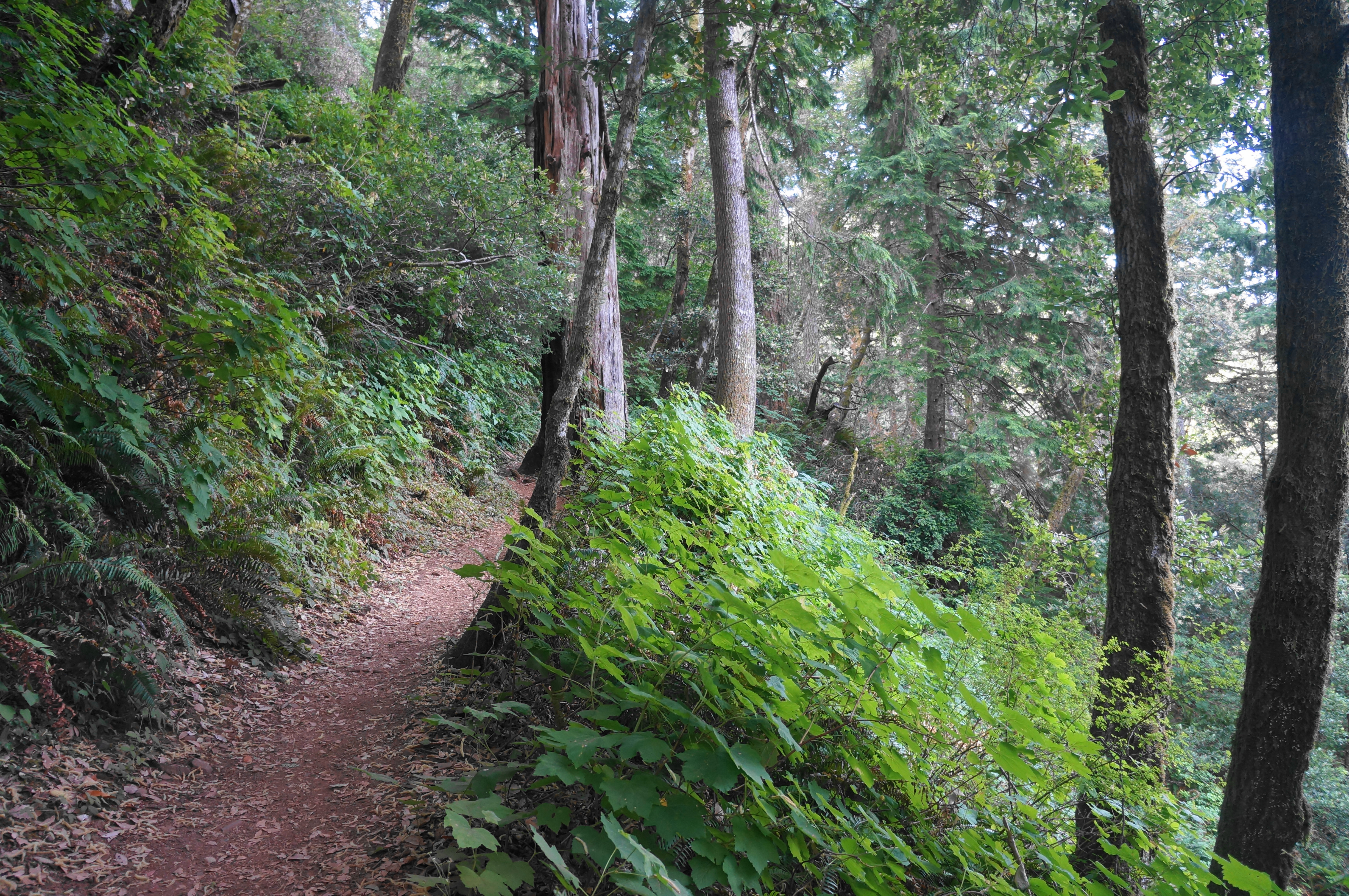
Cross a seasonal, fern-lined stream, then begin to climb sharply up to the left. Walk through a dense mixed forest of bay laurel, oak, maple, and Douglas fir, with a variety of ferns—including five-finger (maidenhair)—blanketing the north-facing slope. Some limited views of the valley formed by Brush Creek come into shape at around 2/10 mile. Head into a set of two wiggles, then pass the ¼-mile marker, followed by a steep incline and a right-hand switchback. With the trail now heading back westward and south, hikers can see a bit of the ocean to the northwest.
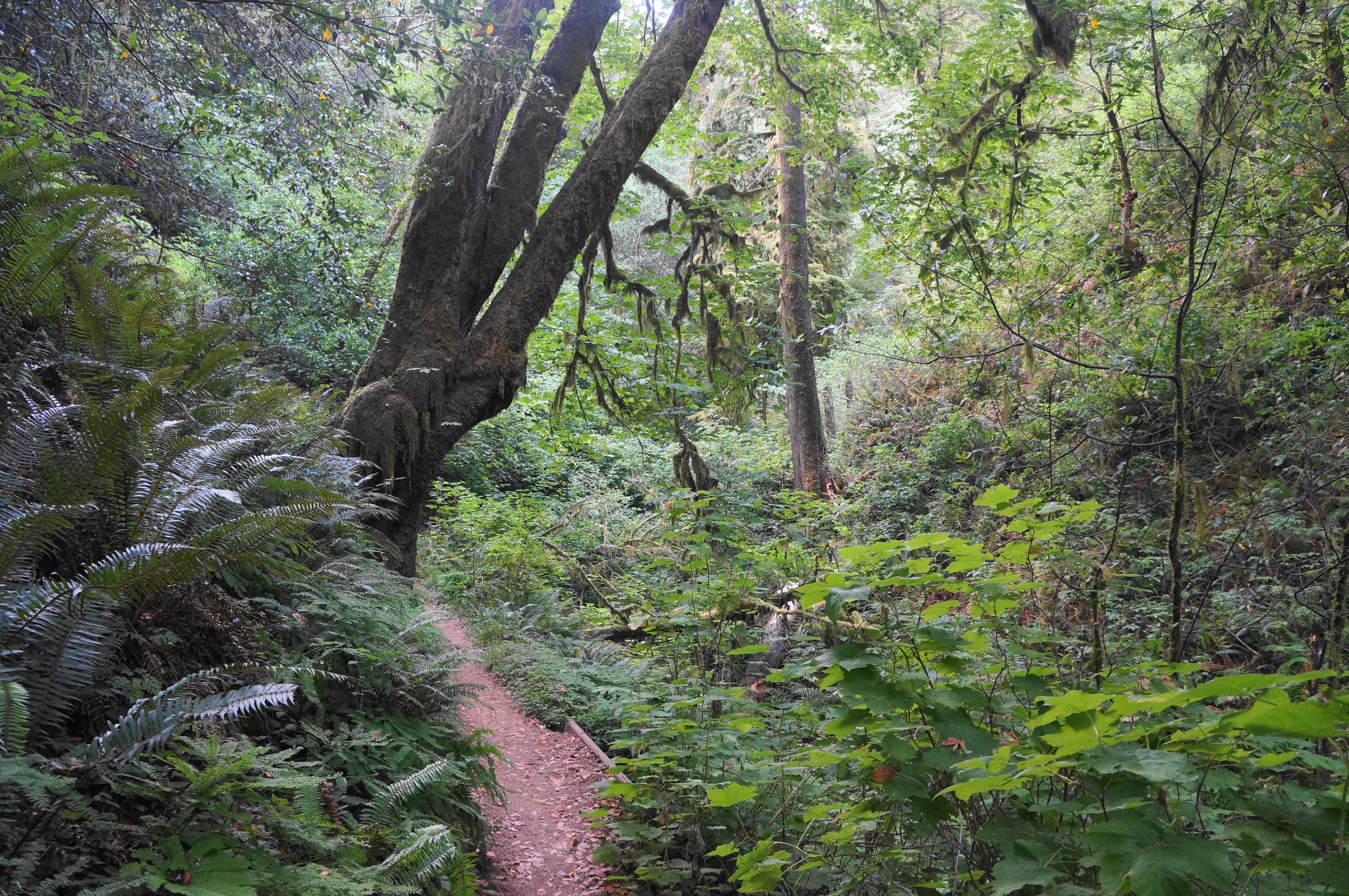
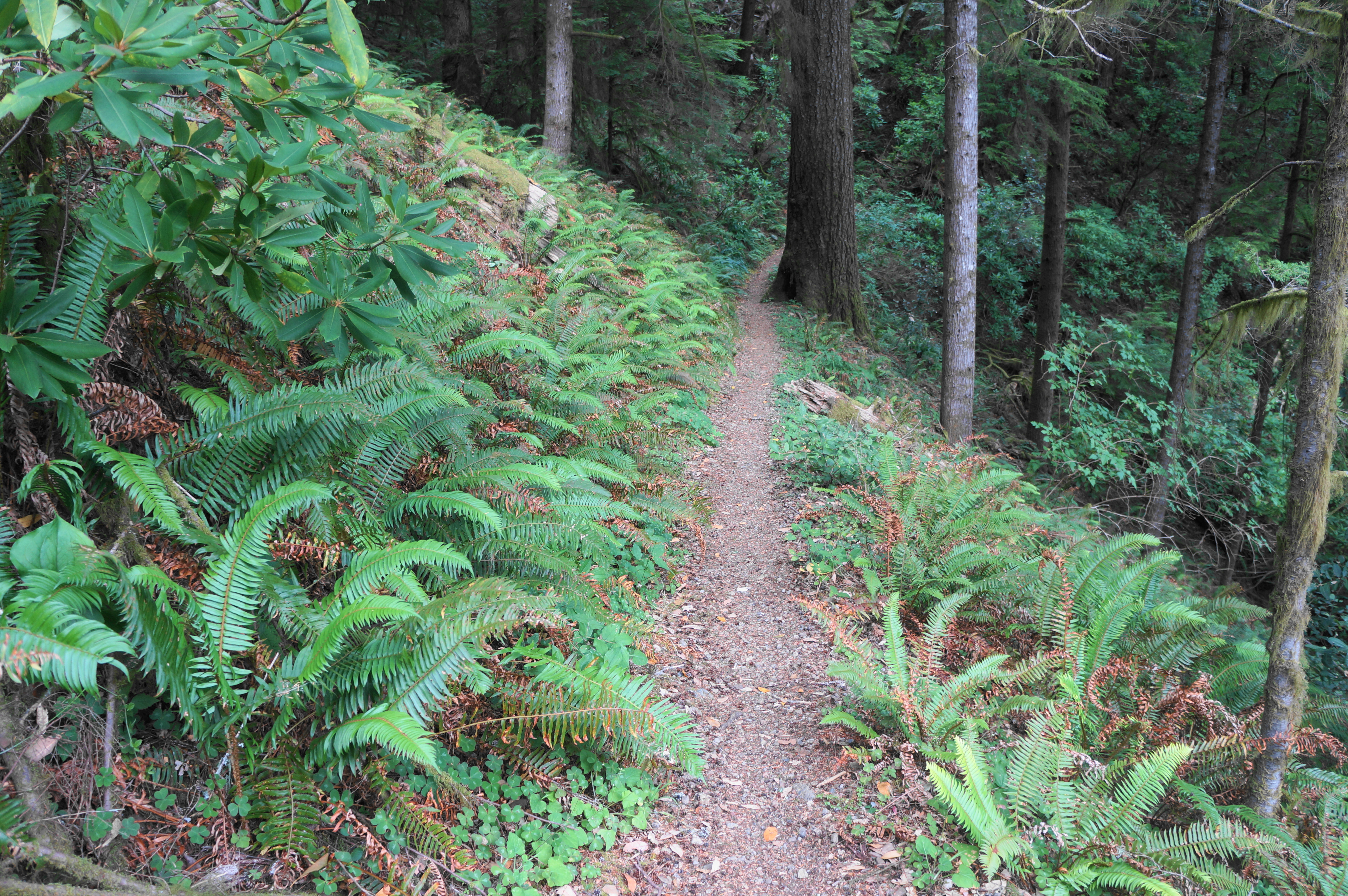
After the ½-mile marker, the route enters a leafy ravine. Round the gully and ascend to the ¾-mile post, stopping for a breath in the middle of the hike’s toughest stretch. Continue westward and around a bench to a trail junction. This marks the start of the loop portion, with the so-called Western Route heading left and Eastern Route bearing right. Stay left, taking the Western Route first as it hugs a west-facing slope, putting the Brush Creek area out of view. By now hikers have gained around 700 feet in elevation.

Soon pass the one-mile mark and round another ravine with distant coastal views between the thick firs. A couple more viewing windows tease hikers before the trail is swallowed up again by the dense forest. The ascent is mild for about a half-mile or so, but it picks up again at around 1.5 miles. Ascend a pair of switchbacks, coming to what feels like the summit—only to find out this is merely a ridge on the larger behemoth that is Humbug Mountain. More than 500 feet of elevation gain remain before reaching the top. Bah Humbug!


While rounding a few more switchbacks, hikers get their first (highly-obscured) east-facing vistas. Passing the two-mile mark, wind through a set of short squiggles across the ridgetop, with several coming in quick succession. Rise to clear another false summit, then approach a post at 2 ¼ miles. It is a short walk from here to the route’s second trail junction. (Note: As of July 2024, this area was passable but littered with debris from a recent storm.)


The Western and Eastern Routes meet at this fork, with a short spur heading right that leads to the top of the mountain. Take this detour as it turns into a short loop of its own, rounding to a trifling meadow and summit of Humbug Mountain (1,761’). The ever-so-modest clearing is enough to afford some far-reaching views southward along the southern Oregon coast. There are several wooden benches at the site.
When ready, find your way back to the trail junction, evading the fallen trees and thick brush. At the junction, look for a path heading downhill, away from the Western Route. This is the start of the Eastern Route. While the initial track is a little blurry, it soon comes into form as the trail exits the summit area, coursing around to the east side of the mountain. Round a left-hand bend and continue north, continuing to gradually shed elevation. Settling into a pleasant downhill, bear west and clear a sharp switchback at about 2.5 miles, passing through patches of bay laurel and Sitka spruce. Proceed around a long rightward curl, then clear a left-arcing bend with a bench for resting.
From here the trail starts to feel a bit monotonous, with the views east and north never becoming clear enough of obstacles to make for anything photo-worthy. But the path is pleasant enough as it curls west again and stretches past three successive ravines. Finally, with more than four miles of hiking behind you, the trail closes the loop, returning to the initial trail fork at about 9/10 mile.

Head right here, retracing your steps from earlier as the Humbug Mountain Trail drops 700 feet. The hike culminates back at the trailhead/campground.
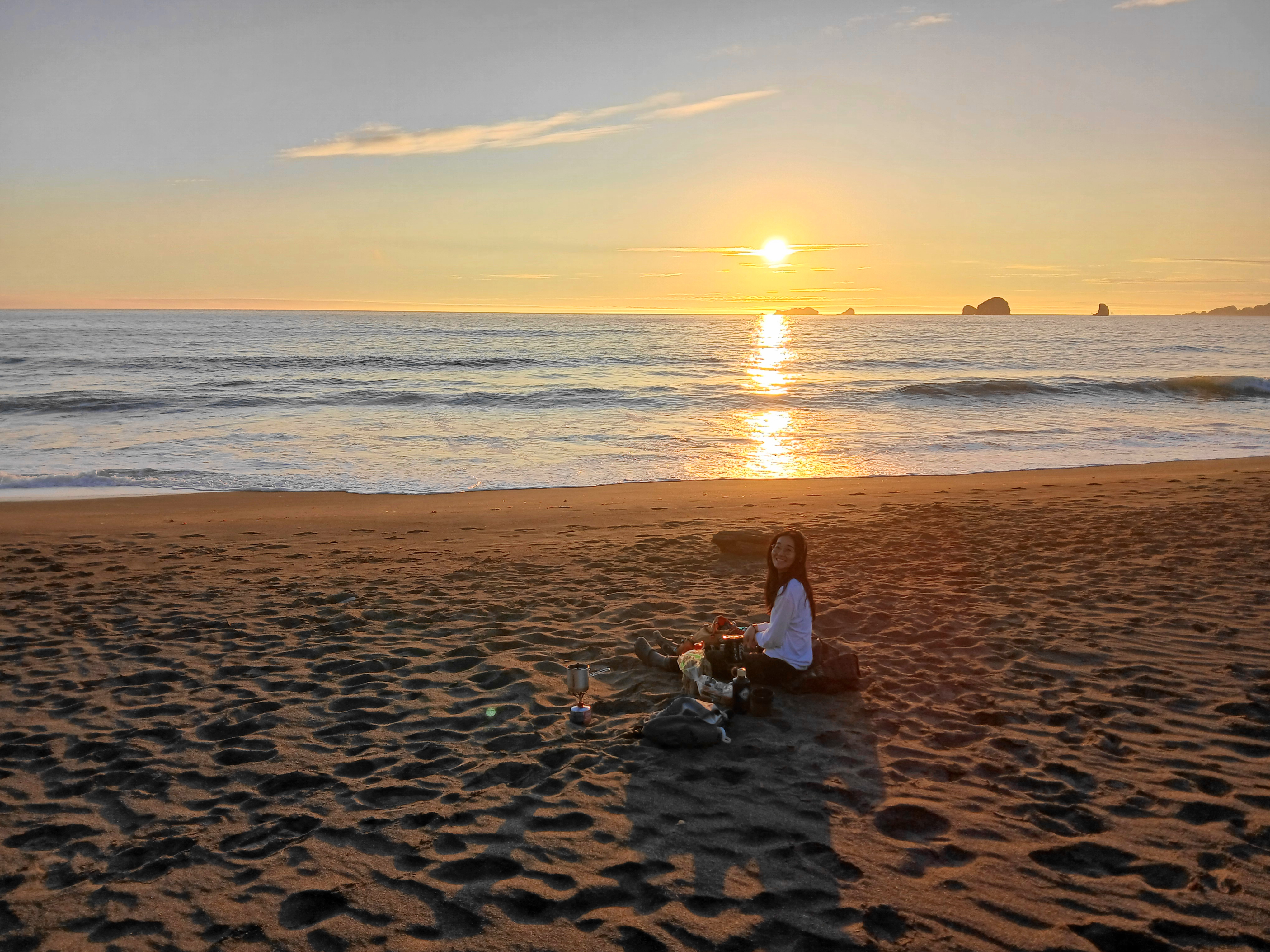
If you still have a little extra energy, it is worth checking out the lovely beach at Humbug Mountain State Park, especially at sunset.


I will miss your California posts greatly. I hope the move went smoothly though!
Thank you!