

At 78 feet, Cunningham Falls, the centerpiece of the state park bearing its name, is Maryland’s tallest waterfall and one of the state’s most visited. Situated in the heart of the Catoctin Mountains, this scenic landmark is less than a 1 ½ hour-drive from Baltimore or Washington, DC. Come during the offseason to get the most out of the falls, as nice weather brings throngs of Marylanders to the park. Casual visitors can follow the short Lower Trail, or the even shorter Boardwalk Trail, to a view of the multi-tiered cascade; for the more adventurous, the rocky Cliff Trail awaits. The description below traces a 1.25-mile loop along the Cliff and Lower Trails to Cunningham Falls and back.


The hike
The hike starts and ends in the William Houck Area of Cunningham Falls State Park, approximately a four-mile drive west of Thurmont, Maryland. From Highway 15 in Thurmont, follow Main Street/Foxville Road west approximately 2 ½ miles to Catoctin Hollow Road, entering the park from the north. Passing Hunting Creek Lake, turn right on William Houck Drive, entering the Houck fee area. Stay right at the next junction, then follow the road ½ mile to the Cunningham Falls parking area on the left. (Note: Additional parking is available at the nearby beach parking area at Hunting Creek Lake, adding a couple hundred yards to the hike.) The wide, well-trodden trail takes off from the northwest corner of the parking lot.
It’s just over a half mile from here to the falls along the easy Lower Trail (alternatively labeled the “Falls Trail”), but veering left after around 100 yards offers a more interesting hike along the steep and rocky Cliff Trail. The sign at the start—which notes that Cunningham Falls is one mile away—overestimates the distance but hits the mark with “more difficult – rocky terrain,” an apt description of this alternative route.
Cliff Trail
The yellow-blazed path begins by cutting sharply left then ascends a stony ravine strewn with slabs of moss-covered basalt. Around 2/10 mile from the trailhead, the Cliff Trail bears north over rocks and logs and climbs steeply to a brief plateau dominated by a mammoth, ovular chunk of Catoctin greenstone. Round the corner and continue climbing uphill to the first of several trail junctions—stay right. (Note: Heading left provides access to the lengthy Catoctin Trail heading south.)

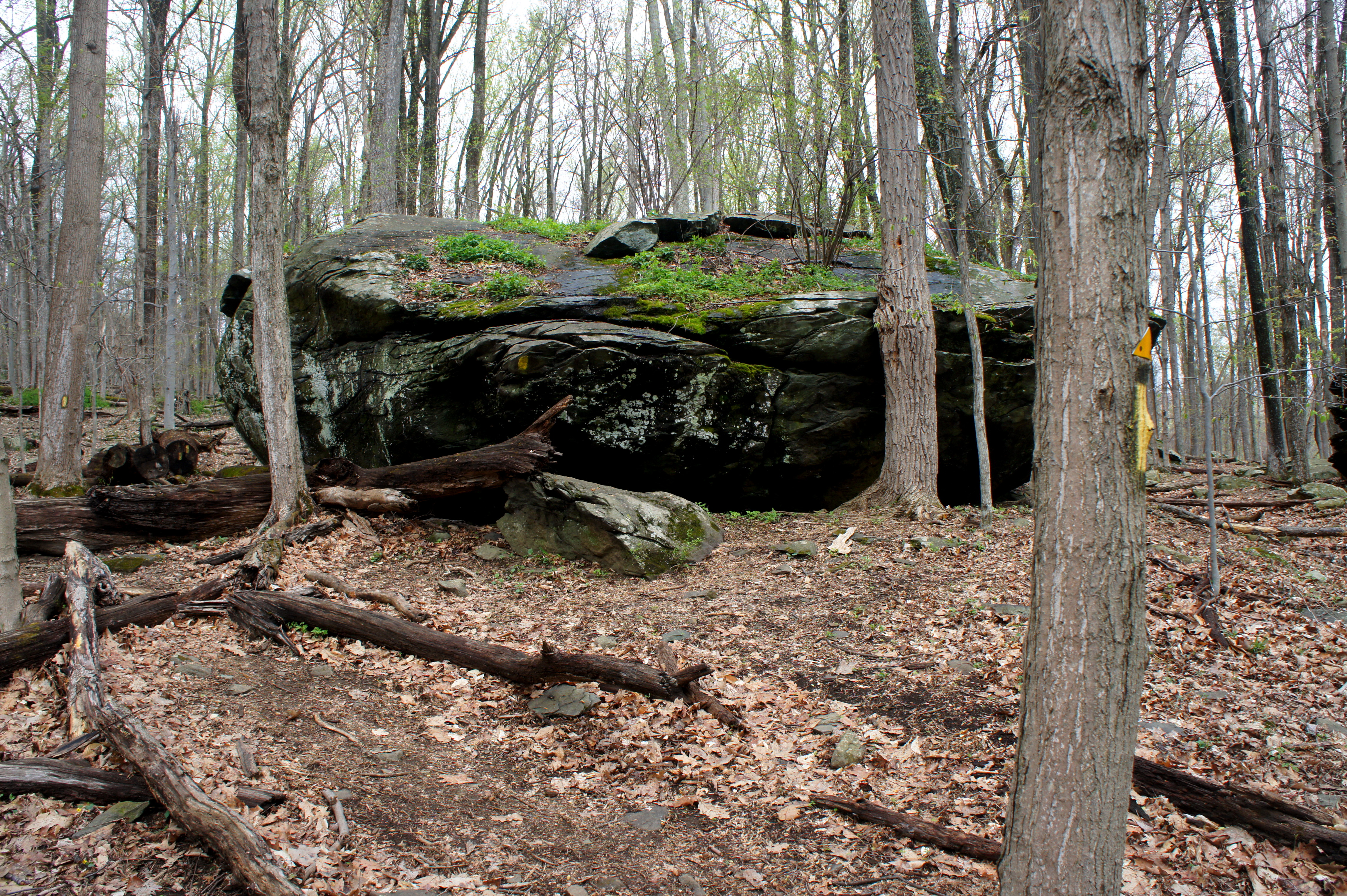
The next ¼ mile is roughly level and straightforward, a welcome solace after the 200-foot climb. Maples, oaks, poplars, and hickories abound. Bear right at the second trail junction. (Note: A left provides access to the Campground Trail and Catoctin Trail northbound.) Follow the sign marked “Lower Trail & Falls Overlook” and begin a bewilderment-inducing descent that makes you wonder why you had to gain 200 feet only to head down again. After a set of stony steps, the Cliff Trail zig-zags down a grassy slope that, as of April 2016, was strewn with fallen branches and logs.

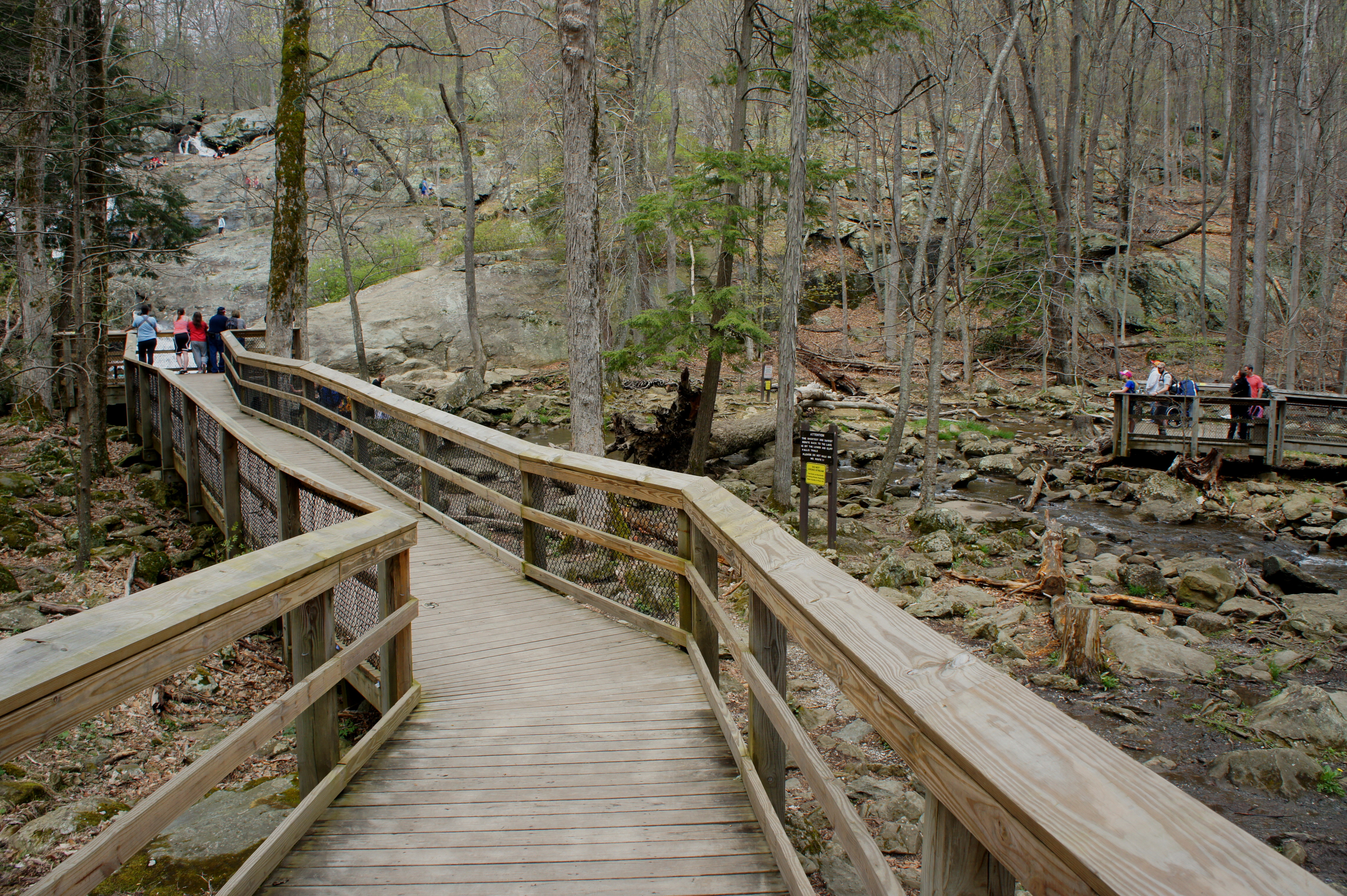
There’s a brief respite as the trail bears northwest and drops gently through a shady notch with a wall of exposed greenstone on the left and large chunk on the right. Then it’s a steady, obstacle-ridden descent again to the bottom of the escarpment and, ultimately, to the junction with the Lower Trail and Cunningham Falls Overlook. A short wooden boardwalk provides access to the viewpoint.
Cunningham Falls and Lower Trail
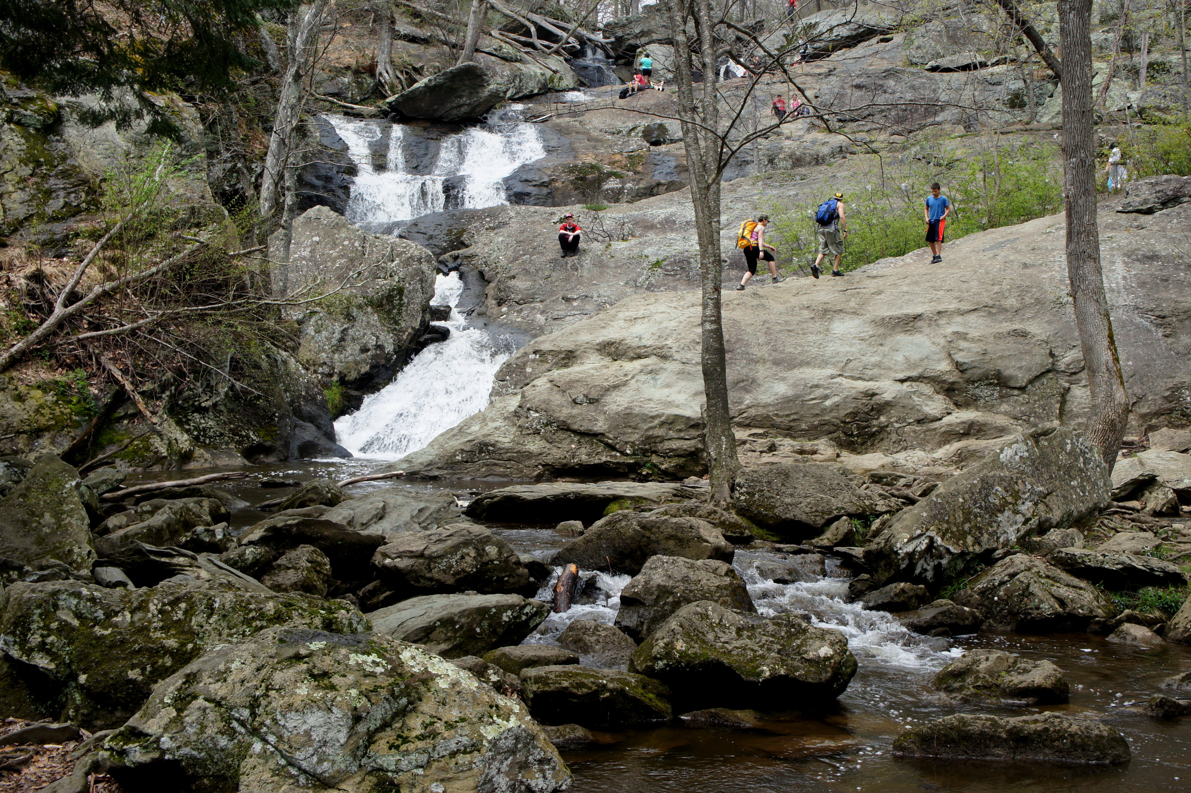
While partly obscured by a huge hemlock, Cunningham Falls appears ahead. Though Maryland’s tallest, the falls does not drop in one free-fall but rather a series of cascades 10-20 feet high, separated by small pools. On a crowded day, it’s a challenge to get a photo without human interference: the falls are crawling with curious visitors fanning out across the curvy greenstone to get a closer look. Another popular viewpoint is visible across the creek, but no official trail connects the two. (Note: this wheelchair-accessible overlook is reachable from the short Boardwalk Trail off Foxville Road.)
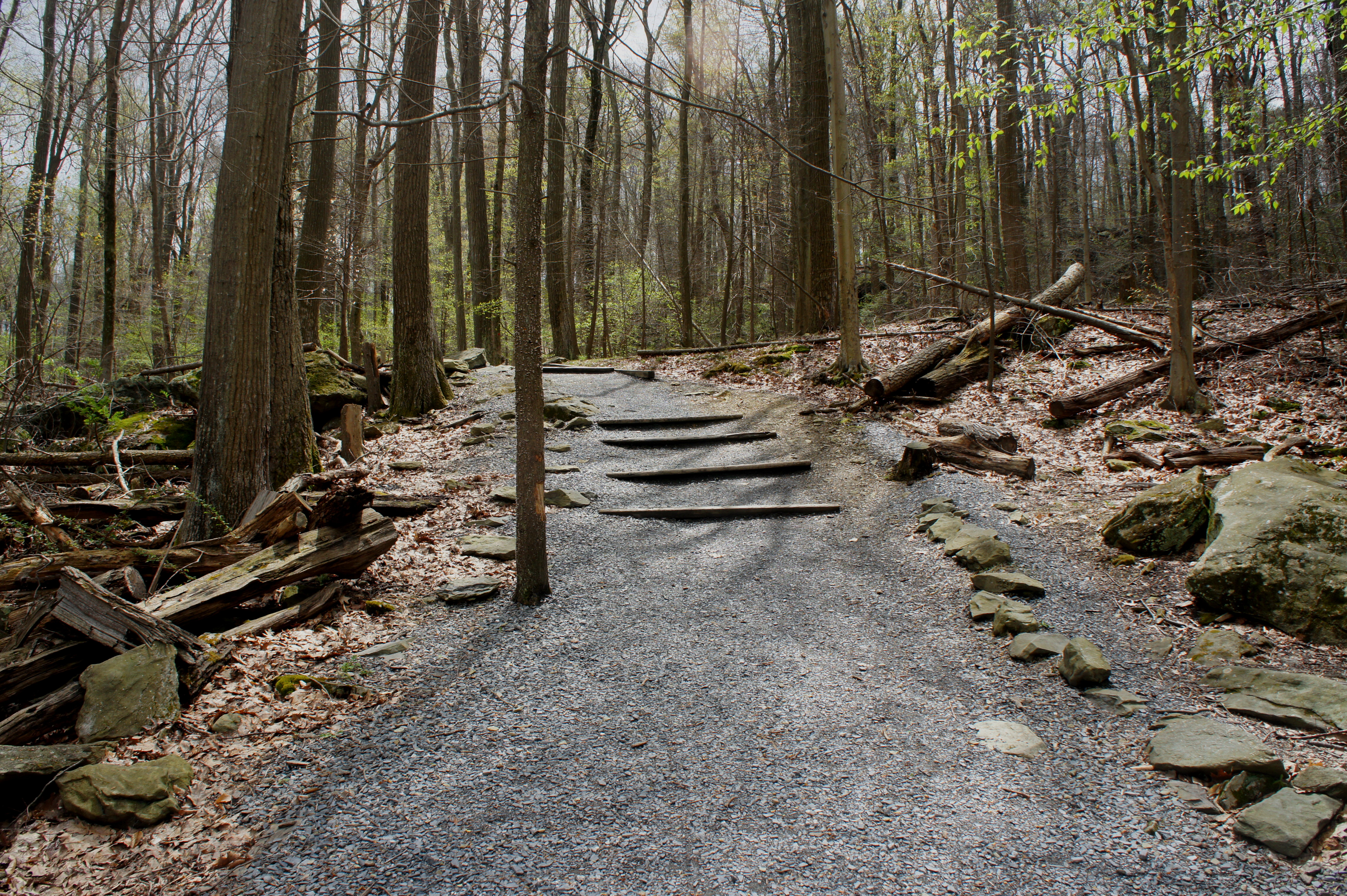
To complete the loop, take the easy Lower Trail (a.k.a. “Falls Trail”) back to the parking area. This crushed gravel path bears southeast as it gains elevation on the tumbling creek below. After 10 minutes of walking, the trail is situated some 60-80 feet higher than the stream, now obscured at the bottom of a woody ravine. As the Lower Trail approaches the parking lot, the terrain gradually levels out and hikers return to the junction with the Cliff Trail. From here it’s less than a minute back to pavement at the trailhead.
This is a fine introductory hike in Cunningham Falls; considering it’s the park’s primary attraction, it’s a no-brainer. The circuit, despite challenging climbs on the Cliff Trail, is relatively easy compared to the more arduous hikes to Cat Rock or Bob’s Hill summit. Allot at least an hour for the round-trip.

Pingback: Cat Rock Loop (Cunningham Falls State Park, MD) | Live and Let Hike
Pingback: Falls Nature Trail (Catoctin Mountain Park, MD) | Live and Let Hike
Pingback: Top 10 Hikes in 2020 | Live and Let Hike
Hello mate nnice blog
Pingback: 18 East Coast Waterfalls That Deserve a Spot on Your Bucket List - Endless Travel Joy
Pingback: 18 East Coast Waterfalls That Deserve a Spot on Your Bucket List - Family Vacations US