

The cluster of subalpine tarns known as Five Lakes, nestled in a mostly wooded saddle northwest of bustling Lake Tahoe, are mediocre by area standards; they lack the dramatic granite backdrops or aquamarine hues that characterize some lakes in California’s Sierra Nevada. But on the short Five Lakes Trail, it’s about the journey more than the destination. The two-mile, 1,000-foot ascent from the valley floor features terrific, unobstructed views and a brief traverse of a granite wonderland buried in winter, when the slopes become part of a world-famous ski haven. Expect to spend 2-3 hours hiking on this 4.2-mile round-trip—or use this route as an entrée into the relatively underexplored landscape of Granite Chief Wilderness beyond.

The hike
Capping at around 7,500 feet, the Five Lakes Trail is likely to be accessible earlier in the summer season than many other hikes in northern California’s Lake Tahoe area—with snow melting relatively quickly on the sun-soaked slopes. To reach the start of the hike, follow Alpine Meadows Road from California State Route 89 (a.k.a. River Road), just northwest of Tahoe City, for about two miles. A small sign marks the trailhead, but parking is surprisingly sparse given then hike’s popularity; expect to park on the shoulder along Alpine Meadows Road.
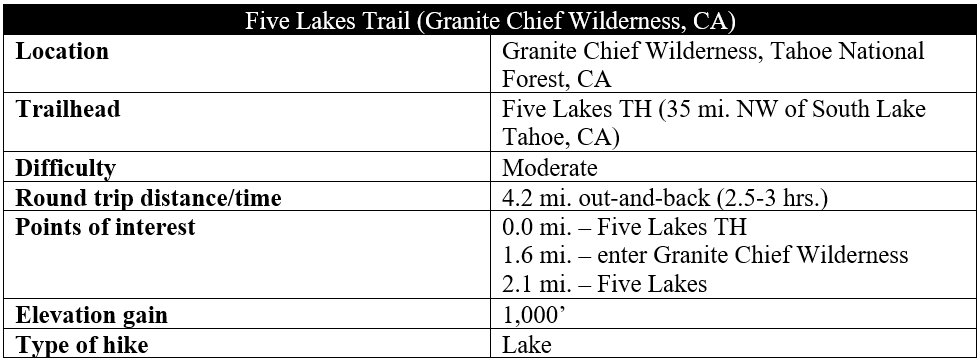
The Five Lakes Trail begins on the north side of the road, immediately traversing a deep-cut tributary, then beginning a steady ascent, which will not relent until the saddle bearing Five Lakes. While white firs and Jeffrey pines can be found in sporadic bunches, the majority of the climb is in full sun—making for a hot summer hike and a wake-up call for those anticipating a leisurely stroll. The foliage is more stunted as hikers ascend the windswept hills, with open views back eastward toward the Truckee River drainage.
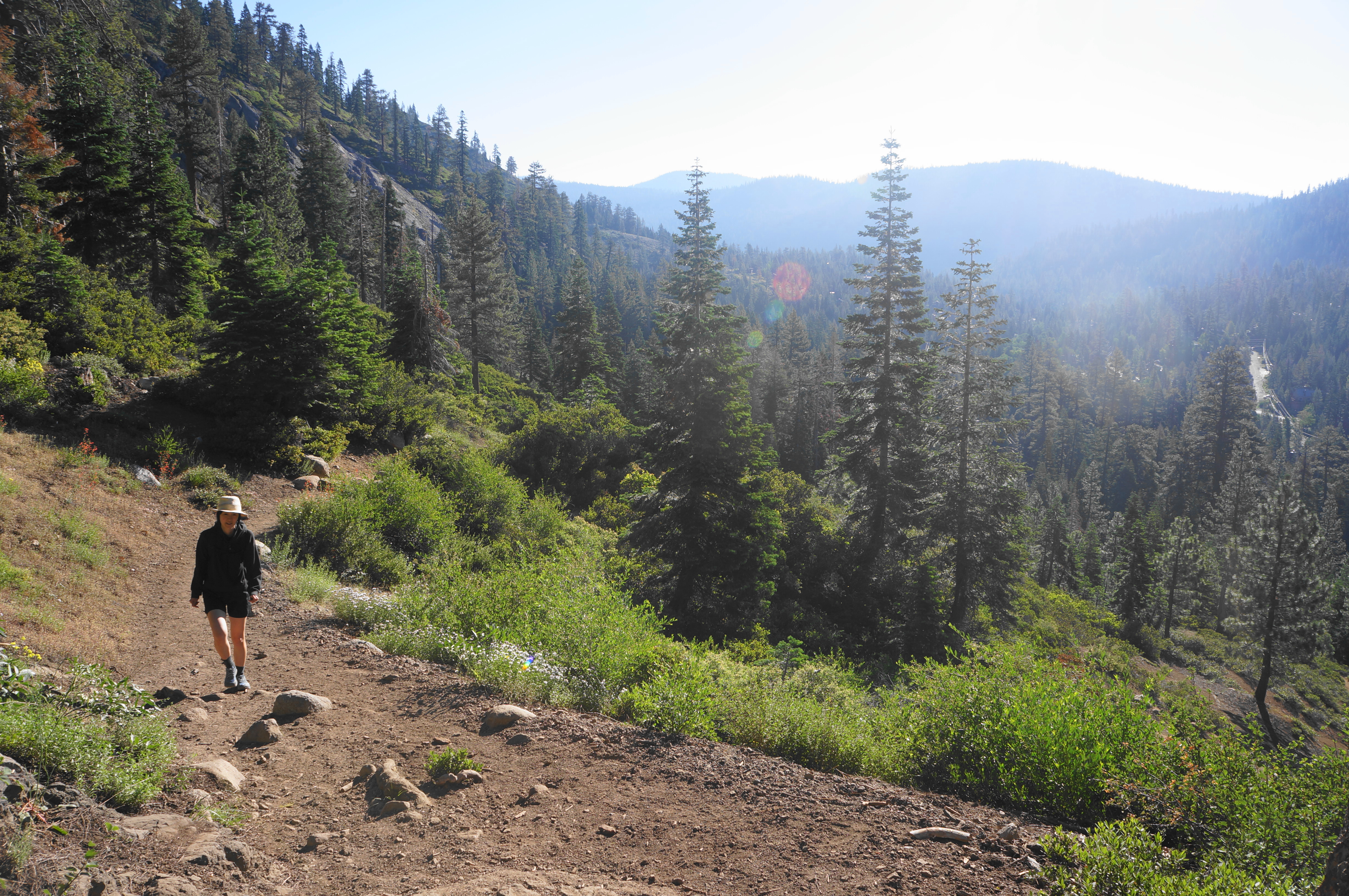
The westward tread and view across the valley to a woody gap between Ward Peak (8,637’) and Scott Peak (8,280’) to the south makes it appear at first that hikers will be heading that-away. But eventually it becomes evident that the route will keep clear of the main ski area to the south, instead ascending to a higher saddle, not yet visible, to the north (on the right).

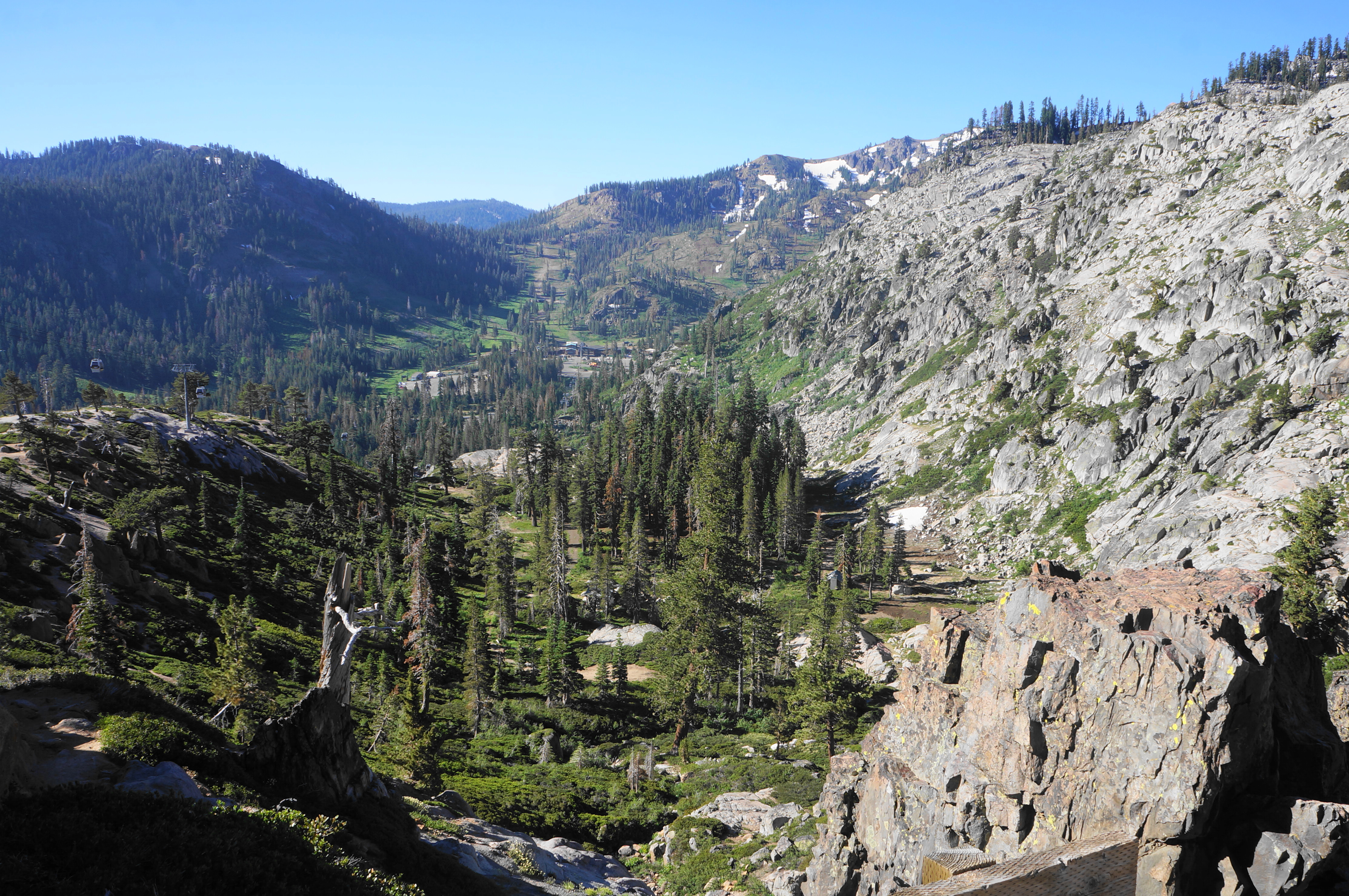
Take a breather at a shady spot below Jeffrey pines at 3/10 mile, then continue into the sun again as the Five Lakes Trail winds and bends through the hearty manzanitas. The gondola connecting the Alpine Meadows and Palisades Tahoe Resorts soon becomes visible ahead, set above a patchy green hillside. After a relatively mild section, the trail ascends a tougher set of switchbacks, rounds a tributary drainage, and continues to rise.
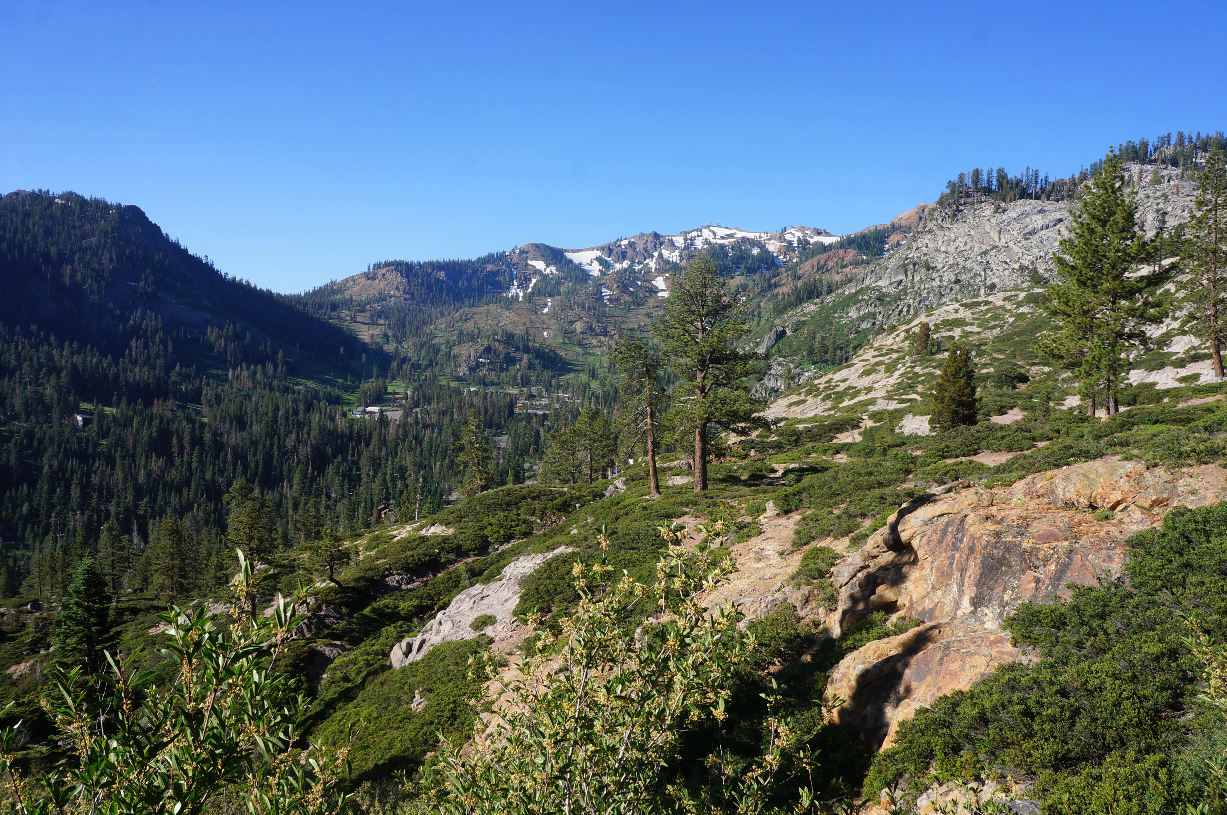
Take a hard right while passing under a seemingly unused ski lift, rising up to a crest with excellent mountain views and a look up at the Palisades Tahoe gondola. The drainage to the west is impressive for its craggy texture and beautiful, varnished granite. Beyond, in the distance, one can see the tops of Washeshu Peak (8,885’). Looking back southward, hikers can see through the gap between Ward and Scott Peaks to the continuing divide beyond.

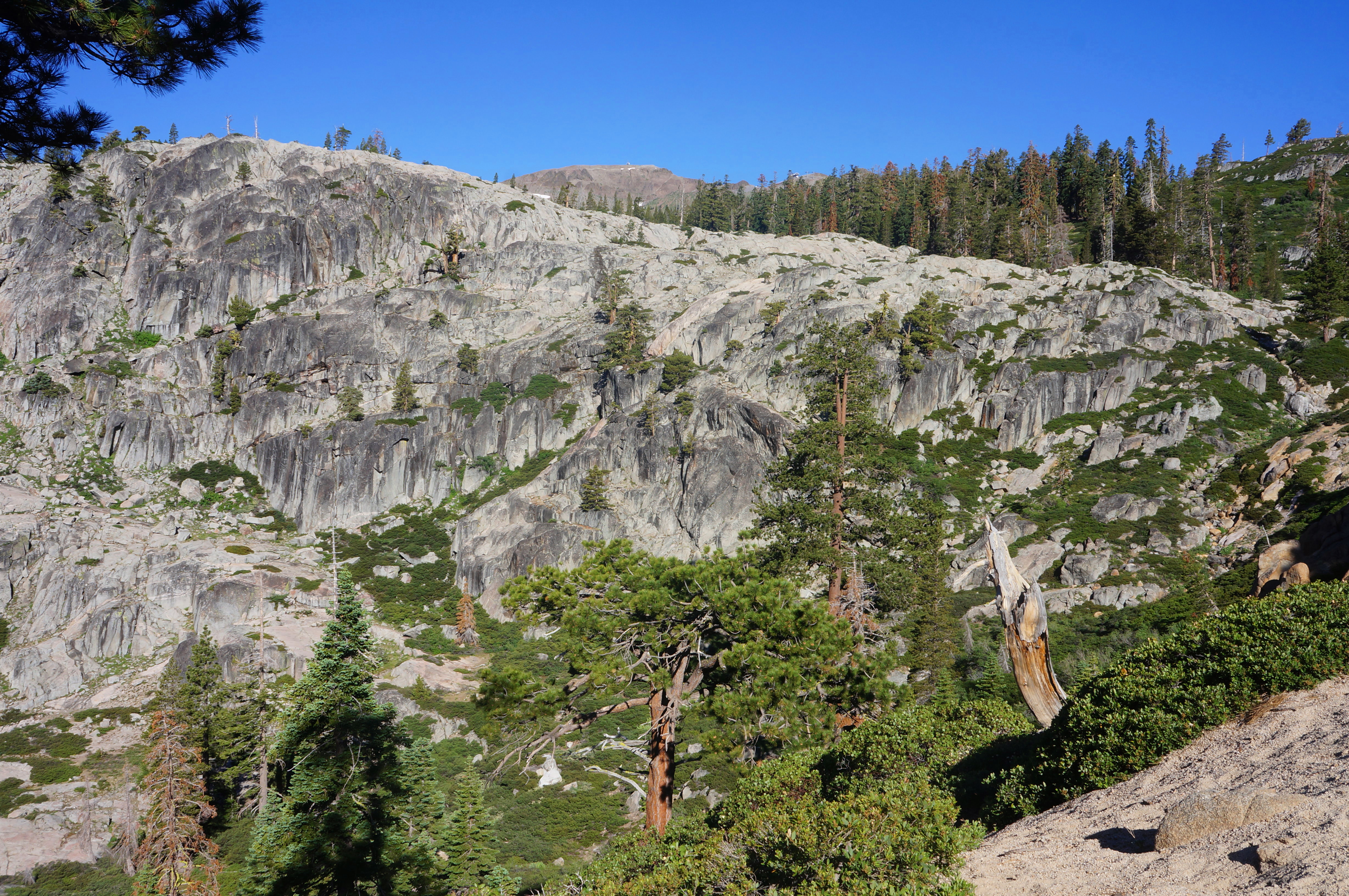
The next section is arguably the highlight of the hike, with the trail skirting the scenic drainage and rising to clear a set of outcrops with outstanding vistas. The Five Lakes Trail rises to a point where the southward views eventually diminish, and the terrain settles into a relative flat.

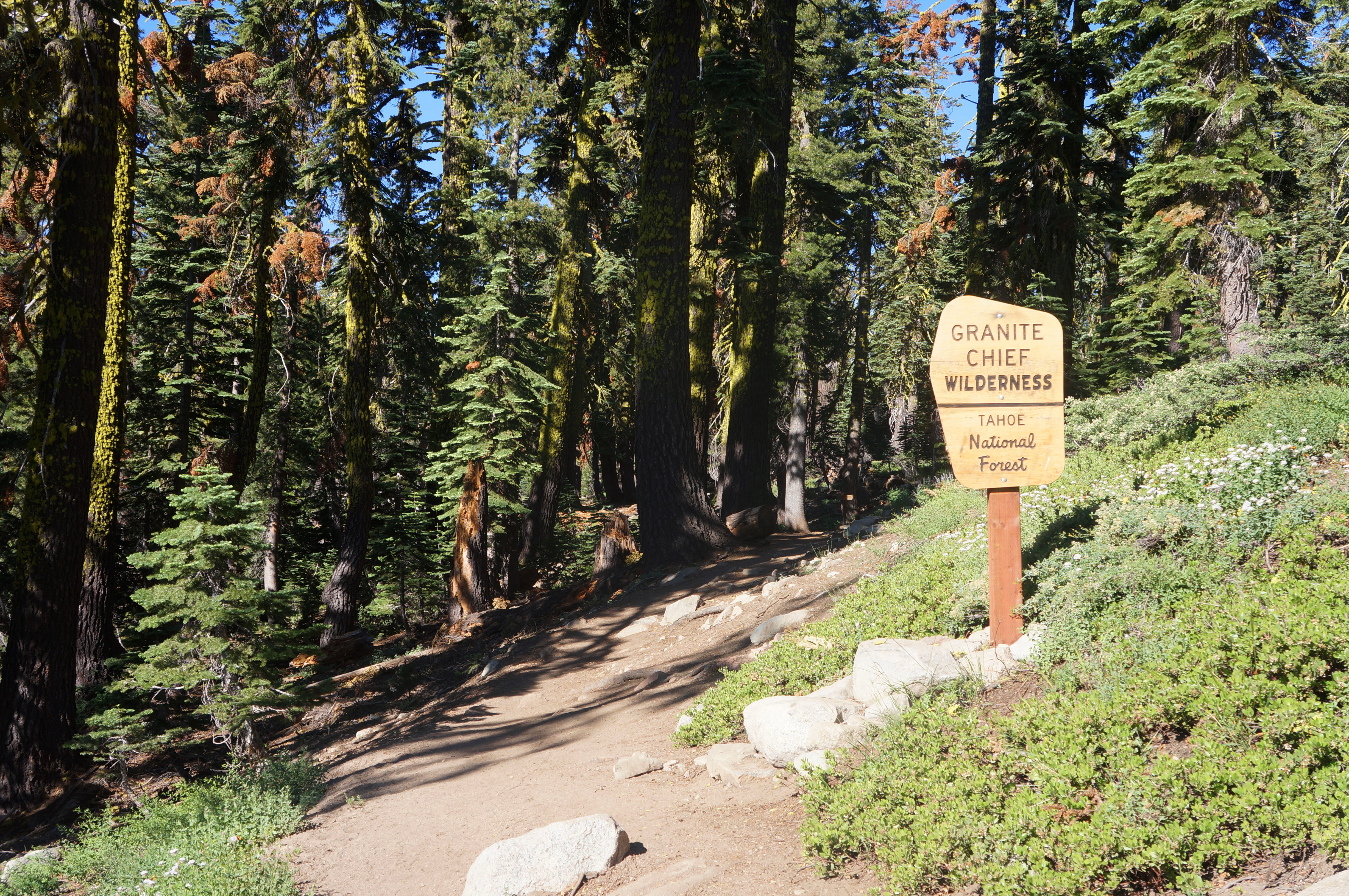
At 1.6 miles, enter the 26,000-acre Granite Chief Wilderness, then enjoy the refreshing cool of the dense forest of red firs. The mostly level path wanders gently into the Five Lakes Basin. By now you have crossed a local divide; the lakes actually feed into a creek that heads west, draining into Hell Hole Reservoir and the Rubicon River—not east through Alpine Meadows.
The first of the Five Lakes comes within reach at an unmarked junction at 1.9 miles. The main trail continues right, while a thinner path offers access to the shores of a mucky pool, the second-smallest of the five. With the thick algae and black color of the water, this is perhaps not the most attractive lake on offer.

Online beta suggests hikers can begin an off-trail walk here that rounds to each of the five lakes in turn. But this is reportedly difficult to follow—perhaps not worth the effort. Instead, I recommend checking out the first lake but then returning to the main path, bearing left toward the pass.
Continue on the shady trail for about 250 yards, coming within sight of the final and largest of the Five Lakes. This is also likely the deepest and most impressive: while mostly lined with trees, there is a small section of granitic scree, with the tip of a roughly 8,500-foot peak beyond.

Exploration around the lake is again limited by dense vegetation, and crossing Five Lakes Creek at the mouth of the basin can be a challenge during high-water season. But there are several spots to sit, take in the view, and enter the chilly waters if desired.

Adventurous hikers can continue westward to Whiskey Creek Camp and the heart of Granite Chief Wilderness. But for most day hikers, this will be the natural turnaround point. Head back the way you came—reentering the sun-exposed sections again, enjoying the views across Alpine Meadows and beyond. The return route is nearly all downhill and finished before you know it—bringing the 2- to 3-hour hike to an end.

Very nice post with good info. I particularly like the Alpine Meadows capture and of course very nice to see photos of the lakes.
Thanks for sharing and greetings from Greece!
Please be careful if you go in early spring. The trails aren’t clear and the paths aren’t marked. I was lost for 2 days with my dog out there and ended up in Hell Hole Res. This is an advanced, experience hiker trail, please PSA that if you’re writing about trails.
Thanks Kelly – I am sure the section beyond Five Lakes is rugged and difficult to follow as you suggest, although the initial route to Five Lakes – without snow cover of course – appears to be one of the best-established paths in the Tahoe area.
Big Pine destroys All of them.
In California
Pingback: Top 10 Hikes in 2023 | Live and Let Hike