Soundside Nature Trail (Jockey’s Ridge State Park, NC)

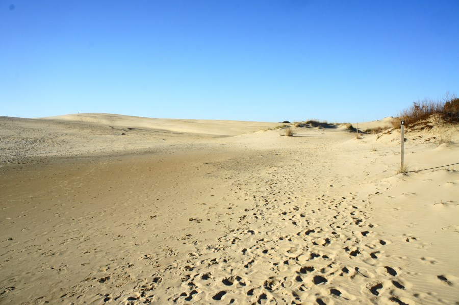
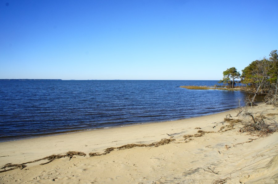
Although lacking the allure of the nearby Tracks in the Sand Trail, the Soundside Nature Trail in North Carolina’s Jockey’s Ridge State Park offers a pleasant and easy stroll through diverse terrain. The dunes of Jockey’s Ridge—the highest on the East Coast—are visible from the path, but the circuit hike largely keeps its distance from …

Continue reading Soundside Nature Trail (Jockey’s Ridge State Park, NC)

Tracks in the Sand Trail (Jockey’s Ridge State Park, NC)

Jockey’s Ridge State Park in eastern North Carolina boasts a surprisingly impressive distinction: the highest sand dunes on the East Coast. With dunes reaching as high as 60 feet above sea level, this is no ordinary beach: Jockey’s Ridge is a wild and rugged sandscape that runs down to the banks of Roanoke Sound on …

Continue reading Tracks in the Sand Trail (Jockey’s Ridge State Park, NC)

Rabbit Ears Peak Trail (Routt National Forest, CO)

Driving west toward Steamboat Springs on US Route 40 in northern Colorado, one of the most noticeable mountains is Rabbit Ears Peak (10,654’). Although its namesake “ears” have partly deteriorated, the multi-pronged peak remains an iconic fixture of the Steamboat area. A moderately difficult climb of around 1,050 feet—stretched out across 2.6 miles—offers hikers access …

Continue reading Rabbit Ears Peak Trail (Routt National Forest, CO)

Upper Fish Creek Falls (Routt National Forest, CO)

While many visitors to Steamboat Springs, Colorado flock to Fish Creek Falls Recreation Area to the see the state’s second-highest waterfall, there are in fact two significant waterfalls in the vicinity: the famous 284-foot Fish Creek Falls and the lesser-visited Upper Fish Creek Falls. While significantly shorter in height, Upper Fish Creek Falls is charmingly …

Continue reading Upper Fish Creek Falls (Routt National Forest, CO)

Mad Creek Trail (Routt National Forest, CO)

The Mad Creek Trail is a popular hike in northern Colorado, just a 10- to 15-minute drive north from Steamboat Springs. The trail remains largely in the foothills of the Park Range but offers access to the higher Mount Zirkel Wilderness in the heart of Routt National Forest. The highlight is a rehabilitated barn dating …

Continue reading Mad Creek Trail (Routt National Forest, CO)

Hahns Peak Trail (Routt National Forest, CO)

Situated roughly a 30-mile drive from Steamboat Springs, Hahns Peak (10,839’) is one of Colorado’s most enticing summits. While not one of the state’s tallest mountains—or even the highest in the Elkhead Mountains—the volcanic peak nonetheless stands out for its prominence: a lonely, rocky bald visible from miles away, the guardian of the grassy valley …

Continue reading Hahns Peak Trail (Routt National Forest, CO)

Fish Creek Falls Loop (Routt National Forest, CO)

At 284 feet, Fish Creek Falls is the second-highest waterfall in Colorado and is easily accessible from popular resort town Steamboat Springs. For visitors with an hour or less, a 0.8-mile loop provides a look at the falls from two different vantage points: a high overlook with views from a distance and a look up …

Continue reading Fish Creek Falls Loop (Routt National Forest, CO)

Tuscarora Trail to Eagle Rock (George Washington National Forest, VA/WV)

Eagle Rock, August 2018 The 252-mile Tuscarora Trail—the shorter cousin to the much-vaunted, nearby Appalachian Trail—weaves through tree-studded mountain ranges and rolling farmlands spanning four different Mid-Atlantic states: Virginia, West Virginia, Maryland, and Pennsylvania. While completing the full length of the trail takes several weeks, day hikers can cover short sections along the trail. There …

Continue reading Tuscarora Trail to Eagle Rock (George Washington National Forest, VA/WV)