Cataract Falls Trail (Marin Municipal Water District, CA)

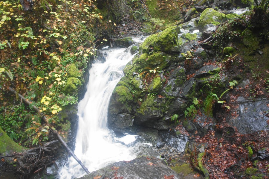
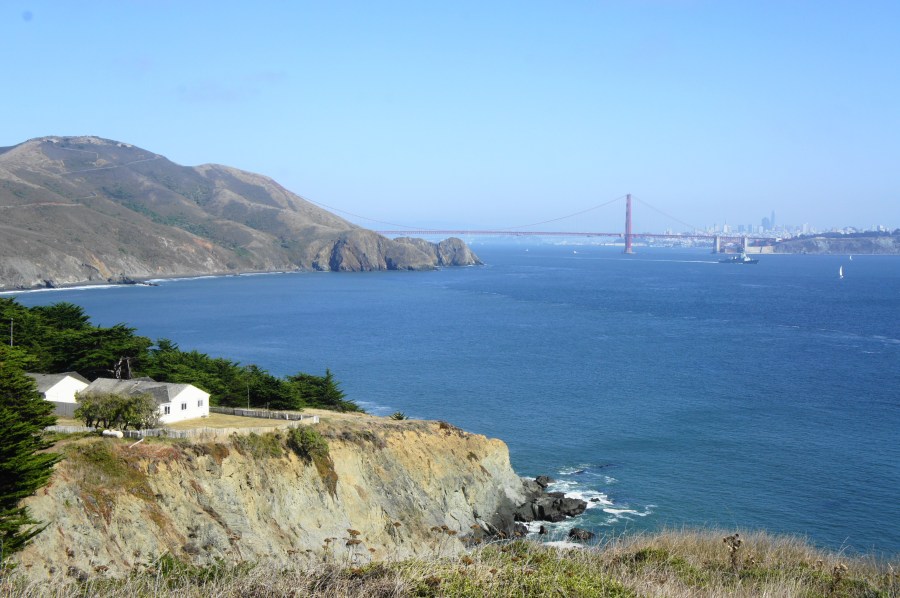
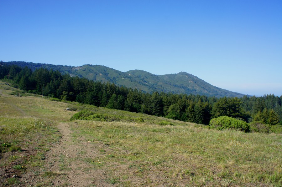
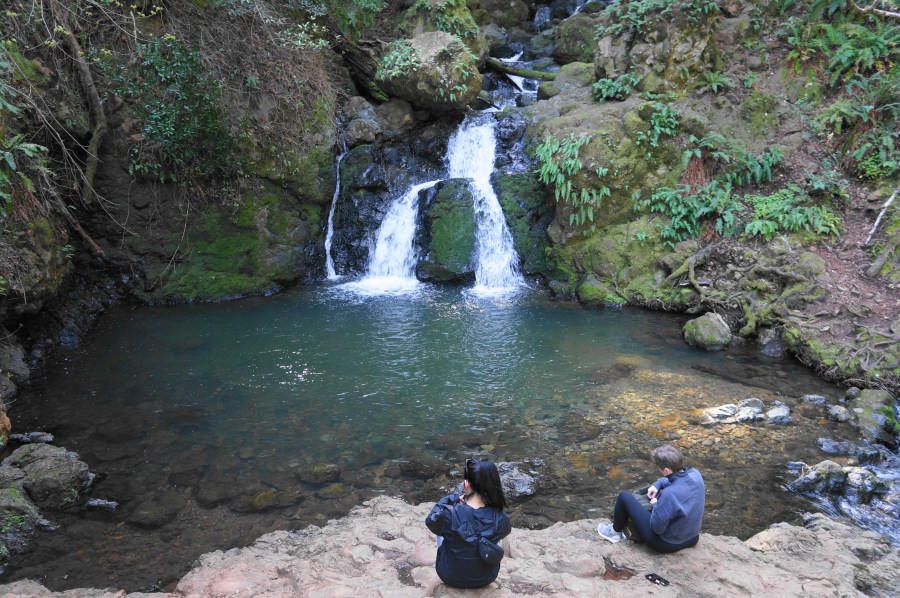
Cataract Falls Trail, Marin Municipal Water District, Mount Tamalpais Watershed, April 2023 Described as “very rugged and demanding,” the stair-master challenge that is the Cataract Trail is nonetheless one of the most popular and rewarding hikes in the Bay Area’s Marin County. The well-trodden path follows the rumbling waters of Cataract Creek, which originates on …

Continue reading Cataract Falls Trail (Marin Municipal Water District, CA)

Fern Creek – Dipsea – Sun Trail Loop (Muir Woods National Monument, CA)

Fern Creek Trail, Muir Woods National Monument, April 2021 Sure the towering California redwoods are lovely, but Muir Woods National Monument on the Marin Peninsula has become almost comically crowded, mobbed by throngs of locals and visitors to the San Francisco Bay Area alike. Visitors must now have advance reservations to park at the main …

Continue reading Fern Creek – Dipsea – Sun Trail Loop (Muir Woods National Monument, CA)

Steep Ravine – Matt Davis Trail Loop (Mount Tamalpais State Park, CA)

The Steep Ravine – Matt Davis Trail Loop in California’s Mount Tamalpais State Park is a longer and more popular variant of the Steep Ravine – Dipsea Trail Loop (described in an April 2015 post). Though not as expansive as the views along the upper reaches of Dipsea, the sunny seaside vistas from the Matt …

Continue reading Steep Ravine – Matt Davis Trail Loop (Mount Tamalpais State Park, CA)

Ben Johnson-Bootjack Trail Loop (Muir Woods National Monument, CA)

The redwood groves of Muir Woods National Monument, while lovely, have a people problem. Within a half-mile radius of the park’s tiny visitor center, there are scores and scores of visitors. Yet the western stretches of the park—or better yet, the areas belonging to Mount Tamalpais State Park that surround Muir Woods—solitude and wildness are …

Continue reading Ben Johnson-Bootjack Trail Loop (Muir Woods National Monument, CA)

Coastal Trail to Tennessee Point (Golden Gate National Recreation Area, CA)

Named for the SS Tennessee, a commercial steamer that wrecked nearby in 1853, Tennessee Point is one of the best vantage points overlooking the Pacific Ocean in Golden Gate National Recreation Area’s Marin Headlands area. A relatively easy hike leads to the popular vista, following a section of the California Coastal Trail before branching off …

Continue reading Coastal Trail to Tennessee Point (Golden Gate National Recreation Area, CA)

Point Bonita Lighthouse Trail (Golden Gate National Recreation Area, CA)

Throughout much of San Francisco’s history, ships seeking to enter the Bay Area flirted with disaster: jagged rocks, shallow beds, dense fog, and nasty waves left hundreds of vessels in the 19th and 20th centuries capsized, torn apart, and buried at the ocean floor. As thousands of gold prospectors—from all over the world—flocked to San …

Continue reading Point Bonita Lighthouse Trail (Golden Gate National Recreation Area, CA)

Dipsea Trail – Steep Ravine Trail Loop (Mount Tamalpais State Park, CA)

At 2,571 feet above sea level, California’s Mount Tamalpais (known affectionately by locals as “Mt. Tam”) offers splendid vistas of Marin Peninsula and the San Francisco Bay area, as well as Bolinas Bay and the Pacific Ocean to the west. Mount Tamalpais State Park—comprising far more than just the mountain’s three peaks—also boasts more than …

Continue reading Dipsea Trail – Steep Ravine Trail Loop (Mount Tamalpais State Park, CA)

Rock Spring and Laurel Dell (Marin Municipal Water District, CA)

*The following is a guest post from my friend and old classmate, the lovely Emily Alpert! Perched on the top of Mount Tamalpais, the Rock Spring Trail meanders through meadows, chaparral, and forests. The trailhead offers sweeping views of the white city of San Francisco and the Golden Gate Bridge. In the summer, Mount Tamalpais …

Continue reading Rock Spring and Laurel Dell (Marin Municipal Water District, CA)