Indian Sands Loop (Samuel H. Boardman State Scenic Corridor, OR)

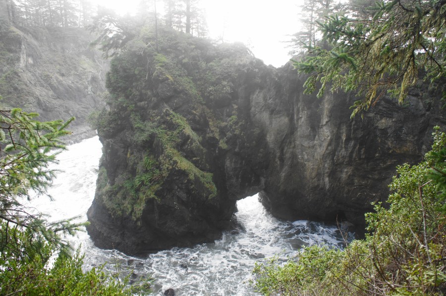
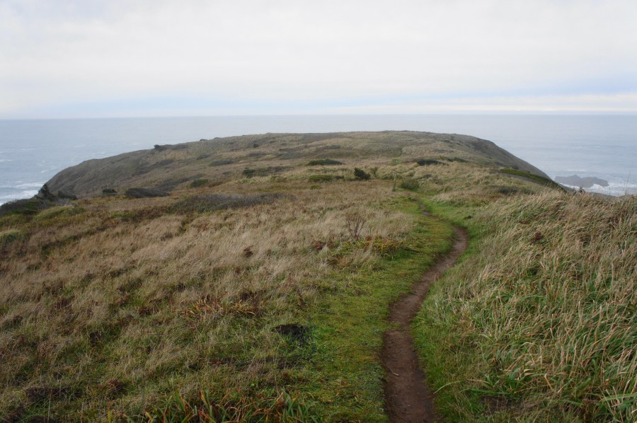
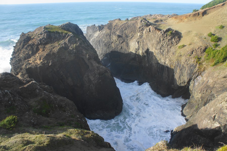
Indian Sands Loop, Samuel H. Boardman State Scenic Corridor, January 2021 The Indian Sands area, situated near the middle of Samuel H. Boardman State Scenic Corridor, is a collection of crisp, windswept dunes, towering headlands, and thundering coves along the southern Oregon coast. Starting and ending at the Indian Sands Trailhead (mile marker 348.6 on …

Continue reading Indian Sands Loop (Samuel H. Boardman State Scenic Corridor, OR)

Thunder Rock Cove Loop (Samuel H. Boardman State Scenic Corridor, OR)

Thunder Rock Cove Loop, Samuel H. Boardman State Scenic Corridor, January 2021 Southwest Oregon’s Samuel H. Boardman State Scenic Corridor features some of the finest stretches of shoreline on the Pacific coast of the United States, and the short-but-spectacular Thunder Rock Cove Loop traverses one of its most picturesque pockets. The brief circuit skirts towering …

Continue reading Thunder Rock Cove Loop (Samuel H. Boardman State Scenic Corridor, OR)

Cape Ferrelo Loop (Samuel H. Boardman State Scenic Corridor, OR)

Cape Ferrelo Loop, Samuel H. Boardman State Scenic Corridor, January 2021 For 296 miles, the restless Pacific Ocean laps up against the Oregon Coast, producing chilly beaches, windswept rock outcrops, and imposing sea stacks. While some more peaceful, wide-open beaches may be found further south in California, the word that best describes the Oregon seashore …

Continue reading Cape Ferrelo Loop (Samuel H. Boardman State Scenic Corridor, OR)

Mastodon Peak Loop Trail (Joshua Tree National Park, CA)

Mastodon Peak Loop Trail, Joshua Tree National Park, October 2020 Mastodon Peak is a rocky knob in the Cottonwood Mountains of southern Joshua Tree National Park, situated in the Colorado Desert of southern California. From the modest summit, hikers gain 360-panoramic views, with the Eagle Mountains unfolding to the east, Cottonwood Mountains to the west, …

Continue reading Mastodon Peak Loop Trail (Joshua Tree National Park, CA)

Grimes Point Petroglyph Trail (Grimes Point Archaeological Area, NV)

Grimes Point Petroglyph Trail, Grimes Point Archaeological Area, September 2020 For travelers driving Nevada’s Highway 50—the “Loneliest Road in America”—Grimes Point is an excellent spot to get out and stretch your legs, taking advantage of a short trail to a fantastic set of ancient petroglyphs. Undoubtedly more vivid and more interesting than Hickison Petroglyphs, which …

Continue reading Grimes Point Petroglyph Trail (Grimes Point Archaeological Area, NV)

Hickison Petroglyphs Interpretive Trail (Hickison Petroglyphs Recreation Area)

Hickison Petroglyphs Interpretive Trail, Hickison Petroglyphs Recreation Area, September 2020 Highway 50, which stretches for more than 400 miles across central Nevada, is called the “Loneliest Road in America” for a reason. Services and cell service are in limited supply as travelers skirt the desolate mountain ranges and sagebrush-studded valleys of the Great Basin region. …

Continue reading Hickison Petroglyphs Interpretive Trail (Hickison Petroglyphs Recreation Area)

Dinosaur Hill Trail (McInnis Canyons National Conservation Area, CO)

Dinosaur Hill Trail, McInnis Canyons National Conservation Area, September 2020 In western Colorado’s Grand Valley, between the modest town of Fruita and splendid Colorado National Monument, lies one of the most famous dinosaur dig sites in the United States. It was here in 1901, on a multi-hued hill composed of rock of the Morrison formation, …

Continue reading Dinosaur Hill Trail (McInnis Canyons National Conservation Area, CO)