Rabbit Ears Peak Trail (Routt National Forest, CO)

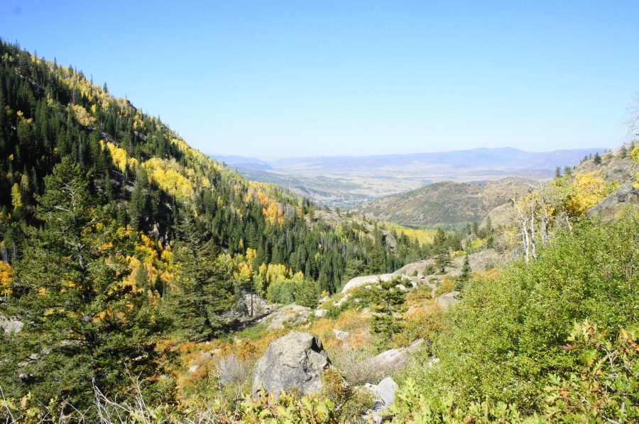
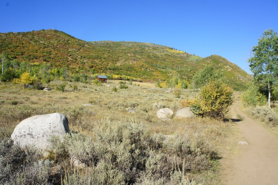
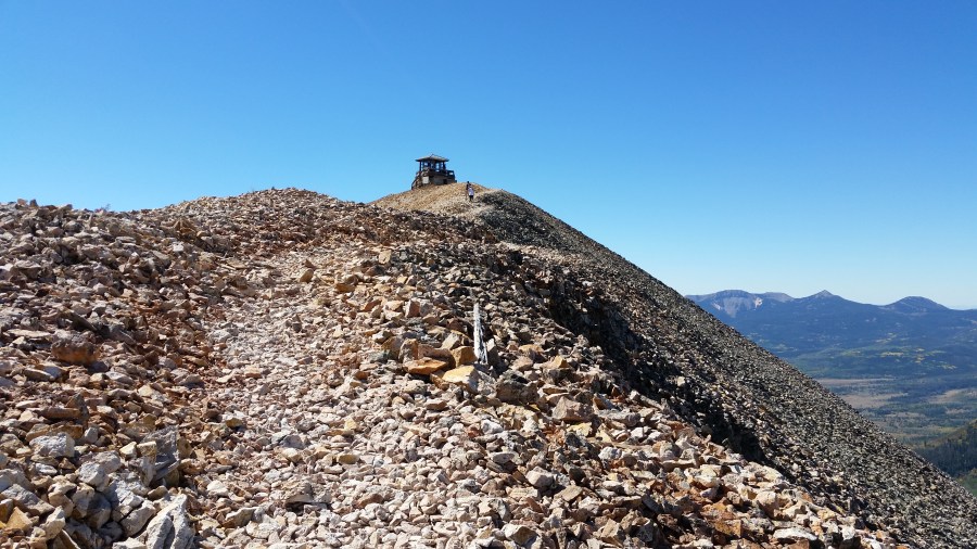
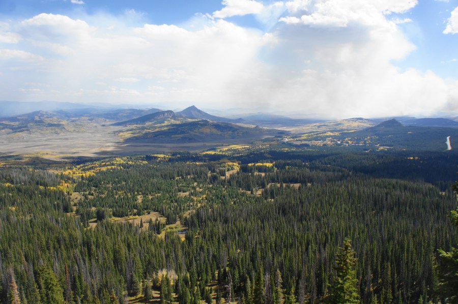
Driving west toward Steamboat Springs on US Route 40 in northern Colorado, one of the most noticeable mountains is Rabbit Ears Peak (10,654’). Although its namesake “ears” have partly deteriorated, the multi-pronged peak remains an iconic fixture of the Steamboat area. A moderately difficult climb of around 1,050 feet—stretched out across 2.6 miles—offers hikers access …

Continue reading Rabbit Ears Peak Trail (Routt National Forest, CO)

Upper Fish Creek Falls (Routt National Forest, CO)

While many visitors to Steamboat Springs, Colorado flock to Fish Creek Falls Recreation Area to the see the state’s second-highest waterfall, there are in fact two significant waterfalls in the vicinity: the famous 284-foot Fish Creek Falls and the lesser-visited Upper Fish Creek Falls. While significantly shorter in height, Upper Fish Creek Falls is charmingly …

Continue reading Upper Fish Creek Falls (Routt National Forest, CO)

Mad Creek Trail (Routt National Forest, CO)

The Mad Creek Trail is a popular hike in northern Colorado, just a 10- to 15-minute drive north from Steamboat Springs. The trail remains largely in the foothills of the Park Range but offers access to the higher Mount Zirkel Wilderness in the heart of Routt National Forest. The highlight is a rehabilitated barn dating …

Continue reading Mad Creek Trail (Routt National Forest, CO)

Hahns Peak Trail (Routt National Forest, CO)

Situated roughly a 30-mile drive from Steamboat Springs, Hahns Peak (10,839’) is one of Colorado’s most enticing summits. While not one of the state’s tallest mountains—or even the highest in the Elkhead Mountains—the volcanic peak nonetheless stands out for its prominence: a lonely, rocky bald visible from miles away, the guardian of the grassy valley …

Continue reading Hahns Peak Trail (Routt National Forest, CO)

Tuscarora Trail to Eagle Rock (George Washington National Forest, VA/WV)

Eagle Rock, August 2018 The 252-mile Tuscarora Trail—the shorter cousin to the much-vaunted, nearby Appalachian Trail—weaves through tree-studded mountain ranges and rolling farmlands spanning four different Mid-Atlantic states: Virginia, West Virginia, Maryland, and Pennsylvania. While completing the full length of the trail takes several weeks, day hikers can cover short sections along the trail. There …

Continue reading Tuscarora Trail to Eagle Rock (George Washington National Forest, VA/WV)

Mount Marshall Loop (Shenandoah National Park, VA)

Mount Marshall—named for John Marshall, the famous 19th century Chief Justice of the Supreme Court—actually comprises two distinct peaks in the North District of Virginia’s Shenandoah National Park. North and South Marshall, as they are known, sport some of the best panoramic views in the park and, as an added bonus, are relatively easy to …

Continue reading Mount Marshall Loop (Shenandoah National Park, VA)

Raymondskill Falls Trail (Delaware Water Gap National Recreation Area, PA)

The 150-foot Raymondskill Falls, when at full strength, is one of the most spectacular waterfalls in the Mid-Atlantic and the tallest in the state of Pennsylvania. Nestled in a shaded valley in Delaware Water Gap National Recreation Area, the three-tiered falls are reached by way of a short but steep trail. While Raymondskill is just …

Continue reading Raymondskill Falls Trail (Delaware Water Gap National Recreation Area, PA)

Top Cottage Trail (Eleanor Roosevelt National Historic Site, NY)

Springwood, the Hudson River Valley home of President Franklin Delano Roosevelt, is now preserved by the National Park Service in Hyde Park, New York. However, during his second term as president, Roosevelt also had built a separate cottage, intended as a retreat atop nearby Dutchess Hill, a mostly wooded ridge east of the Hudson. Today, …

Continue reading Top Cottage Trail (Eleanor Roosevelt National Historic Site, NY)

Butcher Branch Falls (New River Gorge National River, WV)

Southern West Virginia’s New River Gorge National River includes dozens of waterfalls, some easier to reach than others. Among the relatively simple is Butcher Branch Falls, which, despite being less than a half-mile from the Kaymoor Top Trailhead, is rarely crowded. The moderately difficult hike drops 150 feet from the western rim of New River …

Continue reading Butcher Branch Falls (New River Gorge National River, WV)

Coastal Trail – Lands End Section, including Mile Rock Beach (Golden Gate National Recreation Area, CA)

The windswept shoreline of Lands End forms the northwest tip of the San Francisco Peninsula and is easily accessible from northern California’s iconic cultural capital. For those looking for a brief urban escape, the Land’s End section of the Coastal Trail offers a surprisingly rugged hike through cypress groves and along rocky cliffs, with excellent …

Continue reading Coastal Trail – Lands End Section, including Mile Rock Beach (Golden Gate National Recreation Area, CA)